
Wild weather, destructive wind and heavy rain to hit SA
UPDATED: TWO boys were plucked to safety by SES workers after they became trapped in fast-flowing Sturt River in Morphettville.
- Tourist trapped in car in NT flood waters, another family missing
- Burst water main hits Goodwood Rd traffic, puts shops at risk
TWO boys were plucked to safety by SES workers after they became trapped in fast-flowing Sturt River in Morphettville on Tuesday night as the state prepares to be lashed by a severe storm front.
The youngsters spent an hour in rising waters with the SES receiving an alert to Oaklands Road at about 8pm.
Emergency workers managed to lower a ladder into the water and winch the pair to safety. They were not injured.
Destructive winds and heavy rainfall are expected across South Australia until the early hours of Wednesday morning.
A severe weather warning is in place for most of the state, including Adelaide, the Eyre and Yorke peninsulas, Flinders, Kangaroo Island, Riverland and the South East, as a tropical low-pressure system moves slowly across SA bringing humid, stormy conditions and wild weather.
The weather system is tracking near Port Augusta but will hit Adelaide about 9pm where it will stay until 4am, with expected winds averaging 60-70km/h and up to 125km/h near the Flinders Ranges, Mid North and Mount Lofty Ranges.
Burst water main causing traffic issues on Goodwood road and threatening to flood businesses @theTiser pic.twitter.com/GiRqGyq6es
— Mitch Mott (@MitchMottTiser) December 27, 2016
Severe Weather Warning re-issued for heavy rainfall and damaging to destructive winds. For the latest see: https://t.co/IXBXq1M8lR pic.twitter.com/PpfrFWCaGK
— BOM South Australia (@BOM_SA) December 27, 2016
Deep swirling low making its way south bringing heavy rain & damaging to destructive winds. Warnings at https://t.co/5wxFrWeCue #SAweather pic.twitter.com/vC8Sx8sG8F
— BOM South Australia (@BOM_SA) December 27, 2016
The deep low is forecast to be over Spencer Gulf by Tuesday night and south of Kangaroo Island by early Wednesday morning and offshore southwest of Mt Gambier later that morning.
Heavy rainfall is also expected, with Adelaide set to cop up to 50mm.
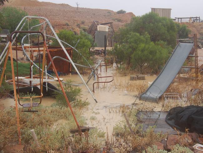
A whopping 117mm of rain has already fallen around Ernabella, in the state’s north, 83mm at Mintabie and 59mm in Coober Pedy.
A flood-watch warning is in place for the North West Pastoral, eastern Eyre Peninsula and Flinders districts, with possible flooding and road closures.
Wind speeds are also high, with a 104km/h gust recorded at Coober Pedy and winds averaging about 80km/h today.
Bureau of Meteorology regional director John Nairn said the winds could impact power lines “because of structures that have been impacted in the past”.
Mr Nairn said this kind of weather system was only seen in Adelaide “once every two or three years”, originating from as far away as the Pilbara in Western Australia.
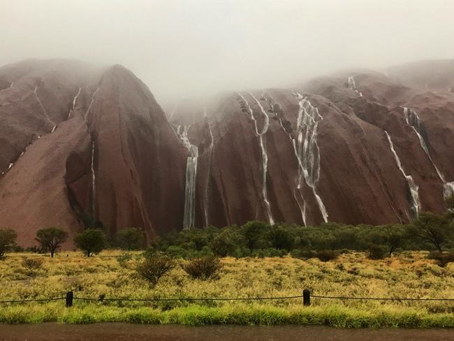
It is the same system has lashed Central Australia, forcing closures at Uluru due to widespread record-breaking rainfall, flash flooding and the rare sight of waterfalls down the rock. It has been reopened.
State Emergency Service state duty officer Sara Pulford said crews were on standby for a busy night.
She said “heat-stressed trees” had the potential drop limbs, combined with the forecast strong winds.
Ms Pulford advised people secure or put away loose items, including outdoor furniture and Christmas presents such as trampolines and sandpit lids.
The SES is also advising that people should move vehicles under cover or away from trees, keep clear of flood water and stay indoors.
Conditions across most of the state are expected to ease by Wednesday.
The bureau is forecasting a top of 32C for Adelaide, with possible storms and a shower or two.
Originally published as Wild weather, destructive wind and heavy rain to hit SA
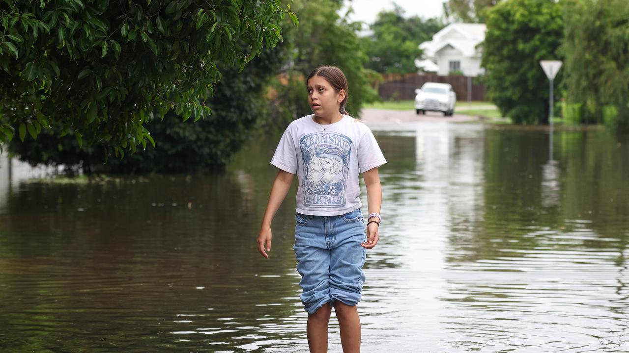
‘Expect more’: Dire warning after floods
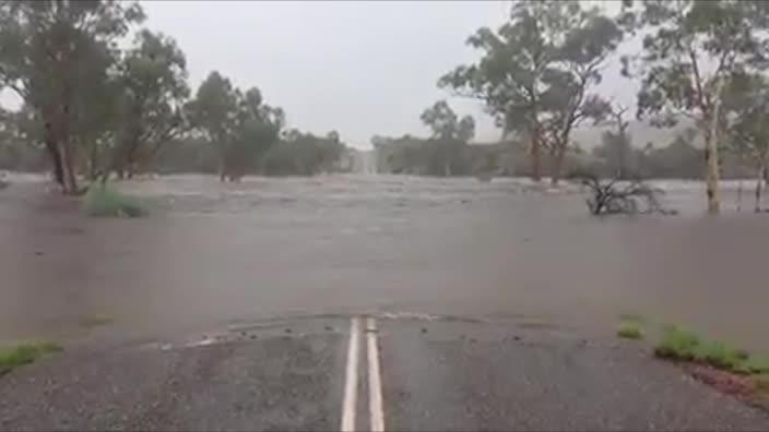
North Queensland has recorded its second “once-in-a-century” flood since 2019, and one thing made the rainfall heavier.
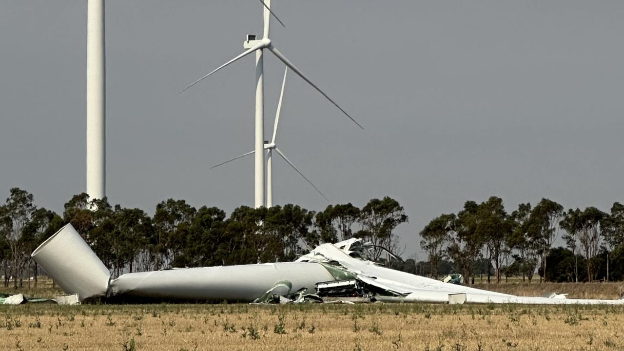
112m turbine collapses on wind farm
A 112m wind turbine has collapsed after severe thunderstorms wreaked havoc in one state, prompting this call.
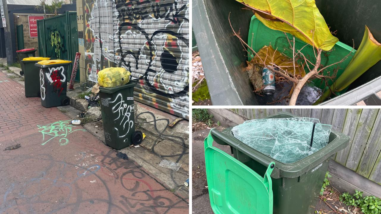
Trendy Aussie area now ’maggot-infested’
A statewide mandate has divided residents and councils with some saying the scheme has turned their area into a “garbage tip”.