
Why Libya’s treacherous floods are a warning for Australia
Australia is under threat from what should be a one-in-100-year event but is happening with increasing frequency.

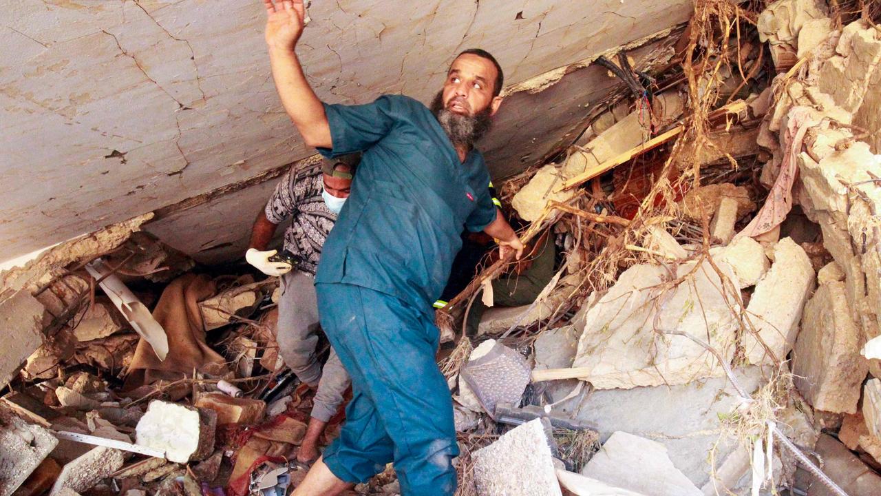
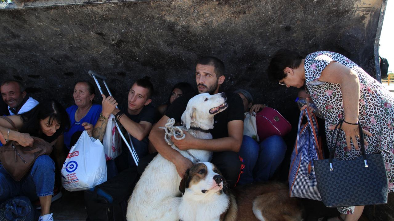
It doesn’t rain. It pours. That’s no longer just an expression of frustration. It’s a truism. And the 20,000 people dead or missing in Libya is a warning of what could happen in our own backyards.
For Libya, it’s not just a natural disaster. It’s an epic failure of preparation, planning and government.
It disregarded expert warnings. It ignored public concerns. It failed to maintain and upgrade infrastructure to meet a growing threat.
And that’s a lesson for Australian federal, state and local governments already experiencing the Russian roulette of climate-change-induced extreme downpours.
“The bad news is we are, in fact, already seeing these kinds of events. They’ve already caused big floods in Australia, last year especially,” says University of New South Wales (ANU) Professor Jason Evans.
But it’s as much about where these extreme rainfall events occur as the rain itself.
And, as the frequency and intensity of these storms increase, the chances of one dumping on an especially vulnerable town or suburb soars.
“The good news for us, compared to Libya, is we have generally higher standards, more robust structures and much better early flood warning systems,” Professor Evans adds.
But Australia also has its weak points.
“There are certainly some locations where if we had that kind of downpour, evacuating people would be very difficult. That’s absolutely true,” he explains. “The likes of Western Sydney and the Upper Hawkesbury can be overwhelmed by the kind of flash flooding we’re now seeing. And that means potentially tens of thousands of people would be put in serious danger.”
The evidence is there.
Earlier this month, a sudden downpour of 500mm (that’s half a metre) within a single day submerged villages in Greece. That same “medicane” (Mediterranean hurricane) then went on to Libya.
In July, more than 250mm was dumped on New York’s Lower Hudson Valley in less than a day. And that was just a thunderstorm. Not a hurricane.
What’s changed?
“Australia has a long history of building in flood plains. And that’s OK – when you can reliably say such an event will only happen once every century. You can build some defences and get away with it,” says Professor Evans.
“But the hazard has changed. That 100-year event is now much bigger than it used to be. And existing defences are questionable – failed levees can actually trap water in a town and make the impact worse, for example”.
The physics is well understood. Even if we’re still trying to model its effects across the full scale of time, distance and influences.
“This extreme Mediterranean rainfall is definitely related to the unusually warm atmosphere they’ve been experiencing this year,” Evans explains.
The higher the temperature, the faster water evaporates. Especially when accompanied by winds. But higher temperatures also mean the lower atmosphere can hold more moisture. And turbocharged instability between atmospheric temperature layers causes it to be rained out faster.
“So all these different aspects add to the storm itself, and that’s why we get this really extreme rainfall,” he adds.
“The hazard is changing. But the other side of the risk equation is the vulnerability of the assets we care about,” adds Evans.
And that’s where building codes and planning codes come in.
“The impact we’ve seen in Tripoli is much higher than we would have seen if it fell somewhere else,” he says. “The way the city was constructed, where it was placed, the way its people live – all meant they were more vulnerable.”
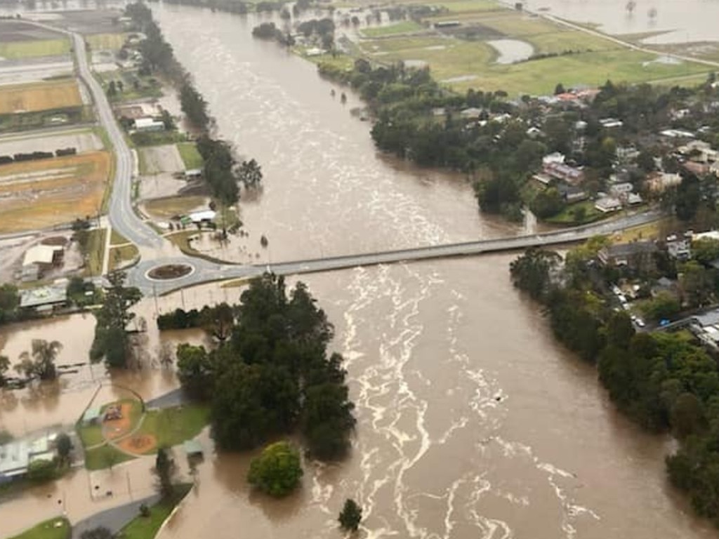
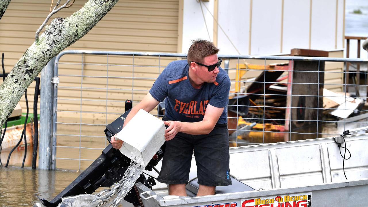
Australia’s not immune.
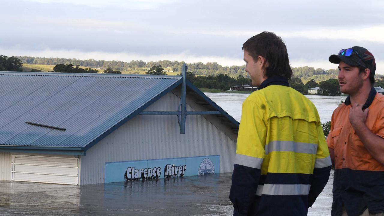
In March 2021, 18,000 people had to be evacuated from the “Sackville Bathtub” – the Hawkesbury-Nepean River district of Western Sydney – ahead of 12.9m high floodwaters.
In February last year, four people died and 2000 houses were destroyed when 14.4 metre floods ripped through the city of Lismore.
The question is – what happens when one of these extreme downpours hits an even more populated area?
Adapting to change
“What we’ve historically seen as a one-in-100-year flooding event is rapidly becoming a one in 50, 30 or 20-year event,” says Professor Evans. “That means the new 100-year event is way bigger than anything we’ve planned for. Our structures and plans are no longer able to perform as needed.”
Not only is existing infrastructure more exposed, it’s also more vulnerable.
The world’s insurance industry now says thunderstorms are its greatest concern. Not fire or cyclones – or even earthquakes or volcanoes. That’s because thunderstorms can bring hail and damaging winds alongside an extreme downpour.
And because they’re happening more often.
“It’s that new one-in-100, or perhaps even the new one-in-50, that we need to be concerned about. And that’s what we need to build and upgrade for now. But we’re not. We’re still building structures based on 100-year-old standards,” Evans warns.
Preparation means resilience. And a dramatically reduced recovery bill after an extreme storm inevitably hits. It’s easier to upgrade stormwater systems and restore natural wetlands than it is to raise a bridge or dam, he adds. But easiest of all is to start building better now and pay more attention to what happens to the water run-off from new developments.
“We’re already rethinking town and city planning codes for increasing heat,” Evans says. “Most major cities in Australia already have programs to increase tree cover for public health. They provide extra shade, but they also do a fair bit more than that.”

Their roots and trunks slow water flow. And their transpiration cools the lower atmosphere – reducing the conditions needed to produce an extreme storm.
“That’s one example of where we’re already adapting,” he says. “But building codes must be next”.
Jamie Seidel is a freelance writer | @JamieSeidel


