
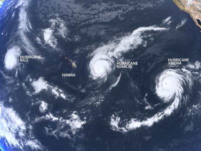
Three Category 4 hurricanes appear in Pacific Ocean
IT’S never been seen before: three Category 4 hurricanes marching across the Pacific at the same time. It has Hawaii battening down the hatches.

IT’S never been seen before: three Category 4 hurricanes marching across the Pacific at the same time. It’s an event which has Hawaii battening down the hatches.
They’re named Kilo, Ignacio, and Jimena.
An awesome image of all three parading across the Pacific was captured by NASA at the weekend.
The serene beauty of the scene belies the threat the trio pose to Hawaii, Japan, Taiwan and the Philippines.
The US Weather Channel notes it is the first time three Category 4 hurricanes have been seen at the same time. It also represents something of a leap: Three concurrent Category 3 hurricanes have not yet been recorded.
Triple hurricane event. El Nino conditions causing warm sea surface temps. Thanks @NOAA. http://t.co/6rLVc2PnwJ pic.twitter.com/yzFd5JXNCR
— BOM Australia (@BOM_au) August 31, 2015In the firing line
IGNACIO: The Big Island of Hawaii is bracing for high winds, heavy rain and ocean swells of up to six metres as strengthening Hurricane Ignacio approaches the state.
Ignacio has sustained winds of up to 217km/h. Forecasters at the Central Pacific Hurricane Center said conditions are right for it to continue strengthening, but upper-level winds will weaken the storm later in the week.
Photos inside the eye of Hurricane #Ignacio in the Pacific. pic.twitter.com/kiygLryuBG
— 403rd Wing (@403PA) August 30, 2015That won’t be enough to prevent high winds and battering surf from hitting Hawaii. A tropical storm watch was issued for the Big Island, and forecasters warned that sustained winds there could potentially reach tropical storm force of 63km/h as early as tonight.
Swells generated by Ignacio along the east and southeast facing shores of the Big Island will increase, creating potentially life-threatening surf conditions, forecasters said.
The hurricane is expected to pass north of Hawaii in the coming week, but forecasters warn that there is still uncertainty about the storm’s path.
Hurricane JIMENA. It's really scary to see the eye of the hurricane closely... pic.twitter.com/EDr6X5vvuo
— 油井 亀美也 Kimiya.Yui (@Astro_Kimiya) August 29, 2015JIMENA: Following close on the heels of Ignacio is Hurricane Jimena, which has strengthened into a Category 4 hurricane with maximum sustained winds of 225km/h. Jimena is expected to remain a major hurricane into midweek, but it will still be far from Hawaii. Forecasters warn, however, that that there is still uncertainty about Jimena’s path.
#Kilo #Ignacio & #Jimena 08/30 14Z @UWSSEC Global IR with #JTWC Tracks http://t.co/K2Zrwl1okT #RealEarthâ„¢ @UWCIMSS pic.twitter.com/aPE0NJoXDg
— Russell Dengel (@RussellDengel) August 30, 2015
KILO: Safely situated in open water, Hurricane Kilo’s 220km/h winds are moving steadily westward at about 15 kilometres per hour. It is also expected to remain a major hurricane until at least Thursday.
Temperature anomalies
The appearance of the chain of hurricanes may be linked to the strengthening El Niño weather pattern being observed in the Pacific.
The Australian Bureau of Meterology says the eastern half of the northern Pacific was now more than one degree warmer than the averages — with patches more than two degrees higher.
Amid warmest N. Pacific SST configuration in 65+ years, basin has yielded 3 simultaneous cat 4 hurricanes. pic.twitter.com/PjDEa689JE
— Anthony Sagliani (@anthonywx) August 30, 2015
Warmer than usual water is also being recorded in the Indian Ocean.
“In the coming weeks, the NINO3.4 region may exceed the peak anomaly values reached during the 2002 (+1.6 °C) and 2009 (+1.7 °C) El Niño,” a statement reads.
Women injured by lightning amid Anzac deluge
Two women have been injured in separate lightning strikes after one Aussie state was pounded by more than 200mm of rain over Anzac Day.

‘Nonsense’: Albo slams Greens over salmon
The prime minister has gone after the Greens in Question Time over salmon farming in Tasmania.
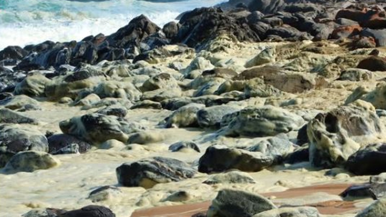
Shock scenes at iconic Aussie beach
Shocking scenes have unfolded at an iconic Aussie beach, with swimmers reporting feeling sick and marine life dying after toxic foam washed ashore.