
Interactive shows Australians how much hotter their local areas will get during summer by 2050
A new map is letting Australians check how bad things will get in their suburb, thanks to climate change.

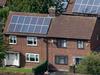
Australians can now check how much hotter average summer temperatures will become by 2050 in their local government areas.
The research provided to news.com.au exclusively as part ofTime is Nowby the Monash Climate Change Communication Research Hub has allowed Australians to see how conditions could change in almost every local government area (LGA) across the country by 2041-2060, compared to average simulated temperatures in 1986-2005.
Time Is Now is part of news.com.au’s partnership with the Monash Climate Change Communication Research Hub, looking at the impacts of climate change across Australia by 2050.
The data is based on climate simulations from the NSW and ACT Regional Climate Modelling project, also known as NARCliM1.5, led by the NSW Government, using a medium emissions scenario as well as a higher emissions pathway.
People can search for their LGA to see how much temperatures are expected to rise under either scenario by around 2050.
Climate researcher and data scientist James Goldie, who compiled the Monash data said he hoped it would help people to understand the impacts of climate change.
“There’s a real risk to our lifestyles and a lot of things we hold dear, like summer sports, or our health,” Dr Goldie said.
“It’s not something that’s far off, it’s here and it will define the next few decades.”
The scenarios are called representative concentration pathways (RCP) and have been developed by the United Nations’ Intergovernmental Panel on Climate Change (IPCC) to understand how our future would look if a certain volume of greenhouse gases was emitted.
The medium emissions scenario (RCP4.5) assumes that no action is taken on emissions reduction until after 2050 with the world waiting until 2100 to reach net zero.
The higher emissions pathway (RCP8.5) assumes no action to reduce emissions, although some policies have been announced that will shift the world away from this scenario if implemented.

Dr Goldie said he used two sources for the NARCliM1.5 data, which was developed by the NSW Government and the University of NSW, to break it down into local government areas.
Some areas were not able to be finalised in time for publication but Dr Goldie hopes the data will make climate science relevant to people around Australia.
“(NARCliM1.5) uses a few global models to look at possible future, it doesn’t include every model, as some are very expensive to run, but it’s a fantastic product and a really valuable look at possible futures,” he said.
More Coverage
You can check out how climate change will affect average summer temperatures in your area below.
These scenarios could be avoided if the world acts to keep global warming to around 1.5C, which would require greenhouse gas emissions to be brought down to zero by 2050.
Australia has yet to commit to a net zero by 2050 target, with Prime Minister Scott Morrison facing increasing pressure to do this ahead of the Glasglow Climate Change Conference starting on October 31.


