
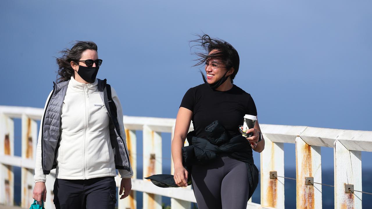
Bureau of Meteorology forecasts high temperatures, strong winds for the weekend
The Bureau of Meteorology has issued several severe weather warnings for much of Australia.

Parts of southeast Australia will face the brunt of damaging winds and severe thunderstorms as a trough moves across the regions.
Bureau of Meteorology metrologist Miriam Bradbury said severe thunderstorms are expected across Victoria and much of southeastern Australian on Sunday following a very windy period over the last number of days.
It comes as current damaging wind warnings remain in place for parts of NSW, including the Blue Mountains to the west of Sydney and the Dividing Range to the south, as well as some of those southeast alpine areas of NSW.
“In those areas, we may see further damaging wind gusts through the course of Saturday, strong enought to bring down trees or branches across roads, potentially leading to dangerous driving conditions,” Ms Bradbury said.
“If you are you travelling into those more elevated parts of the state, beware of those risks today.
“It should ease back below warning threshold later this afternoon, with a much gentler night on the way where winds are concerned.”
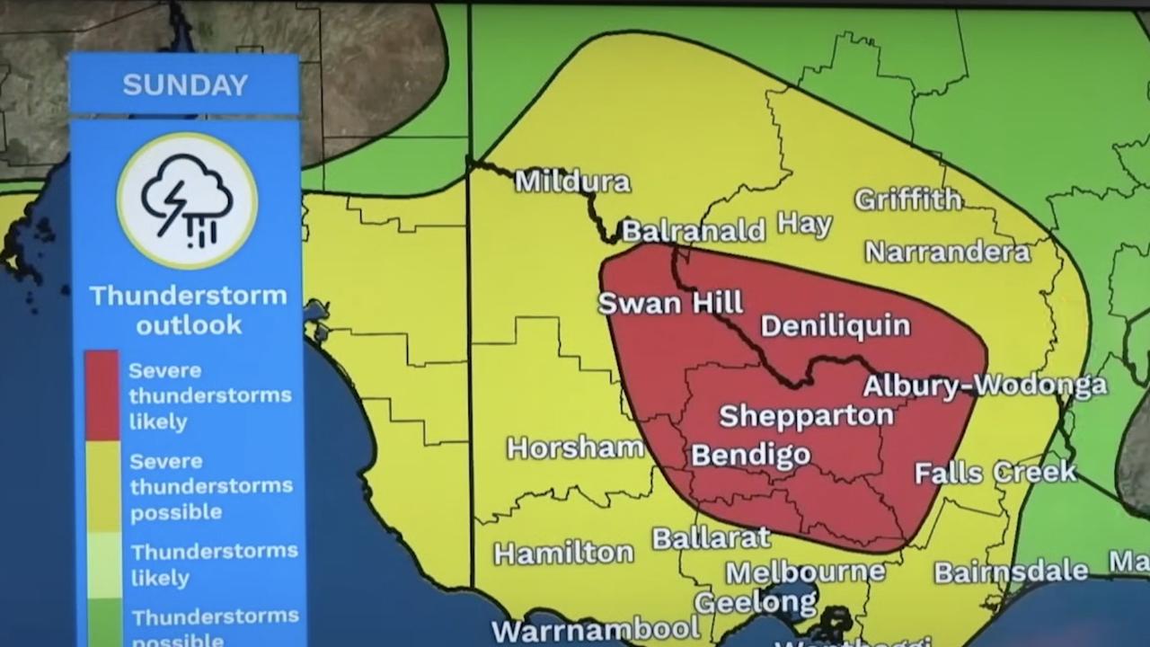
But come Sunday, millions are being warned to stay inside as widespread thunderstorms are forecast for Sunday as a cold front and trough sweep across the south-east.
“Storms possible all the way up through western NSW, extending down to southeast South Australia and Victoria too.
Tasmania is less likely to see thunderstorms tomorrow,” Ms Bradbury said.
“What I really want to focus on though … is the yellow and red areas indicating where server thunderstorms are likely or possible.
“They extend from southern parts of the Eyre Peninsula through southeast SA into Victoria and southern NSW, impacting some of our major populations centres, including Adelaide and Melbourne.”
The warnings also forecast damaging wind gusts or large hailstones throughout the day, with heavy rainfall possible but less likely.
“The thunderstorms will be pushing down into the far northern suburbs of Melbourne and as far north as the southern Riverina of NSW.
Now in that area, severe thunderstorms are likely through tomorrow afternoon and evening,” Ms Bradbury said.
“We may even see destructive wind gusts as these storms move through.”
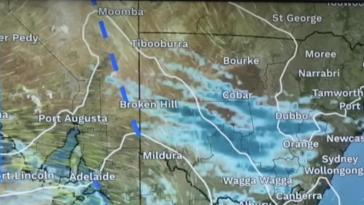
Meanwhile, a front is forecast to sweep through southeast South Australia during Sunday morning, reaching Adelaide late morning or around midday.
“Now that’s were we’re going to see the strongest winds and the storms on that leading edge of the system,” Ms Bradbury said.
“It’ll move through the western parts of Victoria in the afternoon, sweeping through Melbourne in the late afternoon or early evening.
“It’s worth noting we’re seeing continued showers and storms in the wake of the system, but the most intense impacts are likely to be along the line of the trough itself.
“It’ll move into eastern Victoria and southeast NSW through the evening and overnight period with less storms for the way from Monday.”
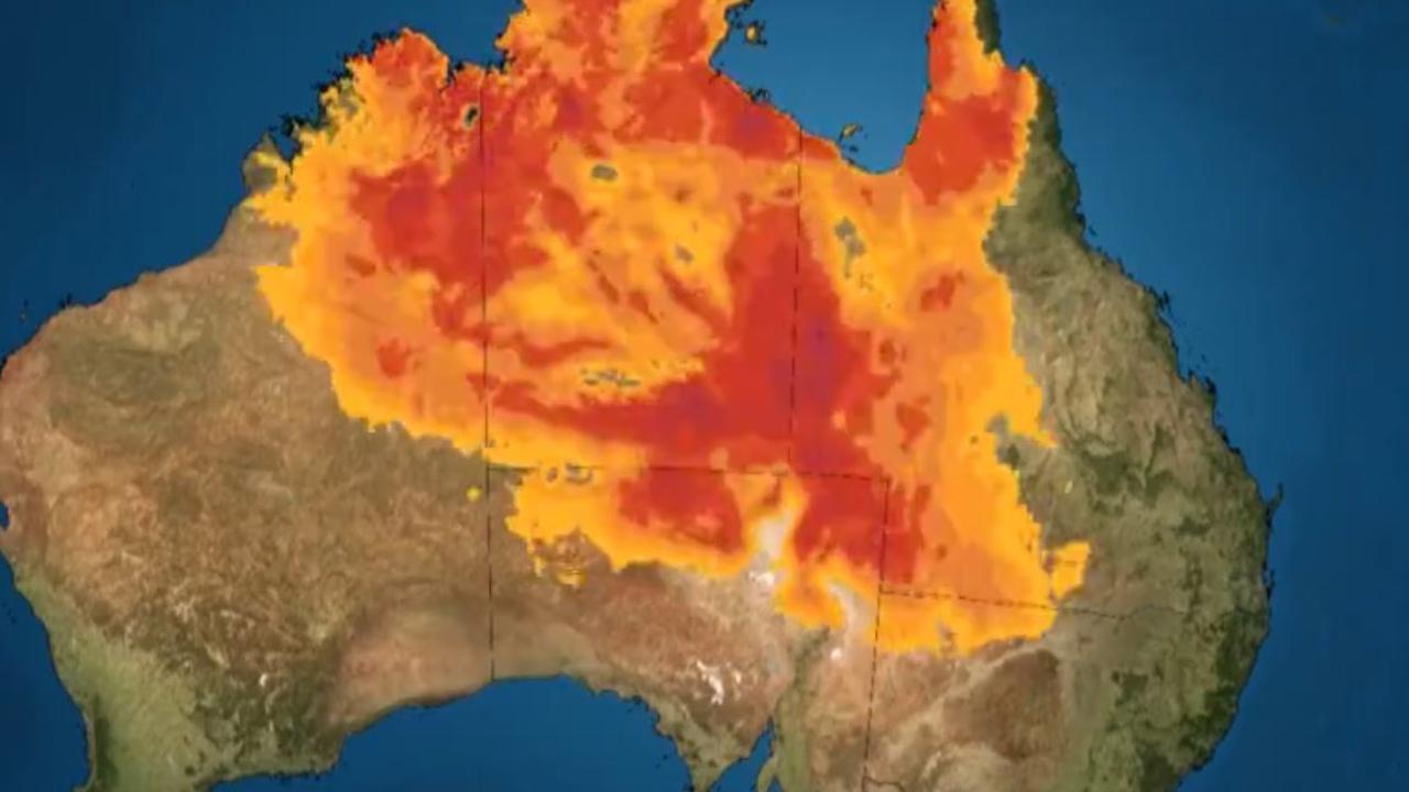
It comes as the Bureau also warned people to check their forecasts as “really intense warm conditions” could break temperature records in some places across Central Australia, with one town set to reach 40 degrees.
The warning comes as unseasonal warmth continues to impact central and eastern Australia this weekend and into next week, according to the Bureau.
“Typically, August is when we see spring weather building, but this extreme and prolonged heat is unusual,” the Bureau stated.
New August maximum temperature records could also be broken in many areas over the coming days.
Unseasonably warm weather is expected across large parts of the country on Saturday.
The hottest places forecast across the country at 4pm on Saturday include:
- 39 degrees in Oodnadatta, South Australia
- 37 degrees Birdsville, Queensland and Catherine, NT
- 35 degrees in Darwin, NT
- 33 degrees in Bourke, NSW, and Charleville, Queensland
- 31 degrees in Broome, WA
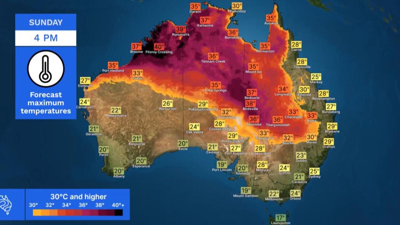
The extreme heat is also forecast to stick around on Sunday, with Fitzroy Crossing in WA expected to reach 40 degrees at 4pm.
The Bureau stated if that occurs, it’ll be the first 40 degree temperature of this season.
Meanwhile, a severe weather warning for damaging winds remains in place for parts of Western Australia.
It comes after a strong cold front came close to the Esperance area on Saturday morning, creating a broad stream of gusty showers and thunderstorms across southwestern parts of the state.
Damaging wind gusts with peak gusts of 90 to 100 km/h on and near the front are possible about the far eastern Great Southern and South East Coastal districts across Saturday.
Similarly, damaging wind gusts of .90 to 100 km/h are also broadly possible with isolated thunderstorms across southwestern parts of the state.
These conditions are expected to ease about the Perth area by around midday, and should contract to southwest of a line from Bunbury to Bremer Bay by mid afternoon.
Exposed coastal areas between Augusta and Walpole may also experience periods of sustained with damaging averaging 60 to 70 km/h.
Conditions are expected to ease completely by Saturday night.
Areas which may be affected include Albany, Bunbury, Busselton, Esperance, Katanning, Mandurah, Manjimup, Margaret River, Mount Barker, Narrogin, Northam and Perth.
The warnings come after damaging winds were recorded on Saturday morning across the state including:
- 107 km/h wind gust recorded at Cape Leeuwin at 6.26am
- 106 km/h wind gust recorded at Busselton Jetty at 6.10am
- 100 km/h wind gust recorded at Rottnest Island at 3.50am
- 98 km/h wind gust recorded at Ocean Reef at 8.07am
- 98 km/h wind gust recorded at Ocean Reef at 8.24am
Bureau metrologist Angus Hines reminded residents to stay alert during strong winds.
“When we have winds this strong, there a number of impacts that may occur, including some of these here,” Mr Hines said.
“We could see trees and branches down, potentially across roads and maybe onto property as well.
“There’s the potential for power outages around southwestern WA this weekend.
“And maybe to damage to lose structures, like outdoor furniture, trampolines, fences and maybe the odd roof tile if it’s not tethered down correctly.”
Meanwhile in the capitals, Sydney is set to reach a top of 26 degrees on Saturday with a 40 per cent chance of rain.


Brisbane will also top 26 degrees while Melbourne will only reach 21 degrees.
Perth will see highs of 18 degrees with a high chance of showers, becoming less likely in the late afternoon and evening.
In Adelaide, temperatures will hit 26 degrees.
Read related topics:Weather

Albo reconnects with Aussie icon in China
Anthony Albanese has gotten a big dose of panda diplomacy in China, reconnecting with an Aussie favourite as he winds down his state visit.
Read more

Greens demand PM act on toxic bloom
As one Aussie state continues to suffer from a “disaster” algae bloom that is putting the future of the fisheries industry in crisis, the Greens have made a simple demand from Albo.
Read more

‘Mind boggles’: Big call to bring back old tax
A former Treasury boss says the axing of a controversial tax “still boggles the mind” amid calls for stronger action to protect the environment.
Read more