
Brisbane, Adelaide weather: Storms to lash Queensland, South Australia
WINDS, rain and storms have battered Australian homes, leaving many of them without power amid warnings more punishment is on the way.

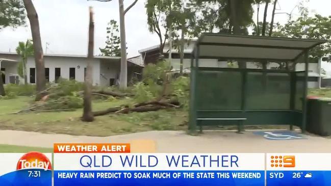
HEAVY rain and wild weather has battered parts of Queensland amid warnings even more falls are on the way.
Storm cells have already left parts of north Queensland soaked and thousands of homes without power.
The Bureau of Meteorology (BOM) has said the worst is over for now, however parts of the state can still expect heavy rain and further storm activity.
The wild weather has seen parts of northern and central Queensland cop more than 150mm of rain with some residents saying the conditions were among the worst they’ve seen.
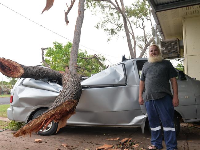
Moranbah resident Nicholas Martorana told Today the conditions were worse than those seen during Cyclone Debbie which hit last year.
“It was like Cyclone Debbie, but worse. It was just insane how much power the wind was,” he said.
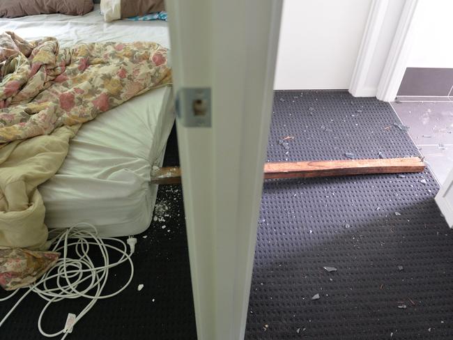
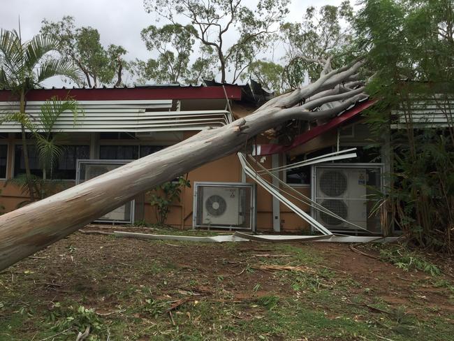
Around 30,000 properties across north and central Queensland were left without power as the wild storms hit and left extensive damage to properties on Tuesday.
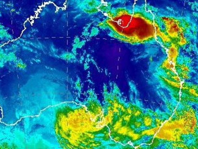
Sky News Weather meteorologist Tristan Meyers told news.com.au eastern Queensland was in the midst of a prolonged and widespread storm outbreak which was affecting areas across the entire state.
“Storms have been bringing heavy rainfall and damaging winds to different regional and rural areas of Queensland since Sunday,” he said.
“For instance on Monday, Cloncurry had a gust of 115km/h, Julia Creek 102km/h.
“On Tuesday, Moranbah had gusts of 104km/h, Clermont 93km/h and Emerald 91km/h. Also, Injune had their heaviest rain in at least three years. Extensive damage was also reported around the Mackay area.”
Mr Meyers said a pool of cold air in the upper atmosphere has rolled over Queensland and this was causing widespread instability.
“This is because it’s hot and humid at the surface. Hot air likes to rise above cold air, so you get widespread rising motions (convection), which leads to showers and storms,” he said.
“While that pool of cold air will gradually dissipate, plenty of tropical moisture and hot temperatures will ensure that the storm outbreak will linger well into next week.”
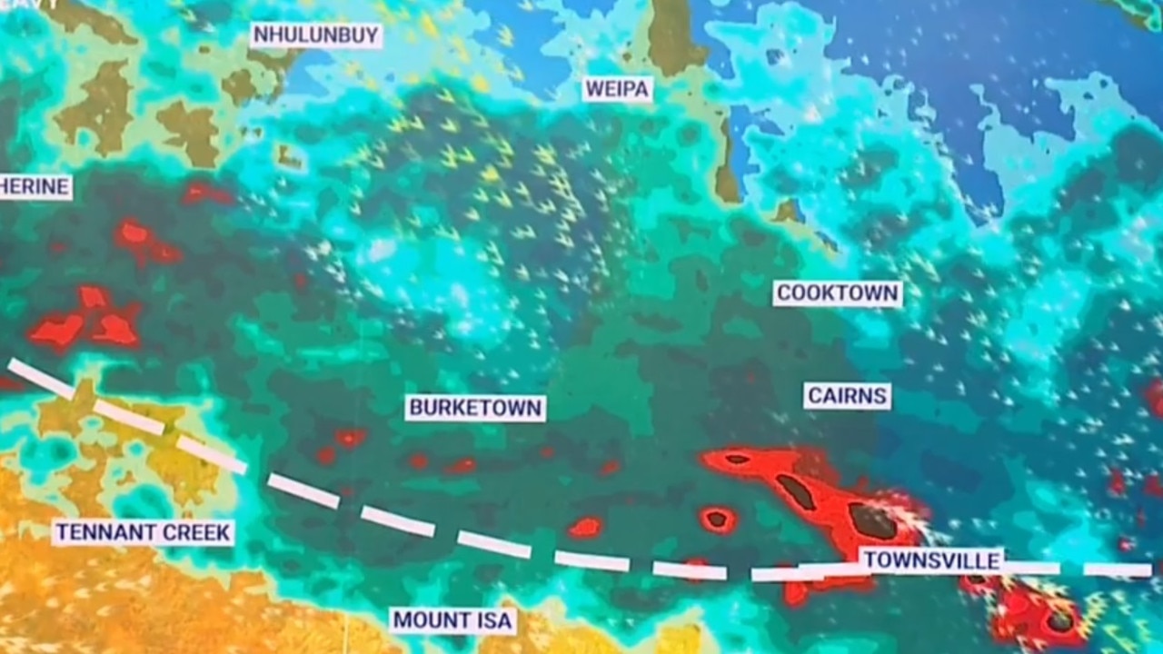
Mr Meyers said storms were possible every day from Burketown in the northwest of the state, across to the tropics and down to the southeast.
However he said that doesn’t mean storms would occur — only that there was a risk they could hit.
Get used to this! Plenty more showers to come for coastal parts with moist onshore flow in coming days. Good rainfall totals building along #Capricornia and #WideBay coasts. Heavy falls possible in ðŸŒ©ï¸ #qldstorm today - take care on the roads! More radar: https://t.co/nURrT72l3F pic.twitter.com/T3keICOIx2
— Bureau of Meteorology, Queensland (@BOM_Qld) February 21, 2018
Meanwhile terrifying footage has emerged of a Qantas flight in the severe storms.
Passengers on QF 2475 from Mount Isa to Townsville were rattled when the plane was caught up in Tuesday’s storms and landed an hour and a half later, Yahoo reported.

Terrifying footage obtained by 7 News showed the plane shaking vigorously while those on board gasp.
Get used to this! Plenty more showers to come for coastal parts with moist onshore flow in coming days. Good rainfall totals building along #Capricornia and #WideBay coasts. Heavy falls possible in ðŸŒ©ï¸ #qldstorm today - take care on the roads! More radar: https://t.co/nURrT72l3F pic.twitter.com/T3keICOIx2
— Bureau of Meteorology, Queensland (@BOM_Qld) February 21, 2018
And it seems there are plenty more showers to come for coastal parts of the state.
BOM meteorologist Jess Gardner said the state was experiencing some fairly unsettled weather at the moment, and that pattern was likely to continue into the weekend.
“Moist air masks over some parts of the state combined with an upper low is creating moist air leading to heavy rainfall, showers and some storm activity,” she said.
The north tropical coast has already been hit by big falls with South Mission Beach recording up to 179mm since 9am yesterday.
Innisfail had recorded 69mm, Bundaberg 80mm while parts of the Sunshine Coast recorded up to 111mm, Ms Gardner said.
Brisbane has so far escaped the worst of the wild weather but the BOM warn storm activity is possible over the coming days.
The city is expecting a top of 26C today with showers.
Showers and storms are forecast for tomorrow with up to 70mm of rain forecast.
Rain is set to continue across the weekend for Brisbane as well as parts of northern and central Queensland.
Meanwhile Queensland isn’t the only state being battered by some intense weather.
Feeling tropical? Remnants of #CycloneKelvin is feeding moisture & humidity o/SA. Forecast map https://t.co/Pxq4TdKkaY shows how the low will track over SA bringing with it windy conditions along coast. Gale & Fire Weather Warnings are current, to view https://t.co/5wxFrWeCue pic.twitter.com/QgVoGFMkq5
— Bureau of Meteorology, South Australia (@BOM_SA) February 21, 2018
South Australia is feeling the remnants of Cyclone Kelvin which is bringing windy conditions along the coast.
The BOM has issued a series of wind and fire warnings for the state.
Adelaide will remain hot and humid with showers forecast up until Sunday.
The city will hit a high of 32C today, 33C tomorrow and 25C on Sunday.
State braces for more severe storms
More than 20 people have been rescued after becoming trapped in floodwaters while thousands are without power as storms threaten to smash NSW for a second day in a row.

Train crash causes diesel spill in beloved region
Emergency services are mopping up a diesel spill in a tourist region after a train crashed into a tree.
Worst news possible for flood-ravaged towns
Already flood-ravaged areas of Far North Queensland are bracing for the next deluge, with warnings in place for flash flooding and torrential rain.