Band of gales ‘thousands of kilometres’ long to batter southeast Australia
A massive tract of ferocious winds is set to batter the continent with 100km/h winds, huge waves and shudder-inducing temperatures.
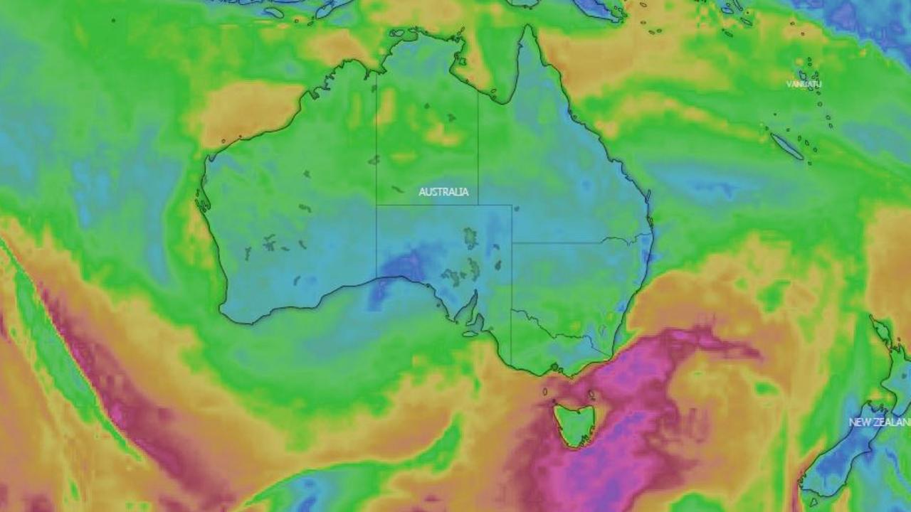
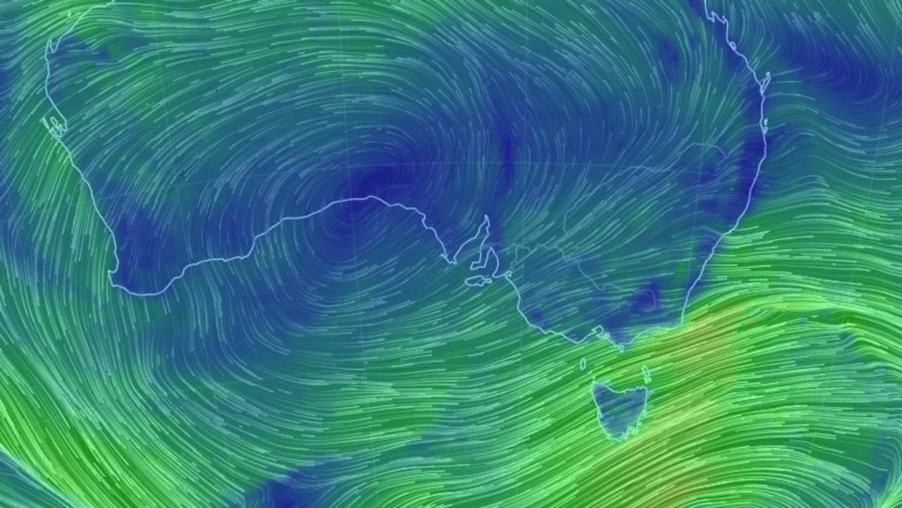
A band of ferocious gales “thousands of kilometres long” is set to batter southeast Australia for at least the next 24 hours, bringing winds of more than 100km/h, coastal erosion and waves of up to 15 meters high.
Severe weather warnings are in place for large tracts of Victoria, Tasmania and New South Wales, including areas close to Sydney, Melbourne, Canberra, Hobart and Geelong.
Flood warnings are out for parts of Victoria and Tasmania.
Two huge cold fronts are responsible as they power their way through the Bass Strait and head up into eastern Australia. One passing through on Wednesday is set to be followed by another on Thursday that could prolong some of the wild weather for up to 48 hours.
Cape Grim, on Tasmania’s west coast, recorded a gust of 95km/h this morning; Hogan Island in the Bass Strait was hit with a gust of 113km/h, with nearby Wilsons Promontory almost reaching 90km/h.
Essendon Airport, in Melbourne’s north, recorded a blast of 57km/h at 10am today.


“Gale force winds will continue to last for the next 48 hours as a pair of cold fronts whip across southeast Australia” said Sky News Weather channel senior meteorologist Tom Saunders today.
Boat owners, skippers and rock fishers are being warned to expect dangerous surf conditions along much of the NSW coast. The Bureau of Meteorology (BOM) said surf and swell conditions would develop on Wednesday afternoon and into the evening.
These were expected to create hazardous conditions for rock fishing, boating and swimming along the Macquarie, Hunter, Sydney, Illawarra, Batemans and Eden coasts, the BOM warned.
A marine wind warning for gale force winds is also forecast for the Eden coast, in the state’s south, and a strong wind warning is in place for Sydney closed waters and the Macquarie, Hunter, Sydney, Illawarra and Batemans coasts.
âš ï¸ #Warning current for damaging #winds across the southeast including #Illawarra, #SouthernTablelands, #SnowyMountains and #SouthCoast. Windy conditions likely to persist until later Thursday. Check the latest at https://t.co/Z11hCDKat1 pic.twitter.com/SUtLd5w9V8
— Bureau of Meteorology, New South Wales (@BOM_NSW) August 20, 2019
“There’s a long stretch of gales extending thousands of kilometres, and as a result, we’ll see massive waves along the NSW coastline averaging eight metres with maximums waves of 15 metres on Thursday and Friday,” said Mr Saunders.
Hazardous surf and coastal erosion were all possibilities, he added.
AROUND THE CAPITALS
The cold fronts may well bring wind but not necessarily much rain. Some heavy falls are forecast for Tasmania and Gippsland but light showers only in Melbourne with none forecast in Sydney.
A trough will lower temperatures, however, with a high in Melbourne of just 13C on Thursday and a low of 5C overnight into Friday.
Hobart is looking at a high of 11C on Thursday and bracing for lows of 2-4C over the night few nights.
Highs in the mid-teens are expected in Canberra, but get set for a shudder-inducing minimum of -5C on Friday morning.
Sydney’s average temperatures will touch 20C with sunny days, albeit possibly windy. Highs around 20C are forecast with lows dipping to 8C.
It will be cloudy in Adelaide with highs in the mid to high teens. Brisbane will see out a beautiful week, getting to 26C on Thursday.
Perth is looking at 25C on Thursday, but heavy rain could sweep through overnight and into Friday. It will be sunny and a high of 32C over the next few days in Darwin.


