
Wild weather weekend: Australia’s East coast smashed by flash flooding and heavy winds, Cyclone Damien gathers steam
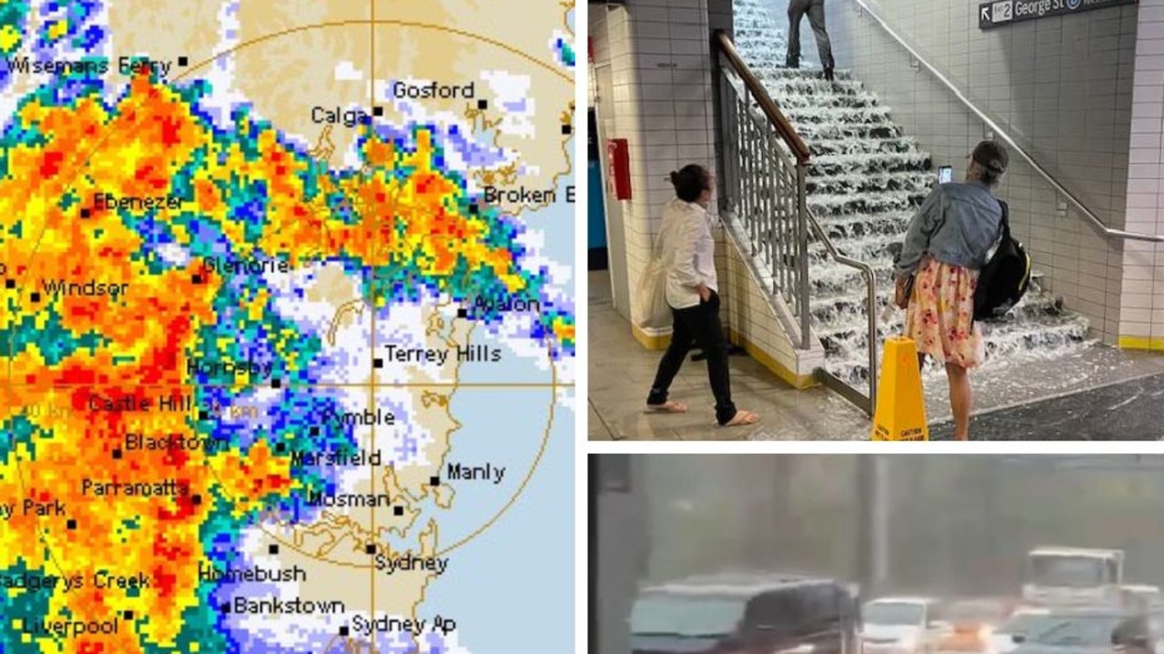
Australia’s east coast is bracing for record breaking rainfall this weekend with Sydney set to see months’ worth of rain by Sunday.

Meteorologists have said they are increasingly worried about the unfolding weather event in New South Wales and have “great concerns” that “intense bursts” of rain could see hundreds more millimetres fall far quicker than originally expected.
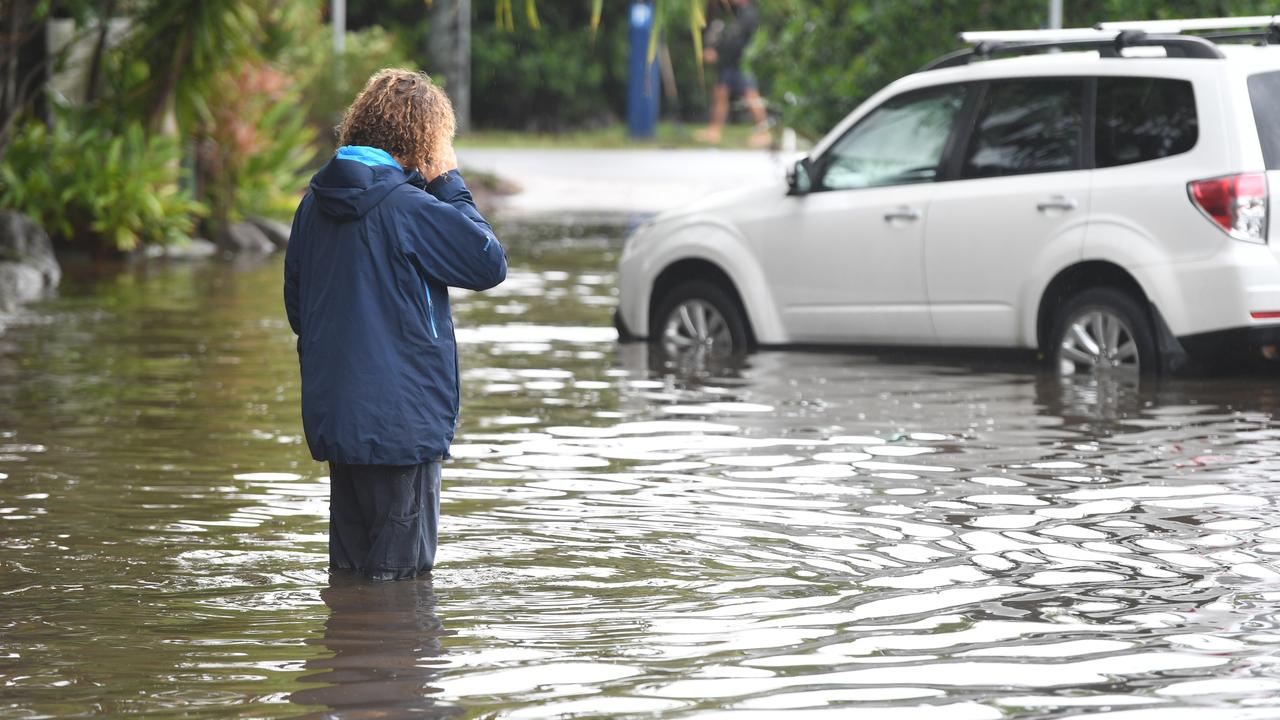
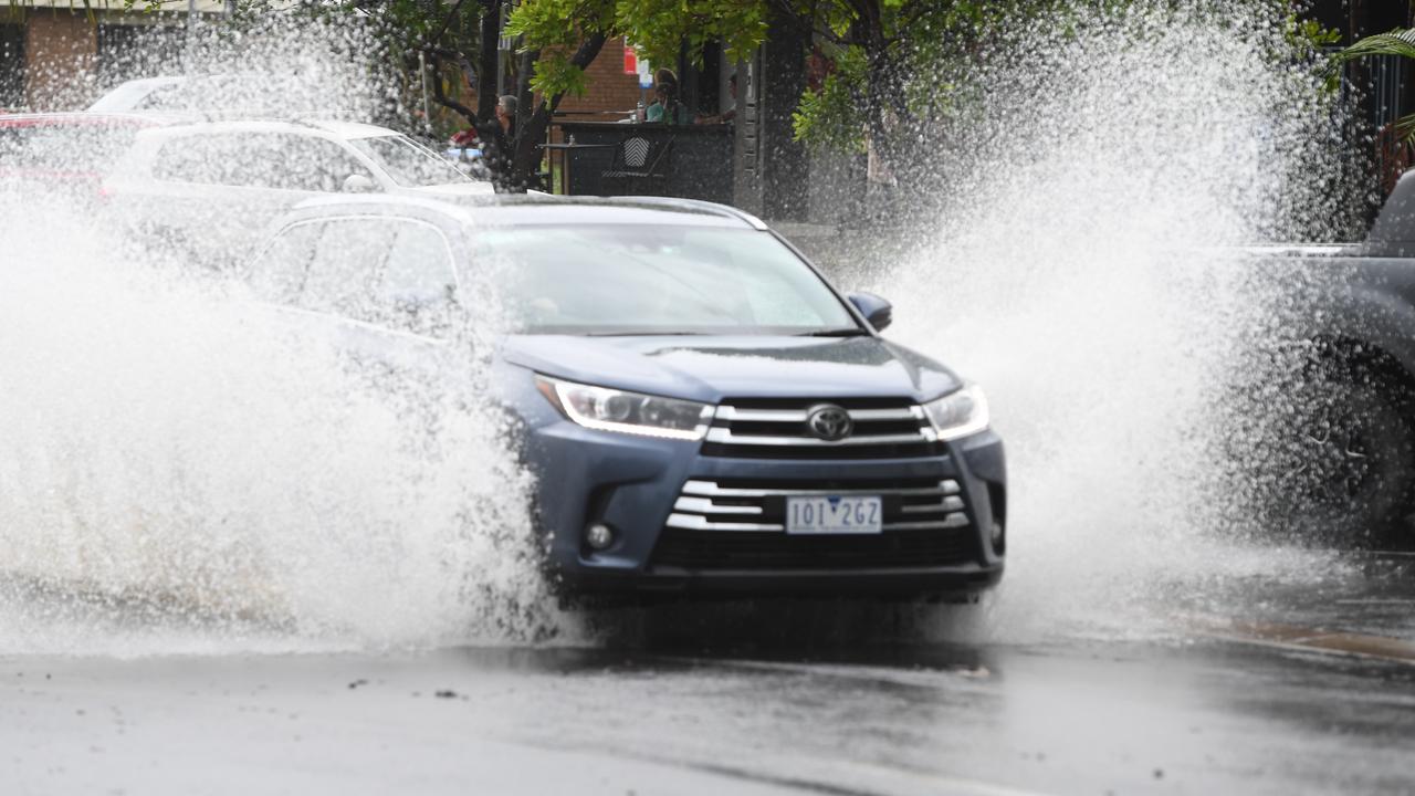
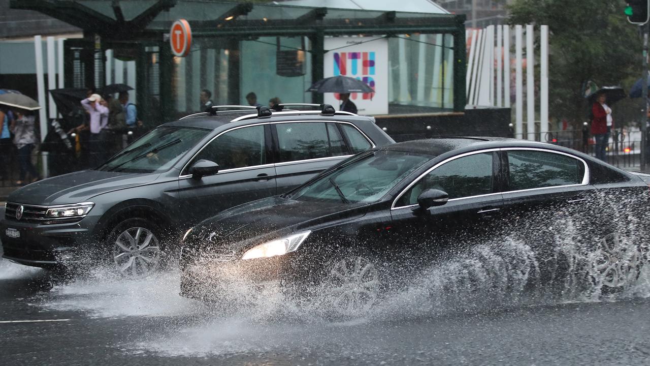
Heavy rain drenched large swathes of the state’s east on Friday, forcing road closures and sparking concerns about the risk of flash flooding.
The sheer amount of rain still set to fall is more reminiscent of tropical Queensland than bushfire-stricken NSW.
Over the coming weekend as much as 400mm of rain could fall along much of coastal NSW – that would be months of rain in just three days.
“By the time the rain ends, many coastal areas of northern NSW will have seen their highest rainfall totals since March 2017, and for others in southern NSW, since June 2016,” said BOM meteorologist Dr Adam Morgan.
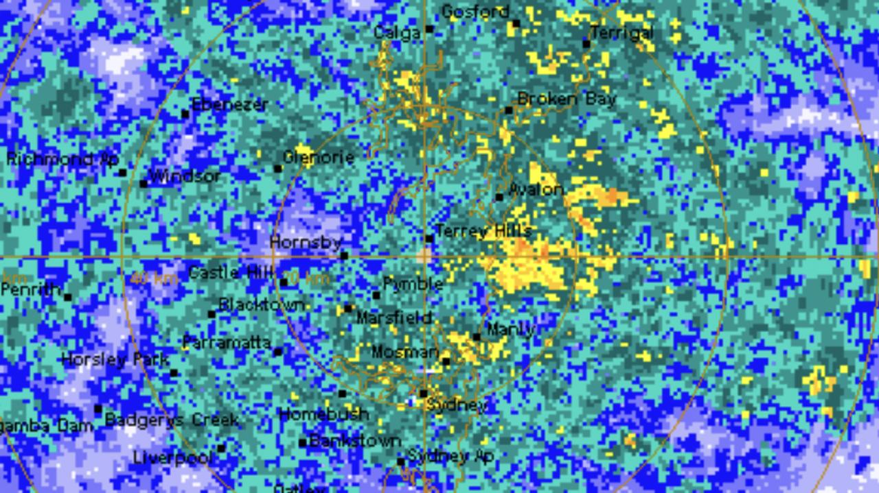
SYDNEY RAIN RADAR
A severe weather warning, stretching along the coast from the south of Wollongong up to Lismore in the north, was issued by the Bureau of Meteorology on Friday morning for heavy rainfall, flash flooding, “abnormally” high tides and dangerous surf.
An intense coastal trough that’s developed over the state’s north will strengthen into the weekend, bringing with it all of the ingredients for continued prolonged rain, heavy showers and thunderstorms, Dr Morgan said.
But, warned the BOM’s Jane Golding, “intense bursts of rain” are of “great concern from the NSW Central Coast to the Victoria border”.
“It’s not out of the question that we could get another 200 to 300mm more before Sunday.”
Sydneywas sodden on Friday with its highest 24 hour rain total since November 2018, Brisbane was drenched and Byron Bay saw its biggest downfall for almost half a century.
By 9am on Friday, Byron – the easternmost point of mainland Australia – had received 275mm of rain in 24 hours – a feat not seen for 46 years.
The Harbour City could see 120-200mm of rain on Saturday and up to 150mm on Sunday. Brisbane could be wet as well with around 100mm on the weekend.
While the deluge is bringing some much needed drought relief – and aiding in putting out the fires still burning in NSW – there is also a risk of falling trees and landslides, and large volumes of run off containing debris including ash, soil, trees and rocks.
“The rain is good for business and farms as well as being really good for quenching some of these fires we’ve been dealing with for many, many months,” NSW Rural Fire Service commissioner Shane Fitzsimmons told the ABC on Friday.
“We don’t want to see lots of widespread damage and disruption from flooding, but it is certainly a welcome change the relentless campaign of hot, dry weather.”
So nice listening to rain falling last night & driving with windscreen wipers on for a change this morning. @BOM_NSW indicates continued rain this next week & importantly, falls across our fire areas which will be so welcomed by our farmers, fire fighters & all affected. #NSWRFS pic.twitter.com/gJ3aFRQlzF
— Shane Fitzsimmons (@RFSCommissioner) February 6, 2020
“Heavy rain resulting in flash flooding along the coast is a real possibility,” NSW SES Deputy Commissioner Daniel Austin said earlier this week.
“Flash flooding is incredibly dangerous. I’m urging motorists, please stay safe on the roads – pull over if the rain becomes too heavy or if you can no longer see where you are going. Make safe decisions and never enter floodwaters.”
Nearly 700 calls have been received by emergency services on Friday following the downpours, with five people in NSW rescued from floods.
PILBARA REGION PREPARES FOR CYCLONE DAMIEN
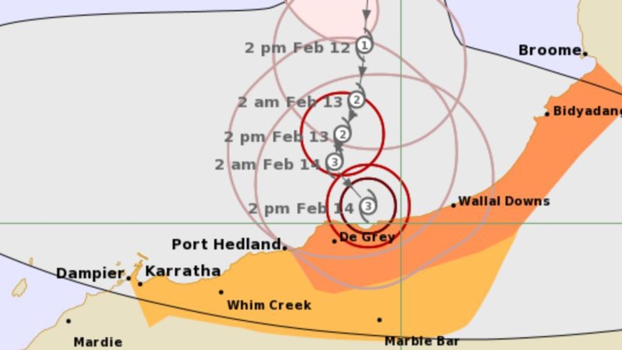
Western Australia’s Pilbara region is battening down as Tropical Cyclone Damien gathers steam.
Supermarket shelves have been stripped bare and locals are preparing to take shelter as winds of 225km/h or higher smash the coast of north west Western Australia. The Pilbara Ports Authority said the Port Hedland port is being cleared, while the Port of Dampier is in the process of shutting down. The Port of Ashburton is still in the preparation stage.
Currently at category two, Cyclone Damien is set to intensify on Saturday up to a category four storm by the time it hits the Pilbara coast on Saturday.
Gales expected on the Pilbara coast this evening or overnight. Destructive winds to comence on the coast Saturday morning. #CycloneDamien https://t.co/B1MVXBYXhh pic.twitter.com/1wTTIpScG0
— Bureau of Meteorology, Western Australia (@BOM_WA) February 7, 2020
The Bureau of Meteorology has warned gales are forecast to develop between Wallal Downs and Mardie, including Port Hedland and Karratha, from as early as Friday evening.
Very destructive winds, with gusts to 230km/h, are expected near the cyclone centre as it crosses the coast on Saturday, and residents between Dampier and Pardoo Roadhouse have also been warned of the potential for a very dangerous storm tide.
Heavy rain is also likely to cause flooding in the Pilbara and Gascoyne regions as the cyclone moves inland.
The Red Cross have opened an online register for families affected by the cyclone, and is urging people to get in touch with family and friends if they hold any concerns.
WHAT’S CAUSING ALL THE RAIN?
Sky News Weatherchannel Meteorologist Tom Saunders told news.com.au on Friday that a “positive Indian Ocean Dipole climate system has broken down and the monsoon is active across the northern tropics.
“Also we have a very moist east north easterly along the east coast which is pumping moisture in from the Coral and Tasman seas. This moisture is linking with a coastal trough to cause the torrential rain.”
“We’re only about halfway through this event,” Mr Saunders said.
RAINFALL AROUND AUSTRALIA
Darwinhas a stormy few days ahead, with the mercury set to hit above 30C over the weekend and at least 20mm of rainfall anticipated on both Saturday and Sunday, with similar conditions forecast into next week.
While the state’s north is battered by Cyclone Damien, Perth will finally see some relief from the heatwave that moved through the city earlier this week. There’s a possibility of some rain on Saturday, with the mercury topping 28C, before a windy Sunday with tops of 29C.
The deluge of rain impacting NSW might reach East Gippsland, but Melbourne is looking at a mostly dry and humid weekend, with a top of 29C on Saturday and 27C, and a higher chance of rainfall, on Sunday. The city is expected to see some rainfall early next week.
Adelaide should expect a mostly sunny weekend is expected, with temperatures into the 30s.
After last week’s horror fires and heat, Canberra is in for a wet weekend with a high chance of showers forecast for Saturday and Sunday.
State braces for days of cyclonic weather
Western Australian residents have been warned a cyclone is expected to hit as the country’s torrent of wild weather shows no sign of slowing down.
State braces for more severe storms
More than 20 people have been rescued after becoming trapped in floodwaters while thousands are without power as storms threaten to smash NSW for a second day in a row.
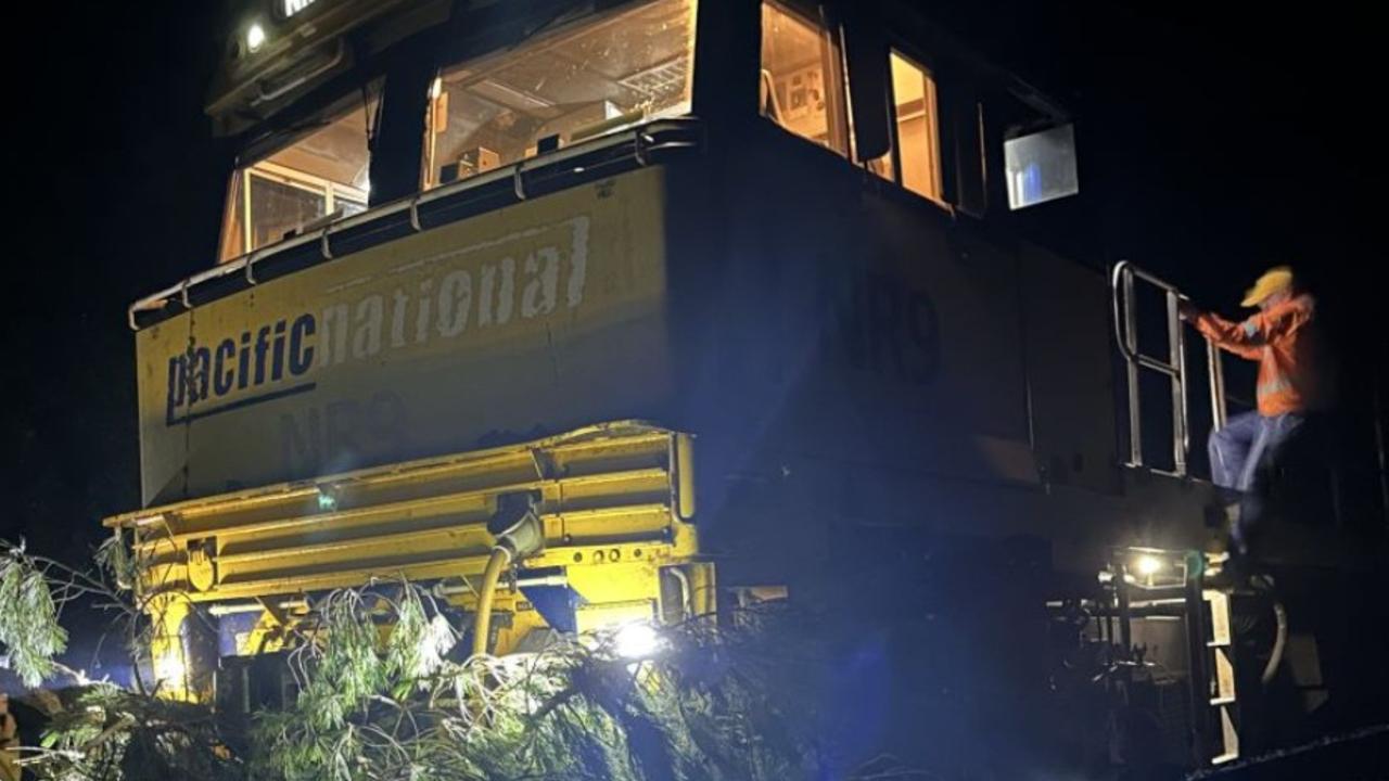
Train crash causes diesel spill in beloved region
Emergency services are mopping up a diesel spill in a tourist region after a train crashed into a tree.