
Australian weather: Short-lived relief for storm-battered regions
Eastern parts of the country battered by wild weather this week will enjoy a brief reprieve over the weekend before storms return.
Much of the country is looking at a wet week ahead as parts of Queensland and NSW recover from several days of severe storms.
Golf ball-size hailstones bombarded eastern regions of the NSW and Queensland border on Wednesday and Thursday, with a series of thunderstorms expected across the country next week.
In the days ahead, atmospheric moisture will push eastwards, creating widely spread showers and thunderstorms.
Rainfall will be concentrated in southeastern Queensland where some regions could experience up to 100mm of rain cumulatively over the next eight days.
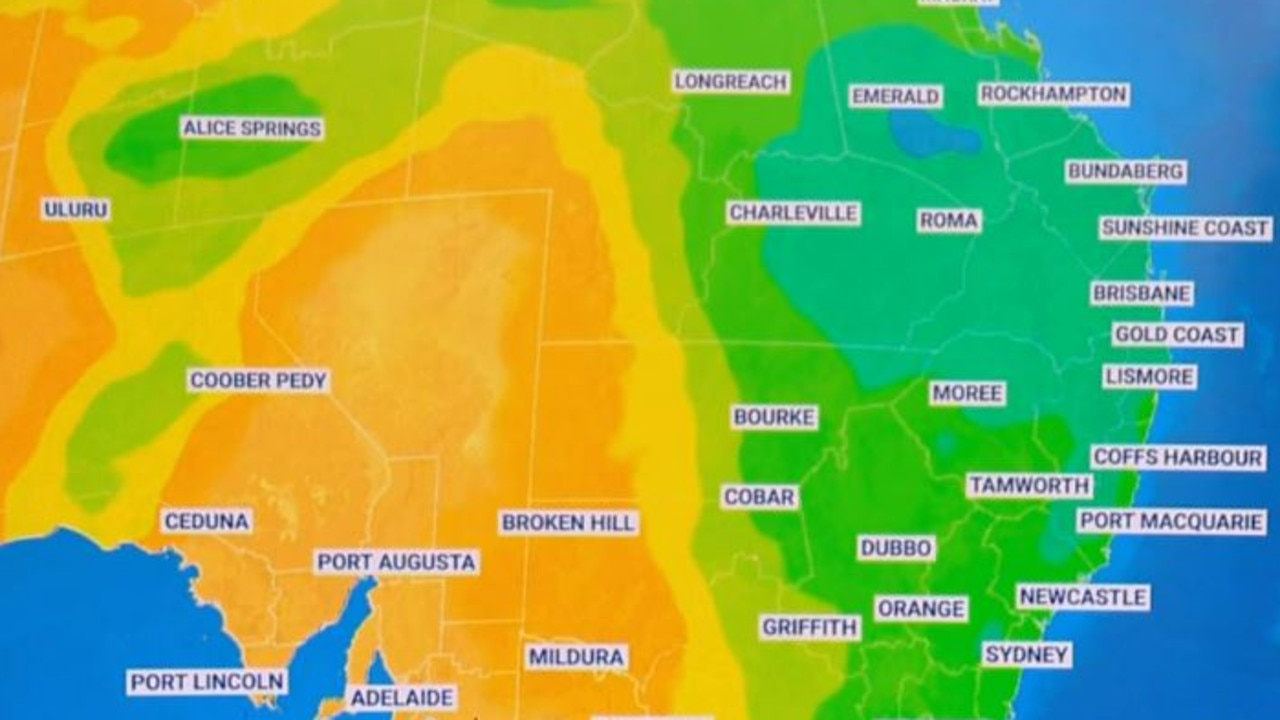
Sky News Australia meteorologist Bradlyn Oakes said cloud cover over eastern parts of the country had caused plenty of wet weather over the past few days, with showers and storms returning next week.
“We definitely could see some severe thunderstorms in northeastern NSW as well as southeastern Queensland,” she said.
Brisbane and Ipswich will reach maximum temperatures of 31 and 33C today, while the risk of severe thunderstorms and showers will persist into the evening.

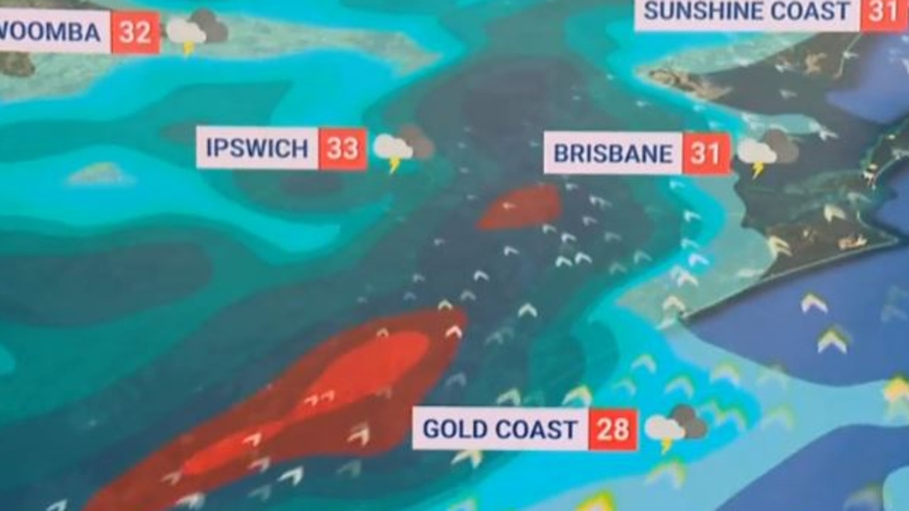
Skies will clear over southeastern Queensland over the weekend, with Brisbane enjoying partly cloudy skies and maximum temperatures of 26C before the wet weather settles back in on Monday.
“(From Monday) we could see some significant falls through to the end of next week,” Ms Oakes said.
Showers will likely “linger into the afternoon” across Sydney on Friday before clearing in the evening.
Temperature should warm “a touch” over the weekend before showers return to NSW’s capital city on Tuesday, continuing throughout the week.

Showers could persist in Melbourne from Monday through to Thursday with maximum temperatures lingering in the low 20s.
Across the country more broadly there will be “quite a bit of thunderstorm activity” to close off the working week, with showers covering parts of the Northern Territory on Friday as well.
A severe heatwave warning will persist across Western Australia’s Kimberley District through to Sunday and also widely across Queensland until Saturday.
More Coverage

Perth will next week reach maximum temperatures of 36C, where the mercury will hover from Tuesday through to at least Thursday, while Brisbane temperatures will fall from 31C on Friday to the mid-20s next week.
Maximum temperatures will hover in the mid-30s for Darwin through next week, with thunderstorms moving across the Territory on Wednesday and Thursday.
Marine wind warnings will remain in place on Friday for every state and territory except the NT.


