
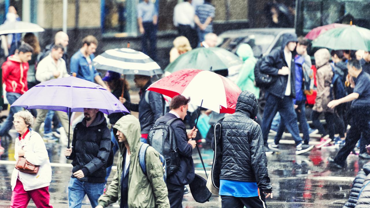
Australia set to be lashed with heavy rain this week
Record-breaking rain is set to lash huge parts of Australia this week as a bizarre weather event drenches much of the country.

The whole of Australia is set to be drenched this week as record-breaking heavy rainfall soaks the country.
The bizarrely unseasonable rain will be the result of a rare spring northwest cloudband, a weather event usually only seen in autumn and early winter.
Widespread heavy rain to this degree is extremely unusual for September, which is usually Australia’s driest month.
Experts say that the drenching could be the start of a wet spring and summer as a potential La Niña emerges in the Pacific Ocean.
Western Australia is already experiencing rainfall that will only intensify over Sunday, before gradually spreading across to the interior and eastern states from Monday to Thursday.
The Pilbara and Kimberley could be lashed with 100 millimetres of rainfall in the next 48 hours, which is extremely unusual considering the area usually averages 0 to 5mm through the whole of September.
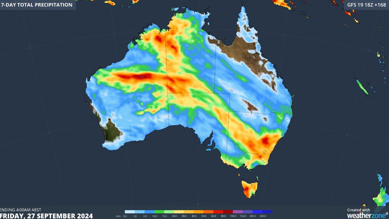
The most intense rain is likely to fall over sparsely populated inland Australia, which could wipe out any previous rain total for the month, but the coast may also hit record-breaking weather.
While Port Hedland and Broome usually only have monthly rain averages of 1.4mm and 1.2mm, both towns could be drenched by an excess of 22mm over the weekend.
South Australia and the western regions of the Northern Territory will see lots of rain over Monday and Tuesday.
By Wednesday, Tasmania, Victoria and New South Wales are also predicted to be hit with light to moderate rainfall.
The outlook from Thursday onwards is uncertain at this stage, however, it is likely that the rainband will shift up the east coast and central Queensland.
But modelling has also hinted at a low-pressure system forming over NSW later this week, possibly leading to heavy rain or even a second rainband over WA.
While most of the country is set for a soaking, some areas in northwest Queensland and on the west coast of WA near Shark Bay could miss out completely.
This weather system will cause a nationwide soaking that could last for around seven to 10 days,” Weatherzone reported.
“Some areas in WA and the NT that typically receive 20 to 50mm of rain in September could pick up about 50 to 100mm from this event.
“The widespread nature of this rain event also increases the risk of flooding and travel disruptions in multiple states.
“Anyone travelling by road or rail in the next couple of weeks should keep an eye on the latest warnings and road/rail conditions across the country.”
Breaking records
In the Northern Territory town of Noonamah, located 45km southeast of Darwin, a huge 54mm of rain fell in the last 24 hours.
This is three times the average rainfall for September and marks the highest 24-hour rainfall the town has seen in the past 15 years.
From Sunday evening, unseasonal moderate to heavy falls are also expected in northern WA and northwest NT.
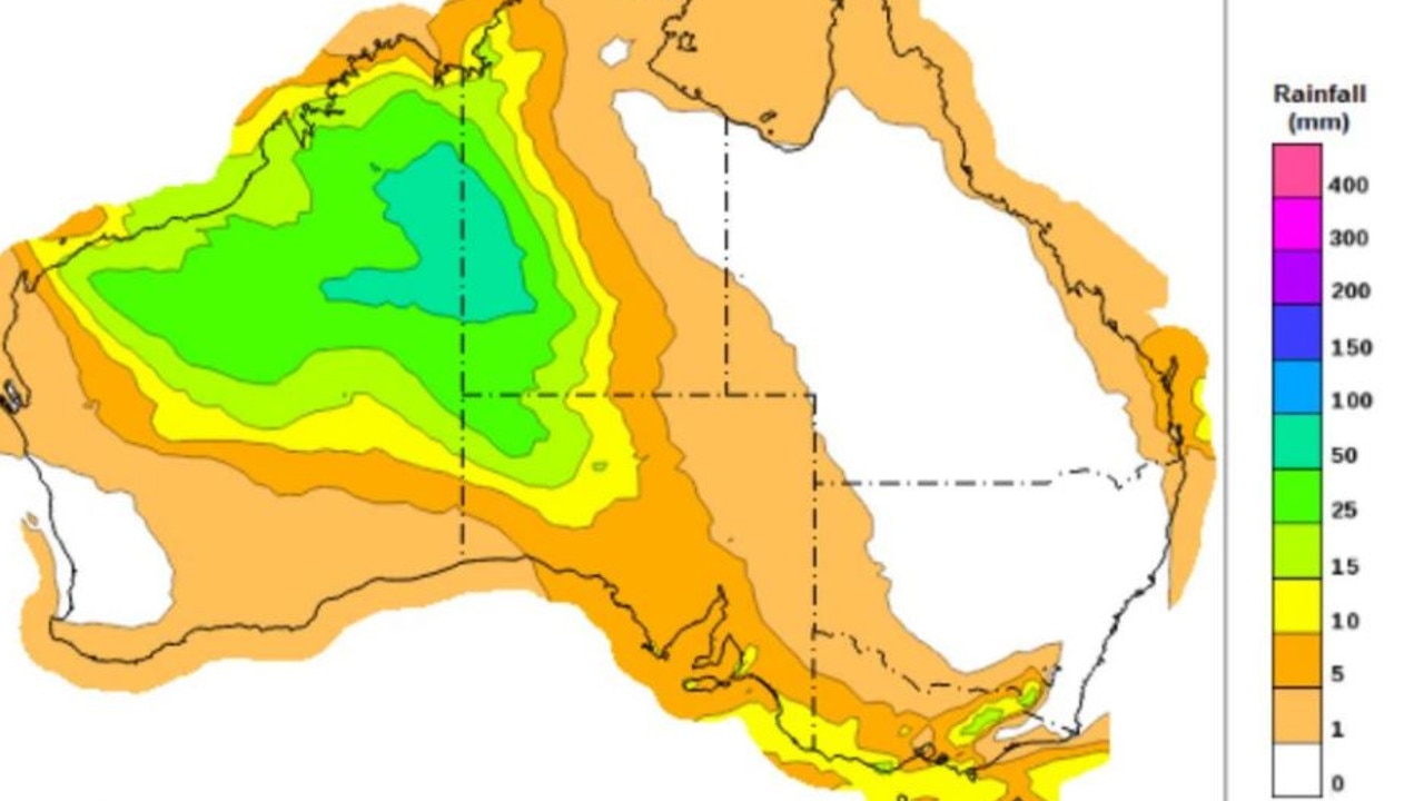
Forecasts predict widespread rainfall totals of 30-60 mm on Sunday, 30-100 mm on Monday and 10-40 mm on Tuesday, with isolated daily falls exceeding 100mm possible on Sunday and Monday.
These unprecedented conditions may cause localised flooding and overland inundation from stream levels rising, potentially affecting road access and isolating some communities.
The unusual out-of-season drenching is a result of multiple unique weather features all coinciding in an ideal location.
More Coverage

Warm ocean temperatures off the north coast of WA, which are currently 2 degrees Celsius above average, provides the optimal state for moisture.
Lower-than-average pressure off the northern coast has then combined with the warm seas to create abundant clouds through convection (the vertical transport of heat and moisture).
A jet stream from the northwest will transport this humid air across the country, which will lead to further cloud and rain and it encounters cooler and denser air.


