
Deadly polar blast hits large parts of Australia bringing severe wind and low temperatures
A woman has died and a child is fighting for life after wild weather brought a huge tree down on top of a family car in Victoria.

A woman has been killed and child is fighting for life after destructive winds brought a large tree crashing down on top of a car in Victoria.
It’s the first death recorded after a ferocious day of wild weather pummelled southern Australia bringing destructive winds and plummeting temperatures. Victoria and South Australia have borne the brunt of the polar blast so far but wind damage has been seen as far north as Newcastle on the NSW coast.
Forecasters have warned we’re only on day tow of a four day winter storm which is likely to persist until Sunday.
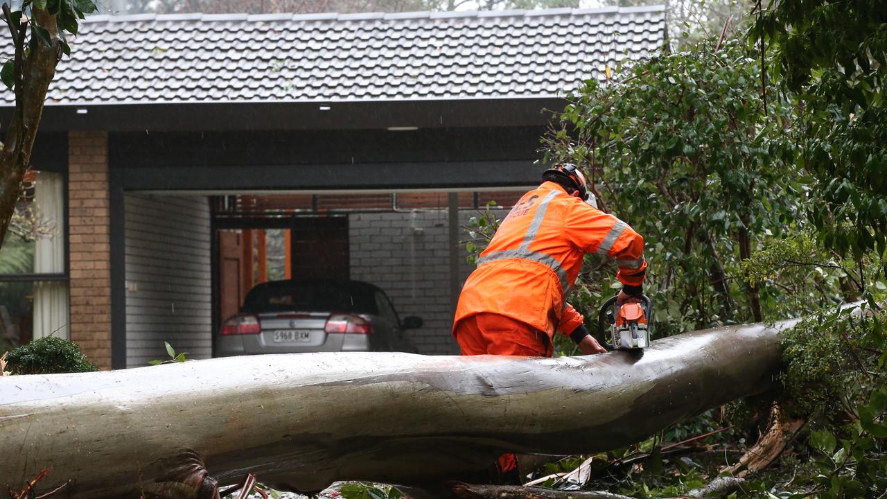
Four people were travelling in a car in Fernshaw, in the Yarra Ranges northeast of Melbourne, when the tree fell and crushed the vehicle, trapping the people inside.
Emergency services were called to the incident on Maroondah Highway at about 9.40am.
Three of the occupants were removed from the car but the front passenger died at the scene.
She is yet to be formally identified.
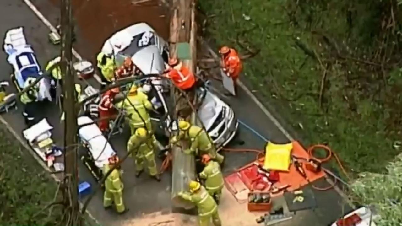
A child was flown to Melbourne’s Royal Children’s Hospital in a critical condition after suffering serious injuries.
Another child was also taken to a nearby hospital in a stable condition and a male passenger was flown to the Alfred Hospital with serious injuries.
“Yarra Ranges Highway Patrol officers are investigating and will prepare a report for the Coroner,” Victoria Police said in a statement.
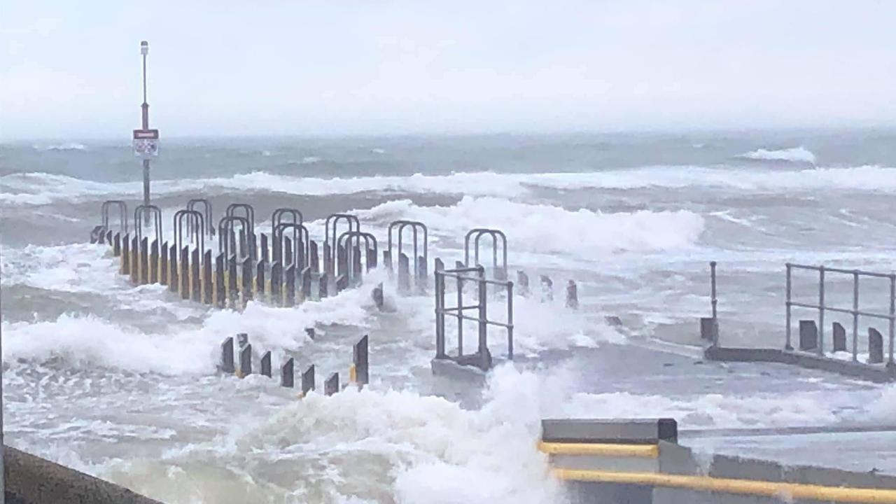
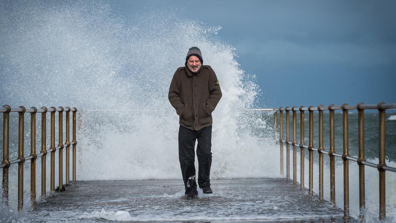
Melbourne has been smashed by ferocious winds of up to 120km/h, with a pier snapping off and washing away in large swells.
A local man told the Herald Sun newspaper that about 10m of the structure was ripped off.
“These weather conditions I would describe as cyclonic — extreme winds. The Frankston Pier — what we can see is the end of the pier — has come away with the force of the wind and the waves,” he said.
Damaging winds have also torn the roof off a nursing home in NSW as wild weather lashes the state.
At around 10am emergency services were called to Wescott Presbyterian nursing home in Stockton, just across the Hunter from Newcastle’s CBD, following reports a section of roof had been ripped off by a massive wind gust.
Around 30 residents were evacuated and there were no reports of injuries.
SES and NSW Fire and Rescue crews are working to remove the debris.
A South Australian woman has made a lucky escape after falling into a flooded creek in Mount Barker Springs last night.
South Australia was one of the first states to be hit by the wild weather.
Police were called to the property at about 10pm following reports a woman had fallen into a fast flowing, flooded creek.
She was found by authorities grasping onto a tree branch and had been stuck in the water for about 40 minutes, according to the Advertiser.
Police, with the help of the woman’s husband and a neighbour, managed to pull the woman to safety.
She was uninjured and was treated at the scene.
Along with dangerous winds, temperatures have also been sent plummeting in the country’s east.
The Bureau of Meteorology (BOM) warned ACT residents they may see some snow around the area and the wind chill will make it feel even colder than it is.
A small dusting of snow was seen on the ranges around Canberra today, but there has also been a few reports of it swirling around the air in the city.
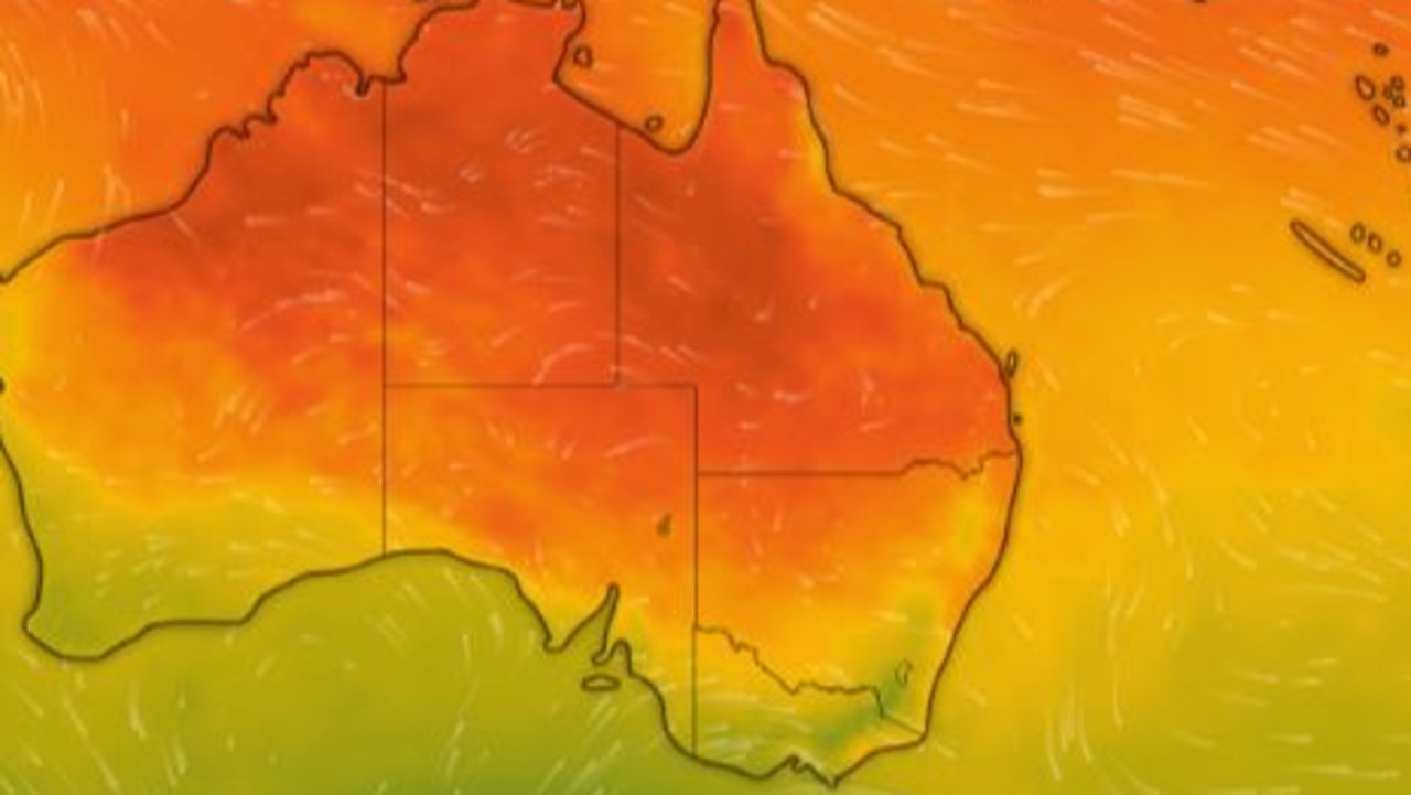
A “polar blast” bringing extreme gusts and plunging temperatures has hit much of Australia’s east coast today and will continue throughout the weekend.
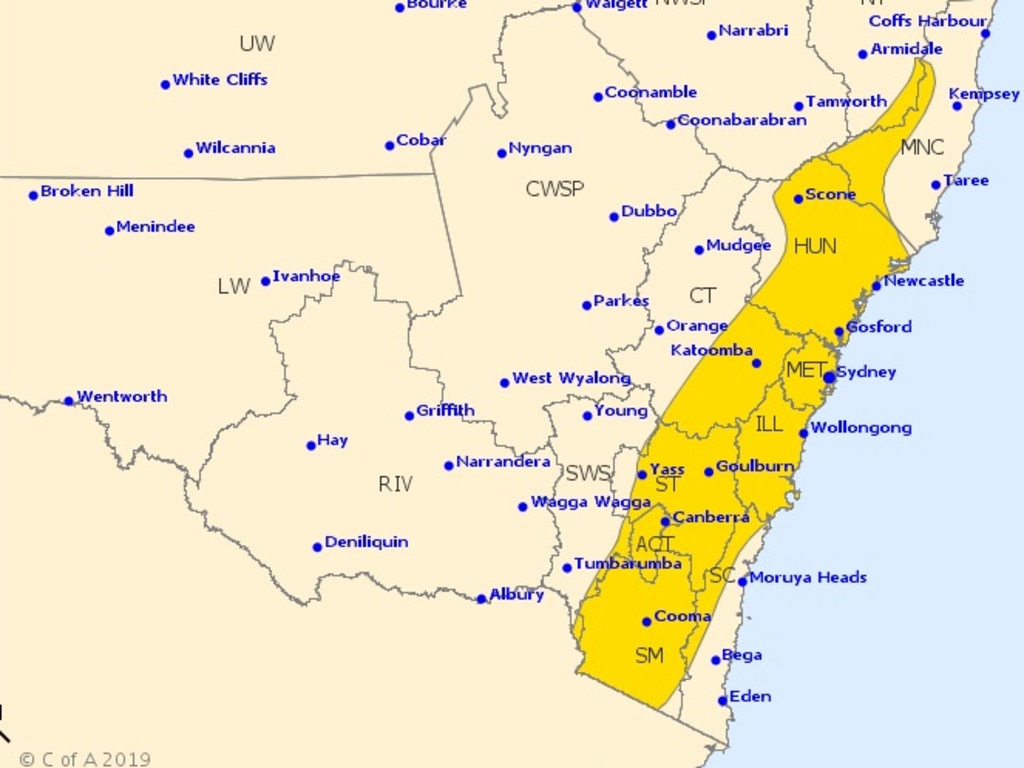
The BOM issued a number of severe weather warnings covering New South Wales, Victoria and South Australia. Authorities are urging motorists to take care due to fallen trees.
In Sydney and Melbourne, those flying this evening are being told to expect delays with a number of cancellations and diversions tipped.
Snow day!📡â„ï¸ðŸŒ¨ï¸ðŸ”ï¸
— CanberraDSN (@CanberraDSN) August 9, 2019
A good dusting of #snow on the ranges around the tracking station today as the cold front moves through #Canberra.
Our onsite weather station says the local temperature is about 6°C, with the wind chill taking that to an apparent temp of -0.3°C 🥶 #weather pic.twitter.com/lZR9aRxYwH
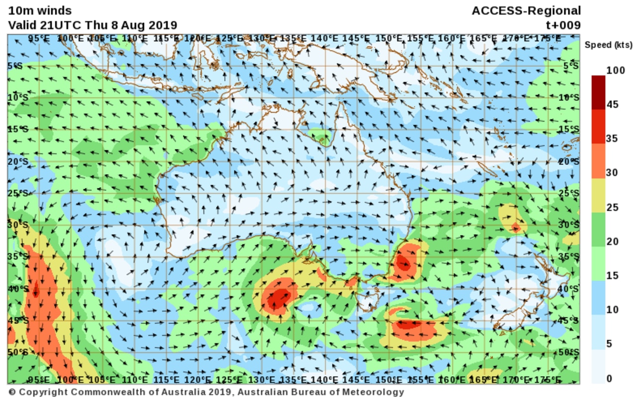
Significant gusts have smashed Victoria, with Bureau senior forecaster Michael Efron saying winds of up to 120km/h have been recorded.
“We’re actually seeing gale force winds across Port Phillip and down towards the Geelong region there are gusts of up to 90 kilometres and hour,” Mr Efron told 3AW Breakfast earlier.
Strong swells have caused part of the Frankston pier to snap off and wash away.
WEEKEND FORECAST
In NSW, a series of cold fronts that began crossing the country’s southeastern parts yesterday will intensify today, generating “vigorous westerly winds”, the Bureau said.
Damaging winds of up to 90km/h are likely, with warnings in place for the Southern Tablelands, Snowy Mountains, Illawarra and Southern Coastal Ranges, as well as the ACT, Blue Mountains and high country about Barrington Tops.
RELATED: Flights chaos as strong winds force cancellations and delays
Greater Sydney saw a gust of 76km/h at the North Head this afternoon. Similar winds could
continue throughout the day and into the weekend.
The gusty wind are expect to remain in eastern parts of NSW throughout Saturday as temperature sin Sydney struggle to get to 17C and drop overnight to 8C.
Blizzards are likely for Alpine areas above 1500m.
Conditions in Victoria will stay precarious with a gust of 109 km.h at 3.07pm.
The State Emergency Service warns motorists in Melbourne to take care, with dangerous wind conditions posing a hazard on roads.
The state’s Alpine region above 1200m could see peak gusts up to 120km/h on Friday, with blizzards likely.
It’s likely to be as cold as five degrees in Melbourne overnight, only reaching 11 degrees tomorrow and on Sunday.
The ‘feels like’ temperature is making it feel far colder.
Across most of NSW and Victoria, the extent of extreme winter weather could be the worst seen in at least three years.
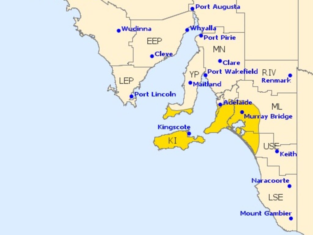
In South Australia, the Bureau is also urging residents in the state’s southeast to exercise caution with Adelaide, Murray Bridge and Kingscote in line for gusts in excess of 110km/h overnight.
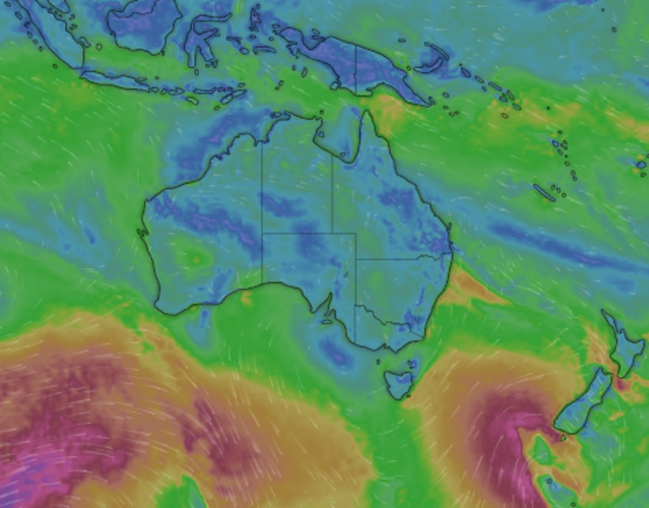
An intense low over Bass Strait is moving further eastwards and a second low in the Southern Ocean will move north to north-eastwards during Friday.
In Adelaide, Saturday will see a low of seven degrees and a maximum temperature of 13 degrees, with similar conditions on Sunday.
“This could be the strongest cold outbreak so far this winter,” the Bureau’s Michael Logan said.
“We’ll see temperatures really plummet and snow levels down to 500m in Victoria and NSW and blizzard conditions in Alpine areas. It certainly is a real cold snap, now is the time to prepare.”
WHY IS IT GETTING SO COLD?
Unusually warm temperatures has been a feature of Winter 2019 in Australia. In an average winter, cooler air from the Antarctic pushes into southern Australia bringing down the mercury and serving up wind and rain.
However, stubborn areas of high pressure have, for months, acted as a barrier to this polar air which has been unable to push very far into the mainland at all.
High pressure brings settled conditions and clear skies. In winter, that means warm days with maximums ways above the average. For instance, in Sydney 17C is the usual winter daily high, but this year it’s been closer to 18C, while overnight lows are around three degrees warmer.
Clear skies also let that warm weather escape overnight which has led to lots of frost this year too.
But now, the high pressure appears to be losing its battle with the Antarctic conditions. It’s heading north to more tropical climes, allowing unsettled conditions and cloud to make an appearance in the south. That will mean cooler days but, in some places, more average night time lows.
Join the conversation
State braces for severe thunderstorms
Residents of one state have been warned of damaging winds, large hailstones and heavy rain amid a severe weather warning.
Read more
Heat blast to hit state as mercury soars
It looks like summer has hit early, with one big city set to swelter through 32C temperatures.
Read more
‘Dark hole’: Big issue in rise of smart cars
The threat of foreign EVs being remotely controlled on Australian roads is unlikely, but the computers on wheels are still listening and watching everything we do.
Read more