‘Wet weather for a least a week, possibly two,’ across Australia’s east coast
An unusual occurrence with Australia’s weather patterns is bringing grim conditions and it could last for far longer than expected.
The east coast is looking at a weekend “washout” and potentially up to a fortnight of rain as an unusual weather pattern emerges.
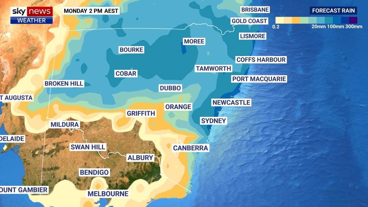
By the end of the weekend, “well over a month’s rain,” may have fallen on Sydney, say meteorologists, with more than 100mm coming down between Friday and Sunday.
And it’s not just Sydney. Newcastle, Wollongong, the south and north coasts of New South Wales and south east Queensland can all expect consecutive days where moisture is the main feature.
“It’s looking rather wet for at least a week – possibly two – for the east coast,” Sky News Weather channel meteorologist Alison Osborne told news.com.au.
“Basically, our weather patterns have stalled,” she explained.
“At this time of year we tend to see less of a gap between the subtropical Jetstream and the polar Jetstream, which in turn aids in the development of cold fronts from west to east.
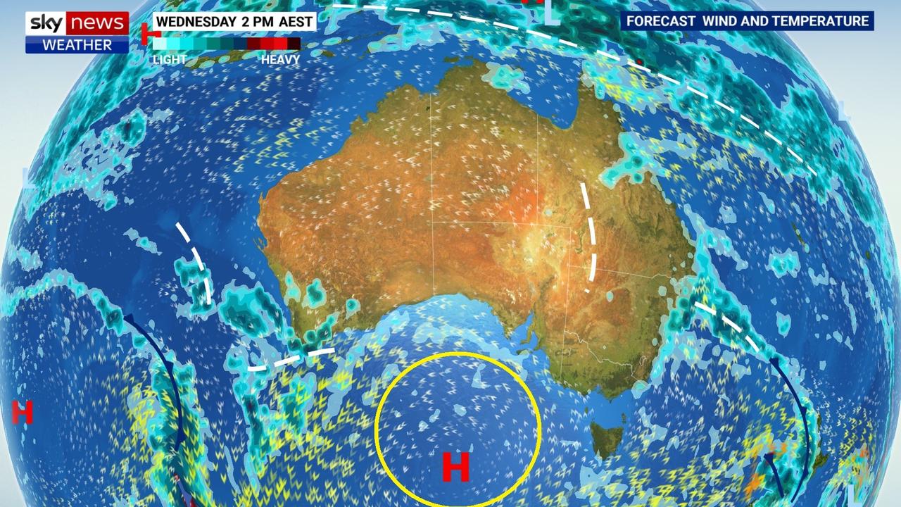
“But at the moment there is a big split in the Jetstream, meaning a large and strong high pressure system has developed south of the Bight and it’s ‘blocking’ the passage of frontal systems.”
Essentially, weather systems that might flush out the rain are being prevented from reaching land due to the high pressure, said Ms Osborne.

“Anticlockwise winds around the high are leading to onshore winds and therefore persistent showers along the east coast, with the heaviest between Sydney and the Sunshine Coast.”
There’s already been some rain in the east. Norah Head, on the central coast, has seen almost 100mm over the 48 hours to Thursday morning with Gosford seeing around 70mm.
Tuesday and Wednesday in Sydney saw 20mm of rain each.
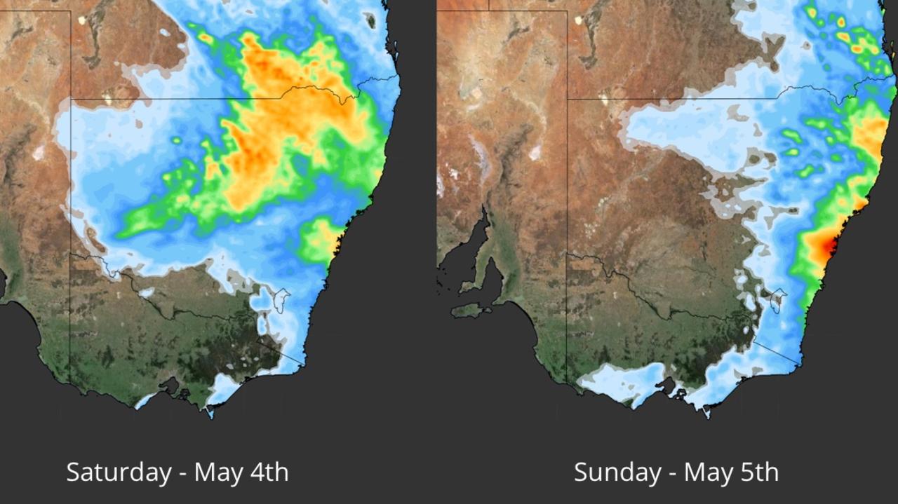
But a fresh batch of moisture is bubbling up in inland NSW and it’s tracking east likely bringing heavier falls to a greater area. Between Friday and Saturday that will drive rain to the east.

‘Well over a month’s rain’
“Twenty to 50mm for Sydney is possible on Saturday and Sunday – with weekly totals in excess of 150mm for Sydney and the central coast,” said Ms Osborne.
“This is well over a month’s rain.
“The silver lining is that the heaviest rain looks very coastal, but that’s not amazing for being out and about on the weekend.”
Ms Osborne said flash flooding on the weekend was possible in Sydney and people should stay up to date on warnings.
While the daily rain totals should lessen as we had into next week, most days could see rain on the coast. Indeed, some models have shown daily rain persisting until mid-May, although the further out you go, the less spot on forecasts can be.
On Thursday, 3-10mm can be expected in Sydney but it’s Friday where it’s likely to ramp up with a forecast as high as 25mm of moisture.
Saturday could see 9-35mm of rain and then 20-50mm on Sunday, up to 30mm on Monday and anywhere from 2 to 20mm on Tuesday. Temperatures will be around 20C with mid teen lows.
The city’s west could see a slight drop in the rainfall but the weekend is still looking very soggy.
Similar to Sydney in Wollongong but both Saturday and Sunday could see 50mm each with Newcastle looking at 15-60mm spread across both days.
The Entrance, on the central coast, will be soggier still with heavy falls beginning on Thursday and then continuing until Tuesday with the lower forecast of 60mm across five days and up to 150mm.
Port Macquarie may see a maximum of 110mm from the weekend until Tuesday with the heaviest falls on Saturday but wet weather every day; Ulladulla could register 45mm in the gauge across the weekend; the Blue Mountains potentially up to 60mm.
Inland there may be much lighter showers on the weekend or even none at all particularly in southern areas of the state like Wagga Wagga and in Canberra.

Weekend across the rest of Australia
South east Queensland will see some moisture but Brisbane may not even break 10mm each day. Although Surfers Paradise could be soggier.
Melbourne will have partly cloudy skies with rinse and repeat days of 17-18C over the weekend with much the same in Hobart.
A sunny end to the week and weekend in Adelaide with 22C maximums.
Some showers in Perth heading into the weekend, but relatively light, and then party cloudy on Saturday and Sunday with highs in the low twenties.
Darwin will be mostly sunny with 35C temperatures.


