
Two cyclones forming at once off Australian coast
Parts of Australia are set to be lashed by wild weather, with twin storm systems that could develop into cyclones brewing off the coast.


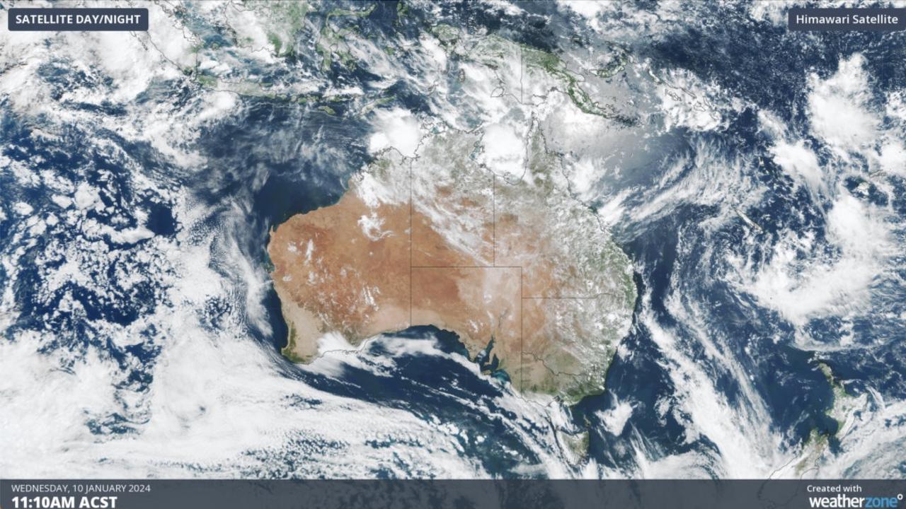
Northern Australia could be lashed by another round of wild wet weather, with two systems that could each develop into a cyclone brewing off the coast.
The Northern Australian Monsoon — a key feature of any tropical climate — is set to arrive over Australia’s tropical region on Thursday, bringing increased potential for gusty winds, heavy rain and storm activity.
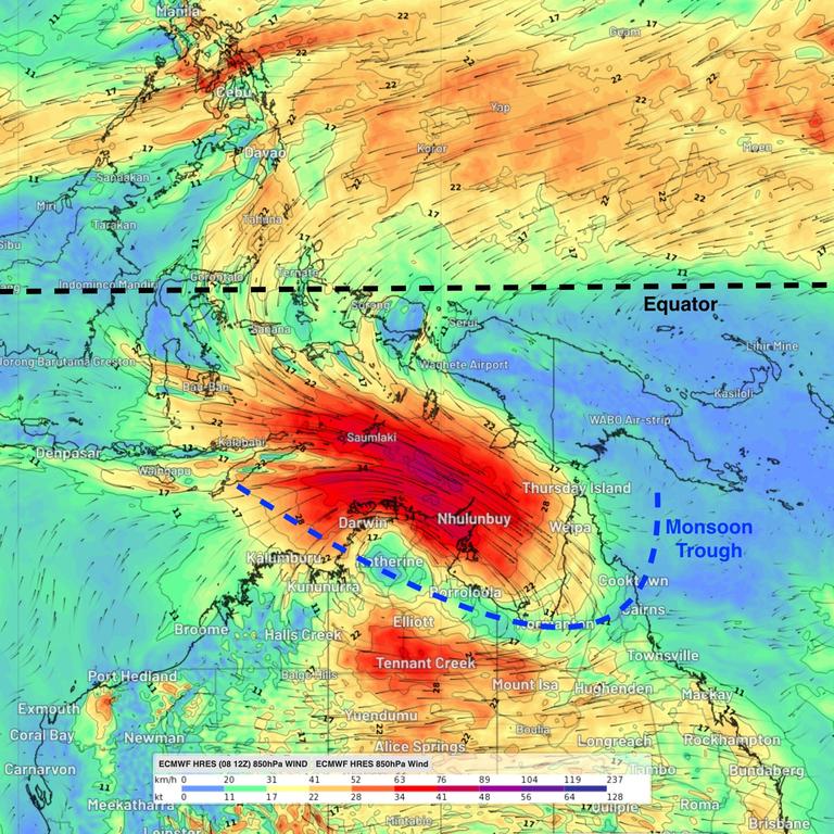
Tropical cyclones often form within the monsoon trough, particularly if embedded low pressure systems linger over warm water for several days, per Weatherzone.
Currently, the Bureau of Meteorology forecasts two such lows — one off the coast of WA and the NT, and the other off The Gulf of Carpentaria — which each has the potential to develop into a tropical cyclone.
Even if the systems do not become cyclones, they are still expected to bring heavy rain.
For the first system, this is likely to mean heavy rainfall and potential flooding in parts of the Top End and Kimberley, according to Weatherzone.
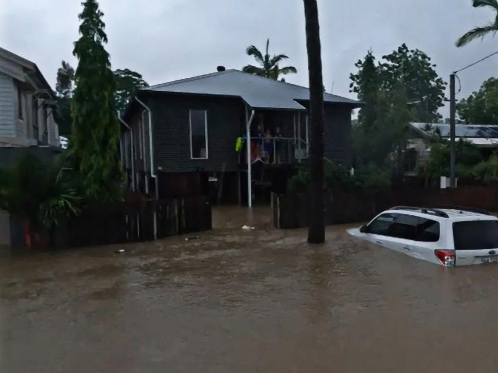
The second is forecast to bring heavy rain to Far North Queensland, potentially soaking areas that are still recovering from the floods caused by Cyclone Jasper last month.
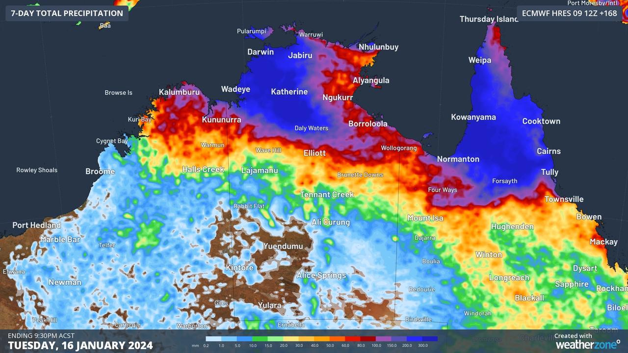
Maps from Weatherzone show two wet weather hotspots driven by the systems.
Areas coloured dark blue could see up to 500mm of rain between Wednesday and next Tuesday, while areas in lighter blues and purple could see between 150mm and 300mm.
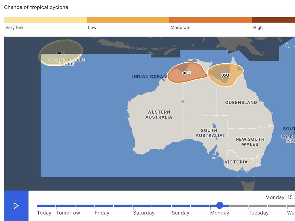
Potential cyclone one
A tropical low — 03U, or the third tropical low of the season in the Australian region — is likely to develop in the Top End near the Joseph Bonaparte Gulf, west of Darwin, on Friday, according to the BOM.
If it remains over the water, it could develop into a tropical cyclone as early as Saturday. The chance of it doing so is moderate (the BOM’s second-highest rating).
The tropical low is likely to be slow-moving and its longer term direction is, as yet, highly uncertain. It’s possible the system will move east over the NT or southwest and near the WA coast.
Potential cyclone two
A second tropical low, 05U, could form over The Gulf of Carpentaria, off far north Queensland, from Friday or Saturday.
This has the potential to develop into a cyclone as early as Sunday, though its chance of doing so is still forecast as “low”.
On tracking maps the two potential cyclones appear very close together or even overlapping, but BOM meteorologist Angus Hines said this was not the case.
“The bubbles represent areas of potential development, a risk area rather than an impact area,” he explained.
“If both (cyclones) form at once, they would still be very far apart.”
Third cyclone possible over Christmas Island
A third system, 04U, is a potential tropical low that could form in the Indian Ocean early next week.
Though it’s not expected to impact the mainland, forecasters predict the system may develop over the Australian territory of Christmas Island.
As of Wednesday, 04U is not expected to develop into a tropical cyclone, though its chance of doing so increases slightly next week.
The low is expected to be slow-moving and may migrate towards Australia. If its risk area moves farther north or west, it may leave Australia’s area of responsibility.
Is a twin cyclone phenomenon normal?

The chance of two cyclones forming at the same time is uncommon but not unprecedented, according to Mr Hines.
“It’s not super uncommon for multiple risk areas to be present at once, however, if they both formed (into cyclones) that would be much more uncommon,” he said.
He said he could only think of one example in Australia’s history when two cyclones crossed.

Severe frost alert for Aussie farmers
Farmers are being urged to keep their livestock warm as a freezing start to winter puts animals at risk.
More hikers send out SOS amid icy blast
Another pair of alpine bushwalkers need rescuing amid the icy polar blast hitting parts of Australia.
Polar blast marks start of Aussie ski season
Blizzard conditions and damaging winds have marked the start of a frigid Australian snow season as multiple states brace for a brutal polar blast.