
Tropical Cyclone Kirrily to hit Queensland mid week
A category 3 cyclone is set to hit part of the country this week, with the Bureau of Meteorology predicting a severe impact.


A category 3 cyclone is set to hit Queensland mid-week with the Bureau of Metereology (BOM) predicting the impact could be severe.
A tropical low is developing in the Coral Sea and is likely to become a tropical cyclone, with forecasters saying it is likely to “quickly intensify”.
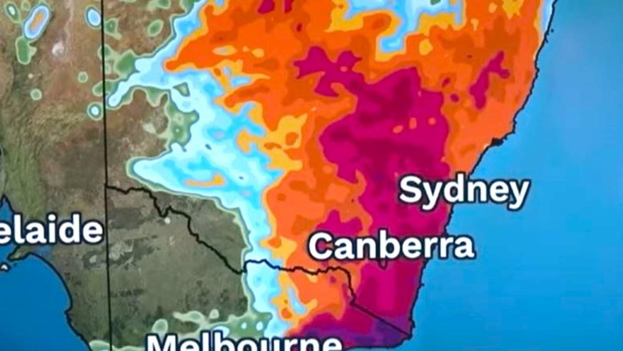
The system is forecast to begin to move to the southwest late on Monday, towards the Queensland coast, with the most destructive impact to be felt between Cairns and Mackay.
“A severe impact is possible, particularly if the system crosses near or south of Townsville,” a release from the BOM suggests.
A tropical low is developing in the Coral Sea, well away from the #Qld coast and will continue to strengthen to a tropical cyclone by Monday. For the latest forecasts and warnings, go to https://t.co/4W35o8i7wJpic.twitter.com/5QZ8m6dCIU
— Bureau of Meteorology, Australia (@BOM_au) January 20, 2024
It will intensify into a category two by 4am on Wednesday, and then category three by 4pm that day, according to the latest tracking map.
But the Bureau acknowledges there could be a “range of scenarios” after it hits the Queensland coast - it could head back offshore, or inland towards the state’s southeast.
Bureau meteorologist Steve Hadley told The Courier Mail heavy rainfall and flash flooding could impact the southeast for several days following the cyclone’s crossing.
“There is potential for it to move south and recurve back east out towards the Coral or Tasman Sea, which means it could move over southern Queensland, even some northeastern parts of NSW over the days following the landfall,” he said.
“It will be different from Jasper, which was sort of held back by the weather systems at that time ... unfortunately that does mean it’s going to be quite concerning for those in south central Queensland and in thesoutheast.”
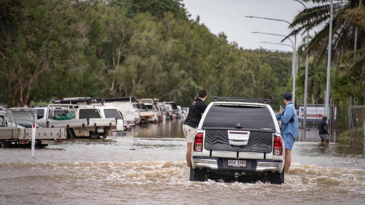
Mr Hadley said heavy rainfall was the main concern, particularly as the impacts would likely hit on Friday when people started to travel for the Australia Day long weekend.
Rainfall has the potential to last into the following week, with large scale flooding a possibility.
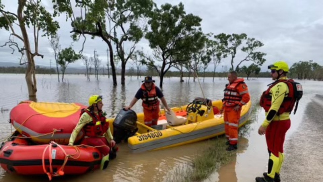
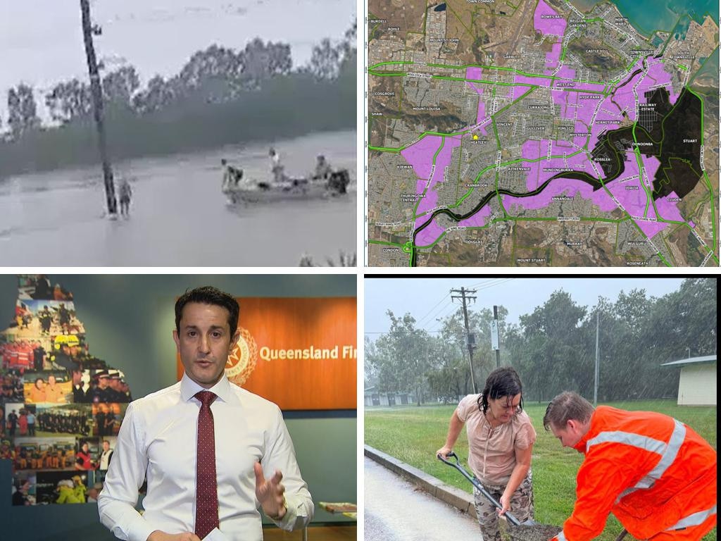
Queensland Police Assistant Commissioner Chris Stream warned Queenslanders not to take any chances driving on flooded roads if flash flooding did occur.
He said the forensic crash unit had been investigating the behaviour of modern vehicles in floodwater and the results were clear that it was extremely unsafe.
“Those vehicles float very well in water — they lose traction and the vehicles are washed away,” he said.
“A lot of modern vehicles have electric windows and other electric systems, so once the water gets in and affects it, you will not be able to put your window down.

“[Investigators] were also able to dispel the myth about removing your seat headrest and using that to break a window ... you will not be able to exit your vehicle.”
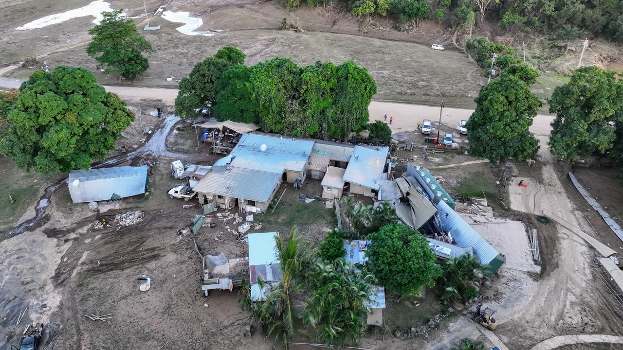
In December Queensland was hit by Cyclone Jasper, a category two, and it took the system almost five days to move west across the state. It left havoc in its wake, with many areas recording more than a metre of rain.
The Insurance Council of Australia estimated that Jasper was responsible for $1 billion dollar in claims.
‘Dangerous situation’: Grim weather warning
Forecasters are warning of a “dangerous … multi day outbreak” of dire weather, with storms, heavy rains and floods all possible.
‘Expect more’: Dire warning after floods
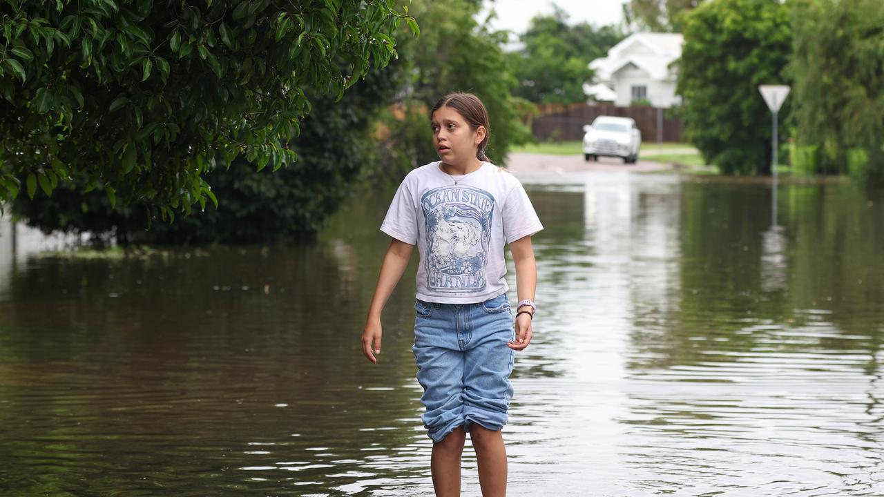
North Queensland has recorded its second “once-in-a-century” flood since 2019, and one thing made the rainfall heavier.
‘Leave now’: Urgent plea amid flooding event
A person has died and thousands remain without power as dangerous floodwaters inundate towns and cities in north Queensland.