‘Threat is real’: Dangerous storms for coming days with even wetter conditions next week
Forecasters are warning of a round of intense and dangerous weather in the coming days – with even worse conditions around the corner.
Eastern and central parts of Australia are in for an intense period of rain and potentially dangerous thunderstorms over the coming days – followed by possibly even more unsettled weather into next week.
Queensland and New South Wales could be hit, including with dangerous supercell storms, as well as parts of South Australia and the Northern Territory. But some of that rain could also creep into the other states.
“The wild impacts will be isolated each day, but the threat is real,” said Sky News Weather meteorologist Rob Sharpe.
This isn’t exactly what El Nino had in mind when it was declared by the Bureau of Meteorology (BOM) in September. An active El Nino often leeches moisture away from eastern Australia. However, another climate driver, the Southern Annular Mode, has pushed moisture from the south into the continent – at least for the time being.

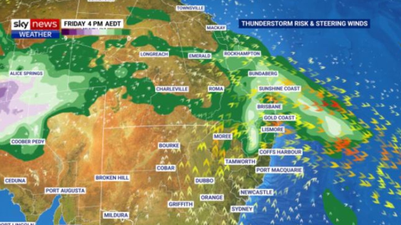
On Thursday, a stretch of the east coast from around Coffs Harbour to Brisbane and inland to the Ranges is at most risk from rain and storms.
Much of the precipitation in the coming days could be associated with storms – which means it could come down quick and heavy. Damaging winds are also a threat.
Brisbane is looking at 32C with a late morning storm on Thursday.
But Sydney could also see stormy weather particularly in the city’s west where the mercury is set to hit 30C. That could come through in the late afternoon and evening as a southerly change pushes through.
The following day things could ramp up.
“Friday’s thunderstorms look set to be the most intense,” said Mr Sharpe.
“That southerly change will continue its march north along the coast, bringing the showers with it.”
The system should move into Queensland during Friday.
“If it arrives in the morning, the storm threat in Brisbane is minimal, but if it comes through in the afternoon it could be the biggest of the three storm days for the capital.”
The storms are then due to shift north towards the Wide Bay region and west into the Darling Downs.
Brisbane should then spend a settled weekend with some cloud reaching into the mid-twenties with Sydney seeing much the same.

The drama will miss Melbourne completely. Thursday will see a few spots of rain and then cloudy into the weekend. Temperatures getting to around 18C for the rest of the week and then into the low twenties on Saturday and Sunday.
Some sun peeking through the clouds in Canberra with a high of 26C on Thursday and 29C on Saturday.
A shower or two for the coming days in a mostly cloudy Hobart with temperatures pushing 20C on the weekend.
Some clouds in a sunny Adelaide which will see a maximum of 22C on Thursday rising to 26C on Friday and 17C on Saturday.
In Perth it will be warm and bright for the coming days with 29C on Thursday and 33C on Sunday.
Storms for Darwin on Thursday and then clearing for the weekend topping out at 33C. Alice Springs is forecast to see storms between Thursday and Saturday with up to 40mm of rain falling.

‘Even wetter week’ coming
Enjoy the weekend sun, however, as it may not last.
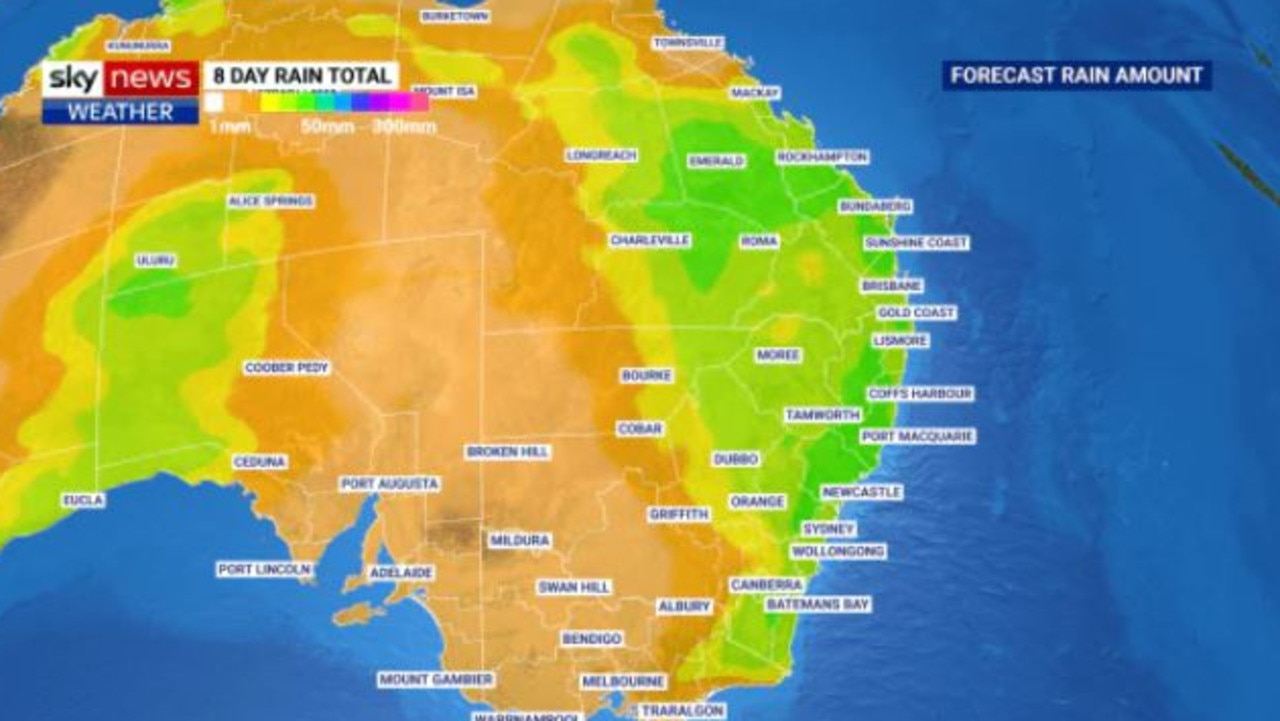
“Next week showers and thunderstorms will build again across eastern and northern Australia with an even wetter week for the country on the cards” said Sky’s Mr Sharpe.
The cause is a series of troughs that are set to roll across the country.
“Most forecast models suggest this wet and stormy weather will continue into the first half of next week across a broad area of the nation’s east and north,” states website Weatherzone.
We’re still several days out and in that time forecasts can change quite a bit. But, for instance, the BOM is currently suggesting showers early next week in Sydney and heavy rain for Brisbane with up to 60mm falling between Monday and Wednesday.


