Terrifying heatwave map reveals extent of weather issue
A terrifying has revealed the extent of the heatwave about to grip Australia’s most populous state.
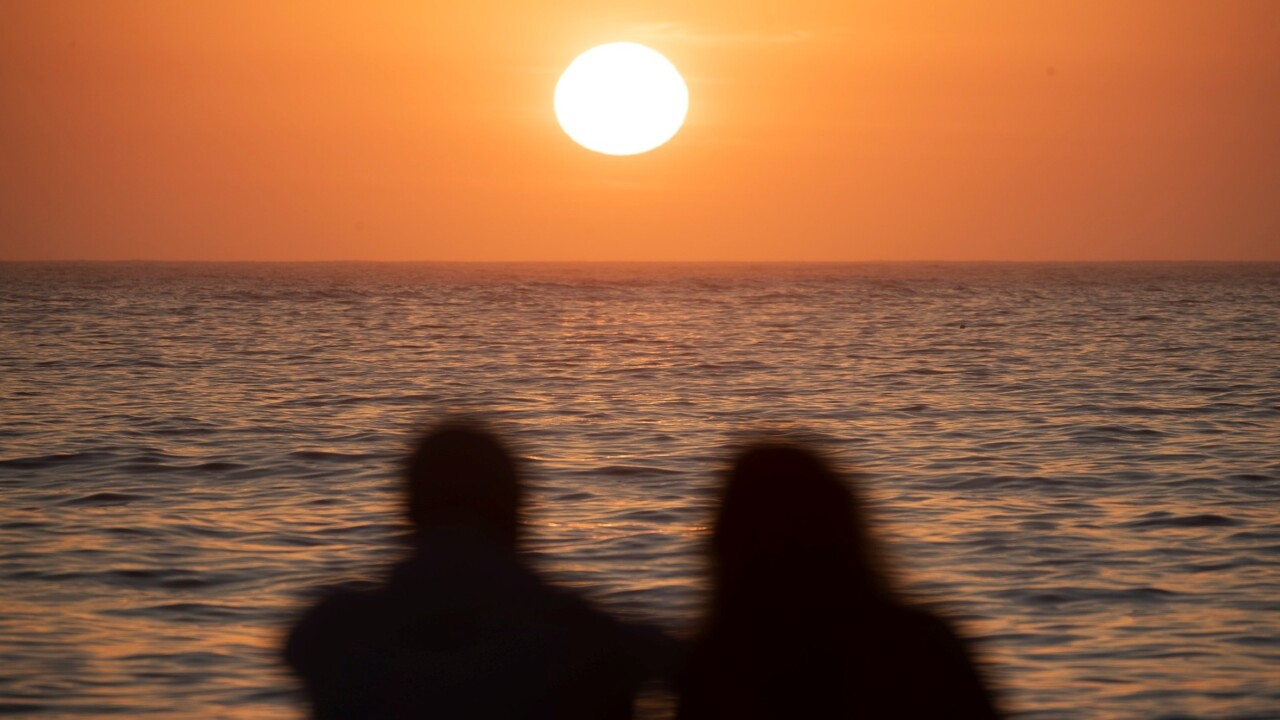
A terrifying map has revealed the extent of the horror heatwave about to grip Australia’s most populous state.
The map shows extreme heat conditions building inland in northern parts of NSW.
Large areas have been coloured deep purple indicating temperatures will soar past 40C.
The tortuous conditions will start building on Wednesday, extending towards central and northern coastal parts of NSW during the week before easing by the weekend.
Maximum temperatures are forecast to reach the mid forties in the northwest.
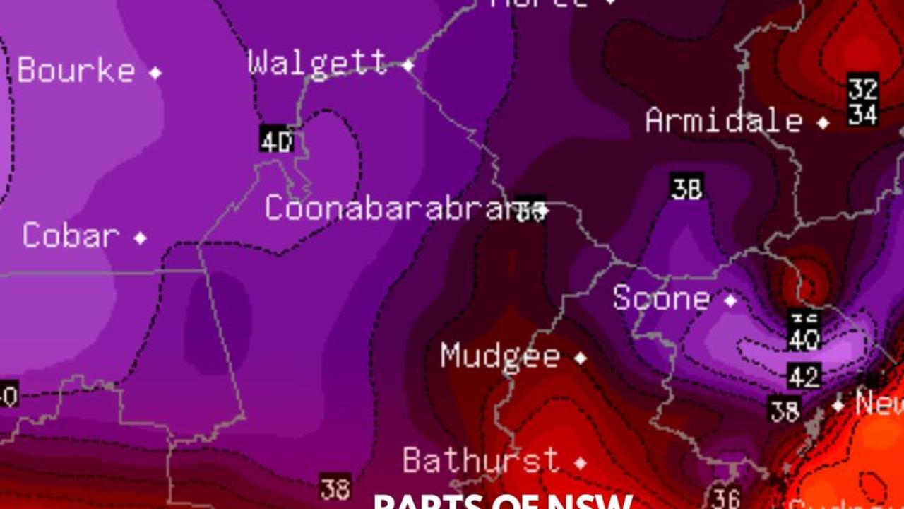
Bureau of Meteorology meteorologist Dean Narramore told news.com.au the hardest hit area would be northwest NSW with temperatures reaching the high 40s at Tibooburra and Wilcannia.
“We will see that heat extend into northern and eastern NSW with temperatures in the lows 40s including Moree and Maitland,” he said.
“It is likely the heat will continue Wednesday through Friday. A cool change will move into southern NSW on Friday and northern NSW on Saturday.”
Locations also likely to be impacted by higher temperatures include Camden, Campbelltown, Hornsby and Liverpool in Sydney and Moree, Nowra, Orange, Richmond and Wollongong in regional NSW.
And it’s not just NSW that will be experiencing the difficult conditions.
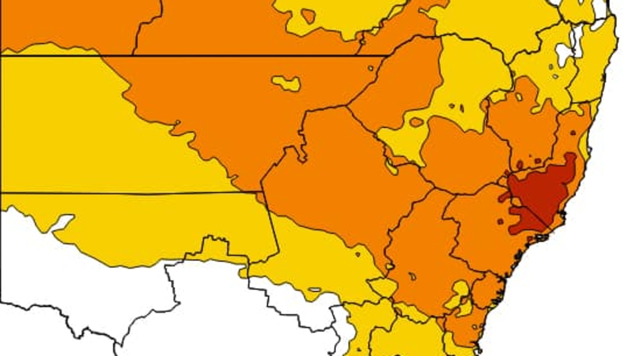
Mr Narramore said heatwave conditions will extend to western Australia, central Australia and into eastern Australia with low to severe conditions across central and inland eastern Australia.
“Similar to NSW we will see temperatuers in high 40s in northern South Australia and southwest Queensland and that will continue for the coming days before seeing cooler conditions into the weekend,” he said.
He also advised there would be heavy rainfall expected in northern Western Australia with flood watches and warnings likely to persist on Wednesday and Thursday easing into the weekend.
South Australia nudged just past 41C on Tuesday afternoon, the first over 40C day this year.
SA Premier Peter Malinauskas urged people to check in on their neighbours and particularly the elderly who can be more at risk in extreme heat.
“It’s probably a good time for people to remember to look after themselves, look out for their neighbours, but look out for the elderly in particular, it has been a while since we’ve gone over that 40-degree threshold,” he told reporters.
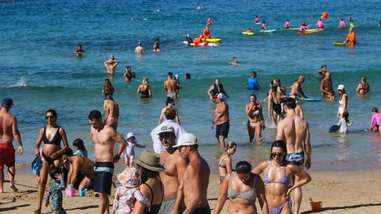
Queenslanders are also sweating through searing temperatures, some climbing as high as 44C, as a “severe” heatwave warning remains in place.
The mercury climbed to 35C in Brisbane but the “feels-like” temperature was another 6C higher.
Birdsville, on the state’s border with the Northern Territory and South Australia, recorded a maximum temperature of 44C on Tuesday.
Locations likely to be impacted in the coming days will be Bowen, Birdsville, Bundaberg, Brisbane Metropolitan Area, Gladstone, Ipswich, Longreach, Roma, Thargomindah and Yeppoon.
“Severe heatwave conditions will ease over the southeast coast from Tuesday, including Brisbane, as a milder southeasterly flow develops, but peak over the southwest midweek,” the warning states.
In Western Australia Laverton, Leinster, Leonora, Meekatharra, Paraburdoo and Wiluna could also experience heatwave conditions.
Cyclone fears grow
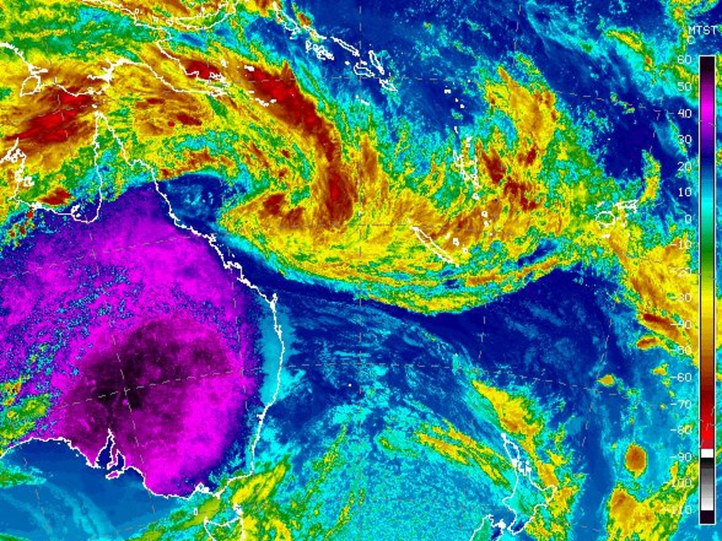
Meanwhile parts of northern and central Queensland are facing threats from a tropical cyclone system expected to form as early as Tuesday.
The system, expected to develop into Tropical Cyclone Kirrily, is building off the far north of the state and is tipped to cross the coast as a category 3 storm in the next few days.
The Sunshine State is facing a hellish week of weather, with Kirrily in the north and a heatwave in the south.
The Bureau of Meteorology said on Monday the system is forecast to cross the coast, most likely on Thursday in the 350km between Innisfail and Airlie Beach around Townsville.
It’s not yet known exactly where the cyclone will cross, but Queensland Premier Steven Miles on Monday said “severe” impact was likely if the system crossing occurred near or south of Townsville.
“It’s then expected to lose intensity and weaken, travel south where it could impact with heavy rainfall around central and southeast Queensland,” he said.
Preparations by the state disaster management authorities was under way.
Already the region has been battered just before Christmas by the aftermath of ex-Tropical Cyclone Jasper, which caused widespread flooding further north around the Cairns and Far North Queensland centres.
Mr Miles said one of the biggest concerns was the “fatigue” of volunteers and emergency services after the hellish summer of storms.
“We’ll be carefully making sure they have all the support and services they need,” he said.
Dams across the affected regions are also being reviewed for possible water releases should they reach capacity from the heavy rainfall.
Shane Chelepy, the state’s disaster coordinator, urged families to be prepared with the right supplies and stay connected with government messaging.
Laura Boekel from the Bureau of Meteorology said the system would likely reach tropical cyclone-strength by Tuesday.
She said the most likely scenario was for the system to cross between Innisfail and Airlie Beach by Thursday.
BOM is expecting large impacts from the weather system over the long weekend.
“We have issued a Tropical Cyclone Watch... current from Ayr to Saint Lawrence, and that includes Mackay and the Whitsundays as well,” Ms Boekel said.
“Gales with damaging wind gusts of up to 120kmh may develop about coastal communities.
“That could extend beyond Wednesday as that system moves closer.”
Ms Boekel said the system was then forecast to move inland and become a tropical low - dumping a large amount of rainfall on the state.
Areas in central and southern inland Queensland could experience heavy rainfalls as a result.
Mr Miles also warned the state was due to exceed its record power demand on Monday due to the scorching heatwave temperatures across the state.
Energy Minister Mick de Brenni assured there was an “adequate” supply of power for Queenslanders on Monday night as people return home and turn on appliances, such as air conditioners.
“This heatwave has been gathering in scale,” he said.
“There remains adequate supply of power... so (Queenslanders) will be able to continue to use their air conditioners tonight, and other appliances as needs be.
“Of course it will be very, very tight.”
On Monday evening, about 40,000 customers lost power.
If the cyclone crosses the coast, it’s expected to weaken to a tropical low before moving south over land, bringing heavy rainfall as far south as Brisbane later in the week.
Residents between Ayr and St Lawrence are being urged to prepare for gale-force winds as fast as 120km/h that could develop as early as Wednesday morning.
~ With NCA


