
Severe storms, damaging gusts, large hail to wreak havoc in week of wild weather for eastern Australia
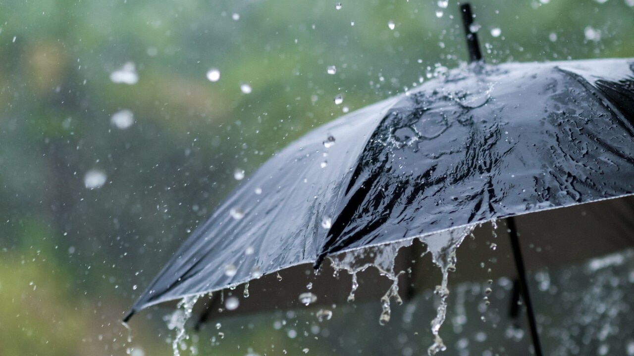
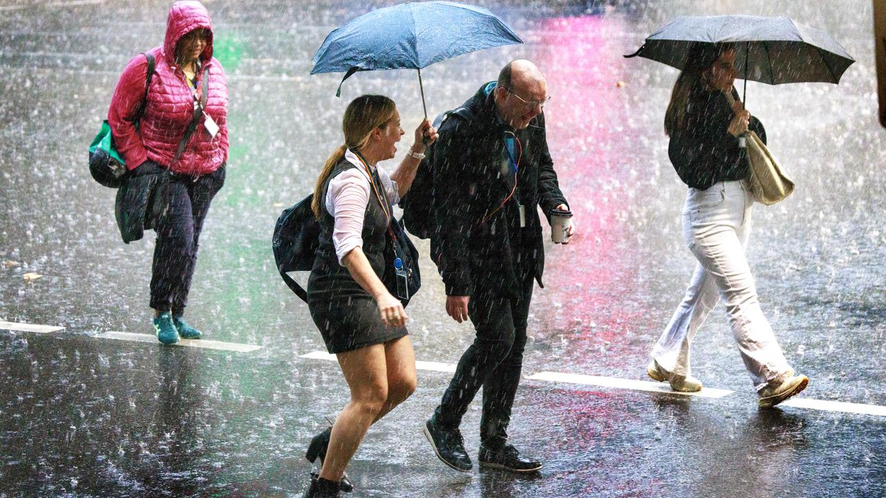
Australia is set for a soggy entry into summer, with meteorologists predicting severe storms and heavy downpours to drench much of the country this week.
Australia is set for a soggy entry into summer, with meteorologists predicting severe storms and heavy downpours to drench much of the country this week.
The wet weather is set to be particularly savage in the eastern states, with some regions set to be drenched by falls between 50mm and 100mm – some upwards of 150mm – over the next few days.
It follows an already wet week just gone, which saw some parts of the country break rainfall records.
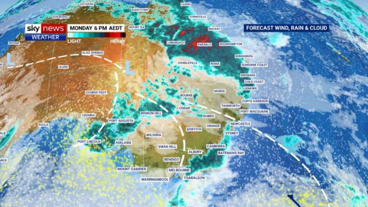
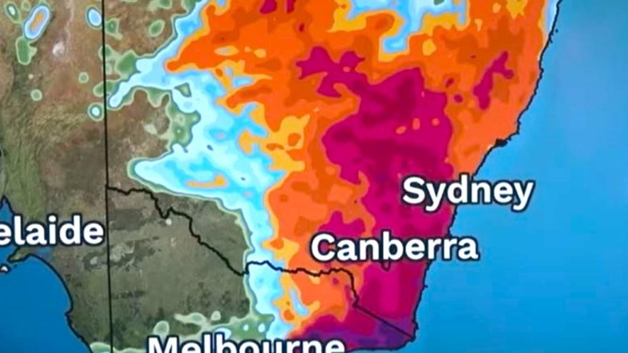
Two storm systems – one attacking from the north of the country, the other from the south – are expected to slide from Central Australia toward the east coast, bringing torrential rain, damaging winds and large hail to some areas.
One is set to batter the northwest Queensland and slide to northeast NSW from Monday.
Meanwhile, South Australia is set to see its own thunderstorms develop on Monday afternoon,
before that low system pushes up through Victoria, NSW and Queensland from Tuesday.
Bureau of Meteorology senior meteorologist Dean Narramore said the wet weather will “ramp up” through the middle of the week.
“We’re expecting severe storms, particularly through northern Victoria and inland NSW with heavy rain, damaging winds, and large hail,” he said.
“Tuesday night into Wednesday we’ll see an area of rain move into coastal parts of NSW and Queensland, particularly central and South Coast NSW.
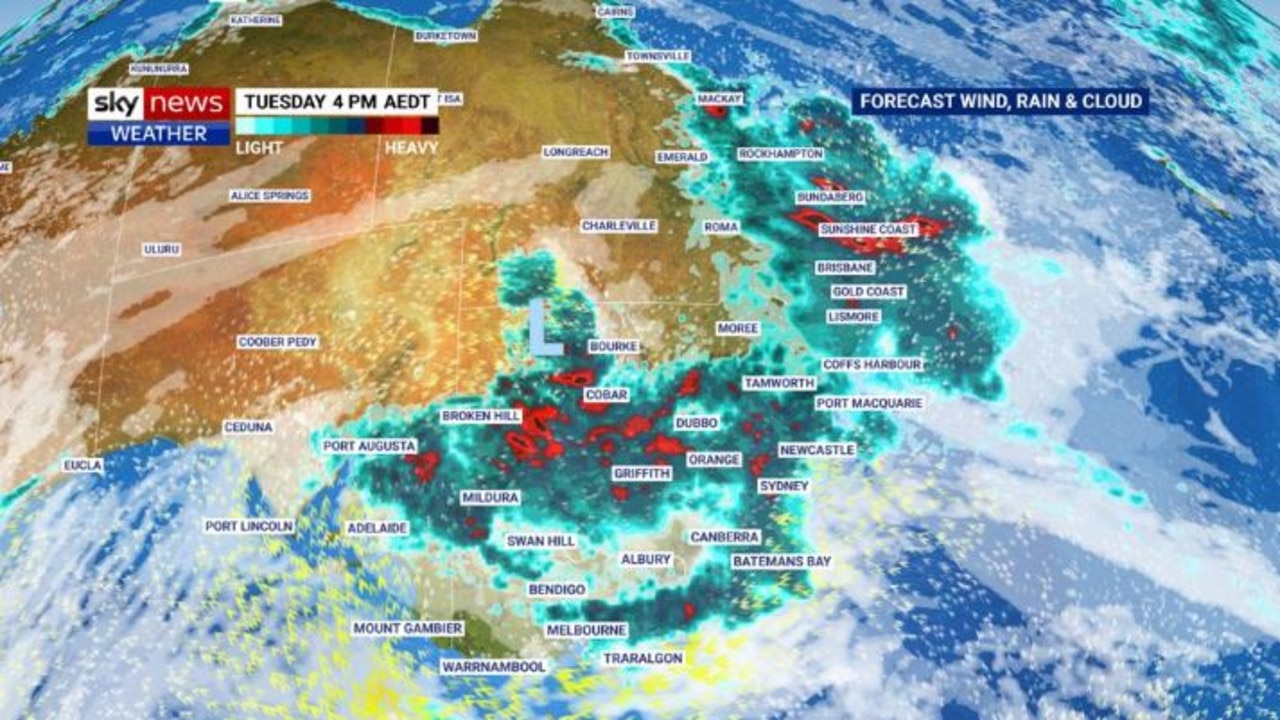
“We could see heavy rain develop and another round of sever thunderstorms for central and southeast Queensland and northeast NSW on Wednesday, before conditions slowly ease as the lower trough moves offshore.”
Mr Narramore said parts of Victoria could see rainfall totals of up to 50mm, while NSW and Queensland could see totals closer to 100mm. Meanwhile, southeast NSW could see “isolated falls in excess of 150mm”.
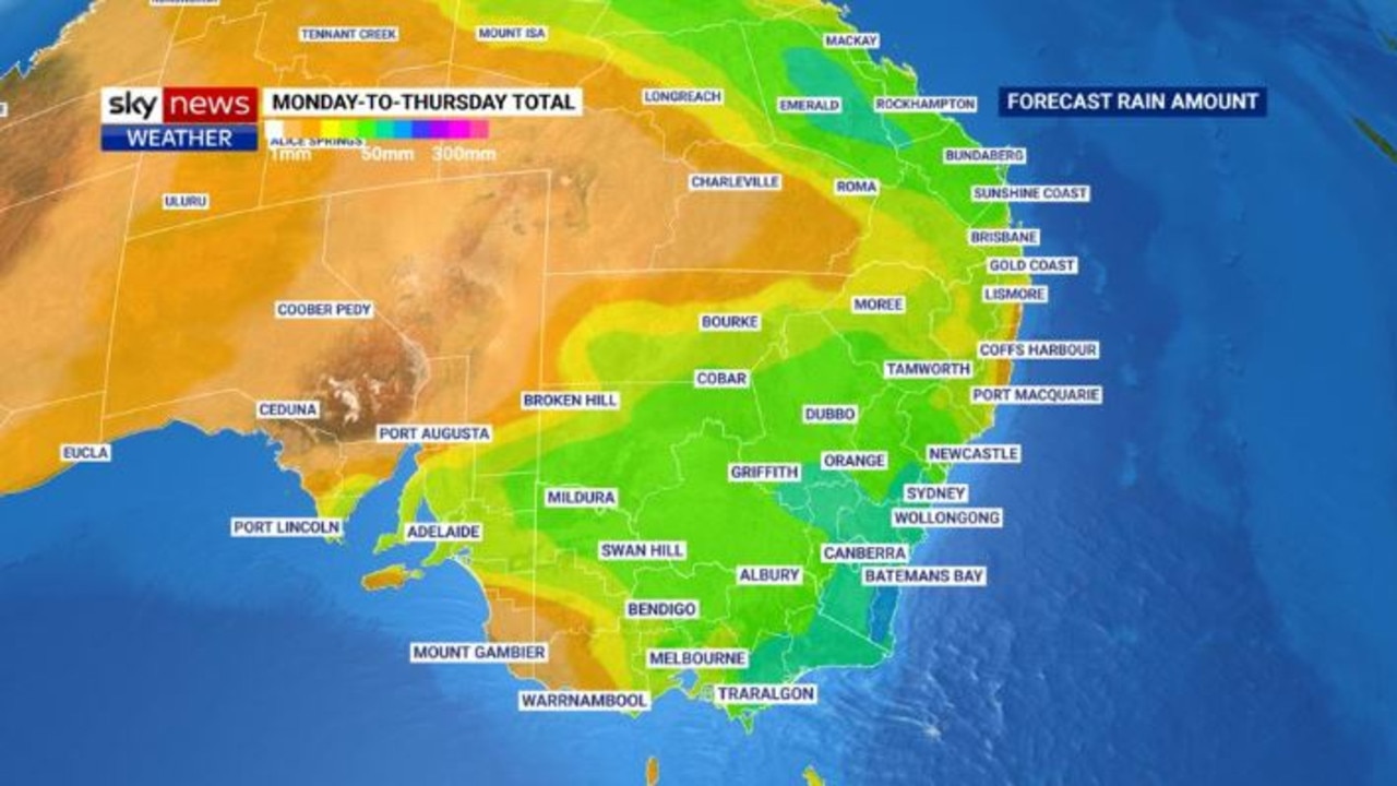
Forecasts suggest the initial downpours will ease across much of the east, except Victoria, by Thursday. The relief will be short-lived, with another low set to redevelop in Central Australia and move across again by the weekend.
“We’re stuck in a lasting weather pattern,” Mr Narramore added.
“We’ve got upper lows and an upper trough system moving through and interacting with very moist and humid air across eastern parts of the country to bring widespread showers and storms.”

Sky News Weather meteorologist Rob Sharpe said it was possible the low systems could “linger” into next week, too – even if it only looks like “cloud and gloom and soaking rain” as it eases.
He said there was “plenty (of rain) to come today tomorrow, (before) days off, then more storms at the end of the week.”
Sky News Weather Australia forecasts suggest the wet weather may even put some regions at risk of flash flooding.
“So not just severe thunderstorms, maybe a severe weather warning could be briefly issued for this event if that low intensifies enough just before it moves out to sea,” Mr Sharpe said.

“But by then … that rain looks to be done.”
While it has been a soggy farewell to Spring and welcome to Summer, forecasts suggest from December 4 Australia’s weather patterns will start to shift again toward drier conditions.
Mr Sharpe said the drier conditions could be “even more evident” by December 11, with skies to clear and the heat looking to ramp up toward Christmas.
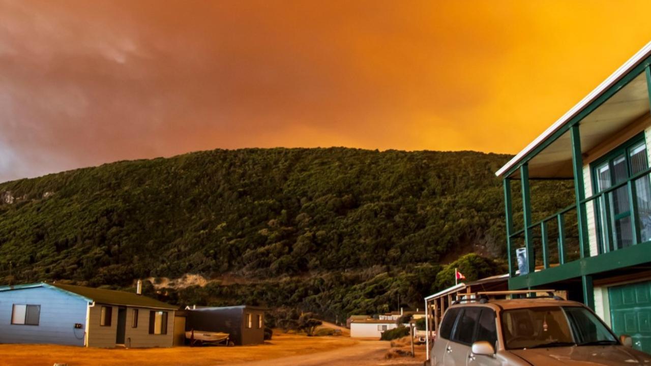
‘Volcanic’: Aussies battle raging fires
Residents in one state have captured startling photos showing apocalyptic scenes as they confront a complex web of bushfires.
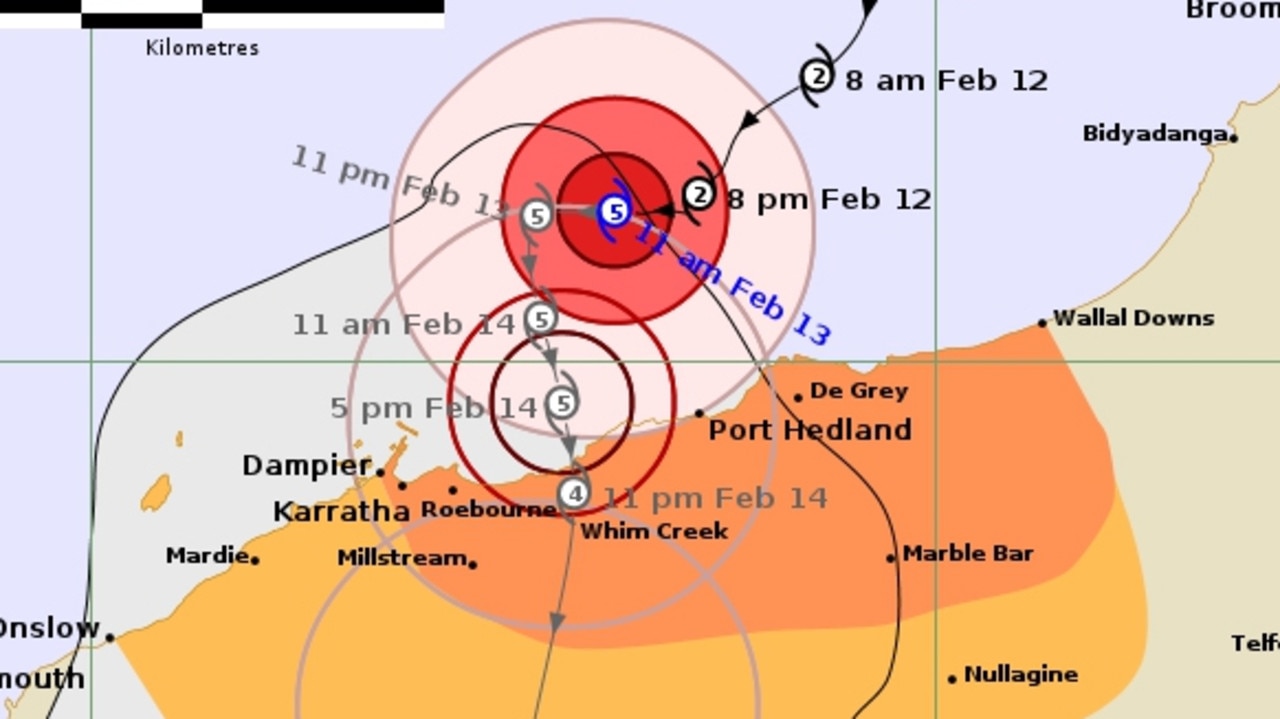
‘Threat to life’: Cat 5 cyclone declared in WA
Tropical Cyclone Zelia has been declared a category five system and is expected to make landfall on Friday afternoon, with winds up to 290km/h possible.
‘Dangerous situation’: Grim weather warning
Forecasters are warning of a “dangerous … multi day outbreak” of dire weather, with storms, heavy rains and floods all possible.