
‘Mass deluge’: More than 200mm of rain could hit east coast during rare ‘black nor’easter’
Two colliding weather systems could join forces to create a rare and dangerous ‘black nor’easter’ bringing hundreds of millimetres of rain to millions.

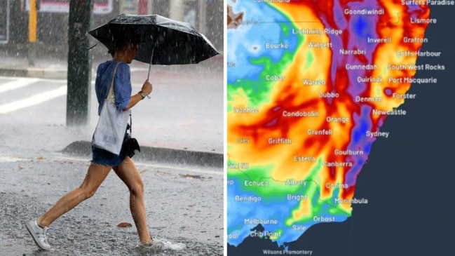
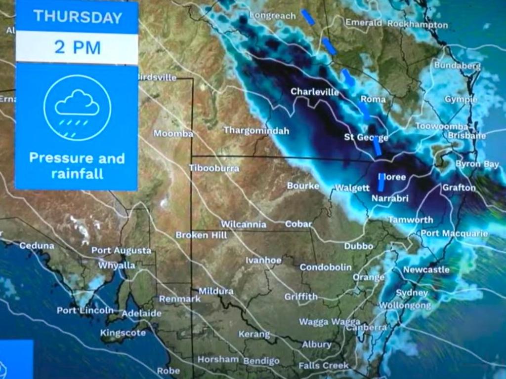
Forecasters are warning residents of Australia’s east coast to buckle up as a “mass deluge” looks set to begin on Thursday and continue for three straight days leading to a washout Friday.
It could lead to a “black nor’easter,” a weather event only seen a few times a year that can bring wild – and dangerous – conditions.
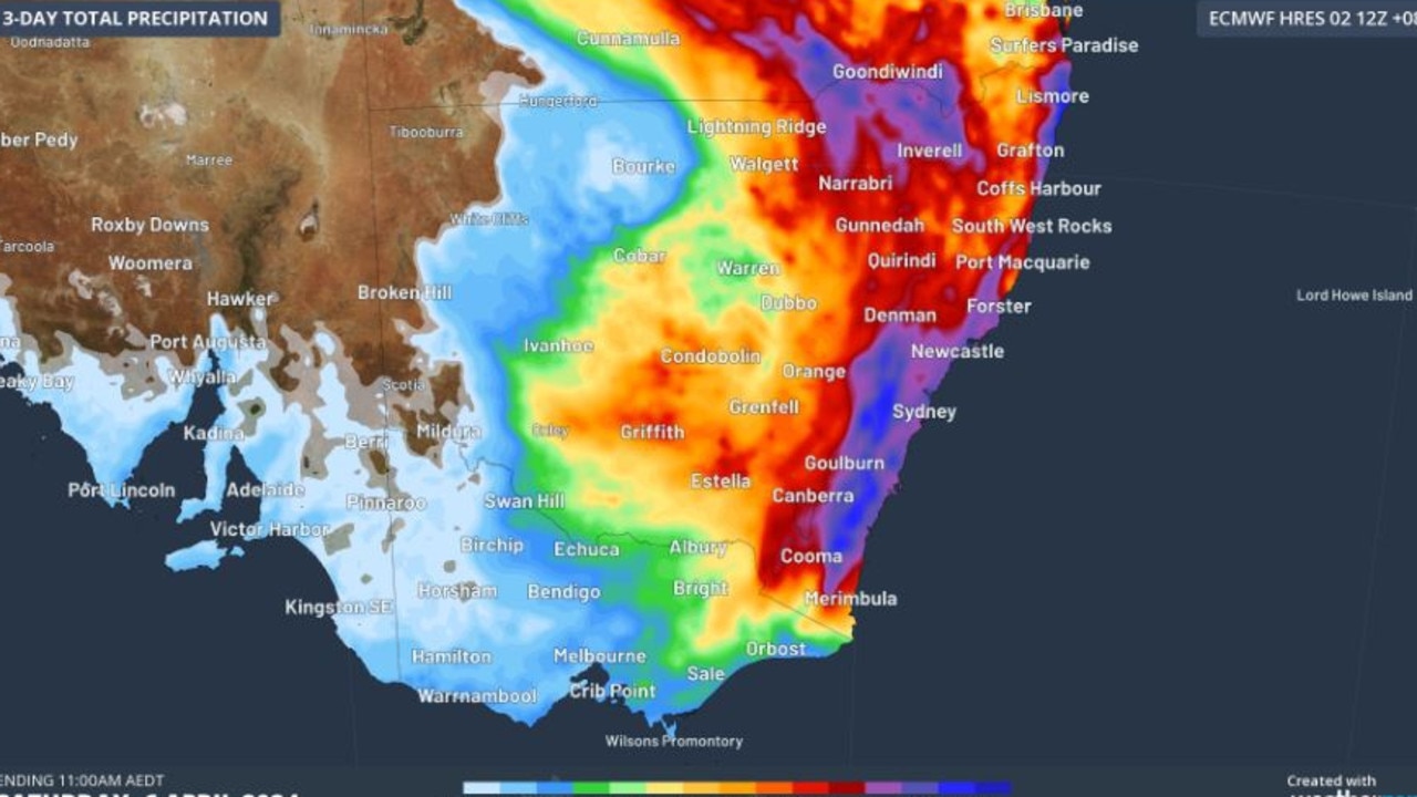
Sydney could be looking up to 175mm of rain between Thursday and Saturday, more than half of that on Friday alone.
Between 200-300mm is possible in some places. While areas of coastal New South Wales and the ranges could see 80-150mm falling in just six hours on Friday.
The system will then push into Victoria across the weekend.
“This significant rainmaker gets underway on Thursday with a deepening trough situated over Queensland feeding in moisture laden air from the Tasman Sea,” Sky News Weather meteorologist Alison Osborne said with the broadcaster characterising it as a “mass deluge”.
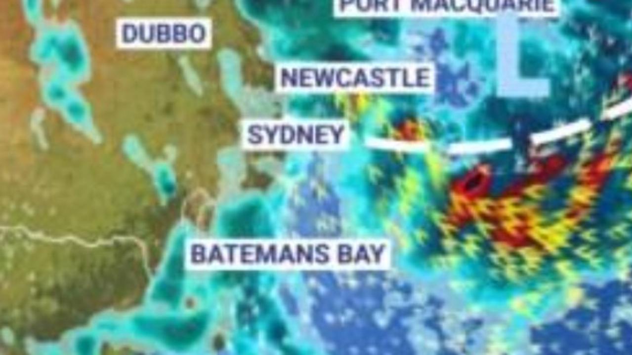
The Bureau of Meteorology (BOM) currently has a severe weather warning for slow moving thunderstorms across the NSW’s northern rivers that could bring heavy rainfall. But it’s almost certain that the warning area will hugely increase during the day and into Friday.
The cause of all this weather wildness is a pool of cold air pushing from the Great Australian Bight up to southern Queensland and northern NSW bringing moisture.
At the same time a trough is forming off the east coast which is directing tropical moisture towards the continent.
As the cooler air interacts with the tropical moisture it can cause it to fall as rain – lots of rain.
Black nor’easter
This potentially violent meeting of two weather systems can lead to a so-called “black nor’easter,” stated website Weatherzone.
These are distinctive due to their deep black clouds laden with moisture which can reduce daylight even in the middle of the day.
A black nor’easter can quite suddenly bring heavy rain and gale force winds.
A black nor’easter in 2020 led to Sydney’s wettest day in 30 years.
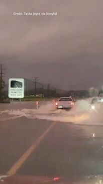
Flooding, hazardous surf and even waterspouts are all possibilities over the coming days.
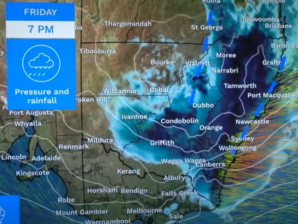
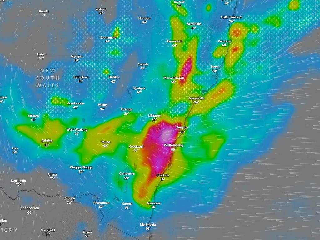
“As we go through the later part of Thursday and into Friday that’s when we’ll see the most severe weather starting to ramp up,” said BOM meteorologist Miriam Bradbury.
“A trough is likely to drag in further moisture to be directed across eastern and central NSW, with the risk of heavy falls becoming more widespread and intense.
“We may also see strong winds wrapping around that trough and high seas and swells starting to be generated offshore”.
Ms Bradbury said a low pressure system was likely to form on Friday.
“The heaviest rain and the strongest winds are likely to be tied to wherever that low may develop.
“Rainfall of this magnitude can quickly lead to flash flooding, cutting off our roads, making them impossible and blocking our drainage systems”.
Hundreds of millimetres of rain
The system is affecting south east Queensland but the rainfall won’t be as heavy as NSW.
Brisbane can expect showers on Thursday and then between 6-25mm on Friday with up to 45mm of rain on Saturday.
Port Macquarie may see up to 20mm on Thursday, then 20-80mm on Friday and 15-60mm on Saturday. Storms could affect these totals.
A particular area of concern is the NSW central coast. A significant 30mm is a possibility on Thursday at Wyong but by Friday that could be anywhere between 25mm and 110mm. While a top up of 30mm on Saturday is possible.
Very heavy rain in Sydney
As you head towards the state’s south the rain begins later and lasts further into the weekend.
Sydney will be in the thick of things with up to 25mm on Thursday, tending towards the afternoon and evening. A possible thunderstorm with between 25 and 100mm of moisture on Friday and then up to 50mm on Saturday morning.
Worse for Wollongong, with Friday’s total potentially reaching 130mm and then 80mm on Saturday. Batemans Bay will see some showers on Thursday and then between 20-70mm on Friday and up to 100mm for Saturday.
It’s not just the coast: Katoomba is looking at as much as 150mm on Saturday and significant falls on the days either side; Orange up to 50mm on Friday and Goulburn 70mm on the same day.
Canberra will be mostly dry on Thursday with 10-40mm on Friday and 10-45mm on Saturday.
The rain should dissipate for NSW from Saturday onwards with relatively clear skies on Sunday.


Some of that rain will reach Victoria.
Mallacoota in the state’s east is expecting 10-45mm on Saturday, Wodonga could record up to 15mm on Saturday and Falls Creek around 20mm.
Melbourne may receive a few spots across the weekend but nothing like what will afflict NSW.
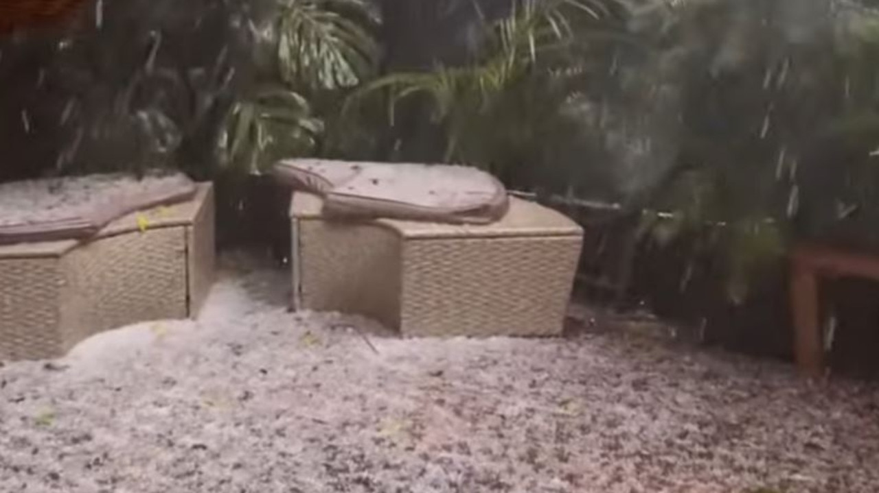
BOM warning as hailstones pound Sydney
Parts of Sydney were blanketed in hail on Tuesday as the nation’s leading weather forecaster issued a fresh warning for flash flooding and severe weather.
Warning after millions cop drenching
Aussies smashed by days of heavy rain may not be out of the woods yet, with warnings for numerous areas still in place.

Man drowns at tourism hotspot
Following a horror long Easter weekend at Australian beaches, another person has drowned at a popular holiday destination.