Warning of ‘destructive winds’ as Tropical Cyclone Jasper hours from landfall, superyachts flee upriver
Incredible images show wealthy boat owners fleeing to safety as Cyclone Jasper prepares to make landfall within hours.
Wealthy boat owners have fled to safety upriver as Tropical Cyclone Jasper prepares to make landfall in far north Queensland within hours.
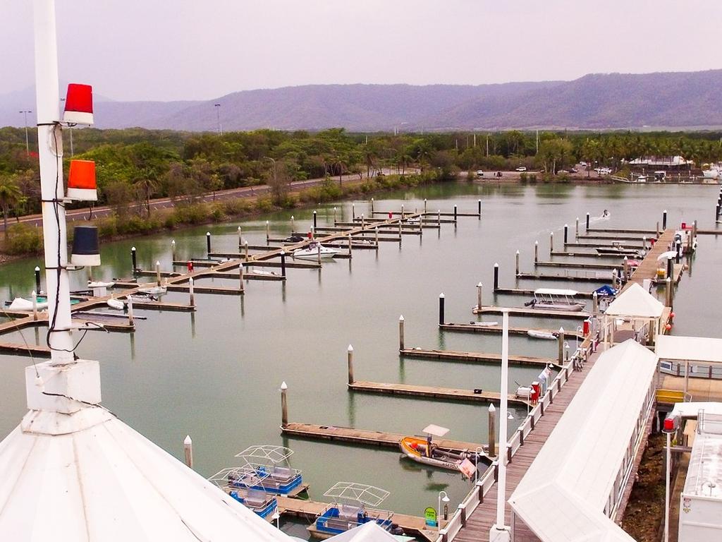
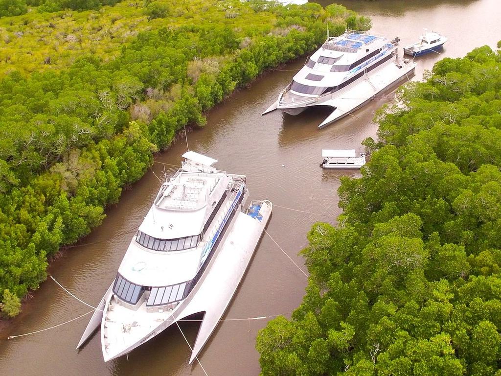
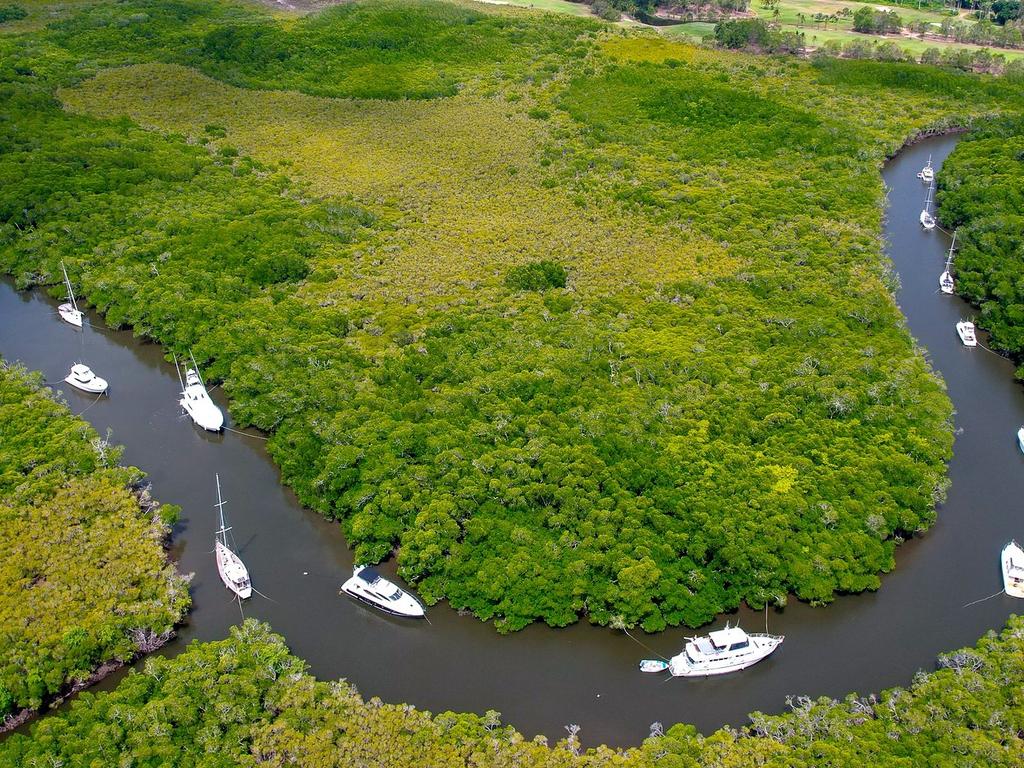
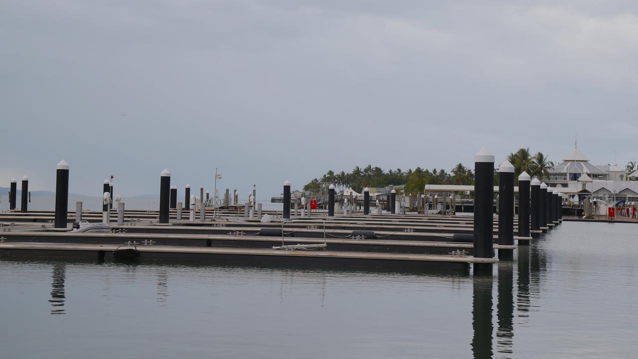
Incredible images show the boats usually berthed at the Crystalbrook Superyacht Marina in Port Douglas taking shelter from the oncoming storm.
“As you can imagine we are well prepared,” wrote the Visit Port Douglas & Daintree Facebook page. “Here the boats from Crystalbrook Superyacht Marina are tucked away in Dickson Inlet — taking shelter in the mangroves and we can’t deny Quicksilver’s catamarans certainly make an impressive sight lined up like that.”
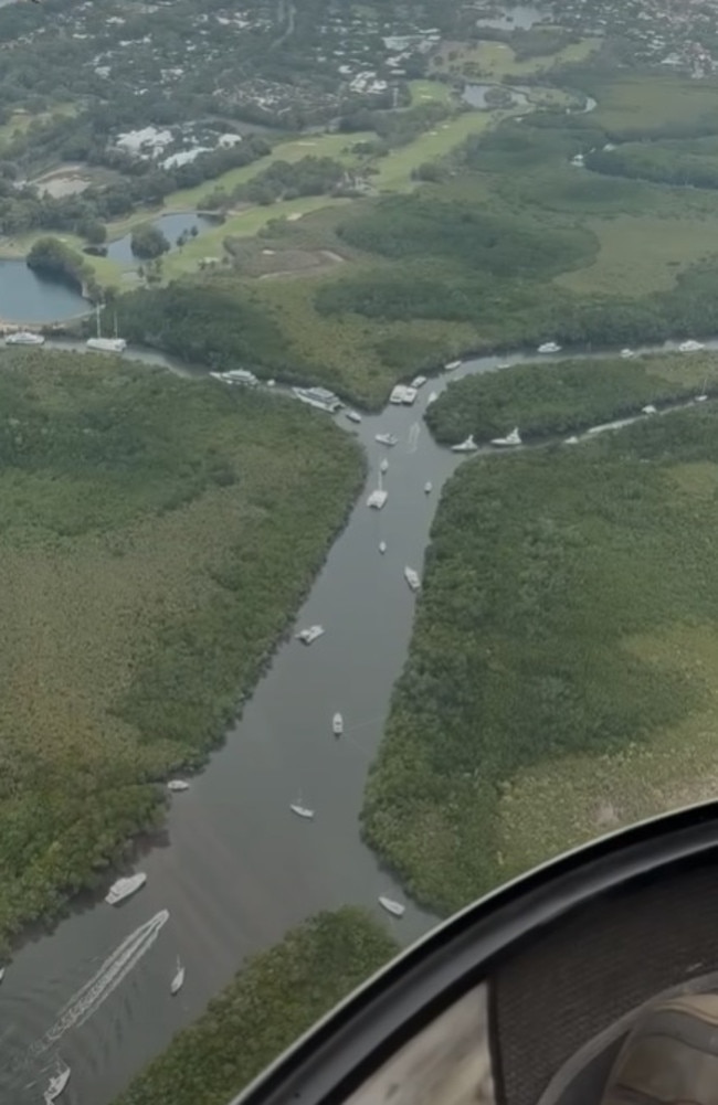
The page Brilliant Adventure shared helicopter footage showing the luxury boats stretching up the river. “A not so common sight!” it wrote.
Meanwhile, Far north Queensland is being battered by “damaging” winds as Tropical Cyclone Jasper prepares to make landfall within hours.
Tens of thousands of residents are bracing for impact amid warnings of “life-threatening flash flooding”, with the weather system tipped to bring more than a month’s rainfall in just six hours.
Currently a category 1 tropical cyclone but with a high chance it could strengthen, Jasper is set to make landfall in the late afternoon on Wednesday potentially near Wujal Wujal, 100km north of Port Douglas, according to the Bureau of Meteorology (BOM).
“Tropical Cyclone Jasper is producing damaging wind gusts on the far north Queensland coast,” the BOM said. “Destructive winds may develop during the afternoon.”

As Tropical Cyclone Jasper approaches Far North #Qld, now's the time to prepare. This video shows the different tropical cyclone categories & potential impacts. #TCJasper is currently a category 1, but may make landfall as a category 2 system.
— Bureau of Meteorology, Australia (@BOM_au) December 12, 2023
Latest: https://t.co/OVGZZ8xBzrpic.twitter.com/objOCiub8c
Communities including Port Douglas and Cooktown are well within the cyclone’s path while Cairns, Atherton, Innisfail and Ingham could all be severely affected by damaging winds and gales.
Some towns within in its expected path were ordered to evacuate at about 3pm on Tuesday.
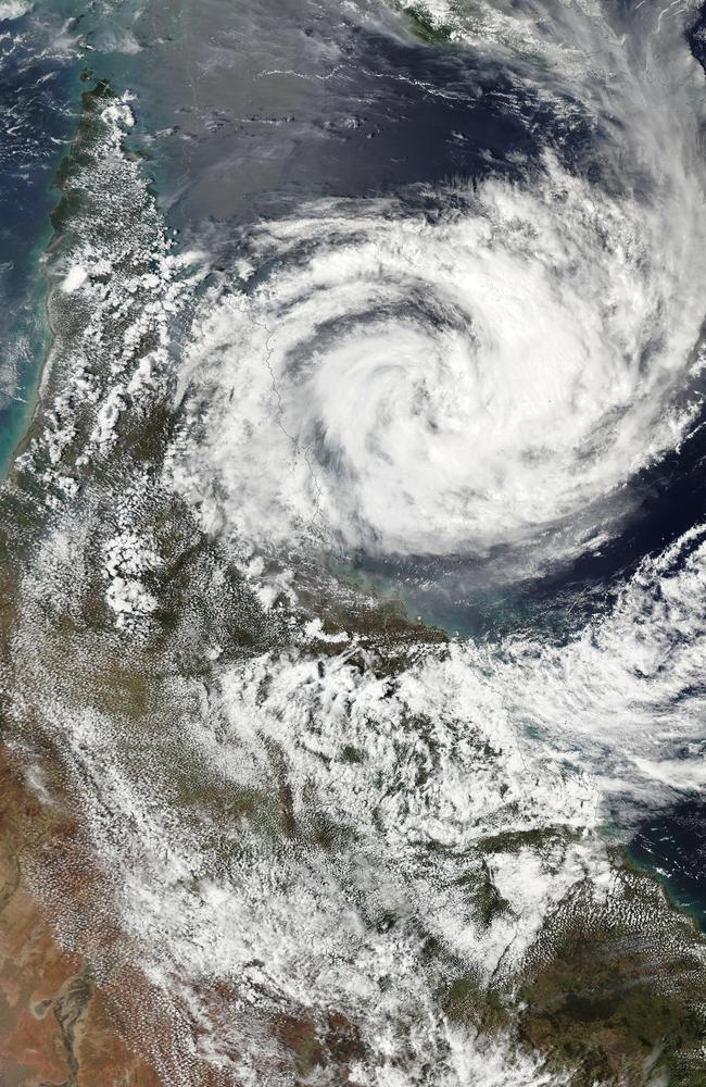
As of 10am on Wednesday, Cyclone Jasper was 135km northeast of Cairns and 125km southeast of Cooktown, and moving southwest at 12km/h, the BOM said.
Cairns has a population of more than 160,000.
Mayor Terry James said he feared residents had become complacent.
“They certainly have,” he told ABC Radio National on Wednesday.
“It’s been a long time since we’ve had a direct hit in the Cairns area, so complacency is a massive problem and we see that all the time. There’s a lot of stories around to say Cairns is protected from the mountains but if you go back in history we have had some decent cyclones in the 1800s and early 1900s.”
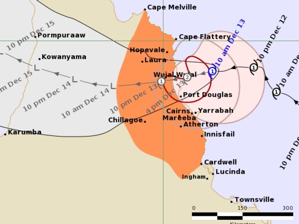
Given the nature of cyclones, even at this stage the exact track of Jasper could change.
“We always prepare for the worst and we hope for the best,” Mr James said.
“We are expecting a category 2 cyclone, as it gets closer to the coast in a lot of free space over the reef it can intensify. It has moved further north overnight but it’s still moving around, making some strange movements — a little bit north, a little bit west, a little bit south — so this thing can go anywhere.”
Up to 500mm of rain could come down between Cape Flattery, on Cape York, and Port Douglas in the next 24 hours. Down as far as Ingham, between 150 and 350mm is possible. That’s enough for “life-threatening” flash flooding.
A “storm tide” with large waves ahead of the cyclone is expected anywhere between Cooktown and Ingham.
“Destructive” wind gusts of up to 140km/h could cause serious damage.
The BOM has warned anyone between Wujal Wujal and Ingham, including Cairns, should now prepare to “shelter in place”.
“Our emergency response plan we activated yesterday to tell people if you’re in the red zone you really need to move out now,” Mr James said.
“That’s downgraded a little bit in the Cairns area, it’s moved up to the Port Douglas area and the Cooktown area, they’ve enacted their emergency action plan for people to take shelter right now.”
Cooktown mayor Peter Scott told Nine’s Today there were currently “five people and a blue heeler dog” being looked after at the town’s cyclone shelter, which has a capacity to take 1000 people.
“Two people have come up from Wujal Wujal, the other ones are locals,” he said.
“We are pretty well prepared. It’s still very quiet up here. We got a little bit of rain overnight. We haven’t had any strong winds as yet. Now it’s looking like we will get the stronger winds later this afternoon or this evening, so we are ready for it.”
Mr Scott said most businesses had closed and council had asked staff to take the day off. He predicted the Mulligan Highway, Cooktown’s main link to Cairns, would be cut off for one or two days by flooding.
“It is a dangerous situation,” he said.
“[The cyclone] has changed its mind a number of times and it can do so again at the last minute. It has the capacity to intensify. It is pretty quiet up here at the moment and that is the worst thing for becoming complacent. I ask everyone to stay on your toes and be aware. Hunker down and follow the normal protocols.”
As residents brace for impact, local tourism operator Richard Berman-Hardman from Cairns Skyrail Rainforest Cableway said it was possible crocodiles could appear in the streets.
The tourist hub is home to a network of storm drains and waterways that help it recover from tropical storms, though that drainage system can bring wildlife right up to residents’ doorsteps.
“Cairns is built for cyclones,” Mr Berman-Hardman told Channel 10 on Tuesday when asked about the possibility of crocs.
“One thing that makes it easy for us to recover from them is that there are waterways and drains right through town, so everything kind of joins up when there are big rains, so it’s not out of the question but probably unlikely.”
“I guess you’ve seen snakes on a plane, let’s just hope there’s no crocs on the cableway by the end of tomorrow,” he joked.
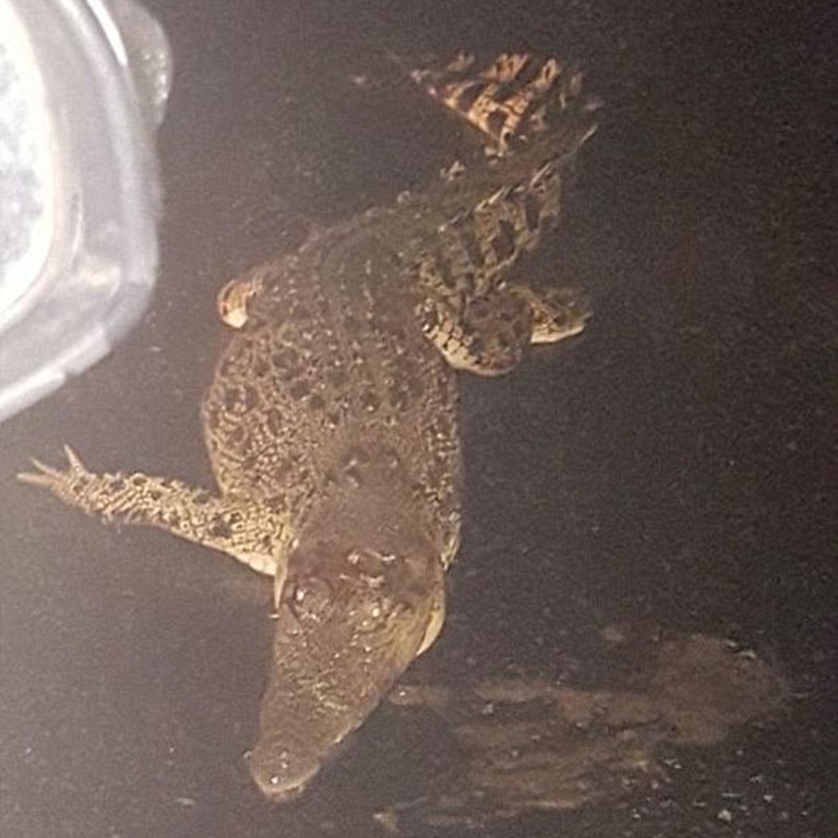
Though the phenomenon sounds bizarre, it’s not unprecedented in Queensland.
In the aftermath of high tides and heavy rains, crocodiles can move further upstream into areas in which they wouldn’t typically be spotted.
There were reports of crocs roaming the streets during the 2021-22 flooding events across Queensland’s southeast, as well as when Cyclone Owen hit the state in 2018.
During Cyclone Owen, crocs were flushed out of surrounding creeks and onto the streets in Far North Queensland, with authorities forced to issue animal hazard warnings in the midst of the disaster.
“There are a lot of crocodiles that are being sighted at the moment so be careful on the roads and please don’t go near the crocodiles,” then-Premier Annastacia Palaszczuk said at the time.
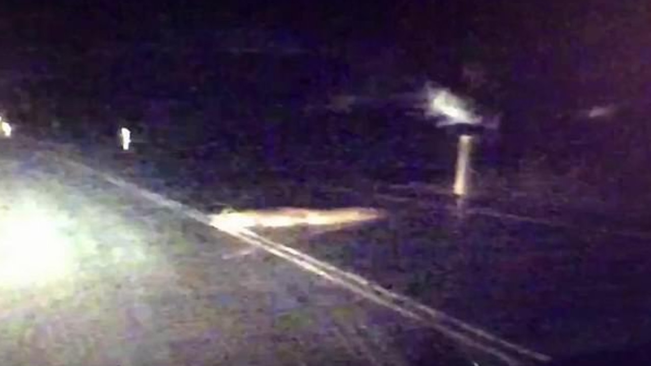
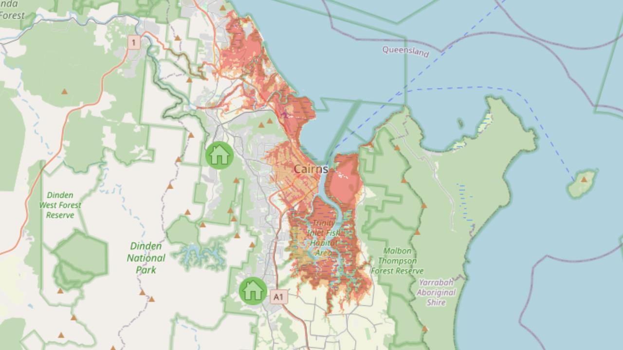
At least 15,000 homes in Cairns are at risk of storm surge flooding.
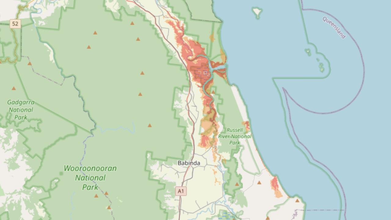
Cairns’ Local Disaster Management Group (LDMG) urged residents in the city’s red zone — the areas at the highest risk of flooding from a cyclone storm tide — to evacuate immediately due to the risk of a large storm surge when Jasper crosses the coast.
“Tropical Cyclone Jasper is expected to cause widespread storm surge in the red zone,” a LDMG spokesman said.
“People in the red zone should leave immediately to higher ground. You may be in danger when the cyclone crosses. Go immediately to higher ground to stay with family or friends away from the red zone surge areas.
“Properties in the orange zone [areas at high risk] may experience flooding.”
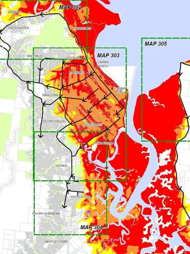
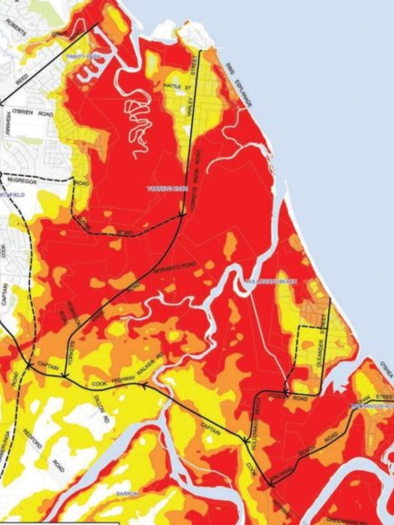
Properties in Cairns North, Cairns City, Portsmith and Parramatta Park are expected to be the worst impacted as Jasper edges towards the Queensland coast.
Residents have been urged to visit the Cairns Disaster Dashboard to check if they are in a storm tide zone.
Two evacuation centres have been set up, one at Redlynch State College sports hall and one at Edmonton storm tide cyclone shelter.
“Big waves and sea water will travel inland and through coastal creeks and rivers. This can flood and damage buildings, wash away roads and cars, and damage bridges,” the LDMG spokesman warned.
“Roads could be blocked by fallen trees, powerlines or flood water from the cyclone. There will be lots of wind and rain from the cyclone. There will be flooding in low-lying areas. Power, water, phone and sewerage services could stop working.”
According to the BOM, residents can expect to feel gale force winds six hours ahead of the cyclone’s coastal crossing.
Cairns Airport was shut down on Tuesday with 18 arrival flights and seven departure flights cancelled. Chief executive officer Richard Barker said the airport was following its cyclone plan in line with advice from the BOM.
He urged both domestic and international travellers to stay away from the airport on Wednesday, as it would be closed due to the unsafe weather conditions.
More Coverage
Jasper is less than 300km from the Queensland coast and moving west.
Queensland Fire and Emergency Services urged those in cyclone regions to prepare an emergency kit in a waterproof container in case disaster strikes.
They recommended residents stock up on three-days worth of food and water, battery-powered technology, first aid and pet supplies and keep important documents handy.
Read related topics:Brisbane


