
‘It will feel like winter’: Crazy cold snap to hit millions of Aussies
Millions of Aussies have been warned “it will feel like winter again” as temperatures plunge and rain falls this week.

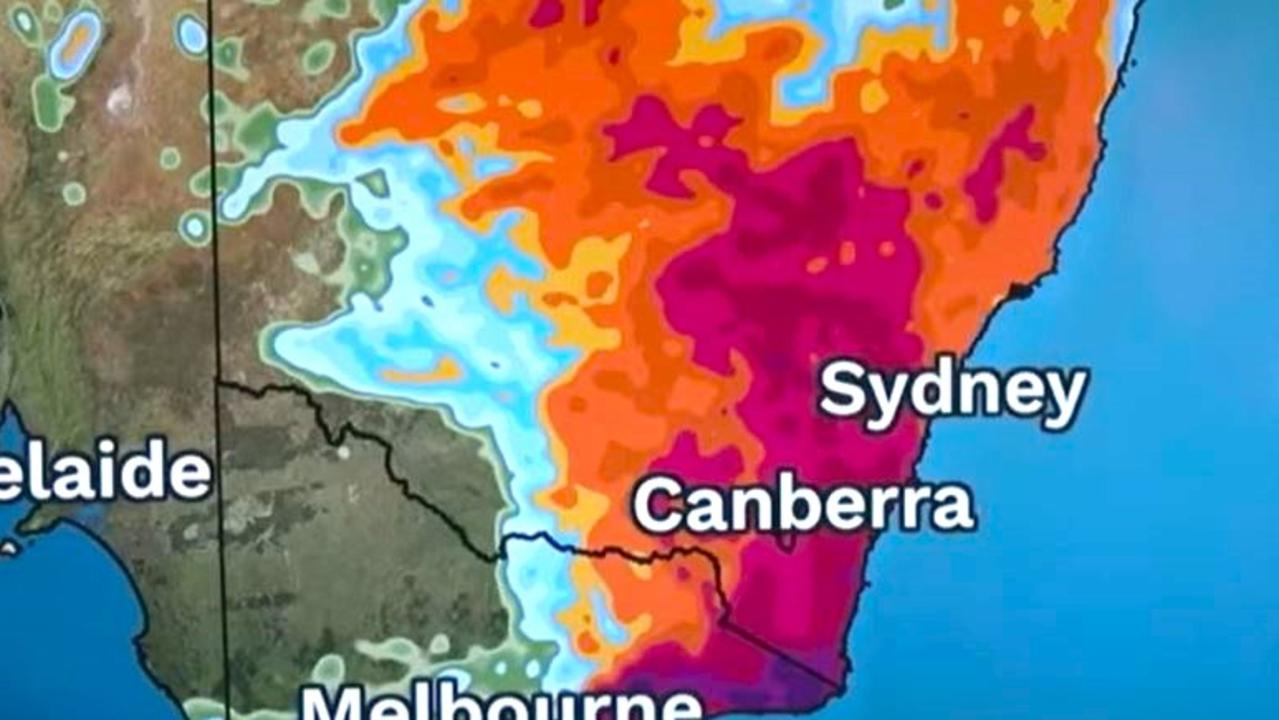
Millions of Aussies have been warned to brace for unseasonal and wintry temperatures as a cold front pushes through the southeast.
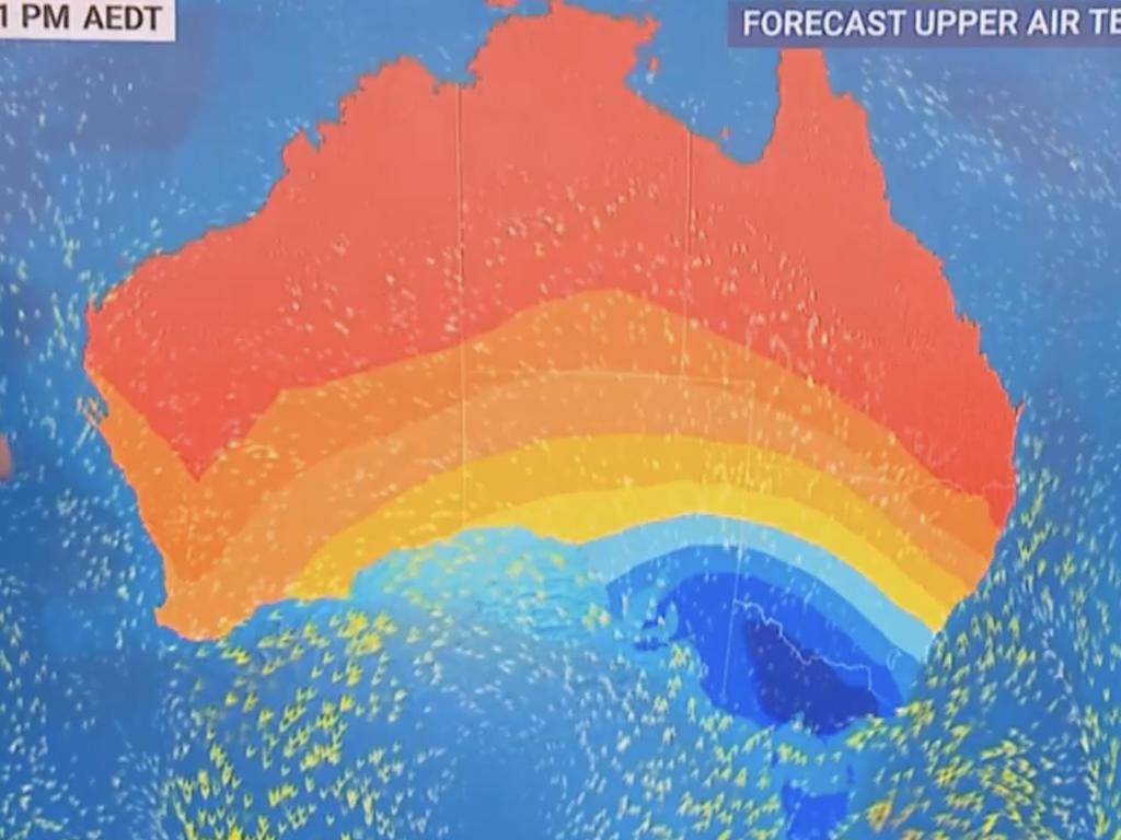
Sky meteorologist Alison Osborne said a countrywide “battle of the seasons” was underway, as icy temperatures seize the southern half of Australia and the north marches into summer.
A wintry chill is forecast to sweep over southeastern Australia from Tuesday, courtesy of a low pressure system and cold front, Ms Osborne said.
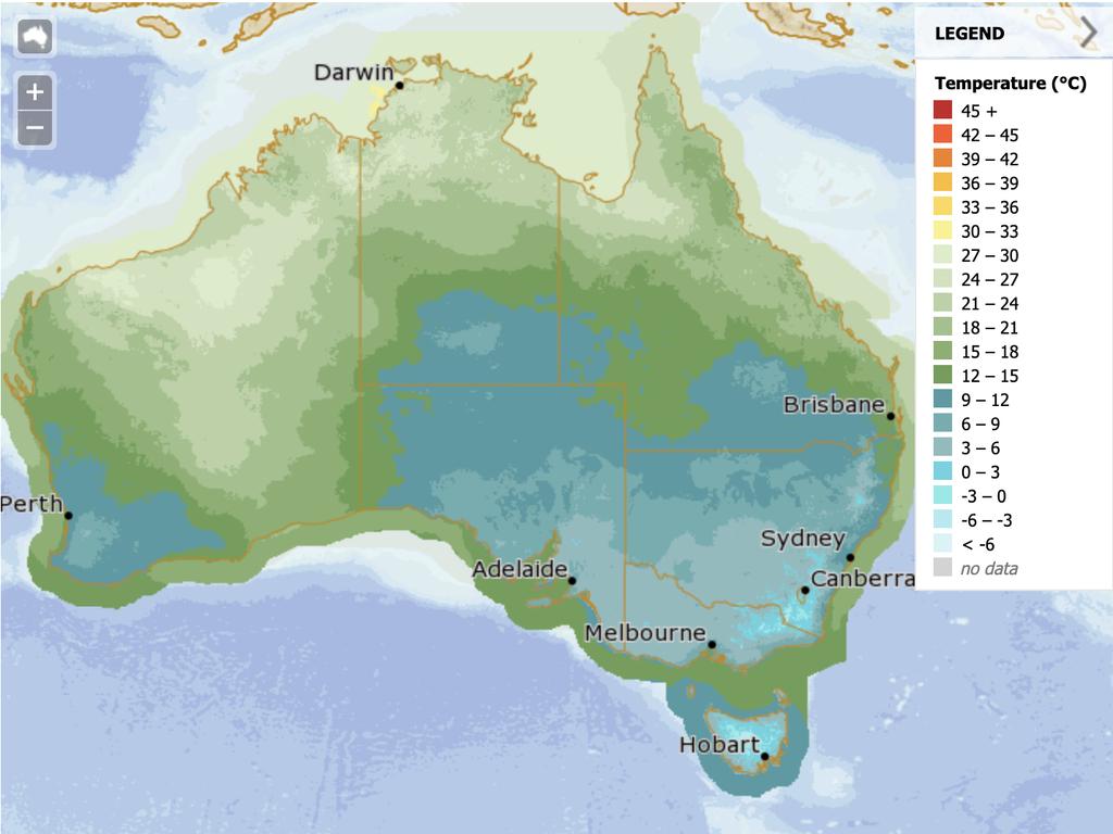
Temperatures are forecast to drop noticeably from Tuesday, falling below 15C across parts of NSW, southern Victoria, the SA coastline and all of Tasmania.
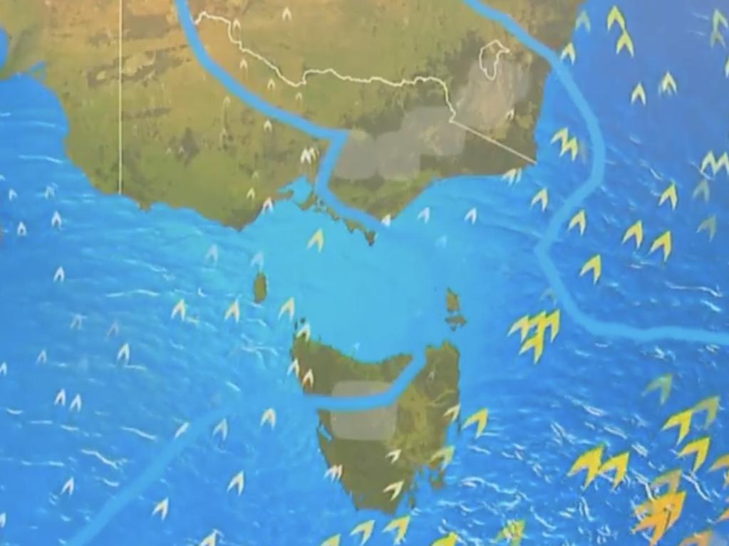
“A cool, blustery south-westerly wind will be pushing across SA on Tuesday. By Wednesday, it is shifting over Tasmania,” Ms Osborne explained.
“Temperatures (are forecast to drop) noticeably by Tuesday, cooling down across SA’s coastline … By Wednesday, it’s cooler still across Victoria, the southern half of New South Wales and statewide in Tasmania.
“It will feel like winter again.”
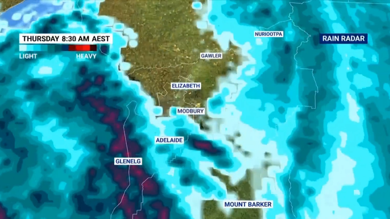
The cold front could be “promising” for some fire-hit regions of eastern Australia, with “significant rain on the way”, Ms Osborne added.
“South-easterly winds will be delivering the showers and possible thunderstorms on Thursday across the NSW coast. Throughout this forecast, rain (is) fairly persistent around the mid north and cross region,” she said.
“It should be enough to turn the fortunes of a couple of active fire grounds, particularly through northern NSW, with accumulations likely to exceed 25 to 50 millimetres in that area between Coffs Harbour and Newcastle.”
It may be cold enough for snow to settle over parts of Tasmania, Victoria and NSW.
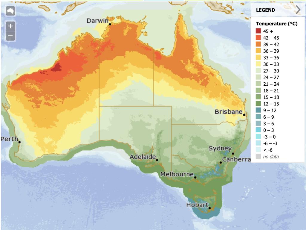
Meanwhile, it is expected to be very hot in Australia’s north, with potential temperature records on the cards.
Ms Osborne said maximum temperatures were forecast at higher than 40C in parts of northern NSW and southern Queensland.
October temperature records could be broken between Mount Isa and Longreach, she added.
Capital cities affected by the cold snap
Adelaide is expected to weather the cold snap first, with the maximum temperature in the city falling to just 15C on Wednesday. On Thursday, the temperature is expected to hover between 7C and 19C, before warming up again from Friday.
Damaging winds are possible in Hobart from Tuesday evening as showers fall over the city. Maximum temperatures are set plunge from Wednesday, dropping to 13C and staying in the mid-teens through to Friday.
Showers are forecast to begin in Sydney from Wednesday, before the cold front takes hold of the city from Thursday, when the minimum temperature is set to drop to a chilly 13C. Showers are expected to continue but ease on Friday, before clearing into a sunny weekend.
Melbourne, too, will experience the cold front, with showers on Wednesday and Thursday. Both days will be unusually cool, with minimum temperatures of 9C, warming up to just 15C. Warmth won’t be back until the weekend, when the mercury is set return to the mid-to-low 20s.
Maximum temperatures are forecast to fall in Canberra from Thursday, dropping to 17C on Thursday and Friday. The mornings are also forecast to be chilly, with minimum temperatures of just 2C both days.
Brisbane is also forecast to be affected by the midweek cold snap, with temperatures dropping by almost 10C overnight. Maximum temperatures are forecast at 31C from Tuesday to Thursday, before plunging to 22C on Friday.
Temperatures will also drop by 10C in Perth, where on Wednesday, the high is forecast at 34C. It is set to cool rapidly, falling to 24C on Thursday and remaining between 24C and 25C through to next week.
Darwin will stay hot and dry, with maximum temperatures of between 34C and 35C right into next week. The minimum temperature will also be warm, sitting at between 25C and 26C.
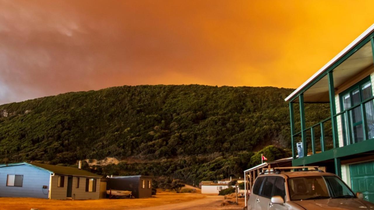
‘Volcanic’: Aussies battle raging fires
Residents in one state have captured startling photos showing apocalyptic scenes as they confront a complex web of bushfires.
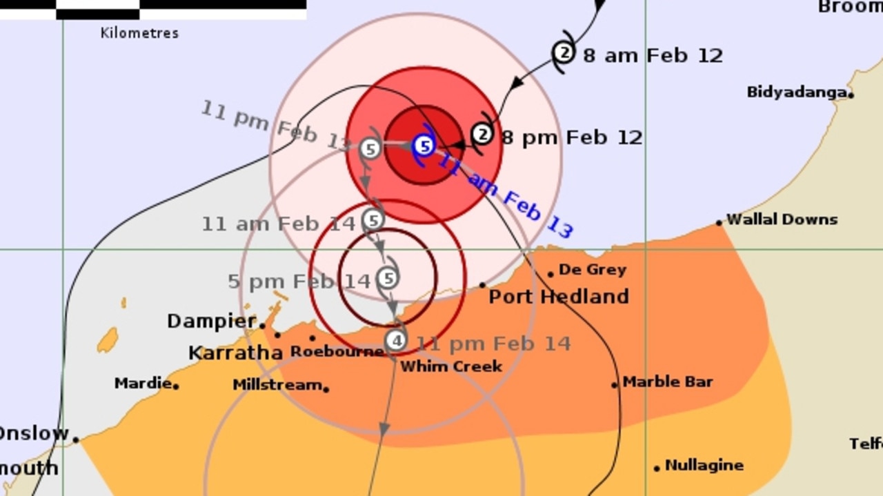
‘Threat to life’: Cat 5 cyclone declared in WA
Tropical Cyclone Zelia has been declared a category five system and is expected to make landfall on Friday afternoon, with winds up to 290km/h possible.
‘Dangerous situation’: Grim weather warning
Forecasters are warning of a “dangerous … multi day outbreak” of dire weather, with storms, heavy rains and floods all possible.