
Southeast Queensland lashed by 300mm of rainfall, flooding
Experts have urged people to “find higher ground” after a popular shopping centre in southeast Queensland goes underwater.
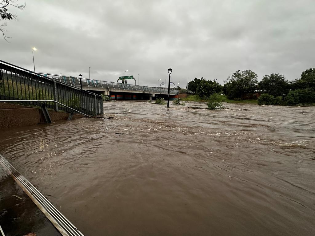
A slow-moving weather system has dumped biblical amounts of rain in southeast Queensland, with two towns home to thousands being inundated and a mall flooded.
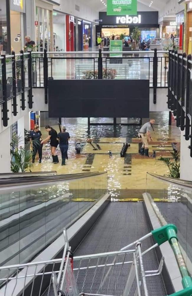
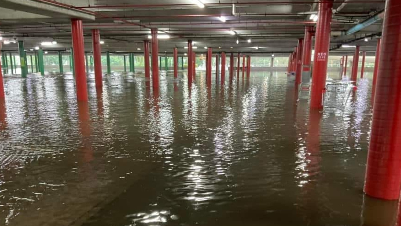
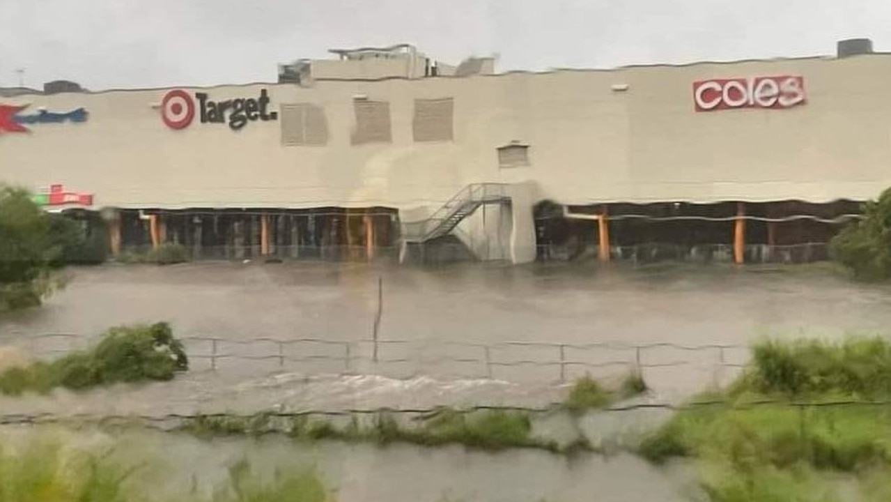
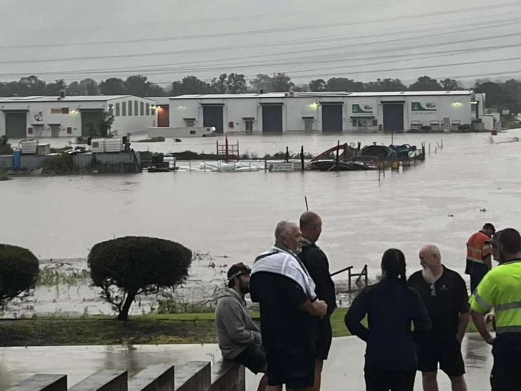
The popular Morayfield Shopping Centre in Brisbane’s north has been submerged by water, following a devastating bout of heavy rain causing flash floods in the area.
The centre’s lower carpark was evacuated due to the rising water, with shocking photographs showing the devastation.
In one picture taken from an escalator, the entire bottom floor of the shopping centre appears to be filled with water as shoppers evacuate the area.
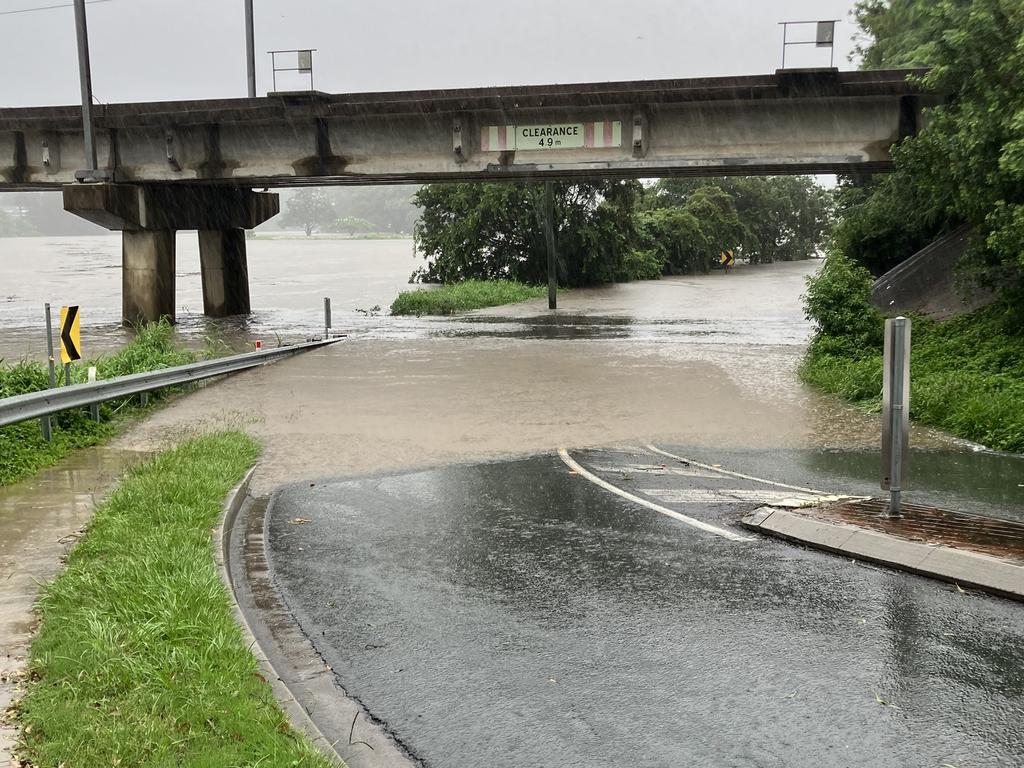
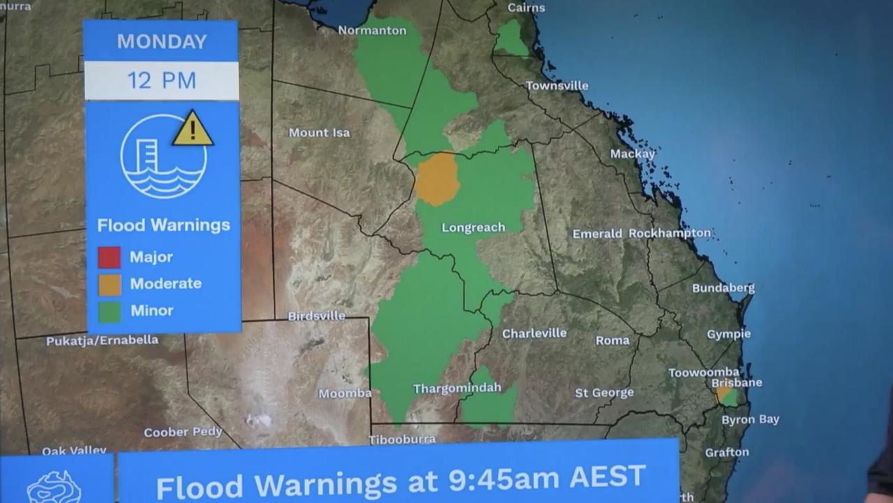
The Bureau of Meteorology has activated numerous emergency warnings, including flood alerts for the lower Brisbane and Bremer Rivers.
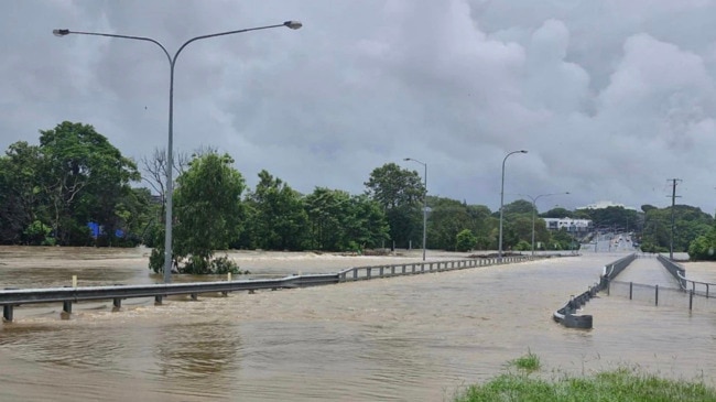
Rain gauges west of Brisbane recorded an excess of 300mm in just three hours. The north of Brisbane was also drenched, with Albany Creek, Strathpine and Samford hammered by more than 100mm in an hour.
Swiftwater crews have been rushed out to help people in the Moreton Bay, Somerset, Lockyer Valley and Darling Downs regions.
To the west of Brisbane, emergency alerts were issued for Laidley and Forest Hill in the Lockyer Valley and the Laidley State High School evacuation centre will open for people seeking shelter, according to a statement by the Queensland Fire and Emergency Services.
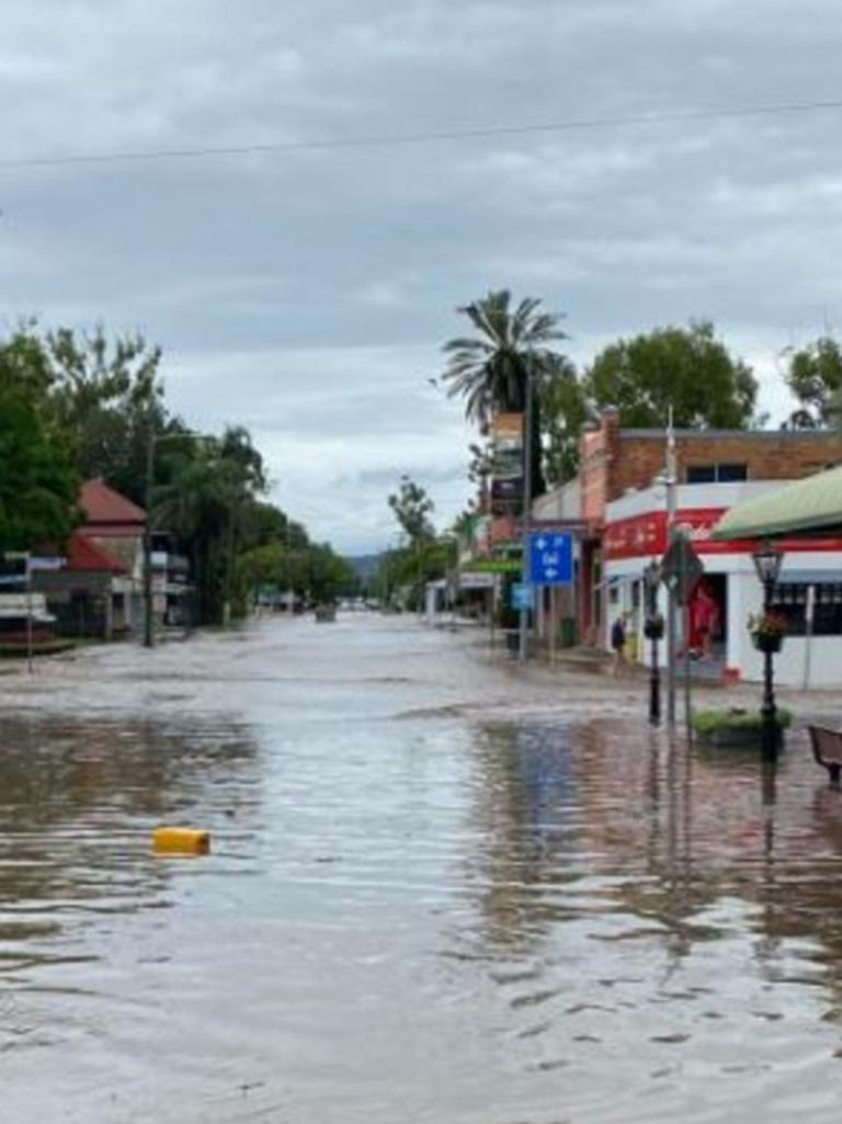
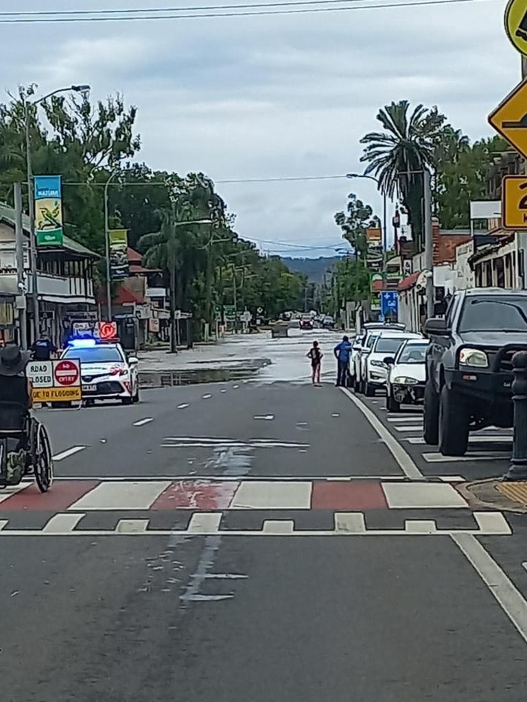
It’s understood the main street of Laidley, a town of just under 4000, has gone underwater, as per credible social media reports.
Lockyer Valley Regional Council Cr Chris Wilson warned the rest of Laidley could be inundated as floodwaters rise.
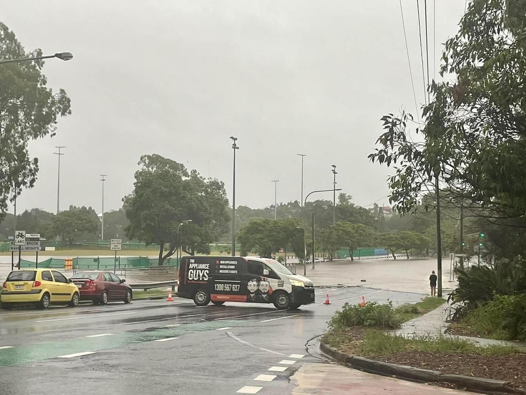
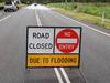
There are also over 130 reported road closures due to flash flooding across Queensland.
The Main Street of Laidley is now cut we hope everyone is ok and safe ðŸ™
— SEQUEST (@SEQUESTRADIO) January 29, 2024
The Laidley State High School Evacuation Centre has been established and is operational from for those in need of safer shelter. pic.twitter.com/QpXsHLPwS7
“Attention Laidley businesses and low lying houses. The peak of the flood water is expected mid morning, possibly as early as 8.30am [AEST]. Current modelled levels are slightly less than the May 2022 event. However, this is only a model! Sandbags and sand is available near the railway station.”
Lockyer Valley mayor Tanya Milligan also told residents to expect local homes and businesses to be inundated - especially those in Forest Hill.
Jandowae, a small rural town and locality in the Western Downs has had its residents warned to move to higher ground.
The town of just over 1000 residents has found itself in the precarious position of having no roads in or out due to floodwaters.
Western Downs Regional Council issued a watch and act alert at 7.30am on Tuesday, urging residents to “secure belongings and go to higher ground.”
According to the Courier Mail, Jandowae woke early Tuesday morning to authorities frantically telling them to seek higher ground, prompting criticism regarding authorities’ preparedness.
“The alerts didn’t go out early enough, but there’s nothing better than having your doors knocked,” Western Downs mayor Paul McVeigh told the Courier Mail.
To the north, people in Deception Bay, Burpengary and Burpengary East have been put on alert for changing conditions due to flooding.
The slow-moving trough has also led to flooding in parts of central Queensland.
Are you being hit by the rain? Email tips@news.com.au

Forecast for rainy days ahead
Overnight, Aussies were urged to brace for an “intense” set of storms.
The forecast indicated western and southeast Queensland, and far north NSW, will be battered by heavy and intense rainfall for the next three days due to two rain events.
Widespread falls of between 100mm and 150mm are expected between the Gold Coast and Gladstone. Isolated falls of between 150mm and 300mm are also forecast, and rainfall at some locations could even exceed 300mm.
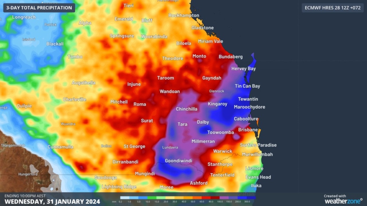
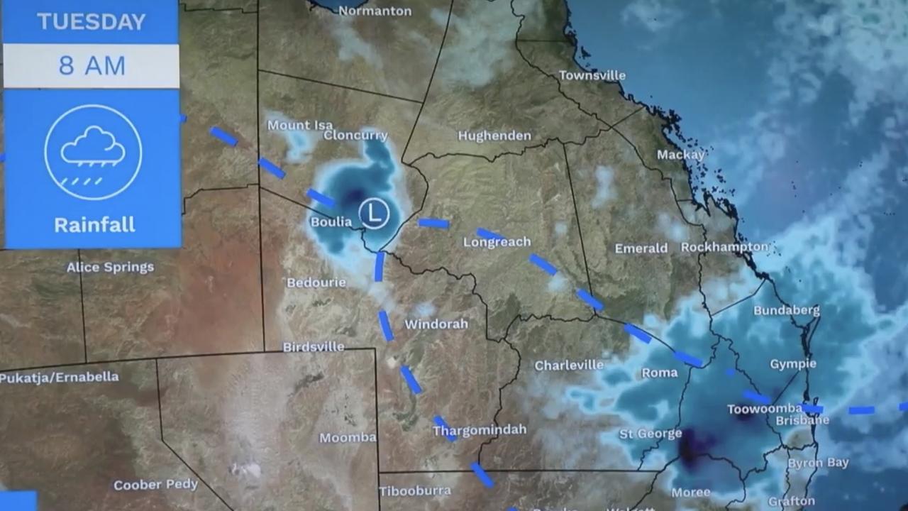
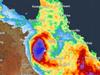
The rain is being driven by ex-cyclone Kirrily, which has settled over western Queensland. A separate system is also developing over the eastern NSW-Queensland border.
“We’re expecting persistent showers and storms across northern parts of the country,” explained Bureau of Meteorology meteorologist Sarah Scully.
“It’s ex-tropical cyclone Kirilly, this low pressure system here, that’s continuing to bring heavy rainfall and flooding to central and western parts of Queensland.
“Kirilly is also drawing a deep layer of tropical moisture across much of Queensland and northern NSW, which is combined with this lingering trough to bring widespread showers and thunderstorms, potentially severe and heavy rainfall as well.”
The worst of the storms is expected to hit between Tuesday evening and Wednesday morning.
The rainfall could cause flooding, BOM meteorologist Dean Narramore warned.
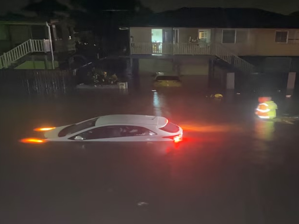
“Forecast rainfall could lead to flash and riverine flooding in the next 48 hours. In the worst cases, that could lead to inundation of homes, properties, businesses and agricultural land,” he said.
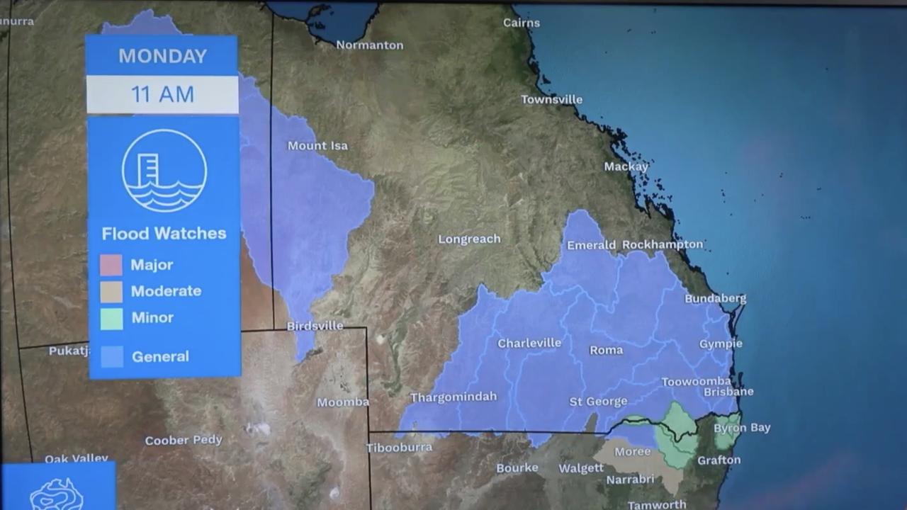
Flood watches are in place for southern and central Queensland and NSW’s northern rivers, with flood warnings active for more than a dozen catchments.
Queensland has been hit by a staggering amount of rain in recent weeks, waterlogging the area.
Seymour Gap in western Queensland received 256mm in the hours to Monday morning, while Kirby received 244mm.
A weather reading at Brisbane airport showed the precipitable water value — which measures how much water is in the air — had hit 70.8mm on Monday morning, just shy of its record of 70.9mm in March 2017.
The rain will begin to push into northern Queensland from Wednesday and won’t let up until Thursday, when a dry weather system finally pushes through and clears up both the storms and humidity.
Heatwave to combine with rain
Meanwhile, parts of Australia — including some that will be impacted by the rain event — are set to swelter through a brutal heatwave.
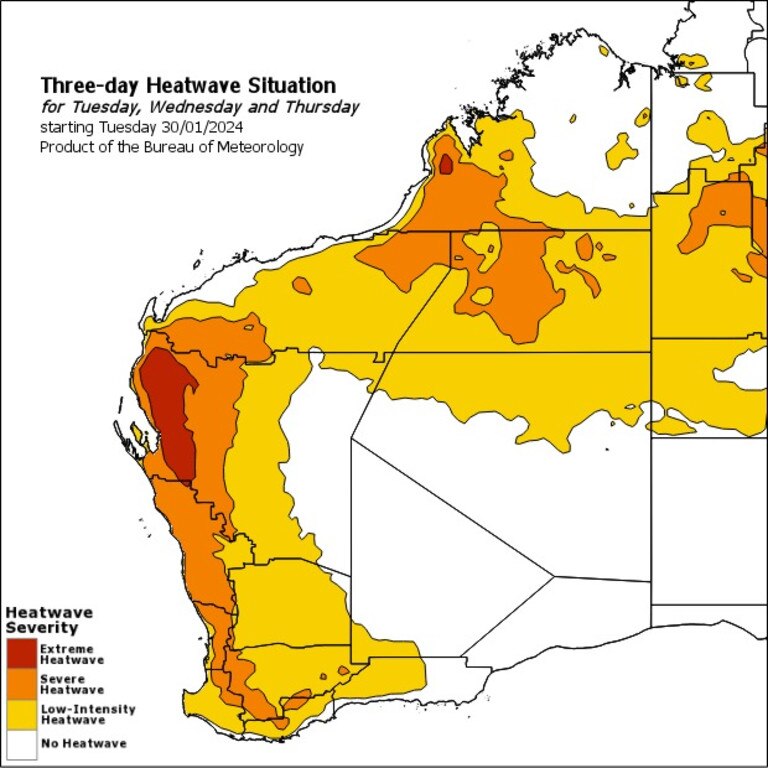
Maps from the Bureau of Meteorology show widespread temperatures in the low-40s across the interior, and the heat is expected to migrate farther south from Thursday.
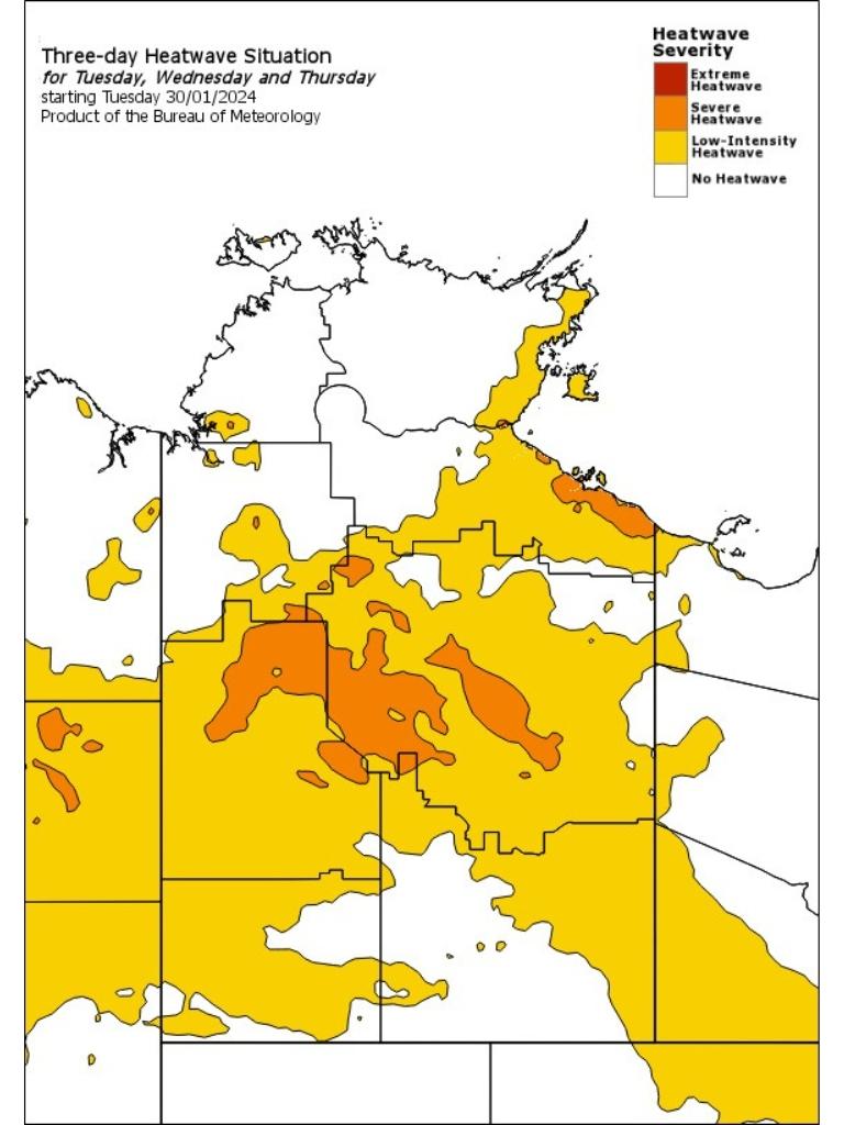
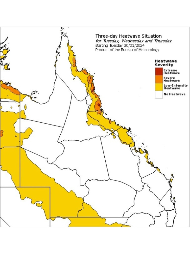
An extreme heatwave warning is in place for Queensland’s North Tropical Coast and Tablelands, as well as severe warnings for the Central Coast.
Those severe warning extend into the Barkly and Tanami districts in the NT. The Barkly catchment is also under a flood watch.
WA will be the state worst impacted by the heat, with large parts of the north and most of the coast covered by some kind of heatwave warning.
An extreme warning is in place for the Gascoyne district, and severe warnings for the Kimberley, Pilbara and large parts of the southwest coastline.
WA residents have been urged to prepare for extreme fire danger for Swan Inland South, Brockman, Blackwood and Southern Forests on Tuesday.


