
Day-by-day breakdown of what to expect from Tropical Cyclone Alfred
Experts have revealed what to expect as the cyclone moves towards Australia’s east coast.

Tropical Cyclone Alfred is tracking towards Australia’s east coast, as residents in the danger zone are warned they have just hours to escape.
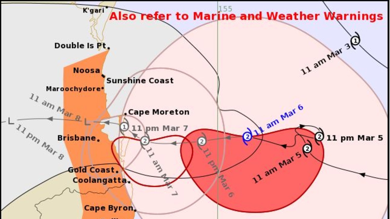
It had been expected to make landfall potentially as early as late Thursday. However, it is now forecast to cross the Queensland coast in the early hours of Saturday morning.
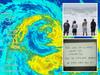
Currently at category 2, early on Thursday afternoon it was 245 kilometres east of Brisbane. There are concerns it could reach category 3.
Here is a day-to-day guide of its updated movements.
Thursday
At the time of writing, Alfred is currently moving on a westward trajectory towards the Queensland south coast at a fairly slow pace – only ten kilometres per hour.
At 10am on Thursday, the Bureau of Meteorology reported Alfred’s location was 280km east of Brisbane and 260 kilometres ENE of the Gold Coast.
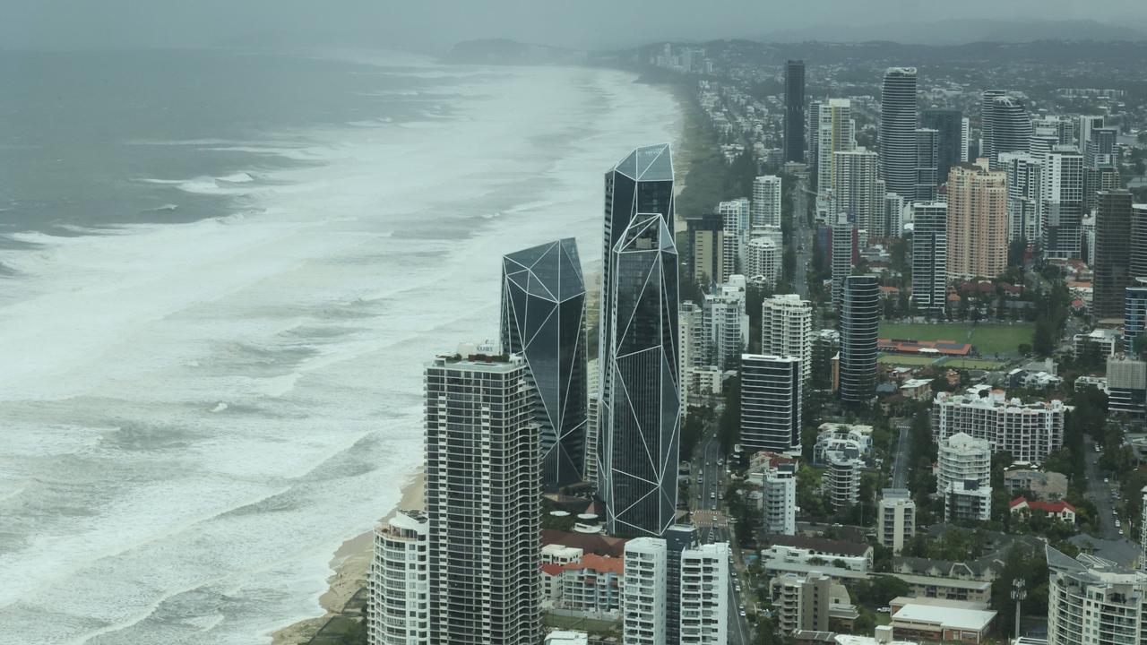
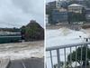
Despite being so far away, the effects of the cyclone are already being felt across the NSW north coast and much of Queensland’s south coast.
Footage has emerged of massive, swelling waves in the Gold Coast and waves in excess of 12 metres in height have been reported in the area.
MORE:Aus insurers’ sick move as cyclone nears
Parts of the NSW north coast are already experiencing power outages, flights in and out of Brisbane have been cancelled and schools across the storm path have been closed.
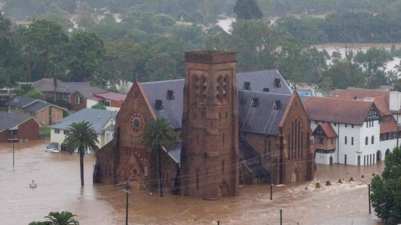
Flood warnings have been put in place as far south as Gloucester in the New South Wales lower Mid-North Coast, and Barrington Tops have received more than 200 millimetres of rain in the last week.
Rains are likely to become torrential on Thursday, and 24-hour totals are likely to exceed 100mm across the regions encapsulated by the storm front.
MORE:1.88m Aussie homes in path of Cyclone Alfred’s fury
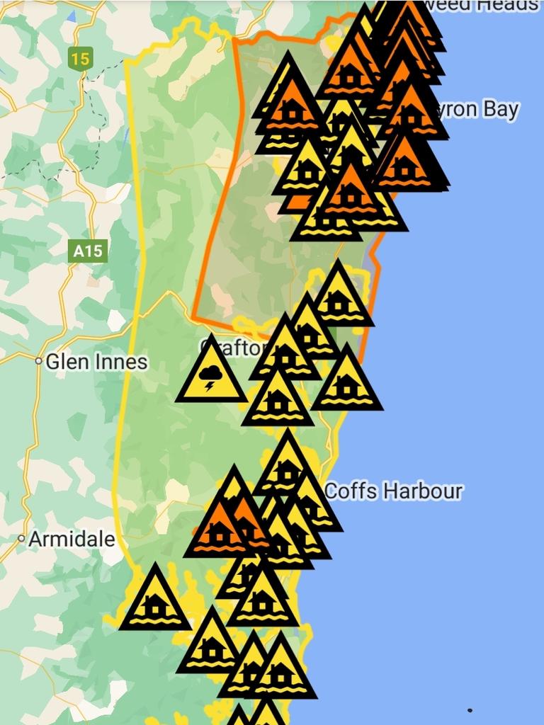
Wind gusts are likely to exceed 90km/hr within the radius between Double Island Point to the north of the storm surge and Grafton to the south.
Closer to Brisbane, where much of the storm’s damage will be concentrated, gusts could exceed 125km/hr by Thursday evening if Alfred gets within 100km of the coastline.
Winds of that strength are capable of knocking down trees and causing minor damage to homes and smaller freestanding buildings.
Professor Steve Turton of Central Queensland University believes many people are likely to underestimate the extent of the storm’s power.
“The stress on buildings, the wind loading on buildings is a significant concern, especially for some of the older buildings around Brisbane and the Gold Coast, where they were constructed under very different rules,” Professor Turton said.

“They’ve been there for many, many decades because there hasn’t been anything to blow them over apart from the odd thunderstorm, but (those storms are) highly localised … I don’t know that people are really fully aware of what this might mean,” he said.
“Four million people are in the path of this cyclone, and I guess we could say we’re lucky it’s not a category 4.”
Friday
Cyclone Alfred is expected to come into proximity of the Queensland coast late on Friday, bringing gale-force winds and torrential rainfall.
Rainfall will peak late on Friday, with some areas likely to receive 250mm within a six-hour period.
Rain of this volume can cause life-threatening flash flooding.
As the cyclone moves further inland and drops to a category 1, places like Stanthorpe, in southern Queensland, and Armidale, in northern NSW, could see upwards of 50mm.

Saturday
When the eye passes over the coast directly over Noosa and Coolangatta as a category 2 cyclone, gusts are expected to reach a maximum speed of 150km/hr – strong enough to cause roof damage, eviscerate crops and uproot large trees.
“Once you’re into the destructive core then you’re looking at structural damage to buildings and homes, lots of vegetation damage,” said Professor Turton.
Uprooted trees and other debris are likely to destroy power lines, and widespread outages are almost a certainty.
“The other big issue is rainfall. Because it’s slow moving, it’s going to be sucking in moisture from the ocean for longer – much longer than we first thought – so there’s a much higher risk of high flooding in the catchments, especially south of the eye,” he said.
Later on Saturday, the Cyclone is expected to drop from a category 1 to a tropical low as it passes over Regency Downs, roughly halfway between Toowoomba and Brisbane.
Wind speeds and rainfall will drop in severity, although residual rainfall patterns can sometimes last for days in the wake of a dissipating cyclone system.
More Coverage
Accumulative totals of rainfall on Saturday will still likely reach 100mm across many parts of Northern NSW and Southern Queensland.
Sunday
The storm is predicted to swing south and pass over central NSW as a decaying low, and could even pass over parts of Northern Victoria, but at that stage it will no longer be causing any tangible damage, and should be completely dissipated late in the day.


