
Bizarre cylindrical clouds appear over Sydney
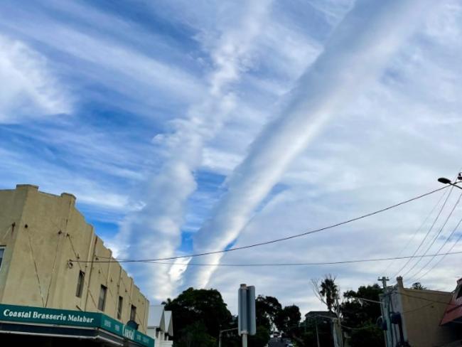
A rare cloud formation, stretching for hundreds of kilometres and spanning the entire length of Sydney, has baffled NSW residents.
A rare cylindrical cloud formation, stretching for hundreds of kilometres and spanning the entire length of Sydney, baffled New South Wales residents on Tuesday.
Images of the strange weather phenomenon flooded social media, showing the uniquely shaped clouds over different parts of the city.
At its peak, the formation was about 300 kilometres long.
“These are what we call altocumulus volutus – that’s the Latin name,” Christie Johnson, a senior meteorologist at the Bureau of Meteorology, explained to Channel 9.
“They’re clouds that form high up in the atmosphere.
“They are a rare phenomenon, you need to get the right mix of ingredients.
“It’s not 100 per cent clear what’s kicked off these particular clouds.
“It takes sort of quite specific conditions to get these clouds, which is why they are rare.”
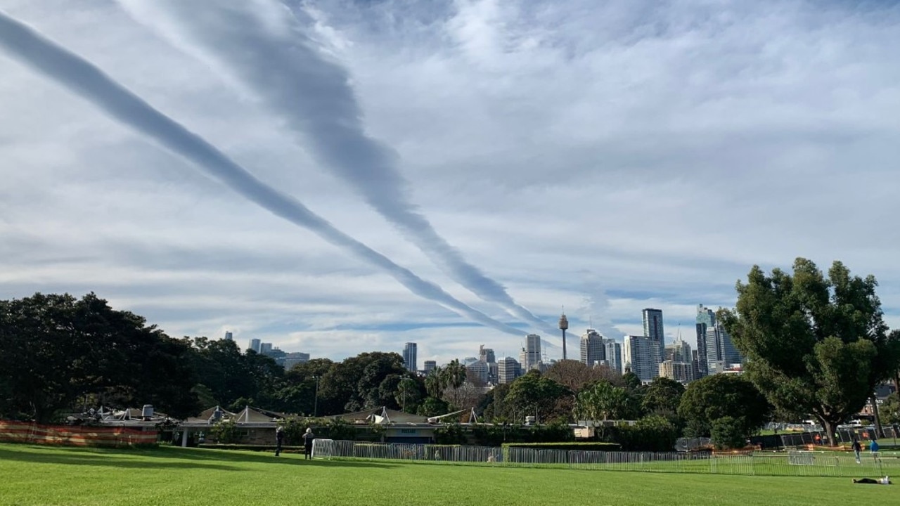
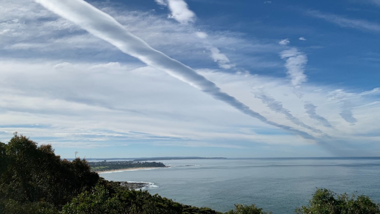
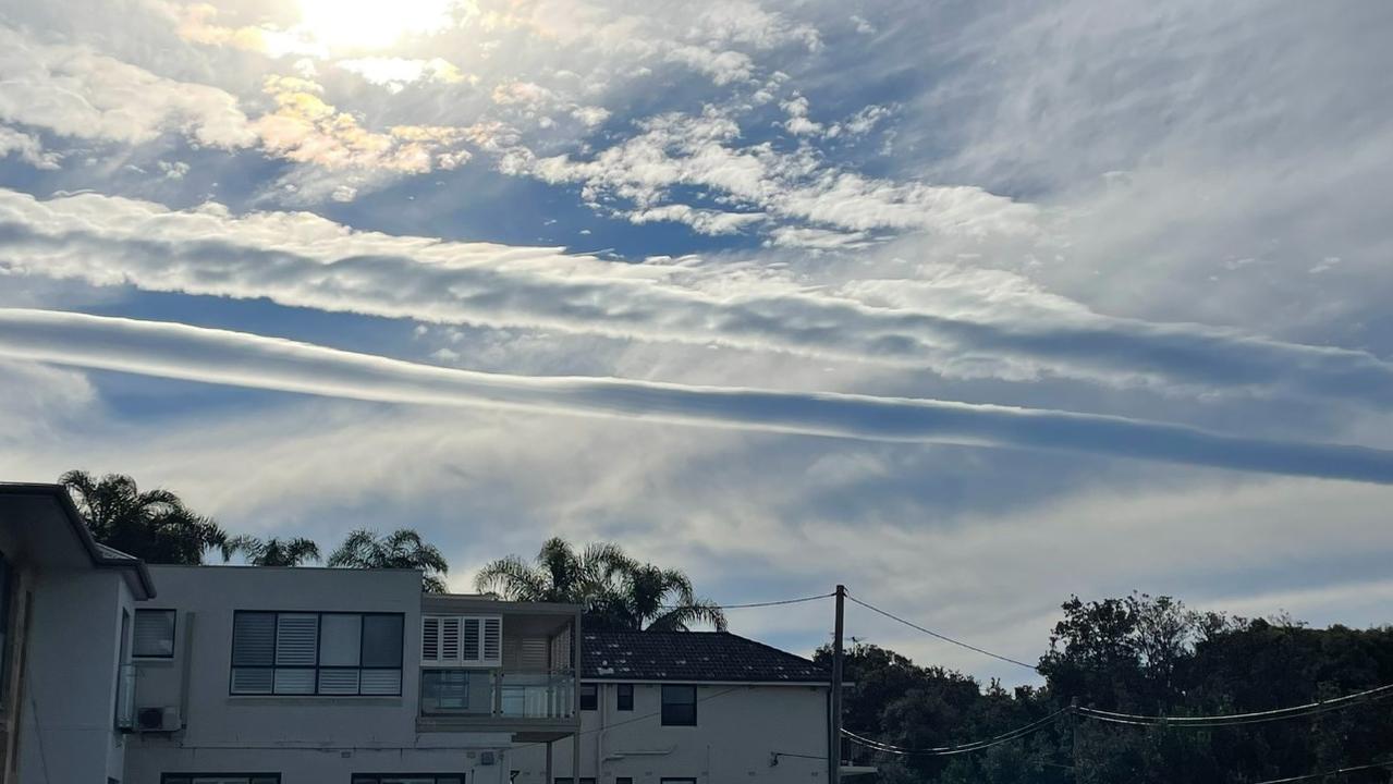
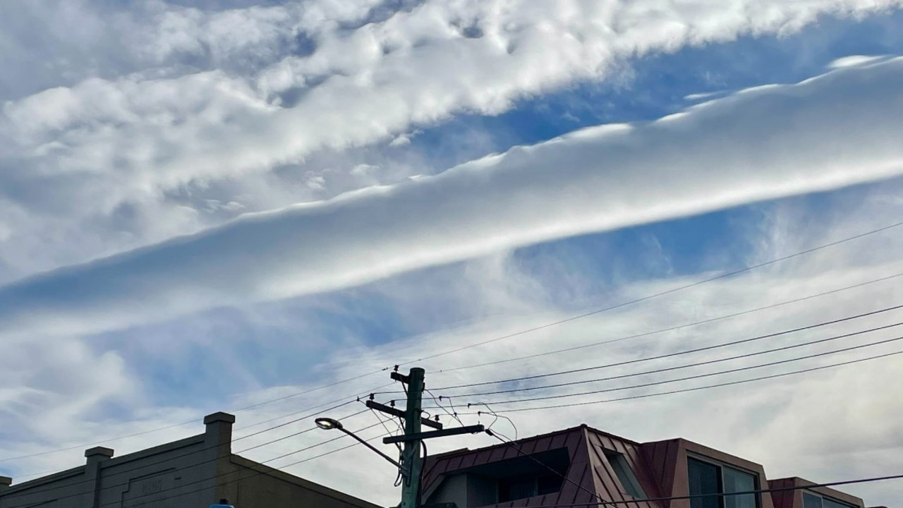
“The roll clouds were produced by atmospheric gravity waves that formed over eastern NSW on Tuesday morning,” meteorologist Ben Domensino said on Weatherzone.
“These invisible waves in the atmosphere caused elongated areas of rising air that cooled enough to produce parallel bands of cloud.
“These roll clouds then drifted towards the east and passed over Sydney, Newcastle and surrounding areas of New South Wales.”
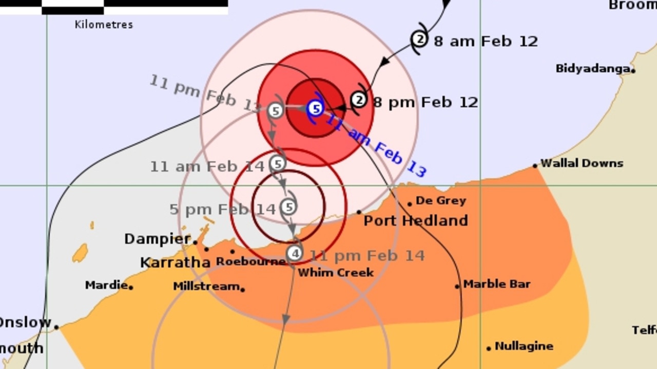
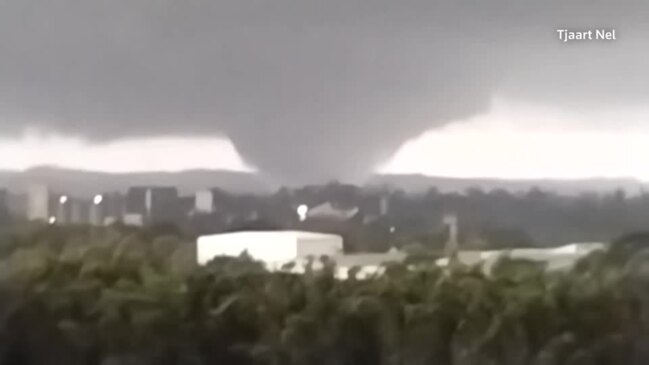
‘Threat to life’: Cat 5 cyclone declared in WA
Tropical Cyclone Zelia has been declared a category five system and is expected to make landfall on Friday afternoon, with winds up to 290km/h possible.
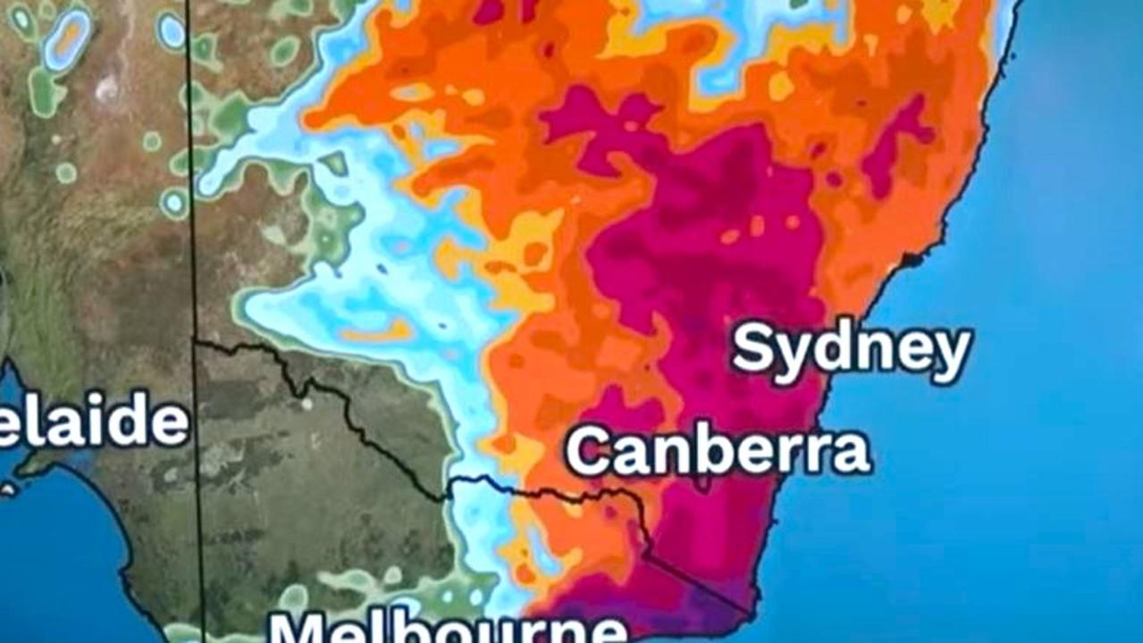
‘Dangerous situation’: Grim weather warning
Forecasters are warning of a “dangerous … multi day outbreak” of dire weather, with storms, heavy rains and floods all possible.

‘Expect more’: Dire warning after floods
North Queensland has recorded its second “once-in-a-century” flood since 2019, and one thing made the rainfall heavier.