Australia weekend weather: Severe wind warnings after ‘microburst’ uproots trees, tears away roofs amid heatwave
Severe weather warnings have flipped the heatwave on its head as windy storms leave a trail of destruction amid the oppressive heatwave.
Storms and severe winds left a trail of carnage on the New South Wales coast, in a wild turn of weather from the oppressive heat that has broiled much of the state.
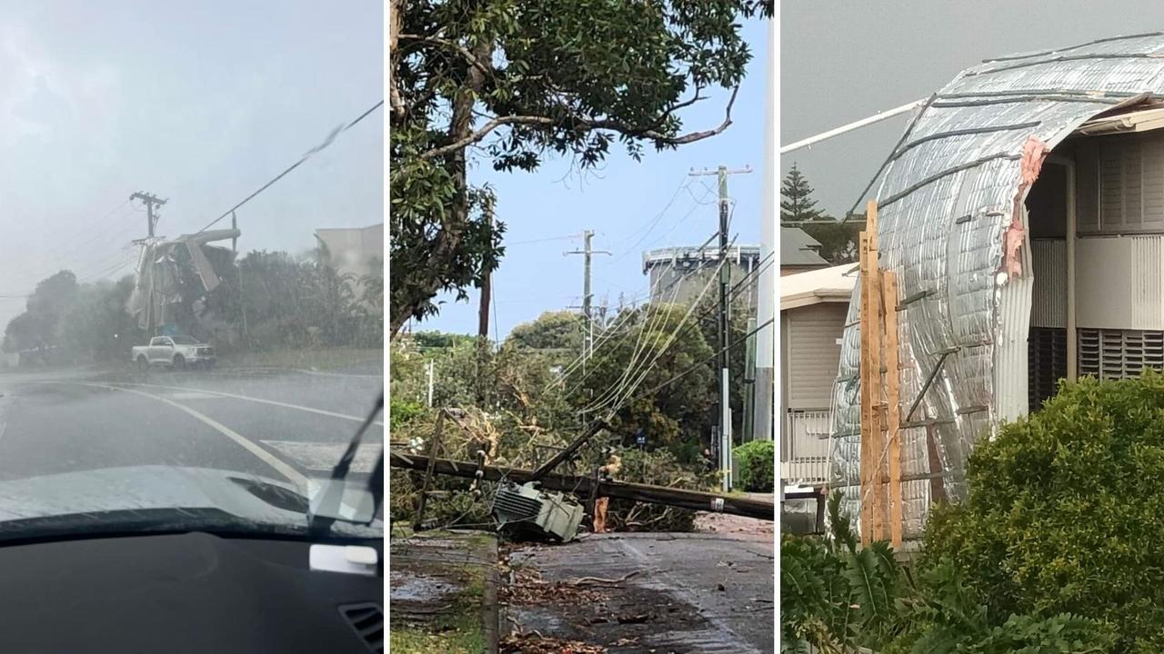
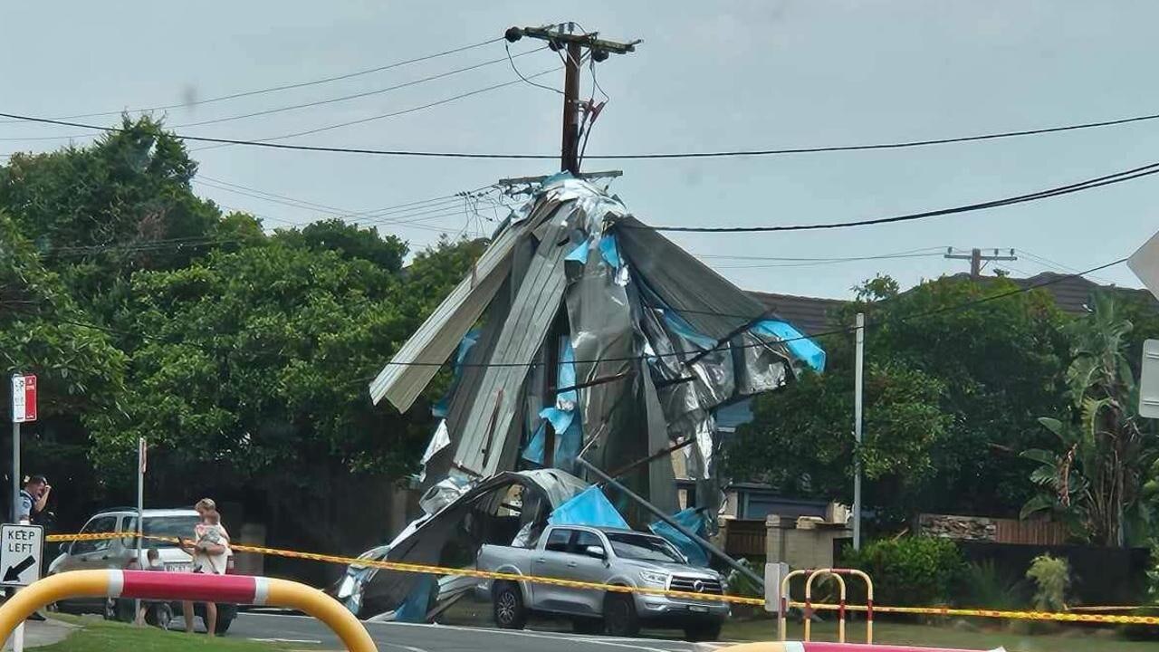
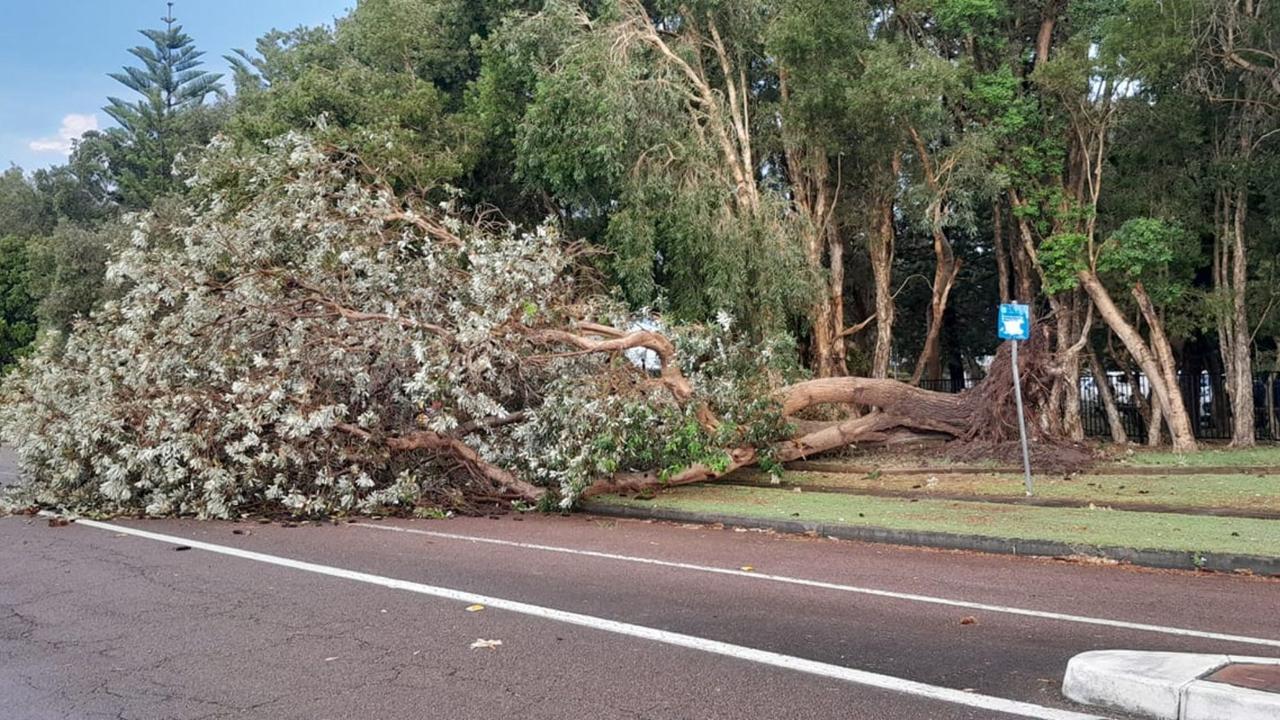
Roofs have been blown from buildings and trees uprooted, and power poles downed across the NSW Central Coast as storms quickly formed and generated “severe microbursts” of wind on Saturday afternoon.
At least nine properties have been damaged in the sudden storm.
The powerful storm cell swept over the Long Jetty and Toowoon Bay areas late on Saturday afternoon, with strong winds ripping the roofs off of buildings.
In one of the most serious incidents, the roof of Long Jetty Automotive Engineering, on the corner of Minto Ave and Central Coast Hwy, was completely blown off the building, the force of which also brought down some walls.
The roof blew on top of a neighbouring home, trapping at least one person inside for some time.
Ausgrid reports more than 3000 properties are affected by power outages in the Long Jetty area, with restoration time predicted to be between four and eight hours.
Locals have taken to the Long Jetty Community Facebook page as they assess the damage.
“Looks like a tornado went through,” said one user.
“It was crazy and thought our windows were going to blow in and some of the fence has fallen too,” said another.
The Bureau of Meteorology has issued a severe weather warning for damaging winds in metropolitan Sydney and the Illawarra.
It warned a “vigorous southerly wind change will move rapidly northwards along the coast” on Saturday evening before weakening later tonight.
Locations listed in the warning include Manly, Randwick, Cronulla, Wollongong, Bulli, Port Kembla, Albion Park, Kiama and Huskisson.
The Bureau has also issued a separate warning for residents of the Mid North Coast, South Coast, Snowy Mountains and Hunter region for damaging winds, large hailstones, and heavy rainfall.
It said a “humid and unstable air mass” moving ahead of a wide trough “combined with strong winds” were aiding the development of “severe thunderstorms” moving toward the coast.
“Severe thunderstorms are likely to produce damaging wind gusts, with large hailstones and heavy rainfall that may lead to flash flooding also possible in the warning area over the next several hours,” the warning reads.
Locations which may be affected include Eden, Bombala, Gloucester, Barrington Tops and Merimbula.
As at 4pm (AEDT) on Saturday, there were 85 fires burning in NSW, 38 of which are yet to be contained, the state’s RFS said.
As at 4pm there are 85 fires burning in NSW, 38 of which are yet to be contained. With hot north-westerly winds driving temperatures up across most of the state, our crews are facing challenging conditions. A big thank you to all our members working on days like this. pic.twitter.com/a6eDvwMN11
— NSW RFS (@NSWRFS) December 9, 2023
The update comes as Sydney recorded its hottest December day on record – with records going back to 1929 – with the mercury at Sydney Airport peaking at 43.5C just after 1pm. The old record was 43.2C, which stood since 1994.
But suburbs in the outer west got even hotter, as expected, but not quite to record-breaking temperatures: Badgerys Creek Creek hit 44C, and Richmond, Penrith, and Holsworthy came dangerously close to the same temperature.
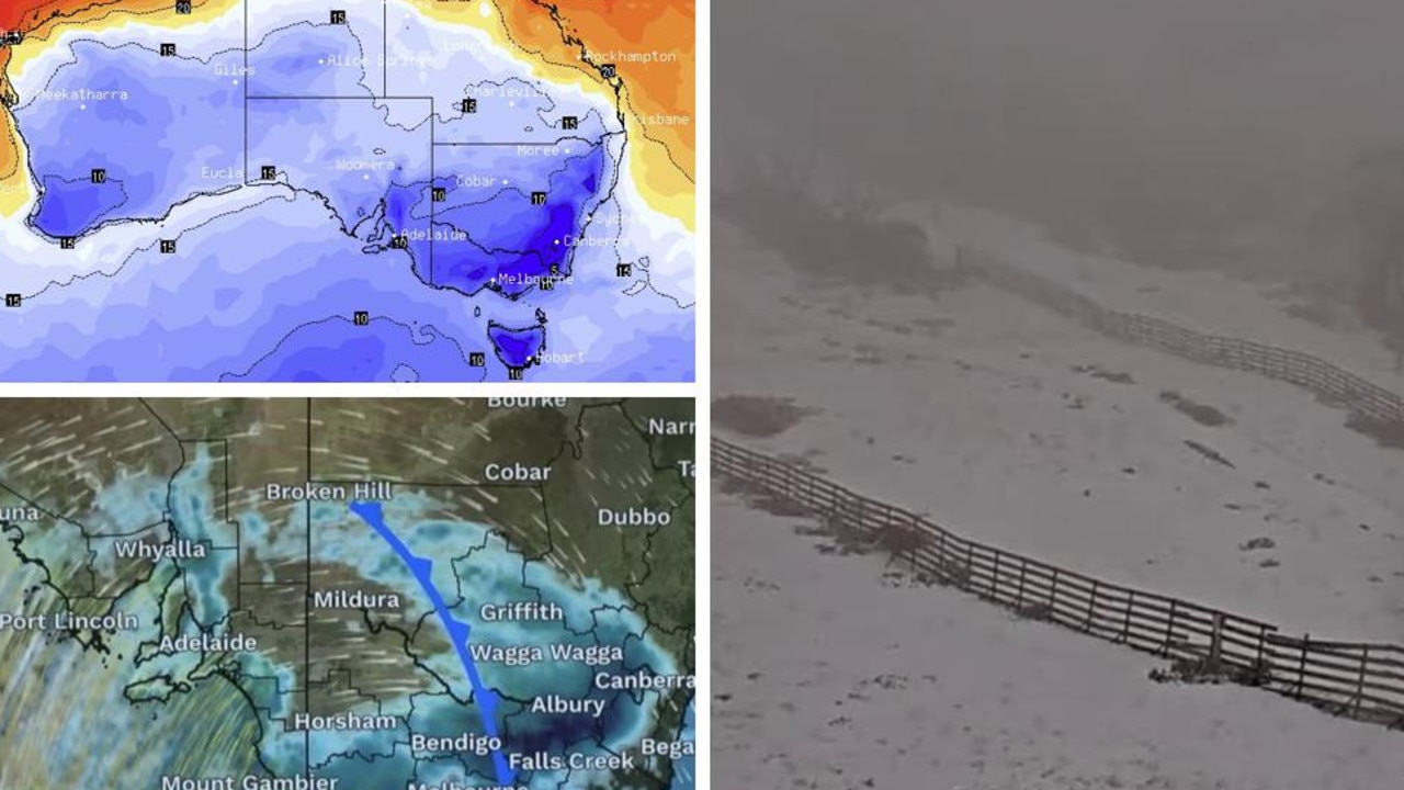
At the other end of the spectrum, Adelaide may have had its coldest December day on record, with unseasonably heavy rain and winds keeping temperatures below 16 degrees all day, according to Weatherzone.
Aussies warned of heat seizures, blood clots
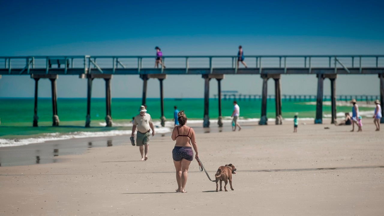
Australia is in the scorching grip of a heatwave bearing down on the country this weekend, already sparking fires and triggering multiple safety warnings from authorities.
As well as the risk of fire, health authorities are urging Aussies to take extreme care of themselves and others as we swelter through 40-plus degree temperatures.
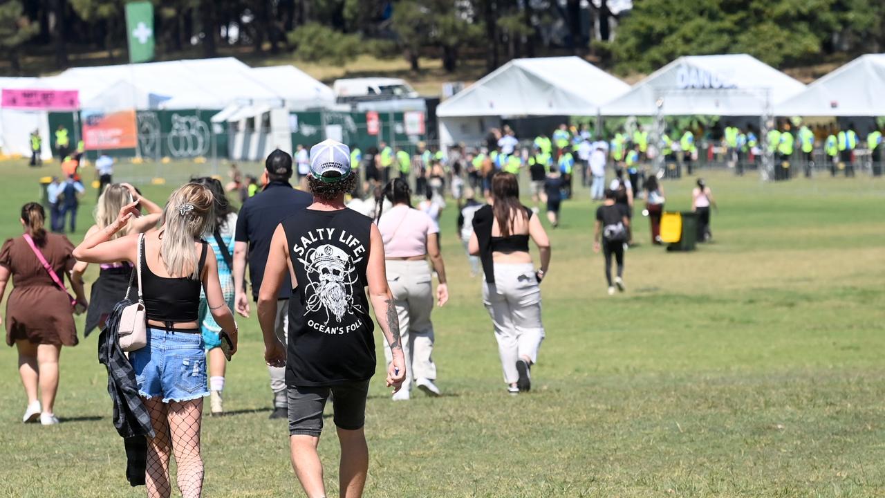
NSW Health urged those attending musical festivals over the coming days – like the sold-out Epik festival at Sydney Olympic Park – to beware the risks of overheating.

“Overheating during activities in dangerous heat is a huge risk, and people need to take a break from dancing, seek shade, drink water and cool down to reduce the risk of overheating at festivals,” NSW Poisons Information Centre medical director Dr Darren Roberts said.
He said festival-goers should make use of the special measures in place – like chilled water and misting fans – to keep cool.
Two men in their 20s died from suspected drug overdoses after attending the Knockout Festival in September, which was held in the same arena as the Epik festival. The investigation into that incident is still ongoing.
Dr Roberts said hot environments can increase the risk of substance harm, and urged festival-goers who choose to take drugs to “watch out for each other”, and know the warning signs of toxicity and when to seek help.
He said toxicity may look like nervousness, tremors, increased heart rate, excitable muscles, lack of co-ordination and sweating. Severe cases can show agitation, rigid muscles, seizures, high temperatures, cardiac arrhythmias and collapse.
Medical experts have warned the combination of heat and drugs – particularly stimulants, which affect how the body regulates heat – can lead to the body shutting down.
“Basically, people die from overheating,” University of Sydney professor of clinical pharmacology Nicholas Buckley told the ABC.
He said bodies are “designed not to work” when they reach high internal temperatures – “blood starts clotting, all sorts of stuff goes wrong.”
At locations other than festivals, call emergency services on triple-0 (000) and ask for an ambulance.
For more information about staying safe, including the warning signs to seek help, see Stay OK at Music Festivals.
‘Remarkable’ heatwave could feel as high as 60C
A meteorologist has warned people a “remarkable” feature of this weekend’s heatwave could mean it’s “the most uncomfortable of their life so far” — and that it’s going to feel as hot as 60C in some places.
Especially in Sydney, and that’s due to an unusual combination of factors not seen in a usual heat event.
Saturday could be the hottest day in the harbour city for four years.
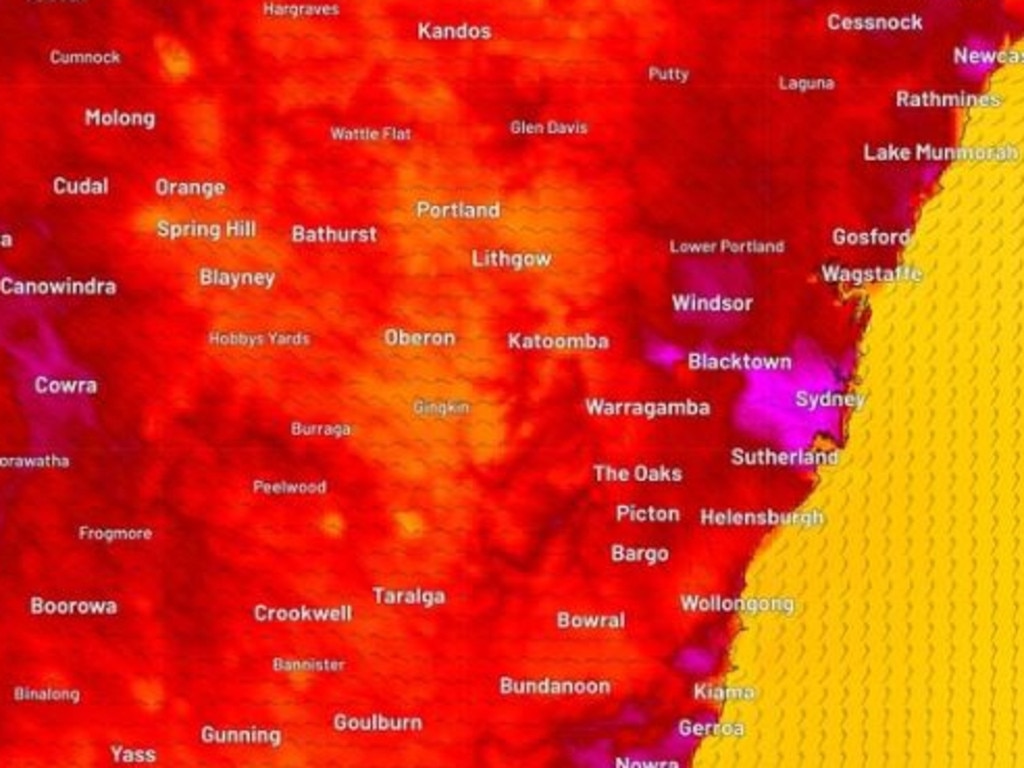
In Sydney’s CBD, expect at least 40C and as much as 44C in the west of the city.
Meanwhile, parts of NSW are on fire; the NSW Rural Fire Service (RFS) issued a warning just past 12pm AEDT about 71 bush and grass fires burning across NSW, 29 of which are “not yet contained”.
“With very hot, dry and windy conditions and Total Fire Bans in place, know your risk and what you will do if threatened by fire,” the RFS warned.
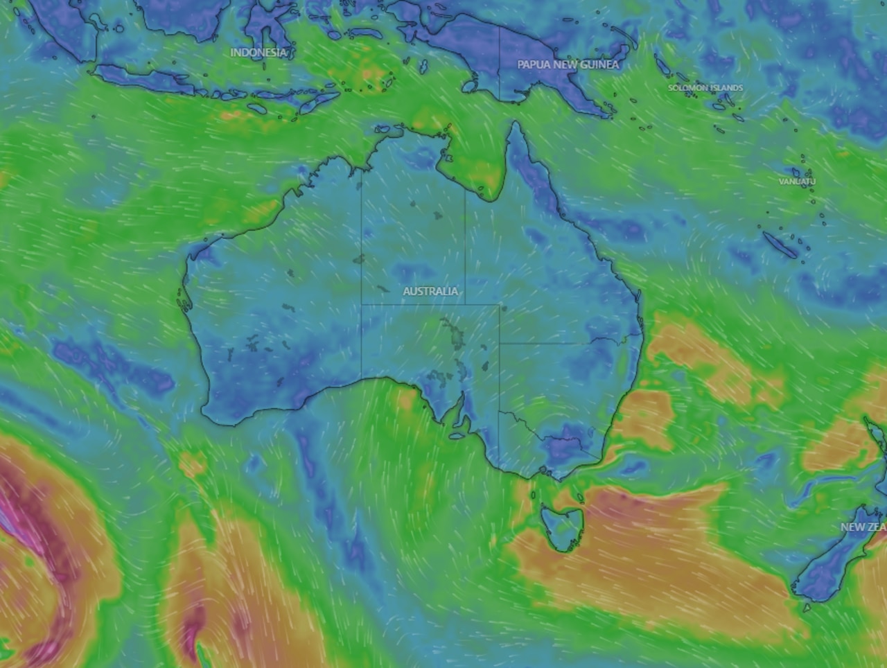
A slow moving dome of heat hovering above New South Wales and parts of South Australia is causing all the drama. But in Western Australia, Perth will also be warm. In addition there’s a cyclone careening towards northern Queensland in a hectic week of weather.
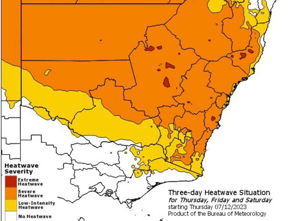
The Bureau of Meteorology (BOM) has issued a three day heatwave warning from Friday to Sunday covering all of NSW except the far north coast. The warning also creeps into northern Victoria and southern Queensland.
At 12pm there are 71 bush and grass fires burning across NSW, 29 not yet contained. With very hot, dry and windy conditions and Total Fire Bans in place, know your risk and what you will do if threatened by fire. Report all unattended fires to 000. https://t.co/GTZ7x31QtH#RFSpic.twitter.com/4FIcKXQDY1
— NSW RFS (@NSWRFS) December 9, 2023
NSW
The BOM advisory states the majority of NSW is under severe heatwave conditions while some areas of the central west are in the most dangerous category – an extreme heatwave.
Severe heatwaves can be a risk for many people, particularly those who are older or very young as well as pregnant women. Extreme heatwaves are bad for basically everyone.
The BOM has advised people to keep cool, stay indoors or in airconditioned spaces like shopping centres, and to close curtains to keep the heat out.
The NSW Rural Fire Service has placed extreme fire danger ratings on the Sydney basin, central west plains, central ranges, northern Riverina, and southern slopes near Canberra. There is a total fire ban in place for the same areas.
The 44C forecast maximum in Penrith in the city’s west is a doozy.
It hasn’t been that hot in Sydney’s outer suburbs since 2020 when Penrith hit almost 49C. Sydney’s 40C would be the hottest for four years too.
‘Most uncomfortable of their lives’
“What is most remarkable about this heat is that it is still quite humid across the Sydney basin – even into the western suburbs,” Sky News Weather meteorologist Rob Sharpe told news.com.au.
“Most times Sydney exceeds 40C the humidity levels are lower than they are at the moment with a dry heat in place,” he said.
“Therefore for many Sydneysiders Saturday’s weather will be some of the most uncomfortable of their life so far.”
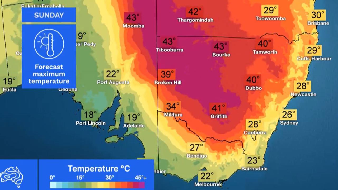
Mr Sharpe said temperatures will sink as a low pressure trough powers through on Saturday evening. Sunday will likely only see a maximum of 27C, some 13 degrees cooler than the day before.
“But the heat will return again through next week due to the slow moving weather pattern across the country,” he said.
Will feel like 60C
Mr Sharpe warned it will feel even hotter than the mercury suggests.
Apparent temperatures take into account the experience of real temperatures for the average person based on wind and humidity.
“If you’re standing on the grass in 40 degree heat, the apparent temperature is more like 48,” Mr Sharpe told The Daily Telegraph.
“Apparent temperatures in the sun on the grass could nudge 50 degrees (on Saturday), and in carparks that could even approach 60.
“It’s going to be awful.”
Regional NSW and ACT
In central parts of the state, the scorching conditions will barely let up over the next week with Dubbo expected to bounce around 40C for seven days.
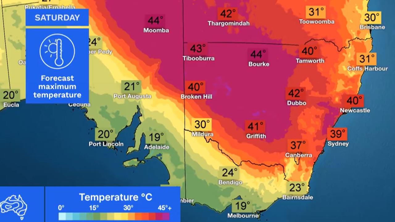
On Saturday, Forbes is forecast to reach 44C, Cowra 42C, Newcastle 40C, Tamworth 39C and Wollongong 40C.
Temperatures begin to drop along the coast north of Newcastle. Forster is expected to top out at 34C and Ballina 30C.
Canberra looks set to reach a high of 37C today with some rain and then 29C on Sunday climbing back up to 36C on Wednesday.
Victoria
In Victoria, the heatwave essentially follows the Murray – the further you are from the river the less oppressive it will be. Areas like Wodonga will be in severe heatwave territory this weekend.
It should peak at 34C today, 36C on Sunday and then ratcheting up to 39C by Wednesday.
In Wangaratta and Cobram expect 35C on Sunday; Mildura will skirt 40C on Monday.
But down in Melbourne the weather is far more reasonable. In fact Saturday will see heavy rain with up to 15mm falling, a high of just 19C and an overnight low of 16C.
Some more showers on Sunday and a 21C maximum but it is hotting up next week – expect 35C in Melbourne on Wednesday.
Following a scorching Friday in Adelaide with temperatures getting to 36C Saturday could not be more different with a high of just 19C and heavy rain. Sunday will be much the same but it’s back to 30C on Monday.
Mild in Hobart with a Saturday high of 18C, gradually warming up to 23C on Monday and 28C on Wednesday.
Warm in Perth hitting 30C on the weekend and 32C during a sunny spell of days.
Stormy in Darwin with possible rain and 34C.
Queensland
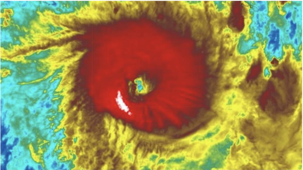
Meanwhile, Queenslanders are bracing for Cyclone Jasper to breach the coastline in what will be the fourth tropical cyclone to reach the state’s east coast since 1970.
Large tracts of Queensland are also in heatwave but mostly it’s less populated areas around the south west and far north.
Thargomindah is looking at 42C on Saturday and, Like Dubbo, it’ll be rinse and repeat for much of next week.
Birdsville could see 44C on Saturday and 42C on Sunday while Cairns will likely see 34C.
Brisbane however will only just nudge 30C but it will be consistently around that figure for the next seven days with 22C lows.
Tropical Cyclone Jasper continues its track towards the Queensland coast. It reached category 4 on Friday afternoon.
It is forecast to weaken and possibly re-intensify as it nears land in what is known as a “zombie effect”.
“Jasper is expected to approach the north Queensland coast around the middle of next week,” stated the BOM.
“While the timing of a coastal impact remains uncertain, the highest risk of a cyclone impact lies between Cape Melville and Townsville, including Cairns and Cooktown.”


