Australia weekend weather: ‘Getting hotter’ while tropical lows bring treacherous conditions
Multiple states could scorch getting well into the forties this weekend – even 50c – but elsewhere torrential rain may bring “life threatening” conditions.
It’s forecast to be an absolute scorcher of a weekend in parts of Australia – with temperatures approaching 50C under blue skies.
Yet elsewhere, the rain will be the issue with tropical lows in abundance and warnings of “dangerous, life threatening” conditions as up to 180mm of rain pelts it down over just a few hours.
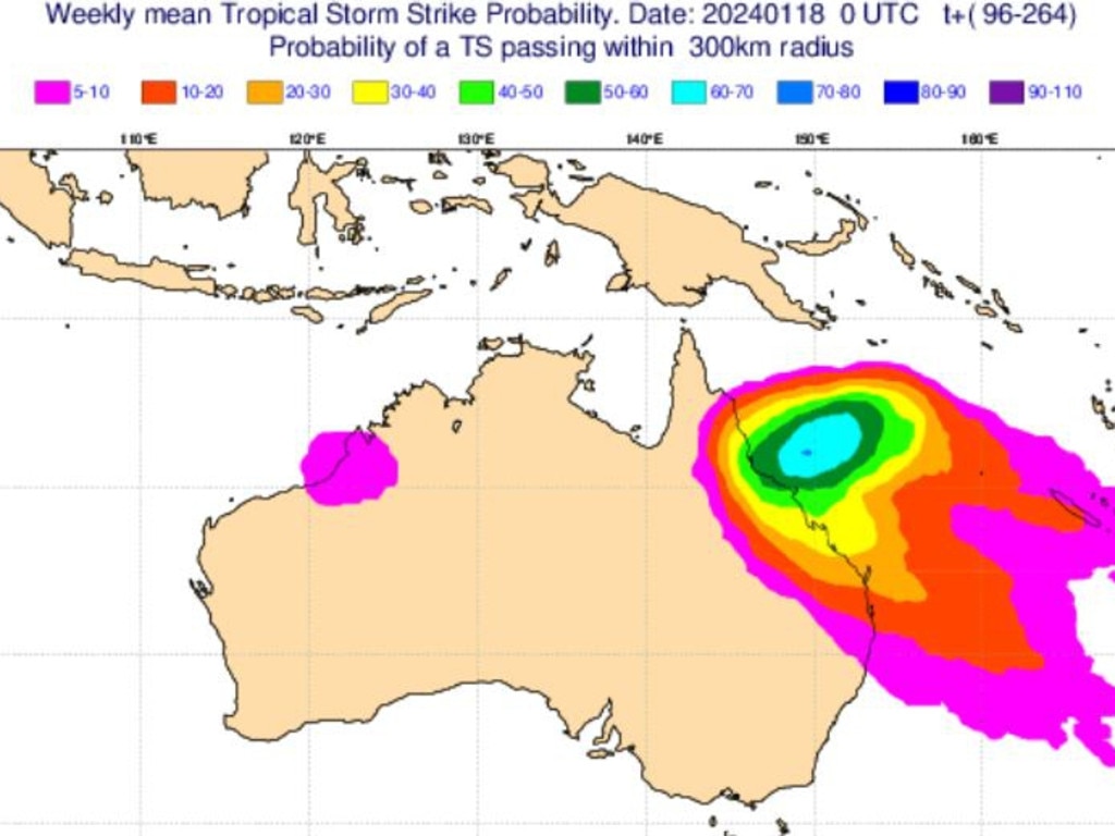
One of those tropical lows could become a cyclone that heads towards the Queensland coast next week.
It’s set to be a messy weekend of weather.
“The theme of this weekend is that it’s going to be hot,” said Bureau of Meteorology (BOM) meteorologist Dean Narromore.
“On the weekend, we’re going to see temperatures really start to increase with greater than 45C and in some locations 48C or 49C.”
While the hottest locations are likely to be confined to parts of Western Australia, 40C or more could be seen in areas of South Australia, the Northern Territory, New South Wales and Queensland.
“As we move into Sunday it’s getting even hotter across central parts of the country with heat also starting to build along our east coast, but it will be quite a bit cooler along our southern coastline thanks to onshore flow,” said Mr Narromore.

Temperatures near 50C
A high pressure system in the Tasman Sea and another approaching the country’s south during the weekend are dominating the weather conditions in much of the country.
Perth is looking at 33C on a sunny Saturday and then 30C on Sunday dipping into the high twenties on Monday.
But it's northern, eastern and central WA that will see the really punishing conditions.
While coastal towns such as Exmouth, Karratha and Broome should manage to escape the forties that’s not the case inland. Kalgoorlie is expected to get to 38C on Saturday, 41C on Sunday and 43C on Monday. Reliably scorching Marble Bar should peak at 46C on Sunday.
South west WA will be cooler with Albany only getting to just 23C on Saturday.
Adelaide should top out at 35C on Saturday before dipping to 27C on Sunday but, looking ahead, a high of 39C is possible on Tuesday.
Heading north in South Australia and the mercury should climb with 41C on Saturday for Port Augusta before a big drop to 31C on Sunday. Coober Pedy will not benefit from that change and should see a string of days in the low to mid-forties.

Eastern Australia to bake
Melbourne will benefit from those coastal winds with 27C on a cloudy Saturday and an almost chilly 22C on Sunday with a shower. Midweek it could warm up into the thirties.
Head away from the coast and it’ll be warmer this weekend with 33C on Sunday in Yarrawonga, 34C for Wodonga and 35C in Nhill on Saturday.
Tasmania will be cooler than other parts of Australia this weekend. Hobart will see some rain and temperatures in the low twenties both days. Burnie could reach a high of 24C on Sunday.
Western parts of NSW will bake with Broken Hill expecting temperatures in the mid-thirties before climbing into the mid-forties by midweek. Dubbo is looking at 38C on Sunday, Wagga Wagga, Grafton and Tamworth 36C the same day and Bourke 42C.
Sydney is scraping the thirties on Saturday, with a forecast peak of 29C and then 33C on Saturday. Newcastle could get to 36C on Sunday.
Canberra’s expected high is 27C on Saturday and then 32C on Sunday.

‘Severe impact’
Like NSW, inland Queensland should be toasty. Birdsville’s chilliest day will be Saturday with 41C but rising to 47C toward the end of next week.
Quilpie may get to 39C on Sunday, Charters Towers 36C and St George 35C.
Brisbane will park itself in the thirties with temperatures between 31-33C on the weekend and a 35C high on Monday. Saturday could see some rain in the city.
Showers and 32C this weekend for Townsville.
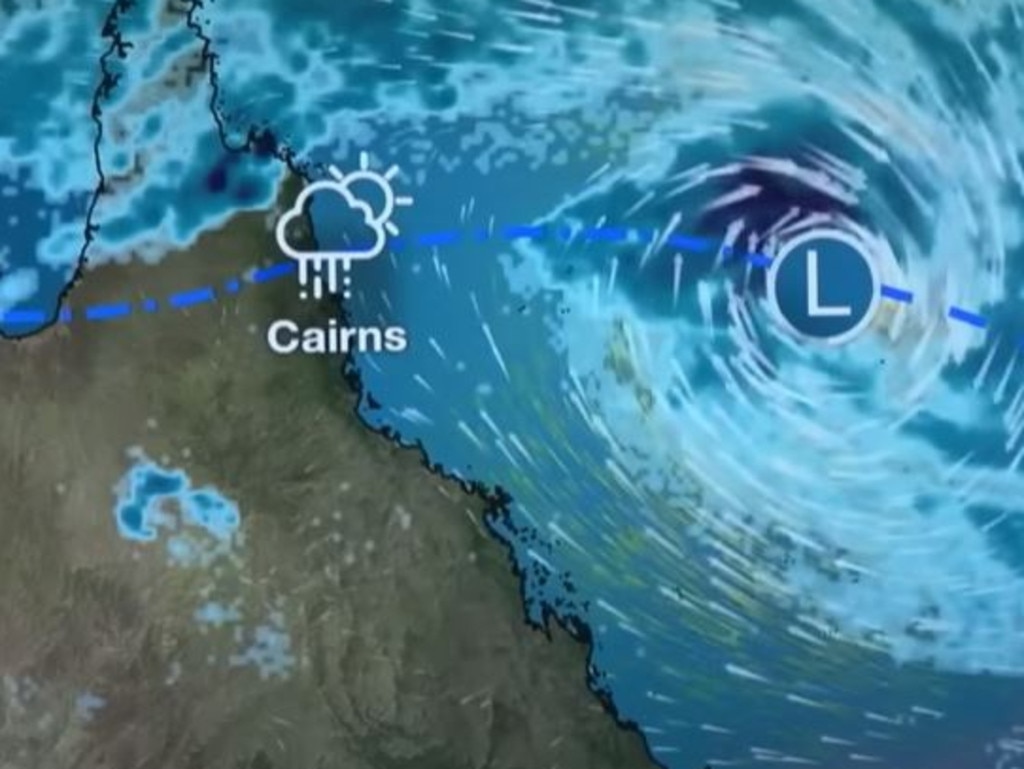
A tropical low, snappily called “05U” is in the Coral Sea north west of Townsville but it’s far enough away to not have any discernible effect on the weather. Yet.
The BOM has said it could ramp up to a cyclone. 05U is slowly moving in a generally south to south westerly trajectory towards Queensland.
It will be called Kirilly if it forms into a cyclone.
“From mid next week, the movement becomes more uncertain, however there is a significant risk that the system will turn to the west and impact the Queensland coast,” stated the BOM.
“A severe impact is possible”.

‘Dangerous, life threatening’
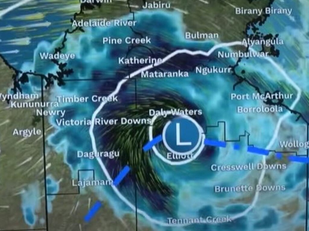
In the Northern Territory the threat is more immediate from a tropical low called 03U.
That’s likely to hang around to the south of Darwin, over areas such as Daly Waters and Tennant Creek, all weekend bringing a far dose of weather drama.
Six hourly rainfall totals of 80-120mm are likely, the BOM has said in a severe weather warning, which could easily see flooding emerge.
Worse than that, “dangerous and life threatening” flooding could happen around Tennant Creek with as much as 180mm falling in just hours in some parts.
It will, ever so slowly, move westwards towards the WA border.
Darwin will see storms this weekend with rain, possibly up to 9mm on Saturday, and 33C highs.


