
Australia weather: Rain target moves into new state
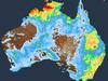
A 1500km band of severe storms battered eastern Australia this week, but now a new state is in the firing line.

Victoria has become the new target of a 1500-kilometre band of severe storms that has battered Australia’s east coast this week, with rainfall totals of between 200 and 300mm expected.
A low pressure system and abnormally warm Tasman Sea has caused heavy rainfall over large parts of NSW, Queensland, Tasmania and Victoria this week, according to the Bureau of Meteorology.
But by Thursday, the system had moved off the south coast of NSW, dragging moisture-laden air into eastern Victoria and causing residents there to bear the brunt of the storms, the BOM said.
“It’s a low pressure centre … which is steering the wind and rain, dragging moisture down from the humid tropics and just ramming it into southeastern parts of the country,” explained BOM meteorologist Angus Hines.
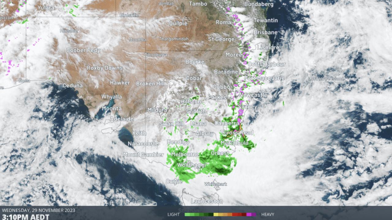
On Thursday afternoon, the BOM issued severe weather warnings for heavy rainfall and damaging winds in parts of Victoria’s East Gippsland, North East and West and South Gippsland forecast districts.
Heavy rainfall may lead to flash flooding, while damaging winds of up to 100km/h are on the cards.
Some 63.8mm of rainfall was recorded at The Gorge in central eastern Victoria in just six hours to 4pm on Thursday. Mount Hotham, in the Victorian Alps, has already recorded a peak gust of 100km/h.
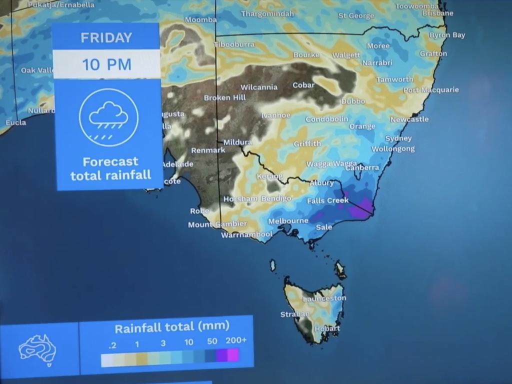
Rainfall totals of 100mm are expected along the farthest southeast border between NSW and Victoria, bringing total rainfall for this event into the several-hundreds range.
“[The 100mm is] on top of the rain we’ve already seen, which is suggesting some parts of eastern Victoria and Gippsland might get 200mm total through the course of this event, and that may be touching 300mm for areas of southeastern NSW,” Mr Hines said.
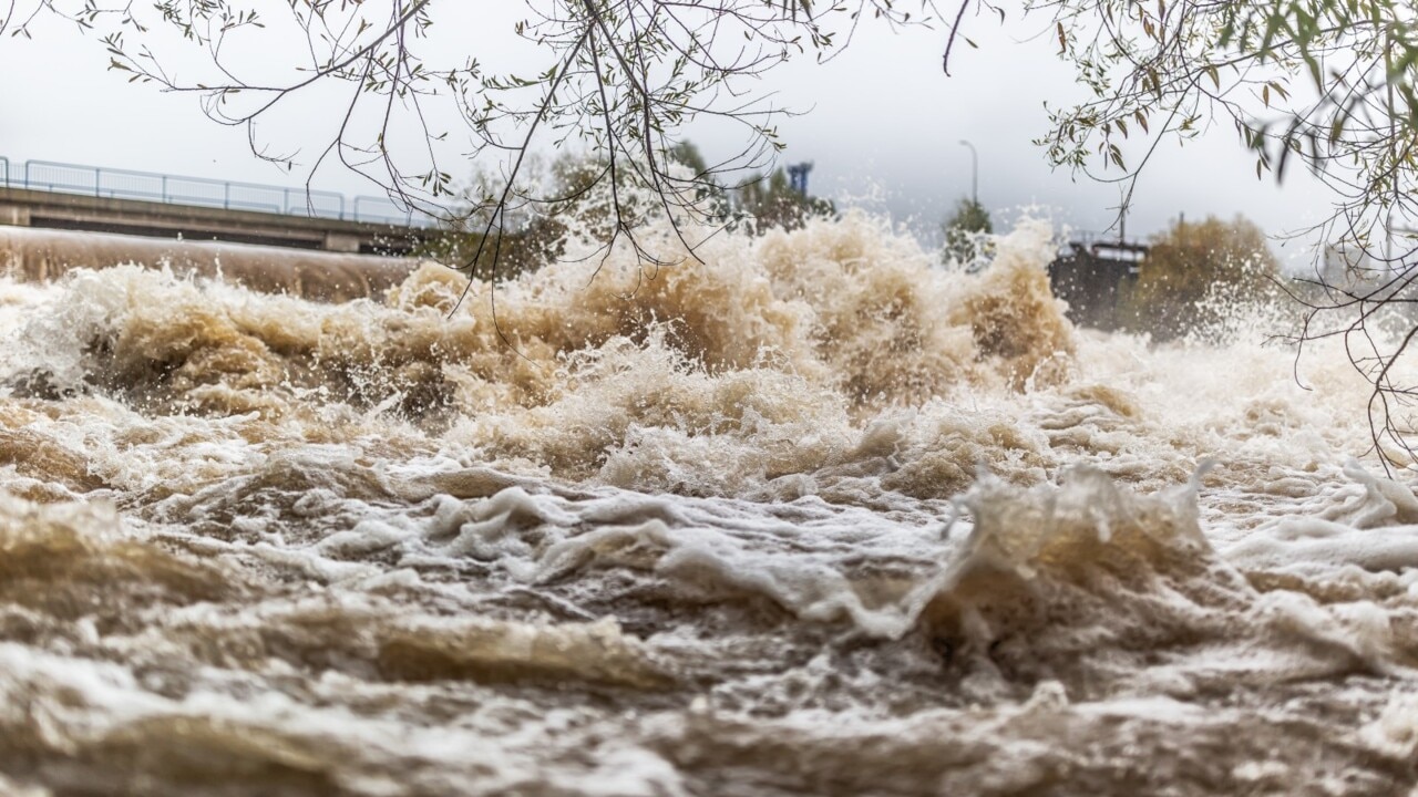
Minor to moderate flooding is occurring in parts of eastern Victoria, with major flood warnings in place for the Buchan, Genoa and Thomson rivers.
Conditions are expected to ease in Victoria by late Thursday evening, though heavy rain is expected to persist through to the weekend.
“As we play through the rest of Thursday and into Friday, we’ll see it take a long time for this low to vacate the premises,” Mr Hines explained.
“It just keeps steering the rainfall into the southeast.
“Eventually on Friday, we’ll start to see this low move farther and farther away from the coastline but it will take a while for the rain to clear up.”
Mr Hines said, on Friday, the rain will become sparser and lose some of its intensity, but “patchy wet weather [will continue] falling onto these waterlogged, saturated parts of the country through to at least the weekend.”
‘Leave now’: Urgent plea amid flooding event
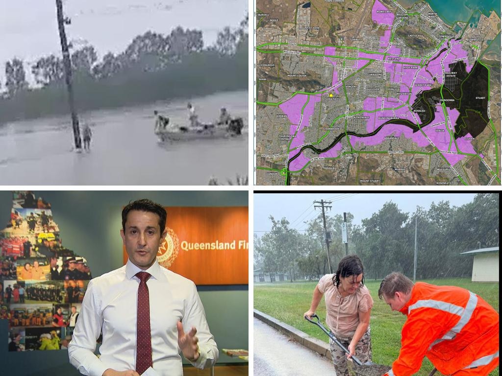
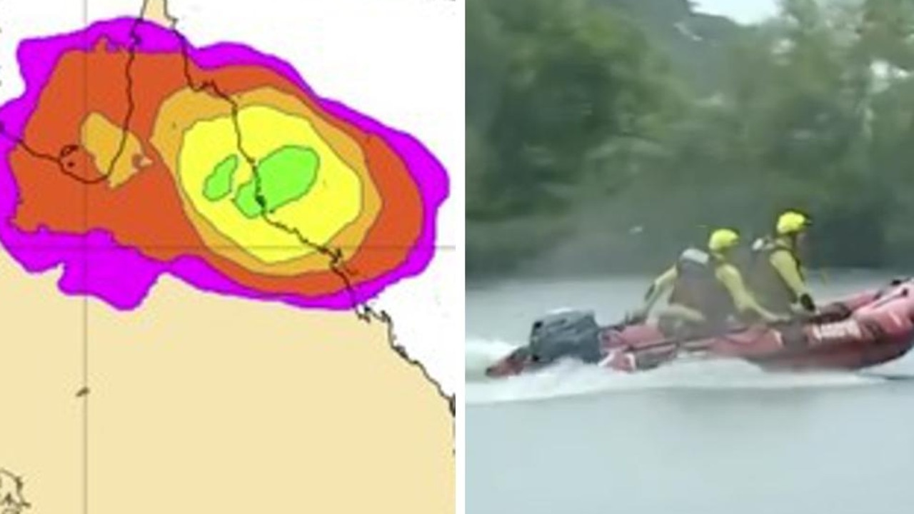
A person has died and thousands remain without power as dangerous floodwaters inundate towns and cities in north Queensland.
Aussie city smashed by torrential rain
Emergency services have deployed multiple water rescue crews as torrential rain and flash flooding smashes one Aussie city.
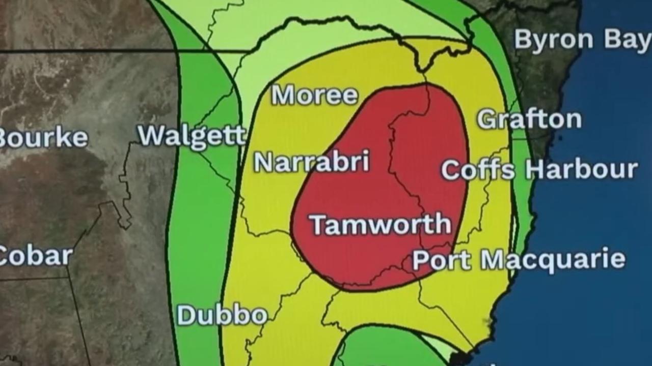
‘Giant’ hail, supercell storm to smash state
A supercell storm which is forecast to bring “giant-sized” hail and heavy rain is set to batter one Aussie state.