
Australia Christmas weather: East set to see up to 100mm of rain while west scorches
El Nino should have brought a hot and dry Christmas but a rival climate driver is pushing rain and cooler temperatures into the east.

El Nino Christmases are supposed to be scorching and dry in Australia’s east. But the opposite is occurring this year and that’s due to a rival climate driver which, temporarily at least, has got the upper hand.
A soggy Sydney could see up to 25mm of rain on Wednesday with regular showers up to an including Christmas Day.
Brisbane, meanwhile, could get up to 100mm of rain in the gauge between now and Boxing Day with thunderstorms and showers. Other areas could see even more.
If you want glorious Yuletide sun it’s to the west you must go with Perth set to see a maximum of 36C. Parts of the Pilbara could see 47C on Christmas Eve.
Weather system bringing Christmas drama
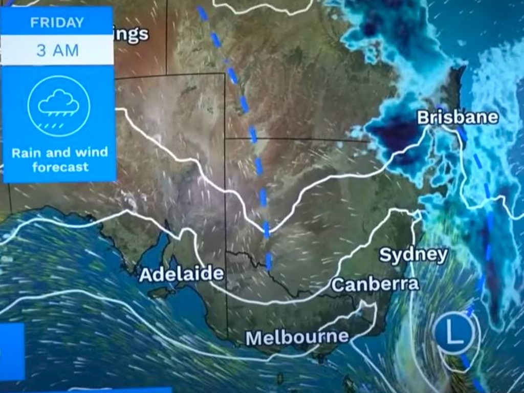
Bureau of Meteorology (BOM) meteorologist Sarah Sully said there was potential for storms across New South Wales and Queensland for the rest of the week.
“The heaviest rainfalls are expected about southeastern inland Queensland and northern New South Wales with up to 100mm between now and Saturday evening and that’s because each day there are generally storms forecast”.
A key reason for all the inclement weather over Christmas in the east is a climate driver called the Southern Annual Mode (SAM) which pushes up from Antarctica. It’s likely to remain in a positive mode from now until early January.
“During summer, a positive SAM historically increases the chance of above average rainfall for parts of eastern NSW, southeastern Queensland, eastern Victoria, and northeast Tasmania,” stated the BOM.
“Rainfall increases are due to the positive SAM shifting westerly winds further south, increasing onshore flow over southeast Australia.
“As we have seen this year, high-impact rainfall events can occur during El Nino years, particularly during October to April when severe storm frequency peaks, even when the season is dry overall.”
A trough is cutting through central Australia and the east which is aiding in the formation of rain.

East cooling down
After highs of around 35C in Sydney on Tuesday, things are far more manageable heading into Christmas with mid twenties maximums the norm.
Sydney will peak at 22C on Wednesday with an 18C low then 23C on Thursday and Friday. Wednesday will be wet with 6-25mm of rain. The moisture will continue but with lesser amounts although 10mm on Christmas Day is possible.
Temperatures during Christmas in the Harbour City will be around 27C and getting to 29C on Boxing Day.
In the state’s north, in places like Ballina, the rain will crank up from Thursday with perhaps 70mm until Boxing Day and around 10mm on Christmas.
Canberra is forecast to reach 19C on Wednesday with 10mm of rain.
By Saturday a high of 27C is possible and 28C on Christmas Eve before heading down to 26C on Christmas Day with possible rain.
Brisbane will break 31C on Wednesday and then stay around the 28C mark for the rest of the week reaching 33C on Christmas Day.
Expect continued showers with 15mm on Thursday, 25mm on Friday and then up to 10 or 15mm each day during the Christmas break.
While rain will persist in Cairns and the state’s far north, the totals will thankfully be much reduced with only around 2mm in the city on Wednesday.

Darwin should see a string of 35C days this week and possible storms. Wednesday is forecast to get up to 10mm of rain. The weekend preceding Christmas will be warm but dry but here could be storm on the 25th.

One capital set to see scorching Christmas
The lead up to Christmas in Perth is set to be one toasty, dry day after another. On Wednesday, temperatures rise to a maximum of 35C then 37C on Thursday.
Christmas is looking like 35C with some cloud in Perth.
Relatively mild conditions in Adelaide with Wednesday on 21C before a 23C high on Thursday and up to 27C to close out the week. On December 24, expect 23C in the SA capital with the same again for Christmas Day.
More Coverage


Melbourne will see a steady rise in the mercury from 20C on Wednesday and a 12C low to 25C on Friday and Saturday.
But it will dip again with 22C highs on Christmas Eve and Christmas Day with the possibility of some rain.
Hobart could see some light showers on Wednesday with a top of 17C. By Saturday, the temperatures should push into the twenties – but only just. Christmas Day should be 20C with the odd patch of rain.

Millions brace for brutal cold fronts
A fresh wave of wild weather is preparing to lash Australia, bringing freezing winds, thunderstorms and icy blasts to millions.

Wild weather warning for this capital city
There will be “one last sting in the tail” of the polar air blast that has marched across Australia, with wild winds to continue battering the nation.

‘Lost everything’: ‘Bomb cyclone’ no fizzer
Just because you weren’t affected didn’t mean the “bomb cyclone” weather event was overhyped. Not everyone was so lucky.