Tasmania weather: Peak hour weather warning for motorists as severe wind gusts and high tides
Motorists are being warned to stay off the roads this afternoon and evening if they can help it, with king tides and extreme wind predicted at rush hour. See the latest details >>>

UPDATE 1pm: Tasmanian motorists are being urged to be vigilant on the commute home this afternoon as severe wind gusts and high tides could affect South and South East areas.
Gusts in excess of 100km/hr are expected to pick up after 5pm this afternoon and ease at about 8pm, as another low pressure system passes through to the South.
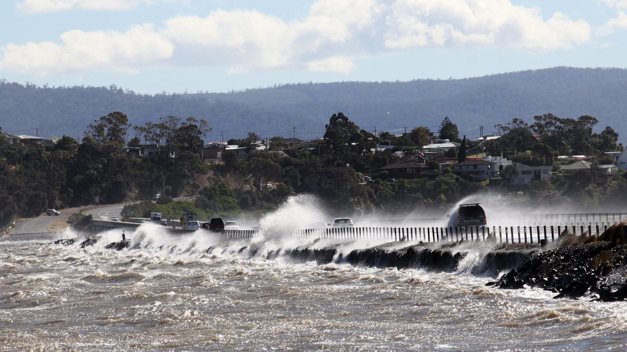
King tides are also expected which has led to warning about susceptible roads around Lauderdale and the Midway Point causeway which are prone to inundation and seaspray.
It comes after extreme winds including wind gusts of up to 178km/h hit parts of the state early Monday morning.
“I don’t think Hobart is particularly in the firing line but perhaps places to the south like Kingston, Blackmans Bay and the Southern towns could see some isolated destructive gusts for that brief period,” Bureau of Meteorology senior meteorologist Alex Melitsis said.
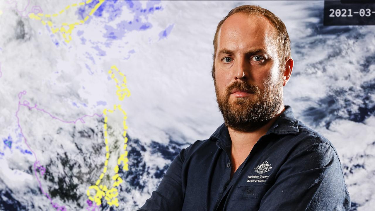
“We’re expecting the gusts to ease later this evening and then just contract to the Western Tiers and parts of the North West overnight tonight and tomorrow morning.”
He said beaches in the South and South East will disappear to high tides.
“Those tides are also being generated by the low pressure as it moves across the area later this afternoon and evening,” he said.
“We’re not expecting significant impacts from the tides, just nuisance impacts and it may actually affect commutes at that time with some susceptible roads being inundated.”
Tasmania Police Inspector Kathy Bennett said the severe weather conditions could affect low lying roads.
“Drive to the weather conditions,” she said.
“If you don’t need to go out later on this afternoon or evening, please don’t and check that roads are open before you actually go.
“If roads do become flooded, do not drive through flooded roads. Please think about the safety of yourself and the passenger you’ve got in your vehicle and do not enter those waters.”

SES assistant director Leon Smith is reminding motorists to drive to conditions this afternoon and evening.
“We will see a high potential for inundation on the roads in Lauderdale, an impact on the causeways across Sorell and Midway Point which will cause hazardous driving conditions,” he said.
“Yesterday, people were required to slow down and drive to those conditions as we saw high winds and sea spray across the causeway and we’re expecting that later this afternoon.
“We’re in a situation now where there’s patches of blue sky and conditions have eased and we encourage Tasmanians to take this opportunity to go back out and have a look around their property. Have a look at what may have been dislodged last night and don’t be complacent.”
SES reported they only had 10 requests for assistance on Sunday night.
About 1496 households across the state are still without power, as the TasNetworks outages website reported 14 separate blackouts.
Nearly 7000 without power as gusts up to 178km/h hit
UPDATE MONDAY 8am:
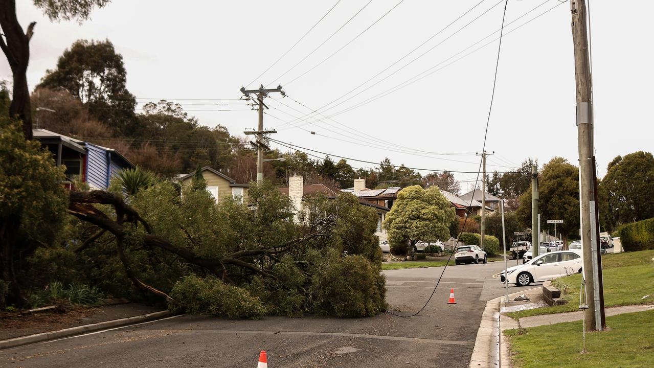
Nearly 7000 households are without power as wild winds have lashed the state overnight bringing down trees which have struck powerlines.
The TasNetworks outages website reported 25 separate blackouts for homes from Eaglehawk Neck and parts of the Tasman Peninsula, The Huon Valley affecting customers at Southport, Geeveston, Lune River and Strathblane through to Judbury. Customers have also been hit at Penguin and Wivenhoe in the North West, George Town in the North and Strahan in the West.
A cold front crossed the state early on Monday and another wintry blast is expected on Monday afternoon and evening.
A severe weather warning is still in place for entire state with strong to damaging winds of 55 to 65 km/h with peak gusts in excess of 100 km/h are again likely to redevelop across Tasmania and the Furneaux Islands.
The bureau warns locally destructive wind gusts in excess of 125 km/h are possible over western and southern Tasmania, and over exposed and elevated areas during Monday afternoon and evening.
Since midnight on Sunday the weather bureau has recorded extreme gusts across the state with 178km/h at Maatsuyker Island at 3:55am, 152km/h at Scotts Peak at 3:10am, 146km/h at Low Rocky Point at 2:33am, 143km/h at Strahan Airport at 3:10am, 139km/h at Mount Read at 3:12am, 135km/h at Cape Sorell at 2:44am, 128km/h at Hartz Mountains at 4:30am and 122km/h at kunanyi/Mt Wellington at 2:20am.
The weather bureau warns that “destructive” gusts will continue.
There were several calls for assistance on Sunday, including for a fallen tree on the Tasman Highway near Swansea and another at Elephant Pass.
Some residents on the East Coast were left without power, with customers affected by outages at Little Swanport, Swansea and Triabunna.
Sydney tourist Mateaki Manuatu, who was heading to Maria Island on Sunday, said she was not deterred by the strong winds.

“By the time we got here, it was extremely windy,” Ms Manuatu said.
“We’ve ridden our bikes at Cradle Mountain and it was a bit windy there, so I think we’ll be fine. ”
Meteorologists say the destructive force was the first of three blasts with more expected on Monday.
Bureau of Meteorology senior meteorologist Brooke Oakley said strong wind was not unusual at this time of year.
“In Tasmania it’s very common for us to see very strong wind gusts, particularly in the winter months, but what is uncommon in this situation is that we’re going to have three separate distinct periods of damaging wind gusts over a two-day period,” Ms Oakley said.
“There are going to be two bursts of damaging winds, the first overnight and into Monday morning, from around midnight to 8am, then a second burst of even stronger winds from late afternoon.
“At that time, there is the chance of locally destructive wind gusts, this means wind gusts of over 124km/h.”
State Emergency Service assistant director Leon Smith said volunteers were on high alert.
“SES have responded to a number of calls in regard to trees down which is not unusual,” Mr Smith said.
“Tasmanians need to be vigilant … the onus is on you to make good decisions and not travel out in these conditions if you don’t need to, be extremely mindful of the potential for trees to come down, and be prepared with your emergency home kit due to power outages.”
Tasmania Police Acting Inspector Scott Mackenzie said motorists needed to take caution on roads.
“Our message in relation to this weather event is simple, if you don’t have to travel, in the affected areas, don’t travel,” Insp Mackenzie said.
“If you do have to travel, factor in extra time to get to your destinations.
“Slow down and drive to conditions, always obey road closure signs and warnings and never drive through floodwaters.”
Sunday 3.30pm
The state has been blasted with winds of up to 137km/h on Sunday – but that might not be the worst of it. More destructive winds are expected on Monday.
Strong gust have smashed the state on Sunday including a 137km/h gust at 6.04am on Maatsuyker Island.
Bureau of Meteorology senior meteorologist Brooke Oakley said the wild weather wasn’t over yet.
“In Tasmania it’s very common for us to see very strong wind gusts, particularly in the winter months, what is uncommon in this situation is that we’re going to have three separate distinct periods of damaging wind gusts over a two-day period,” Ms Oakley said.
“There are going to be two bursts of damaging winds, the first overnight, the first overnight and into Monday morning, from around midnight to 8am, then a second burst of even stronger winds from late afternoon.”
‘At that time, there is the chance of locally destructive wind gusts, this means wind gusts of over 124km/h.”

State Emergency Service assistant director Leon Smith said volunteers were on high alert.
“SES have responded to a number of calls in regard to trees down which is not unusual,” he said.
“Tasmanians need to be vigilant. People need to make good decisions, prepare your properties ahead of that.
“The onus is on you to make good decisions and not travel out in these conditions if you don’t need to, be extremely mindful of the potential for trees to come down, be prepared with your emergency home kit, due to power outages.”
Tasmania Police Acting Inspector Scott Mackenzie said motorists needed to take caution on roads.
“Our message in relation to this weather event is simple, if you don’t have to travel, in the affected areas, don’t travel. If you do have to travel, factor in extra time to get to your destinations,” he said.
“Slow down and drive to conditions, always obey road closure signs and warnings and never drive through floodwaters.”
EARLIER: Elephant Pass in the state’s North East has been cleared after it was earlier blocked by a fallen tree as wild winds continue to smash the state.
Tasmania Police said contractors Stornoway cleared the tree which blocked Elephant Pass Rd in both directions. Motorists were urged to avoid the area.
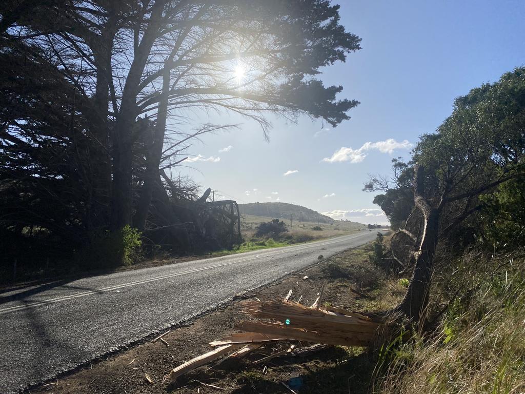
Earlier the Tasman Highway was blocked after a large tree fell over the road near Swansea.
Police have warned for motorist to take extra care on the roads with more severe weather and high winds forecast for Sunday and Monday.
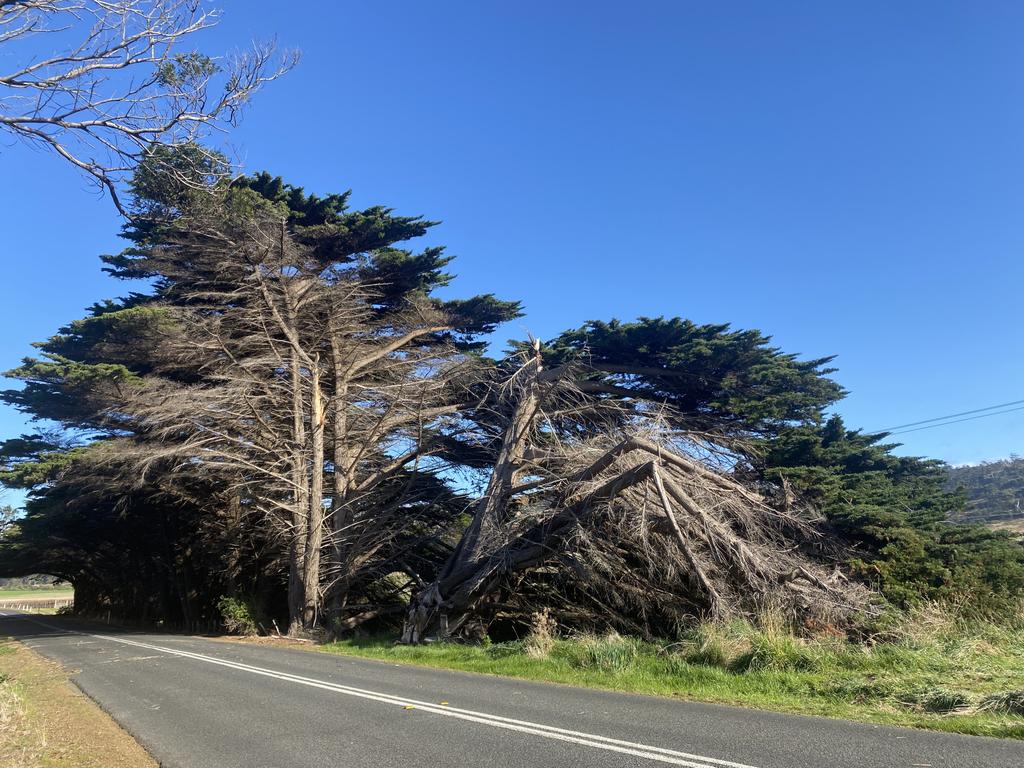
The State Emergency Service has advised Tasmanians to secure outdoor items, closely supervise children and to prepare for blackouts with damaging winds smashing the western, southern and eastern parts of the state this morning, ahead of a cold front.
Gusts as high as 137km/h have blasted Maatsuyker Island in the state’s far South West and 124km/h at Scotts Peak in the state’s South West. The highest gusts in the state’s South East have been 113km/h on kunanyi/Mt Wellington and 111/km/h at Hartz Mountains.
The Bureau of Meteorology has issued a severe weather warning for Western, Upper Derwent Valley, South East, East Coast and parts of North East, Central Plateau and Midlands forecast districts.
The bureau says a series of cold fronts embedded within a strong pressure gradient will cross the state today and Monday, and will bring several bursts of severe weather over the coming days.
EARLIER: Tasmania’s weird winter weather has turned wild with severe conditions lashing the state.
Tasmanians have been warned to prepare for a battering as a series of cold fronts cross the state on Sunday and Monday.
The strong winds brought down a tree on the East Coast about 7am, blocking the Tasman Highway near Swansea.
Tasmania Police and SES workers removed the tree and the highway was reopened about 7.40am.
The State Emergency Service has advised Tasmanians to secure outdoor items, closely supervise children and to prepare for blackouts with damaging winds smashing the western, southern and eastern parts of the state this morning, ahead of a cold front.
The Bureau of Meteorology has issued a severe weather warning for Western, Upper Derwent Valley, South East, East Coast and parts of North East, Central Plateau and Midlands forecast districts.
The bureau says a series of cold fronts embedded within a strong pressure gradient will cross the state today and Monday, and will bring several bursts of severe weather over the coming days.

Despite the wild weather the temperature is expected to be unusually mild ahead of the fronts with Hobart expecting 17C before temperature cools in the evening and drops to 7C overnight.
The first front is approaching the West Coast this morning and will sweep over the state by the middle of the day. Further stronger frontal passages are expected during Monday.
Strong west to north-westerly winds averaging 50 to 60 km/h with damaging wind gusts of around 100 km/h have developed about western, southern and eastern parts of the state this morning, ahead the front.
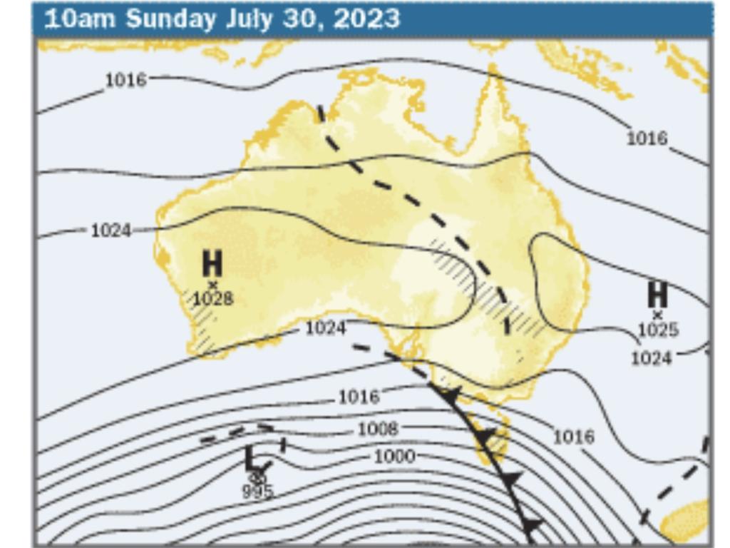
The Weather Bureau says the cold front will move into the North East during the afternoon.
Thunderstorms are also possible over the western and far southern parts, particularly about the coasts.
But Sunday isn’t going to be the worst of it with the conditions becoming even wilder on Monday.
Winds are expected to temporarily drop by late Sunday afternoon, before damaging winds are likely to redevelop again early on Monday as a sequence of stronger cold fronts rapidly move over the state during the day, the Weather Bureau says.
Locations which may be affected include St Helens, Swansea, Strahan, New Norfolk, Hobart and Dover.
The State Emergency Service advises that people should:
SUPERVISE children closely.
CHECK that family and neighbours are aware of warnings.
MANAGE pets and livestock.
SECURE outdoor items including furniture and play equipment.
BE prepared in case of power outages and report any outages to TasNetworks on 132 004. Monitor power outages here
BEWARE of damaged trees and power lines and take care when driving.
LISTEN to the ABC radio or check www.ses.tas.gov.au for further advice.
FOR emergency assistance contact the SES on 132500.
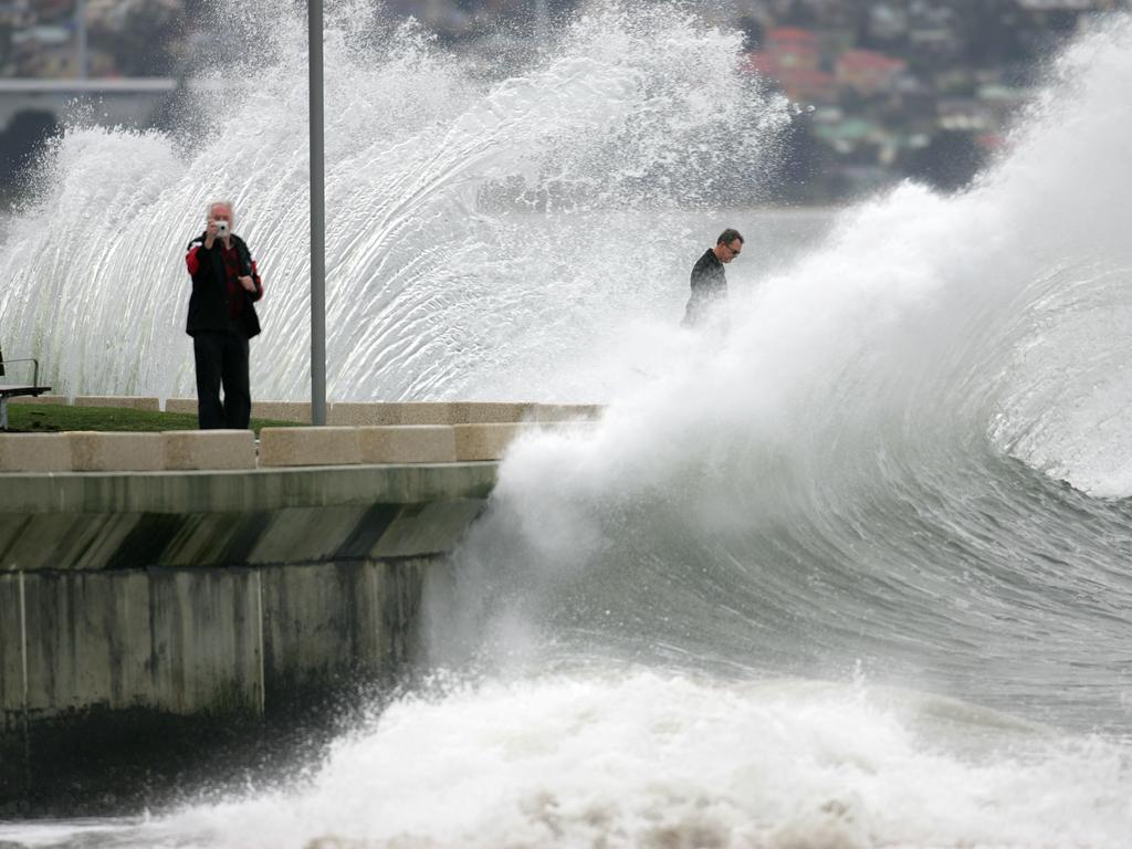
The seas are also expected to be dangerous with a gale warning for the following areas:
Far North West Coast, Central North Coast, Banks Strait and Franklin Sound, East of Flinders Island, Upper East Coast, South East Coast, South West Coast and Central West Coast
There is a strong wind warning for the following areas: Derwent Estuary, Frederick Henry Bay and Norfolk Bay, Storm Bay, Channel, Central Plateau Lakes, South West Lakes and Lower East Coast
The wind is expected to build on Monday with a storm force wind warning for the following areas: South East Coast, South West Coast and Central West Coast.
Originally published as Tasmania weather: Peak hour weather warning for motorists as severe wind gusts and high tides
Read related topics:Weather

