Tasmania weather: Heavy rain and flash flooding forecast for north, east, central
Authorities are warning Tasmanians of intense rainfall and flash flooding on the way today, with the Spirit of Tasmania cancelling sailings and emergency services on standby. FOLLOW THE LATEST
NEED TO KNOW:
- A Flood Watch has been issued for catchments in the North West, North and North East, and Derwent.
- Locations which may be affected include Devonport, Burnie, Launceston, St Helens, Swansea and Strahan.
- The Spirit of Tasmania has cancelled sailings for today, Thursday, October 13, 2022 due to severe weather
- 106mm of rain has already been recorded at Great Lake East since Wednesday 9am
Emergency services on standby
More than 100mm of rain has already fallen in some areas overnight as authorities warn Tasmanians that more intense rainfall and flash flooding is on the way today.
“Tasmanians are urged to be ready for heavy, locally intense rainfall, damaging winds and potential flooding as an intense weather system continues to affect the state today, particularly in the north and north west,” the warning said.
Emergency services are well prepared, with a State Operations Centre and two Regional Operations Centres stood up to monitor, prepare and respond to the weather event.
Tasmania SES acting director Leon Smith said: “The Bureau of Meteorology has advised that this a significant rain event that will impact the north and north west of the state until Friday morning.”
Bass Strait sailings cancelled
Spirit of Tasmania has advised passengers that due to TasPorts’ closure of the Devonport port four sailings will be cancelled.
The overnight sailings between Devonport and Melbourne on Thursday, October 13, and day sailings on Friday October 14 have been cancelled.
Spirit of Tasmania chief executive officer Bernard Dwyer apologised for any inconvenience, saying all passengers would be rebooked onto the next available sailing.
“Additional day sailings will be scheduled to accommodate affected passengers,” he said.
“Passengers impacted by these cancellations who no longer wish to travel can cancel their bookings without penalty. Full refunds will be provided.”
Severe weather warnings
The Bureau has a current Severe Weather Warning which forecasts heavy rainfall which may lead to flash flooding for northern Tasmania today.
Locally intense rainfall which may lead to dangerous and life-threatening flash flooding is also likely over inland parts of northwest Tasmania during this period particularly about the Western Tiers.
“It’s so important that people listen to the warnings and take action to keep themselves safe,” Mr Smith said.
“Remember that Tasmania Police has advised that if you are in the affected area, you should reconsider non-essential travel. This is important to minimise traffic on the roads and for the safety of motorists.”
Trees are likely to come down as a result of the forecast for damaging winds, adding to the treacherous conditions.
Authorities urge residents to make final preparations to their property, warning that some properties in the north and north western Tasmania may become isolated during the weather event.
“You need to review your household emergency kit and flood emergency plan, including evacuation triggers, and move livestock to higher ground,” the warning said.
If predicted rainfall patterns reach forecast levels, townships across northern Tasmania will be impacted such as Railton, Latrobe, Wivenhoe, Burnie, and Sheffield.
“This is a dynamic situation of significance that we are monitoring, but inevitably we will see flooding in some areas within the forecast areas over the coming days,” Mr Smith said.
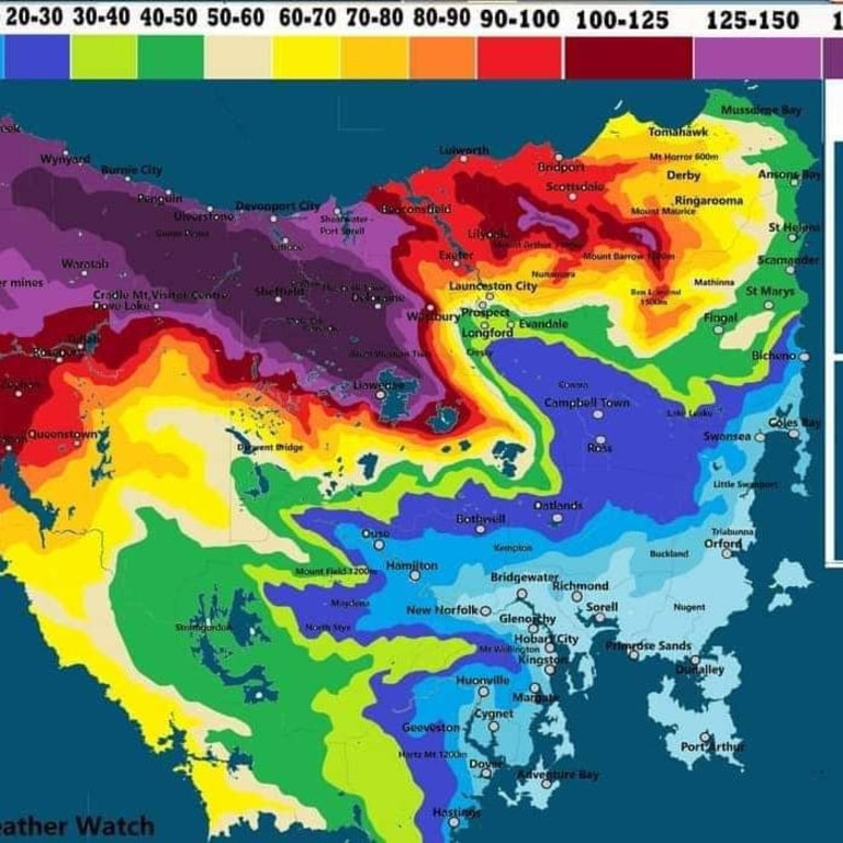
Flooding to 2016 levels may be possible across the North and North West Tasmania, in addition there is the potential for flooding around Ouse and the Derwent River if the rainfall continues to move southward.
Highest rainfall totals since 9am Wednesday to 5am Thursday include:
- 106mm at Great Lake East
- 80mm at Sheffield Farm
- 77mm at Lake Mackenzie
- 72mm at Fish River
Acting Premier Michael Ferguson urged Tasmanians to keep track of warnings on the TasAlert website.
“Right across the north of the state, we’re looking at rainfalls of as much as 200 millimetres in 36 hours. For some parts of the state that’s like a quarter or a third of the state’s annual rainfall in 36 hours. We’re talking about a lot of water. It will lead to flash flooding in some cases and certainly, the rivers will be rising.”
âš ï¸Severe Weather Warnings for Heavy/Intense rain, Damaging NE winds and Damaging Surf are all current for #Tasmania for the next 24-36 hours. Significant Flooding is also likely to develop. Stay up to date: https://t.co/NHL3HYiaxm and follow advice from https://t.co/TrvyMwyHZnpic.twitter.com/VPeyUUaQ2C
— Bureau of Meteorology, Tasmania (@BOM_Tas) October 12, 2022
BOM’s grim warning also says locally intense rainfall “which may lead to dangerous and life-threatening flash flooding” was also possible over inland parts of northwest Tasmania, particularly the Western Tiers, with six-hourly intense rainfall totals to 100mm, and 24 hour totals in excess of 300mm.
In 2016, widespread floods devastated 20 of Tasmania’s 29 municipalities, claimed three lives and caused damage to homes and farms — a total damage bill of about $180 million.
Latrobe Mayor Peter Freshney said people in the town were concerned the major flood warning would again see houses and businesses inundated and lives put at risk.

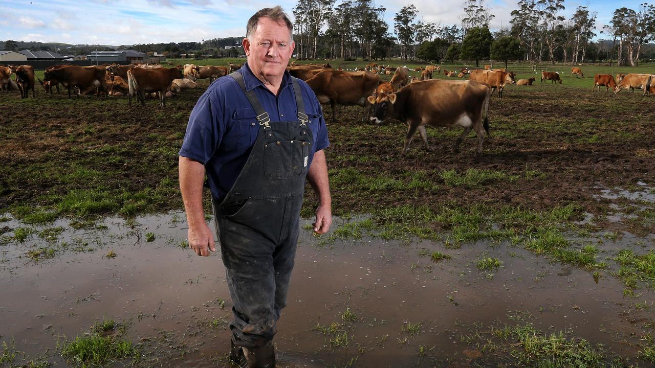
Tasmania SES acting director Leon Smith urged residents to get prepared.
“The advice we have from the Bureau in regard to the rainfall values we’re about to be confronted with are by all accounts equivalent to that in 2016, which was of significant impact in consequence to the state,” Mr Smith said.
“If you were in the areas of the northwest during the 2016 floods and you are aware that your property or your loved ones’ properties ... are in low lying areas that were previously impacted, there’s a high chance that those impacts will be seen during this event.
“It’s absolutely imperative that Tasmanians heed those warnings and they take note of the fact that it is going to be a long, protracted rainfall event.”
Acting Premier Michael Ferguson addressed the 2016 event in his press conference.
“In 2016 there was a major flooding event. This will be comparable to that. So we’re very concerned we want everybody to feel safe and be prepared and listen very carefully for the alerts,” Mr Ferguson said.

Tasmania Police Assistant commissioner Jonathan Higgins said it would be “a weather event of significance”.
“The message to Tasmania communities is to listen to the warnings, go to Tas Alerts to get your information, watch the BOM website as the weather event comes through,” he said.
More Coverage
“It’s a wet state already, the north and northwest have been particularly impacted by rain events already.”
The Bureau said saturated soils across Tasmania brought an increased risk of gusty winds toppling trees and powerlines, with heavy rainfall increasing the potential for landslides and debris across roads.
Originally published as Tasmania weather: Heavy rain and flash flooding forecast for north, east, central
Read related topics:Weather


