
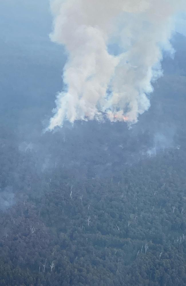
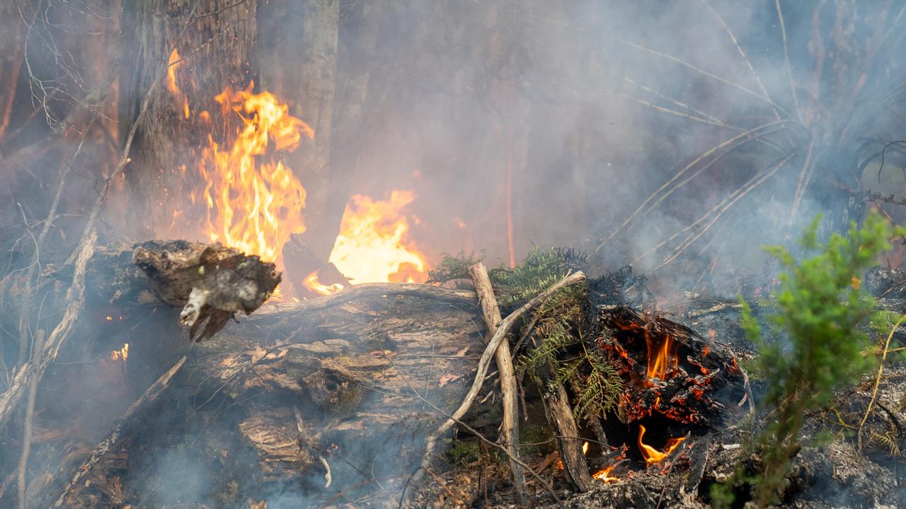
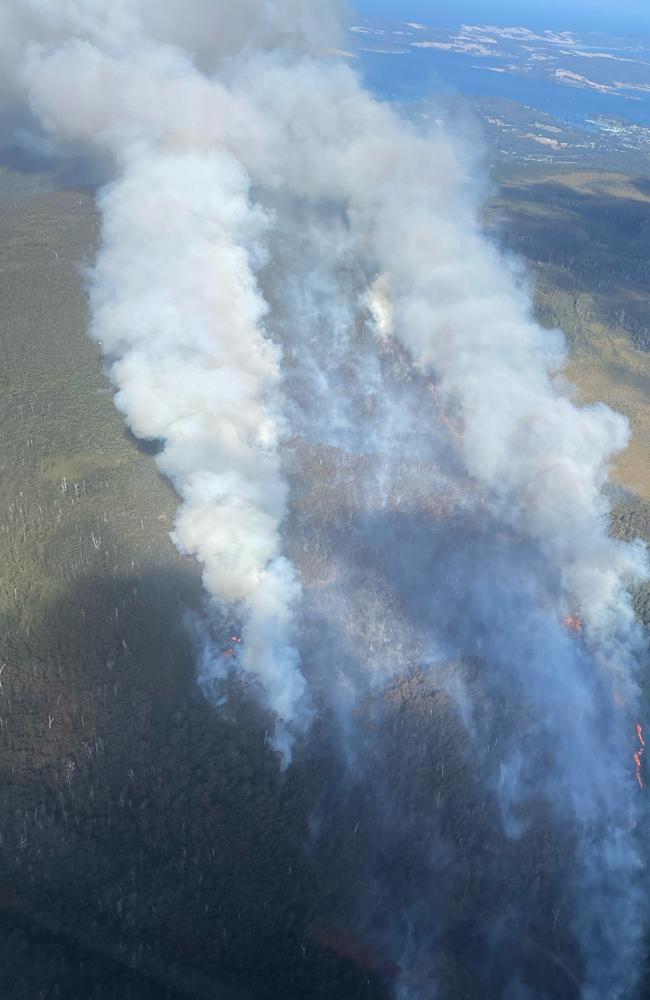
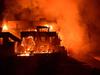
Firefighters work on protecting key assets while blazes burn on West Coast
Another emergency warning for a West Coast community with a bushfire headed toward Pieman Heads.
3pm: Authorities say it’s too late to leave for anyone at Pieman Heads, Conical Rocks and surrounds as a bushfire approached.
Firefighters expect the uncontrolled bushfire to put lives in danger and it could destroy homes now.
“Fire conditions are expected to be uncontrollable, unpredictable and fast moving,” the alert says.
The advice is to go to a safer location now and if there is no safe route, to shelter inside the neared building.
February 12, 10.45am: Firefighters will be assessing the damage of a bushfire that has torn through the small West Coast town of Corrina.
An emergency warning remains in place for Sandy Cape and surrounds. While Corrina is still not safe to return to, despite a downgraded warning from last night’s emergency.
Tasmania Police confirmed on Tuesday afternoon there was no threat to human life from the fire closing in at Sandy Cape, with no people, including shack owners, in the area at that time.
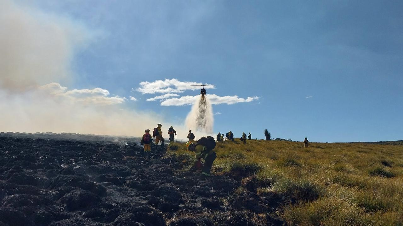
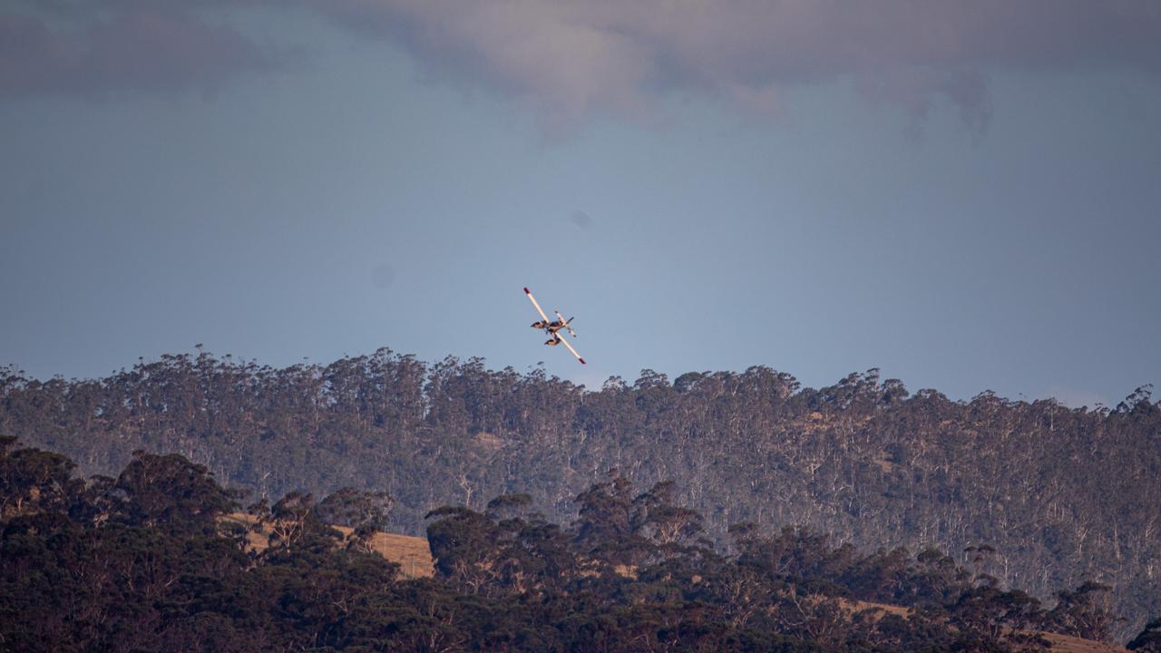
State Fire Commander Jeremy Smith said aircraft would be undertaking the observations where possible this morning.
He expected the task to be made more difficult due to low cloud cover impacting visibility in some areas.
He warned the risk of bushfires wasn’t over with high fire danger weather continuing to present challenges for firefighters.
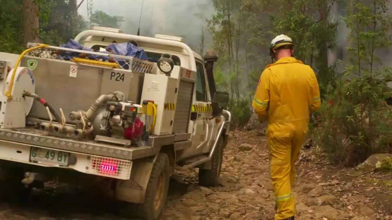
“We are focusing our efforts on protecting key assets, including infrastructure and cultural and natural values,” Mr Smith said.
“We have 50 remote area team firefighters, six bulldozers and 32 aircraft available to be tasked to these fires.”
A community drop in session will be held in Zeehan today to help inform anyone who was evacuated from Corinna or is travelling through areas affected by bushfires.
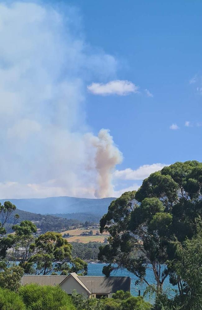
Homes threatened by Weste Coast bushfires
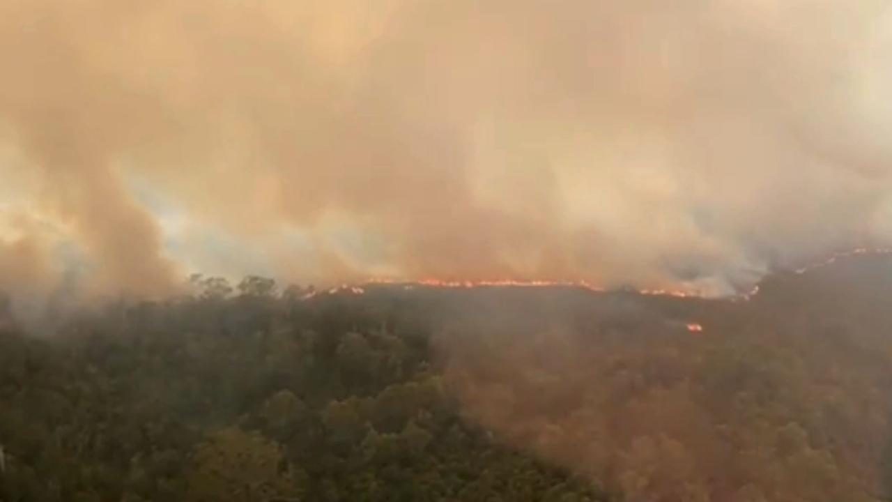
4pm: Bushfires threaten several properties on the West Coast, while the iconic Overland Track has been damaged.
It has been over a week since bushfires started burning in remote parts of the state after thousands of dry lightning strikes.
A pair of emergency warnings were issued on Tuesday for Sandy Cape and Corinna, with those in the areas urged to leave immediately.
Fire and Emergency Services Commissioner Jeremy Smith urged Corinna residents to head south along Heemskirk Rd toward Zeehan, while Sandy Cape residents were told to head to the nearby beaches.
“We’ve also got some challenging fire weather in the next few days, which will mean accessing the fire ground will be difficult – and certainly – controlling some of these fires will be difficult in these circumstances,” Mr Smith said.
“Operationally, we have over 50 remote area firefighters deployed to these fires, as well as 32 aircraft that can either do reconnaissance, insert fire crews, or do water bombing tasks.”

Mr Smith said the Tasmania Fire Service would receive additional resources, such as a Black Hawk helicopter and two large air tankers.
“These resources will be used to put fire lines in, essentially, areas that we cannot access with fire crews to slow the fire spread and to ensure the plant communities that are very fire threatened can be protected.
“So fire crews are not only protecting valuable natural assets, they’re certainly looking at the critical infrastructure in and around the West Coast.”
The fire threatening Corinna is currently not being actively being fought.
“They (where the fires are burning) are difficult; there is limited access by road; the flying conditions are difficult at times, including the ability to access fire grounds, caused by smoke, low cloud or mist in the area,” Mr Smith said.
“So certainly, they are very challenging conditions.”
Tasmania Parks and Wildlife Service State Operations Centre Liason Officer Brendon Clark said the Overland Track had been affected by the fires.
“At this stage, we estimate approximately 1.5kms of the track has been directly affected,” Mr Clark said.
“That’s not all what we call duckboards or boarded walk; some of that length is comprised of gravel and other elements.
“We haven’t really been able to get in and do a thorough assessment at the moment, purely because of the fire activity that remains on the ground.
“But at the earliest opportunity, we’re going in to do those impact assessments and determine the best remedial methodology.”
Bureau of Meteorology Meteorologist Luke Johnston said temperatures are expected to rise on Wednesday and Thursday, along with winds moving from a north-easterly direction to a north-north-westerly, before lowering again.
“The change is expected to move over the fire grounds in the West during Thursday afternoon,’ Mr Johnston said.
“Just to add a bit of complexity to the situation – when that change comes through, we’re going to see quite cold south-westerly winds.
“A different wind change will push fires in different directions, but it’s going to be significantly cold – with the potential for snowfalls to around 100 metres during Saturday afternoon on the back edge of a heatwave.”
Premier Jeremy Rockliff said the government provide support and resources to those affected by the fires.
— SIMON MCGUIRE
1.15pm: A second emergency warning has been issued, the latest for Sandy Cape and surrounds to take shelter.
The warning says an uncontrolled bushfire is expected to put lives in danger and could destroy homes.
“Fire conditions are expected to be uncontrollable, unpredictable and fast moving,” the alert says.
Firefighters are on the scene.
The safest way to survive is to go to a safer location and if there is no safe route, shelter inside the nearest building.
12.45pm: An emergency warning has been issued for Corrina and surrounds urging those in the area to leave immediately as an uncontrollable fire bares down on the West Coast town.
TFS says fire conditions are expected to be uncontrollable, unpredictable and fast morning.
“There is expected to be thick smoke, and showers of embers which may cause fires all around you. Fires will move quickly and may come from many directions,” the alert said.
Firefighting entities, TFS, Tasmania Park and Wildlife Service and Sustainable Timber Tasmania, is unable to attend.
Conditions are expected to worsen.
Corinna residents are advised to evacuate to the south and head to Zeehan via Heemskirk Rd.
Those without a safe route to a safer place are advised to shelter inside the nearest building, regularly checking your surroundings and putting out any fires near the building until the fire passes.
If you’re out of the area do not try to return, is the latest advice.
Also, an alert for Pieman Heads and surrounds has been issued to monitor conditions as they are changing.
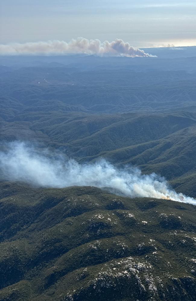
February 11, midday: Three bushfires on Tasmania’s West Coast remain a concern for firefighters gearing up for more high fire danger weather to hit the state.
Blazes at Mount Donaldson, Yellowband Plain and Canning Peak continue to rage after being lit from dry lightning last week.
State Fire Commander Jeremy Smith said more than 50 remote area team firefighters, six bulldozers and 32 aircraft would be battling the three fires on Tuesday.
“This is a dynamic situation, and with high fire danger weather we are executing our plans to contain these fires,” Mr Smith said.
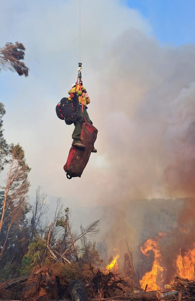
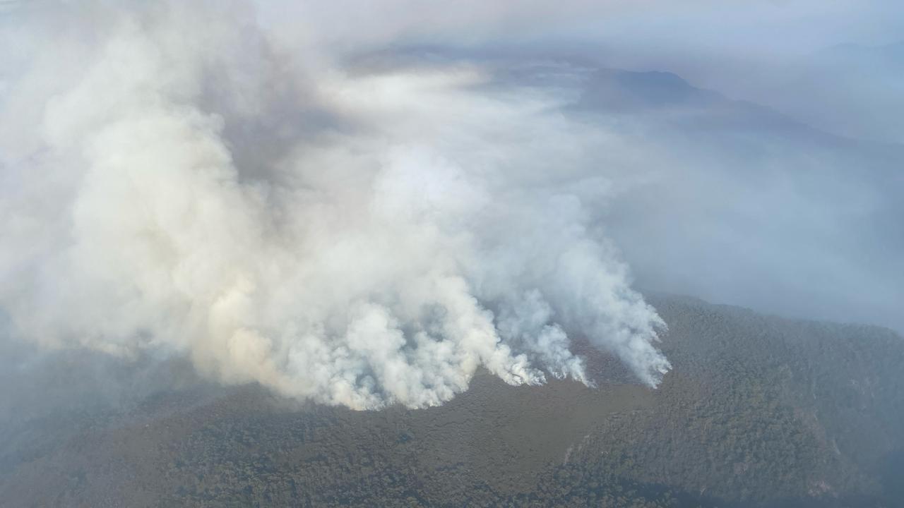
“The fires are largely in inaccessibly and challenging terrain, making our aerial assets and specialist remote area winch capability crucial to our firefighting efforts.”
He said work would continue to suppress the fires and remote area teams and aircraft would focus on any high-risk edges to limit the spread.
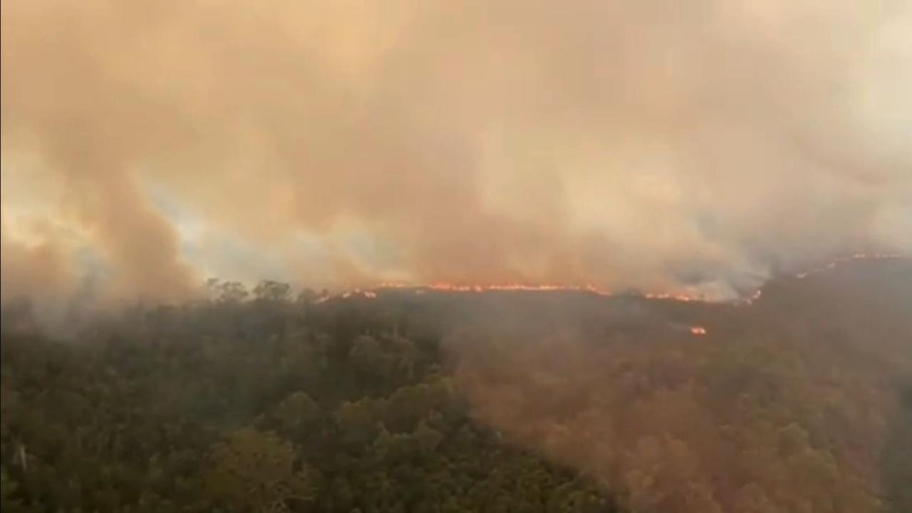
The West Coast blazes have already torn through a combined 45,000ha.
With high fire danger weather forecast over the next three days, Mr Smith said the service would face additional pressures.
He said planning to ensure resource requirements would be met for the coming days and weeks were underway.
It’s expected Tasmania Fire Service will request the assistance of interstate firefighters, likely from next Monday, Mr Smith said.
Current alerts
Arthur Pieman Conservation Area and surrounds: Monitor conditions
Corinna and surrounds: Prepare to leave; Corrina and surrounds at high risk within 6-12 hours
Sandy Cape and Surrounds: Prepare to leave; Sandy Cape and surrounds at high risk within 3-6 hours
Aerial resources “crucial” as over 29,000 hectares burnt
1.32pm: Aerial resources remain crucial in fighting bushfires on the state’s West Coast that have burnt through around 29,575 hectares, a Tasmanian Fire Service officer said on Monday.
Tasmania’s firefighting agencies are continuing to respond to bushfires in the state’s West Coast today, with a bushfire watch and act alert in place for Sandy Cape Track from Sandy Cape to Temma and surrounds and advice alert for the Arthur Pieman Conservation Area, Savage River, Overland Track and surrounds.
Tasmania Fire Service Deputy Chief Officer Matt Lowe said due to challenging terrain and inaccessibility of most locations, aerial resources remained crucial.
“The main priorities for the day will focus on the highest risk fires which are at Sandy Cape Track, the Canning Peak on the Overland Track, Mt Donaldson in the Arthur Pieman Conservation Area and Yellowband Plain fires in Savage River,” he said.
“Our specialist remote area winch capability with remote area firefighters has been critical in enabling the extinguishment or containment of a number of smaller fires that would have otherwise remained a problem.
“Fire suppression activities will continue today, with remote area teams and aircraft focusing on any high-risk edges to limit spread of fires.”
“There are currently 20 aircraft, 59 firefighters on ground in mostly inaccessible areas and five heavy machines managing 16 incidents across the west coast.
“Encouragingly, the growth of the Mount Donaldson fire has been slowed by strategic fuel reduction burns conducted north of the fire in recent years, enabling crews to better plan and prepare suppression efforts.
“The bushfires have burnt a combined area of approximately 29,575 hectares.”
“I want to again thank each and every one of our firefighters for their ongoing efforts, as well as those working behind the scenes to support those in the field.”
Tasmania Parks and Wildlife Service spokesperson Ashley Rushton said the northern half of the Overland Track remains closed due to the Canning Peak fire from Cradle Mountain to Pelion, with plans to reopen on Monday, February 24.
“The closure will enable impact assessments and works that may be necessary to re-open the track to be undertaken,” he said.
“Anyone who has booked to undertake the PWS Overland Track walk during the track closure will be provided a full refund.
“The Cradle Mountain Visitor Centre and Cradle Mountain day walk areas remain open to visitors.”
If you need emergency assistance or see fire or smoke in the landscape, please call triple-0 (000) immediately.
February 10, 10.16am: A bushfire watch and act alert was issued on Monday for Sandy Cape Track from Sandy Cape to Temma and surrounding towns on the West Coast.
The Tasmanian Fire Service (TFS) said the fire was travelling under north-easterly winds and was expected to be difficult to control.
The Sandy Cape 4WD Track from South of Temma remains closed due to a bushfire in the area.
Crews from TFS, Tasmania Parks and Wildlife and Sustainable Timber Tasmania were attending.
“Embers, smoke, and ash may fall on Sandy Cape Track from Sandy Cape to Temma and surrounds,” a TFS spokesperson said.
“Take action now to protect yourself, your family, and your home.
“If you are not prepared for a bushfire, be ready to leave for a safer place.
“If you have made a bushfire plan, check it now.”
The public were also urged to stay away from the Temma and Sandy Cape area if not residents.
For fire updates, listen to ABC Local Radio or visit tasalert.com
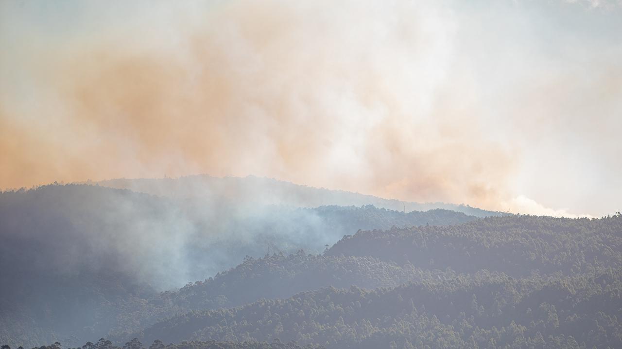
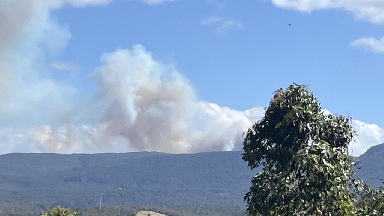
February 7, 2pm: Firefighters continue to battle 19 bushfires in the state’s west with smoke possibly reaching as far as Devonport.
Tasmania Fire Service Deputy Chief Officer Matt Low confirmed some of the warnings for the area had been downgraded on Friday.
Corinna, Sandy Cape and Pieman Head are now under one advice warning for Arthur Pieman Conservation area, which includes the Mount Donaldson fire.
While the Yellow Band Plains fire remains under the Savage River and surrounds warning.
“The fires have burnt through an estimated 16,000 hectares and while there is no threat to communities at the moment, containing them is our priority,” he said.
“We are continuing to conduct containment works, including mechanical, backburning and aerial operations, and community members should continue to expect to see smoke in the air.”
That smoke, he said, might reach as far as Devonport depending on the wind conditions.
He thanked the ongoing efforts of firefighters.
“Our Remote Area Teams have been incredibly successful in their winching operations, getting us access to locations we would not otherwise be able to reach.”
The bushfire at Snug Tiers has been downgraded with no warning, with a bushfire patrol active at Margate.
Overland Track won’t open before Monday
3.40pm: The Overland Track won’t open before Monday, February 10 as bushfire fighting efforts continue.
The Department of Natural Resources provided the updated timeline in a statement, saying it was to ensure public safety and assist with bushfire response effort.
It was initially planned to be closed for three days from Wednesday, when the blaze at Canning Peak began to threaten the track — burning five kilometres nearby.
Tasmania Parks and Wildlife Services North-West regional manager and incident controller Nic Deka said the two-day extension was a precautionary measure that would allow fire crews to consolidate their efforts.
“Firefighting efforts today have focused on containment, including backburning operations. Extending the track closure to Sunday will allow fire crews to strengthen containment lines and consolidate operations,” Mr Deka said.
“It also provides greater certainty for those booked to walk the track in the coming days. Southerly weather conditions are forecast until Saturday, which will test our effectiveness. On Sunday, the weather shifts around to the east and this will reduce the risk to walkers and assets.”
Anyone who has booked to undertake the walk will be provided a refund.
February 6, 10am: Fire bombing aircraft continue to target bushfires on the West Coast with 17 incidents still ongoing in the region.
Tasmania Fire Service Deputy Chief Officer Matt Lowe said the fire near the Overland Track remains almost 5km from the track having not progressed significantly overnight due to weather conditions.
He confirmed TFS and Tasmania Parks and Wildlife Service planned for further containment works today, using aerial and ground assets.
These efforts, including backburning, could result in more smoke in the area.
Mr Lowe said there were 15 aircraft being used in the response for spotter flights, mapping and water bombing, with three more on the way from interstate.
“Our thanks and appreciation go to the New South Wales Rural Fire Service, who are providing two of those aircraft to support our efforts,” he said.
A Watch and Act warning is in place for the Overland Track, while six advice warnings to monitor conditions for Zeehan, Corrina, Savage River, Pieman Head and Roseberry. Sandy Cape is being told to prepare to leave.
There is also a broader smoke alert for the West Coast affected areas.

“These fires have burnt through an estimated 10,800 hectares and while there is no threat to communities at the moment, containing them is our priority,” he said.
“Encouragingly, the fire on the outskirts of Zeehan is expected to be contained today.”
“This is in part due to our resourcing of the fire but is also attributed to a fuel reduction burn that was conducted in 2019, which significantly reduced the fuel load in the area.”
In the south, an Advice message remains in place for Margate, Snug and surrounds.
“We’re again urging all community members to remain vigilant and continue to monitor local conditions,” Mr Lowe said.
Uncontained fire closes Overland Track, 100 walkers impacted
Update 12.10: The Overland Track has been closed impacting about 100 walkers because of a fire southwest of Pelion West at Canning Peak.
PWS North-West regional manager Nic Deca said walkers schedule to depart today have been stopped, those north of Windermere have been told to return to Cradle Valley.
He said the fire grew significantly overnight to threaten the track with conditions becoming challenging.
“There is potential for the fire to impact the Overland Track within the next 24-48 hours,” he said.
The iconic track will be closed for the next three days.
He said significant smoke from the fire was present in the area between Waterfall Valley and Pelion, and anyone currently on the Overland Track was urged to follow instructions.
“We are actively working to contain the fire and plan to reopen the track in three days’ time if conditions allow,” he said.
“Anyone who booked to undertake the walk during the track closure will be provided a full refund.”
Walkers are urged to check the PWS website for up-to-date information and track closures.
Midday: An uncontrollable bushfire at Canning Peak is heading towards the Overland Track, authorities warn.
A watch and act message for Windermere, Pine Forest Moor and surrounds has been issued with people urged to monitor conditions as they are changing.
“The fire is travelling towards Overland Track this is not contained,” the alert said.
Embers, smoke and ash may fall on Windermere, Pine Forest Moor and surrounds, which could cause a threat before the main fire arrives.
Tasmania Fire Service, Tasmania Parks and Wildlife Service and Sustainable Timber Tasmania is attending.
Conditions are expected to be changeable.
February 5: The bushfire at Snug remains a concern to firefighting agencies, despite the blaze that has burned for longer than a week being contained and monitored.
Another 17 blazes burn on the west coast, particularly around Zeehan, Corinna and Rosebery areas.
Tasmania Fire Service deputy chief officer Matt Lowe said there was no threat to those communities at the moment, but containing it was their priority.
Fire bombing aircraft has been called upon to assist efforts on the west coast, made challenging due to the rugged terrain and inaccessible location of many of the blazes, he said.
“These aerial assets are being used for spotter flights, water bombing, and mapping to support our firefighting efforts,” Mr Lowe said.
As of this morning, 15 aircraft were being used through the National Aerial Fighting Centre arrangements and other local aircraft is ready to assist any new fires start, he said.
Mr Lowe also confirmed the state had requested two Blackhawk helicopters from interstate to assist efforts.
Dry lightening sparked was responsible for the multiple blazes on the West Coast that started Monday afternoon and evening. Despite more lightening last night, there were no reports of new fires at this stage due to the accompanied rain.
“We’re again urging community members to remain vigilant and continue to monitor local conditions,” he said.
The latest updates can be found on TasALERT.
Bushfire warnings as of 10am:
- Zeehan and surrounds – monitor conditions
- Savage River and surrounds – monitor conditions
- Rosebery and surrounds – monitor conditions
- Corinna and surrounds – monitor conditions
- Margate, Snug and surrounds – monitor conditions
- Rosebery, Zeehan, Corinna and surrounds – avoid smoke
Two bushfires on west coast upgraded to advice alert level
3.31pm: Two bushfires on the state’s west coast have been upgraded to advice alert levels.
This comes after almost 20 bushfires sprung up across the state following dry lightening late on Monday.
Advice alerts have been given fro Rosebery, Savage River and surrounding areas, with TFS warning communities to monitor conditions.
While there is no immediate threat, conditions are expected to be changeable.
Residents for affected areas are encouraged to check their bushfire plan and decide on whether you will stay and defend or leave your home in the case the warning level is upgraded.
For fire updates visit tasalert.com.
TFS Deputy Commander urges community vigilance
11.05am: Deputy State Fire Commander Mark Dobson said almost 4770 dry lightning strikes hit Tasmania since late Monday.
“With hot and windy weather experienced across the state from late yesterday, over 4770 dry lightning strikes occurred near or over Tasmania, with 1227 recorded as striking the ground since 1pm (time) yesterday, with strikes sparking multiple fires across the west coast area,” he said.
“Aircrews are continuing to conduct spotter flights to gather intelligence, map and prioritise our response to these fires, many of which are in remote areas.”
With bushfire responses ongoing in the west coast and Huon channel areas, the community is urged to remain vigilant and continue to monitor local conditions with the weather predicted to change on Tuesday.
Deputy Commander Dobson said that while no communities are currently at risk from the bushfire advice alert fires in Corinna and Zeehan, he urged local residents to be vigilant and monitor conditions.
“The Bureau of Meteorology has predicted thunderstorms across the west coast, east coast and midlands this afternoon and early evening, with the potential for further lightning strikes,” he said.
“If you are aware of lightning strikes in the local area and you see smoke or fire, please report to Tasmania Fire Service immediately on triple-0.
“Firefighting activities are ongoing in the Huon channel area, with Tasmania Fire Service, Tasmania Parks and Wildlife Service, and Sustainable Timber Tasmania crews on the fireground and in the air, working to extinguish a fire which started on 28 January and has so far burnt 480 hectares.”
“Active firefighting is ongoing, and proactive patrols of the fireground will continue over the coming days to monitor for any flare-ups.”
“With the weather forecast to change today, the best way for people to stay safe is to be prepared and stay up-to-date with local conditions by monitoring TasALERT.”
Bushfires around the state after lightning strikes
February 4, 10.40am: Almost 20 bushfires are going around the state after a series of dry lightning strikes and extreme hot weather on Monday.
Bushfires are mainly recorded in the north-west and west of the state, with 20 bushfires listed on the TasAlerts website, with one in Corinna and one in Zeehan under a bushfire advice alert level.
Tasmanian Fire Service (TFS) crews are in Robinson Street, Zeehan working to get the bushfire under control.
Meanwhile, TFS, Parks and Wildlife and Sustainable Timbers Tasmania crews have been called to Mount Donaldson in Corinna.
Residents in Zeehan, Corinna and surrounding suburbs are advised to monitor conditions and prepare to enact their bushfire plan.
Fires in Trial Harbour Road, Queens Head, Pieman River, Violet Rivulet, Corinna Road, Rocky River, Parsons Hood, Mount Meredith, Yellowband Plain on the West Coast, Mount Black in Rosebery, Canning Peak in Lake St Clair, and Corinna Road and Leatherwood Ave in Savage River have all been marked as going by TFS, with crews currently working to bring them under control.
Crews work to protect property, critical assets at Snug
February 1: The bushfire fighting effort at Snug has shifted to creating containment lines to reduce the risk to property and critical assets, the TFS says.
Margate, Snug and surrounding areas are being encouraged to monitor conditions and avoid smoke with an advice warning and smoke alert remaining in place.
Efforts to lock in containment lines are underway as a joint effort between the Tasmania Fire Service and Tasmania continues to respond to the emergency incident in the Channel region on Saturday.
While back burning operations are also planned as conditions allow in an attempt to contain the fire. This is expected to cause more smoke in the area and its visibility to surrounding communities is not a cause for alarm, firefighters say.
Deputy incident controller Adam Salter thanked the community for their patience and understanding while firefighting activities continued in the area.
More than 200 people gathered to hear an update on the fire and bushfire safety during a community meeting at Margate Primary School on Friday night.
Authorities expect crews to remain on the fireground for several days.
TFS has already suspended fire permits statewide to prepare for high fire danger across Tasmania this weekend and into early next week.
Several other minor bushfires have ignited across the state over the past 24 hours, however no alerts for those are current.
Fire permits suspended ahead of heatwave
January 31: Fire permits have been suspended statewide from Saturday ahead of a forecasted severe heatwave.
Tasmania Fire Service southern regional chief Simon Pilkington confirmed the decision as the state’s firefighting resources are focused on the bushfire in the Snug Tiers.
“Any additional fires may result in depleting resources and increased response times,” Mr Pilkington said.
Fire Permits will be suspended from 2am Saturday, February 1 until 2am Wednesday, February 5.
This means no fire permits will be issued during this time, any already issued have been cancelled and burns under one cubic meter — that don’t require a permit — are strongly discouraged.
Elevated fire dangers into early next week are likely across southern Australia — including Tasmania, BOM warns.
The Bureau of Meteorology senior meteorologist Miriam Bradbury provided an update on Friday morning, saying dry lightning could also pose a risk into early next week with temperatures soaring in many states including the Apple Isle.
Firefighters are expecting to continue battling the blaze at Snug Tiers for weeks with 410 hectares of bushland already scorched.
A monitor conditions warning was in place for Margate, Snug and surrounds with the conditions set to be changeable on Friday.
The firefighting efforts is a join effort between Tasmania Fire Service and Tasmania Parks and Wildlife Services.
A smoke alert was also in place for Margate, Snug, Kettering, Pelverata, Kaoota and surrounds.
The forecast weather conditions arrives on top of dry soil following no significant rainfall being predicted over the forecast heatwave, TFS says.
Ms Bradbury explained the “unusually hot” weather is due to a large unmoving high pressure system over the Tasman Sea.
She forecast a warm weekend would build and flow through to next week.
“Day time and overnight temperatures will push well above average in the southern states.”
Temperatures are set to push 15C above February averages through parts of central Tasmania.
Hobart is also expected to feel the heat, with 31C and 34C forecast for Monday and Tuesday respectively.
A high fire danger rating is also forecast for the midlands on Saturday.
Snug bushfire still rages and set to go on for weeks
January 30: Firefighting efforts continue at Snug Tiers in the Channel region on Thursday with firefighters, aircraft and heavy machinery set to be deployed over the coming weeks to assist with efforts.
Incident controller Andrew McConnon said the fire — fire reported on Tuesday afternoon — remained uncontrolled and had so far burned over 410 hectares.
“Firefighters, aircraft, and heavy machinery will be deployed over the coming weeks to assist with suppression efforts,” he said.
“Yesterday, more than 80 personnel from both TFS and Tasmania Parks and Wildlife Service worked to establish containment lines around the fire, with the support of ten firefighting aircraft.”
The Bureau of Meteorology has forecast an increase in temperatures later this week and high fire danger weather is predicted across inland parts of Tasmania.
Mr McConnon said they were focused on building and strengthening containment lines to limit the fire’s spread ahead of the forecast fire weather next week.
Bushfire advice warnings are in place for Pelverata, Kaoota and surrounds, Margate, Snug and surrounds and Oyster Cove and surrounds.
TFS advised the community to monitor conditions with warnings set to be in place over the coming weeks.
A smoke alert is also in effect for Margate, Snug, Kettering and surrounding areas.
Residents should be aware that smoke and ash may be visible in the region over the coming weeks and anyone at higher risk from smoke should enact their personal health plans.
Visibility also may be reduced in some areas.
People who don’t live in the area have been asked to stay away to allow emergency services to respond effectively.
The best way for Tasmanians to be prepared is to review your bushfire plan, be aware of your surroundings, keep up-to-date with warnings and report any fires to triple-0 (000).
Tasmania Parks and Wildlife spokesperson Katy Edwards said, “the Snug Falls track, Snug Tiers Reserve and Pelverata Falls Track are currently closed to the public.”
Snug fire remains visible, but no immediate threat
January 29: An uncontrolled fire continue to rage in bushland at Snug Tiers.
Firefighting efforts have continued on Wednesday morning after more than 70 personnel and nine firefighting aircraft battled the blaze on Tuesday.
The blaze was first reported at 3.10pm yesterday.
Tasmania Fire Service incident controller Andrew McConnon said additional resources would be deployed today to assist with the firefighting operations.
He said work yesterday, including personnel from the Tasmania Fire Service and Tasmania Parks and Wildlife Service, worked to create containment lines.
So far the fire has burnt more than 170 hectares, and Mr McConnon said it was uncontrolled.
“Today we will be increasing resources on the fireground, prioritised on the southern and eastern edge of the fire,” he said.
“We’re reminding residents in the area to monitor conditions, be aware of ember attacks, and make a plan to stay safe.”
The fire is expected to remain very visible in the Channel area today and a smoke alert remains in place for Margate, Snug, Kettering and surrounding areas.
Drivers are also asked to use caution with smoke reducing visibility.
Tasmania Fire Service advises people to:
* Decide early if you are going to leave, and make sure you have a clear path to a safer place.
* If you have made a bushfire plan, use it now.
* If you don’t live in the area stay away. The roads could become highly dangerous.
* For fire updates visit tasalert.com
Water bombers and fire crews sent to Snug fire
January 28: More than 70 firefighters and nine waterbombing aircraft battled an uncontained blaze inland from Snug on Tuesday afternoon and into the evening.
A Watch and Act alert was issued for communities in the Channel suburbs of Margate and Snug after the bushfire took hold in strong winds.
Incident controller Andrew McConnon told ABC radio the work by crews and waterbombing aircraft managed to quell the blaze and cooler conditions helped ease the situation.
The fire broke out in Margate Plains in the Snug Tiers Nature Recreation Area about 4.40pm, with ember attacks and the bushfire threatening homes in nearby Snug Falls Road, Snug Tiers Road and surrounds.

A line of fixed wing planes and helicopters helped battle the blaze.
The fire warning was downgraded to Monitor Conditions just before 8pm.
However, Mr McConnon said he expected that the Tasmanian Fire Service would likely be fighting the bushfire for at least the next week.
“We are still looking at a longer term containment strategy,” he said.
In a release on Tuesday, the Tasmania Fire Service said that high winds meant the fire was “difficult to control” and smoke and ash would impact on the ability to breath.
.
Heavy smoke from the fire impacted neighbourhoods and residents, with Tasmania Police urging motorists to drive slow in Snug, Margate and surrounding areas due to reduced visibility.
More Coverage
Police also closed Van Morey Road in Margate from Old Bernies Road but the area was later reopened for local residents
For the latest alerts go to the TasAlerts page
Originally published as Firefighters work on protecting key assets while blazes burn on West Coast

Federal election 2025: All your questions answered
With the end of the three-year federal government term rapidly approaching, here’s everything you need to know about casting your vote.

Grill the leaders: Ask Albo and Dutton your burning questions
Get unprecedented access to the 2025 federal election campaign with the chance to grill Anthony Albanese and Peter Dutton on the issues that matter to you. SUBMIT YOUR QUESTIONS
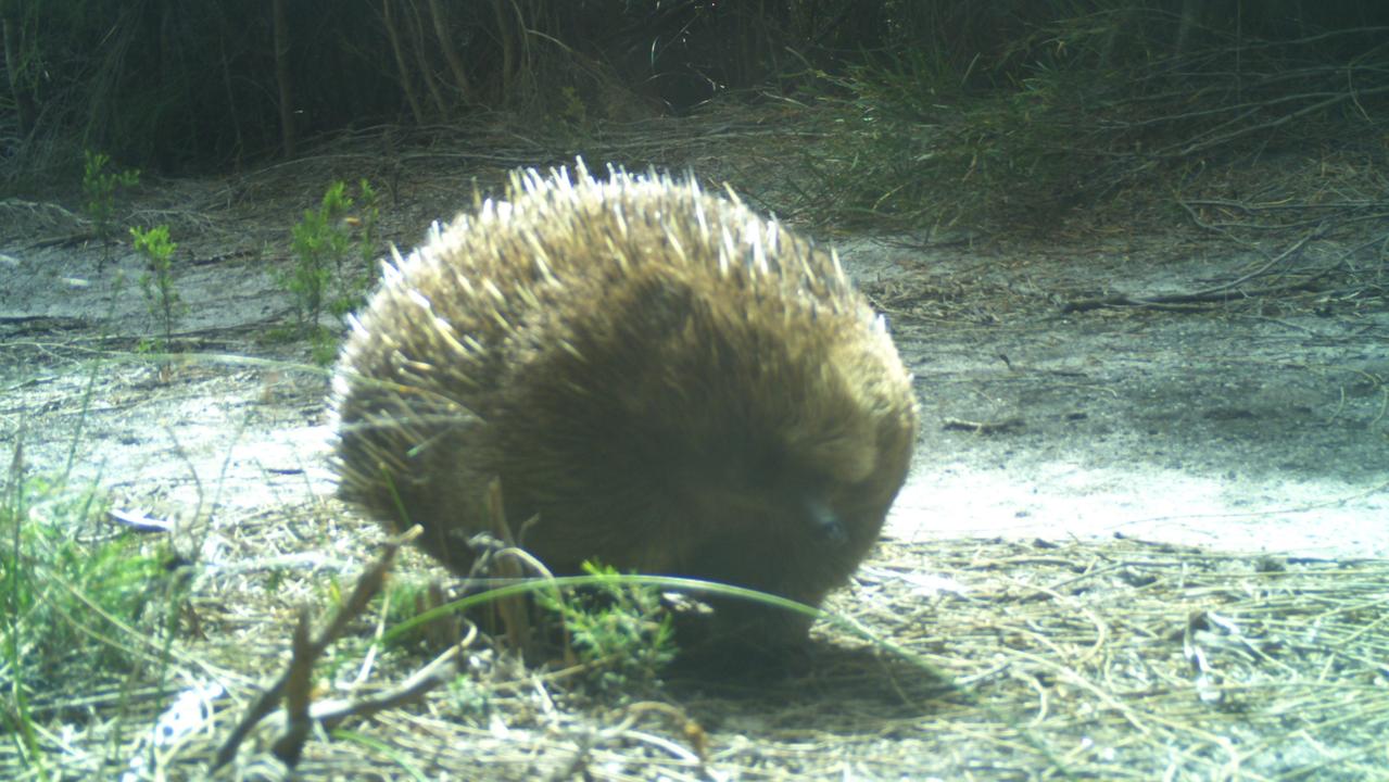
Is this the world’s loneliest echidna?
Echidnas hadn’t been seen on this remote Tasmanian island since a devastating wildfire ripped through more than a decade ago. Now rangers celebrating a monumental win are hoping for more.