
Townsville weather: Life-threatening flood warning issued amid 250mm+ forecast
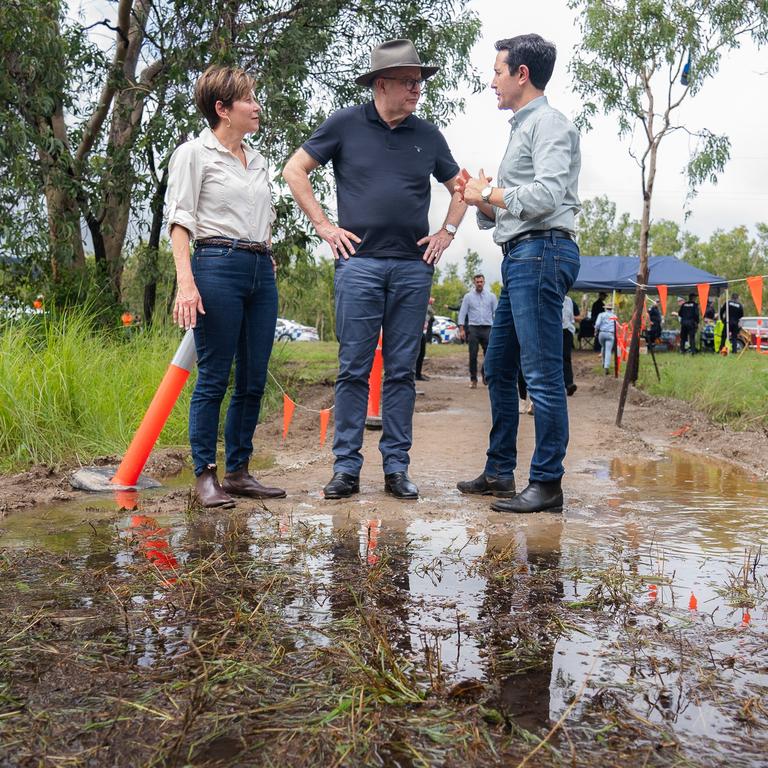
Extra swiftwater rescue crews, police and boats are being sent north from SEQ ahead of what the Premier has warned will be another severe weekend of devastation for an already-saturated and “hurting” region.
Extra swiftwater rescue crews, police and boats are being sent north from southeast Queensland ahead of what the Premier has warned will be another severe weekend of devastation for an already-saturated and “hurting” region.
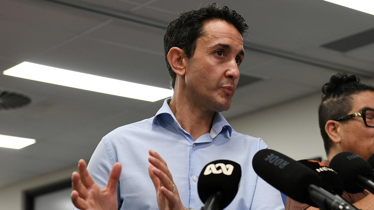
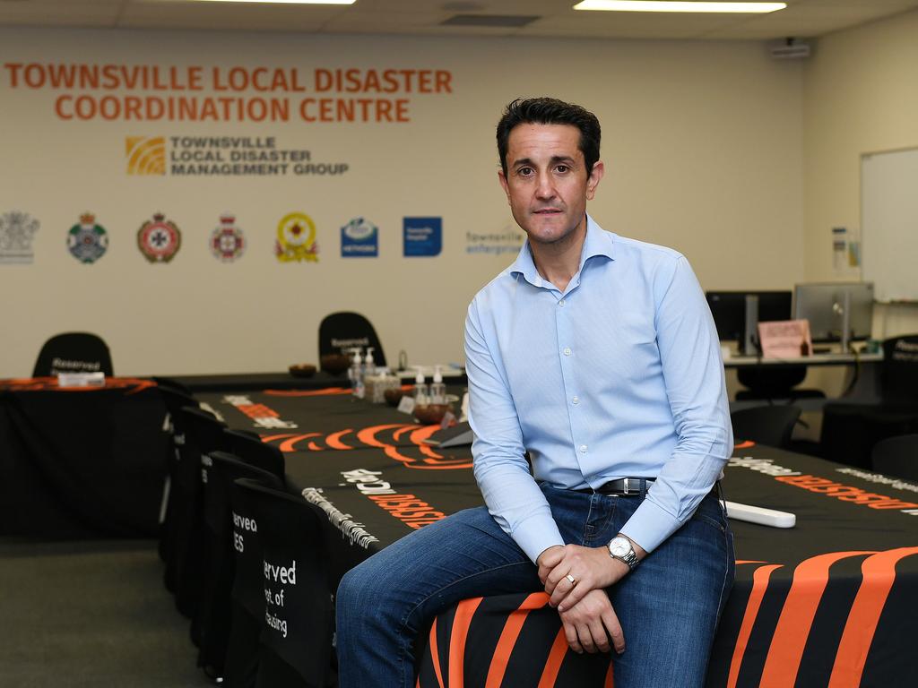
Premier David Crisafulli said the Bureau of Meteorology has warned of more heavy rainfall that could lead to dangerous and life-threatening flash flooding between Ayr and Tully Friday night and over the weekend.
Six-hourly rainfall totals between 140 to 200mm are possible. Isolated 24-hourly rainfall totals up to 250mm are possible. Rainfall is expected to increase from late tonight, with isolated heavy falls possible through the remainder of the weekend.
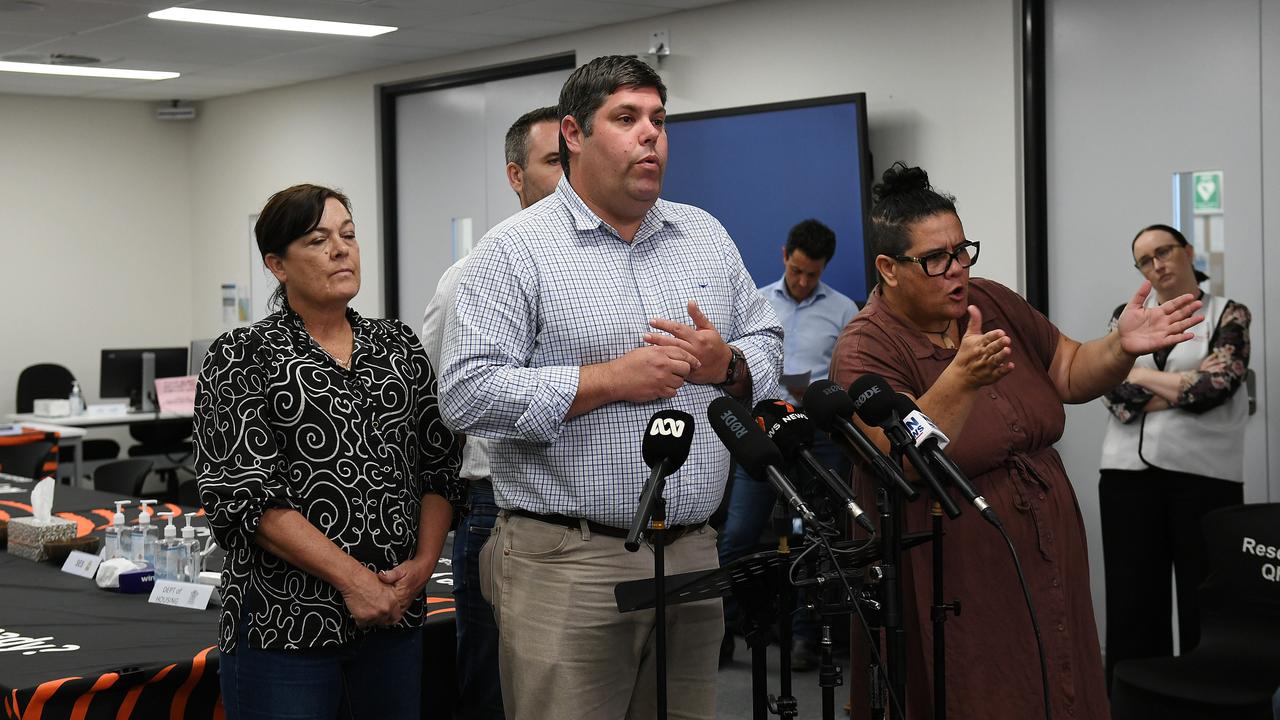
“I’m asking North Queenslanders who are already impacted and are tired and stressed to please stay connected over the course of the weekend,” Mr Crisafulli said at Townsville’s disaster management centre on Friday morning.
“The system remains active and remains intense and as a result that severe weather warning remains in place in those areas between Tully and Ayr.”
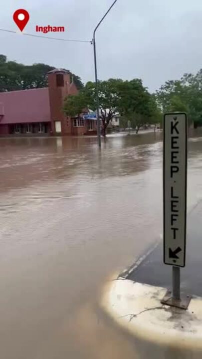
“These communities are already hurting … Cardwell and Ingham and Townsville and Giru and everywhere surrounding those areas. The people of Charters Towers, the people of Georgetown, they have been through a lot in the last week and unfortunately there’s more to come on those predictions for this weekend.”
Mr Crisafulli urged residents to listen to BOM warnings and advice from the disaster management teams.
“We have swollen catchments, and on the back of that we have the prospect of rivers continuing to rise,” he said.
“To the people of North Queensland, thank you for your resilience. This weekend will further test that resilience and that spirit but if anyone has proven their mettle over the years it is the people of this region and we’re asking them to stay connected and above all to stay safe.
“To everybody in this region you need to know we have restocked and resupplied and are ready for what Mother Nature can throw at us this weekend.
A new centre of operation has been activated in the Mackay district, with resources “pouring into that district” to be able to service that region from both Townsville and Mackay.
The Premier said seven floodwater boats were deployed to Mackay, four to the Whitsundays, as well as swiftwater rescue teams in both of those locations .
“Police are currently mobilising from the south to fly into Mackay and Townsville. We are determined to make sure as we did for this event we have people on the ground to support North Queenslanders in their hour of need.
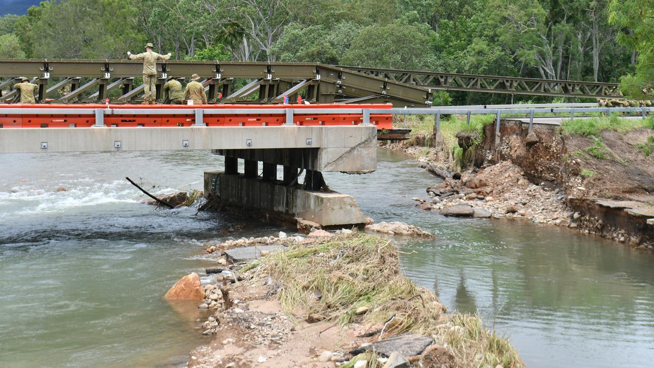
Mr Crisafulli said the operation to install a temporary bridge at Ollera Creek was a ‘godsend’ to allow emergency services and goods into Ingham.
Ergon trucks were able to be taken into Ingham on Friday afternoon to bring back power to residents who had been without it for days.
The Premier advised around 1000 had seen their power return as of Friday morning, with another 5000 homes still hoping to be reconnected soon.
“To see the first of those trucks, the Ergon trucks, that got into Ingham and on the back of that they were really able to take that recovery to the next level,” Mr Crisafulli said.
“The substation has now been repowered, for that to occur in such a short period of time means that the recovery in Ingham can get back on a moving quiver than we would ever have expected otherwise.”
Mr Crisafulli said the area of Lucinda, and the substation that power the Lower Herbert, remains an ongoing operation, with line-stringing in process and poles being stood up.
“Work is underway and they are making great progress,” he said.
Sending a message to Queenslanders, Mr Crisafulli thanked emergency services, clean-up crews and those on the ground in the recovery efforts.
“To the neighbours helping neighbours, and the strangers helping strangers, we are a better state because of people like you,” he said.
Minister for Transport and Main Roads Brent Mickelberg gave an update , saying there has been “considerable progress” made in opening roads that were flooded and closed.
He advised as of Friday morning that the Macrossan Bridge was open, but is also likely to close as rain is predicted to fall in that catchment area.
Routes to the North of Ingham were hoping to be open to emergency traffic after midday Friday, with Mr Mickelberg saying it has been a “significant task” for workers to remove debris from affected bridges and inspect for safety.
An alternative route is hoping to be made available in the area.
“There will be a checkpoint south of Cardwell to control movement in and out of Ingham,” Mr Mickelberg said.
“There is considerable rainfall still in the North and the Far North and that is impacting our ability to do some of these works and will continue to impact our ability to open some of the roads that we are seeking to do,” he said.
In regards to the Ollera Creek temporary bridge, which is currently open for emergency services during daylight hours, Mr Mickelberg said crews are working to repair the original bridge during the night after the temporary bridge is pulled down, and that repairs may take a number of days”.
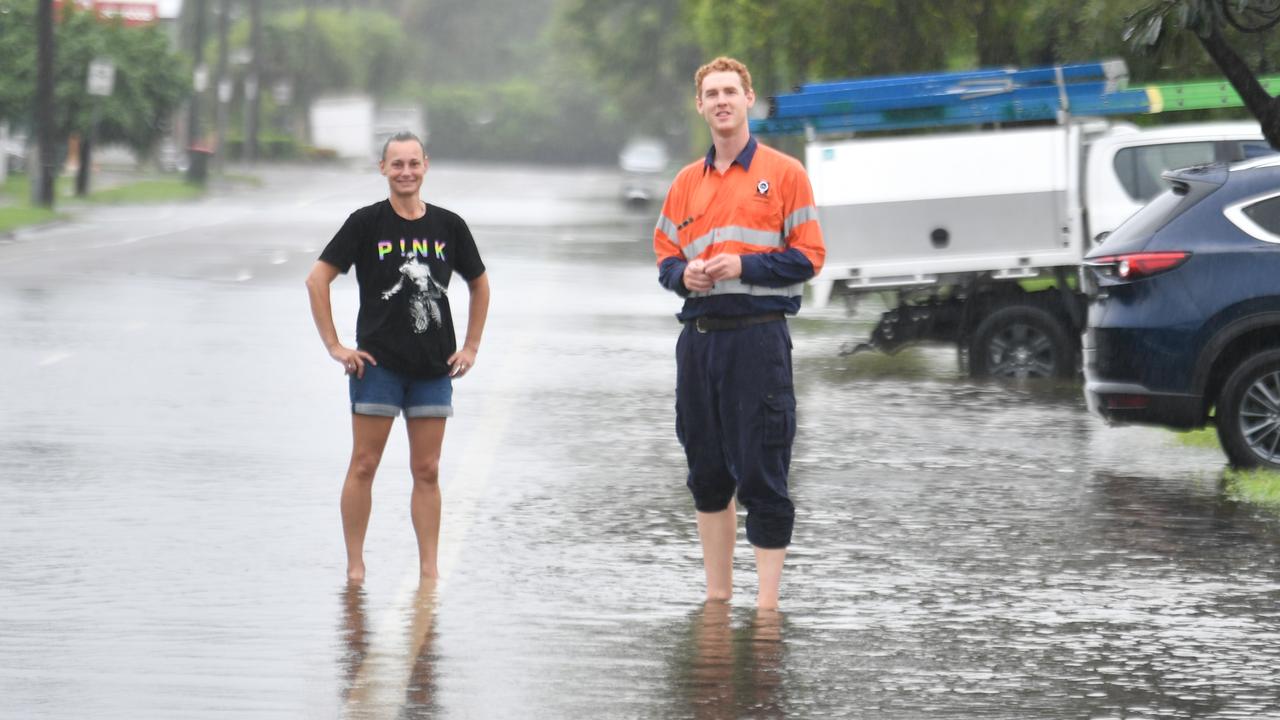
Overnight Thursday, South Townsville had 142mm of rain in the 19 hours until 6am, Alva Beach had 121, Townsville 101mm, Black River 98mm, Deeragun 81 and Mt Bohle 80mm.
The Telegraph Road alert at Bowen recorded 152m of rain.
The weather bureau, in its forecast on Friday, said Townsville could face another 30 to 120mm of rain Sunday, up to another 70mm on Sunday and up to 30mm on Monday.
Senior Meteorologist Sarah Scully said the widespread rainfall would hit flood-affected parts of the northeast tropical coast over the weekend.
“There is a lot of tropical moisture sitting across northern Queensland at the moment and that is combining with (a) monsoon trough to bring rain areas, and an increase in both shower and storm activity.
“By Saturday we are expecting there to be a burst of widespread heavy rainfall about the northeast tropical Queensland coast extending further inland.”
Fresh warnings were issued at 4pm Thursday for moderate flooding of the Ross River and Bohle River catchments.
“Any further rainfall is expected to result in rapid rises and lead to a return of more significant flooding across the Townsville area.”
Ross River Dam will see controlled releases through the spillway, contributing to flows downstream in the Ross River.
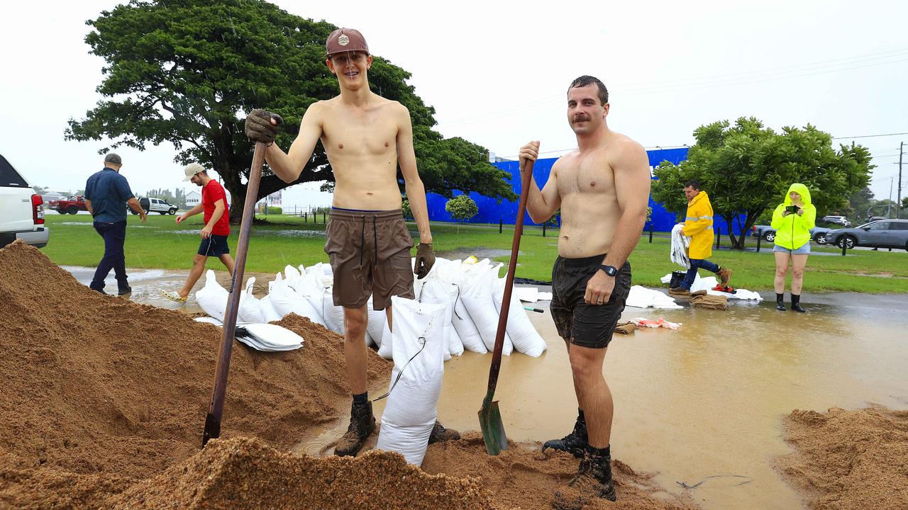
TLDMG Chair Andrew Robinson said residents needed to be alert, with sandbag stations replenished ahead of further severe weather.
“Residents should remain aware and continue listening to advice as the rain picks up today and into the weekend,” Cr Robinson said.
“The current advice is for all residents across the Townsville local government area to stay informed. The TLDMG remains stood up and will continue to meet regularly until the weather event subsides.
“Sand and sandbags have been replenished at sites across Townsville for residents to collect. If you have sandbags at home, bring them along to fill up.”
Chief Superintendent Graeme Paine has warned that even small amounts of rainfall could lead to flash flooding due to already saturated ground.
“You really need to make those decisions that put your safety first and the safety of others first in everything you do at this stage,” he said.
“We have a lot of water; as I said, even a small amount of rain can impact flash flooding quite quickly because everything is so wet.
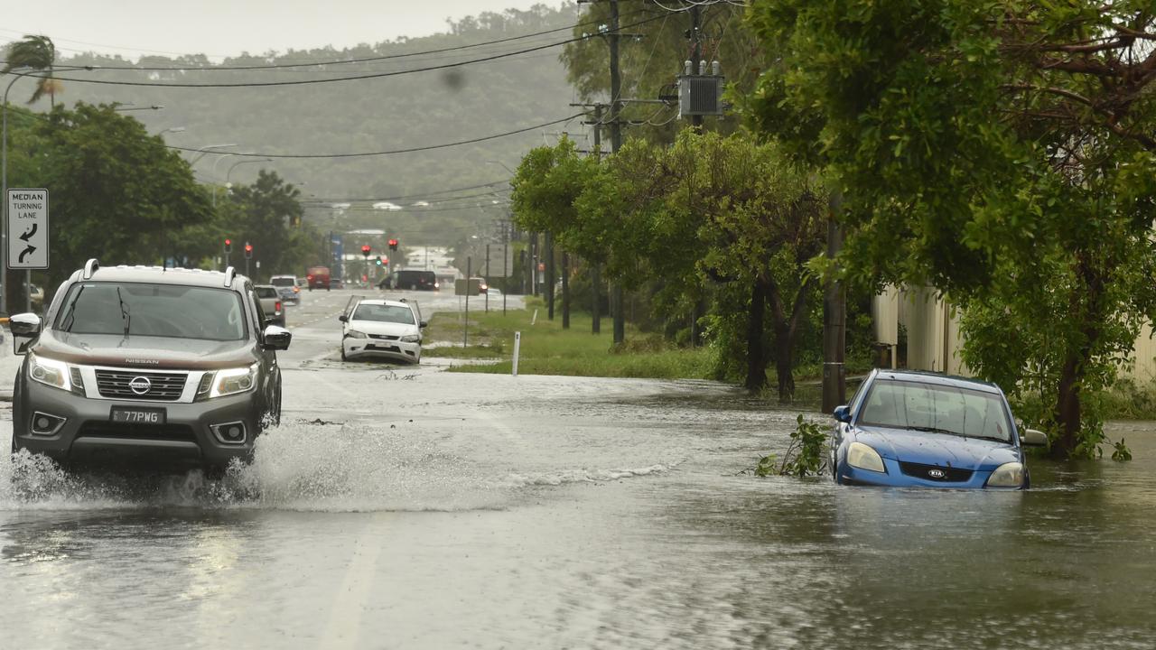
“I’ve had people say that they’re seeing water appear in areas that they’ve never seen before, even within the Townsville metropolitan area.
“It’s an indication that no weather event is the same. The impacts are often different, and unexpected things can happen. So please just take that safety-first approach and really do your research before you’re going to go anywhere.”
Man fined by police after getting stuck in floodwaters
It comes as a 54-year-old Condon man was fined by police after getting stuck in floodwaters.
It will be alleged about 6pm on Wednesday, police received a call for service after a vehicle became stuck in floodwaters on Barratta Road, Upper Haughton.
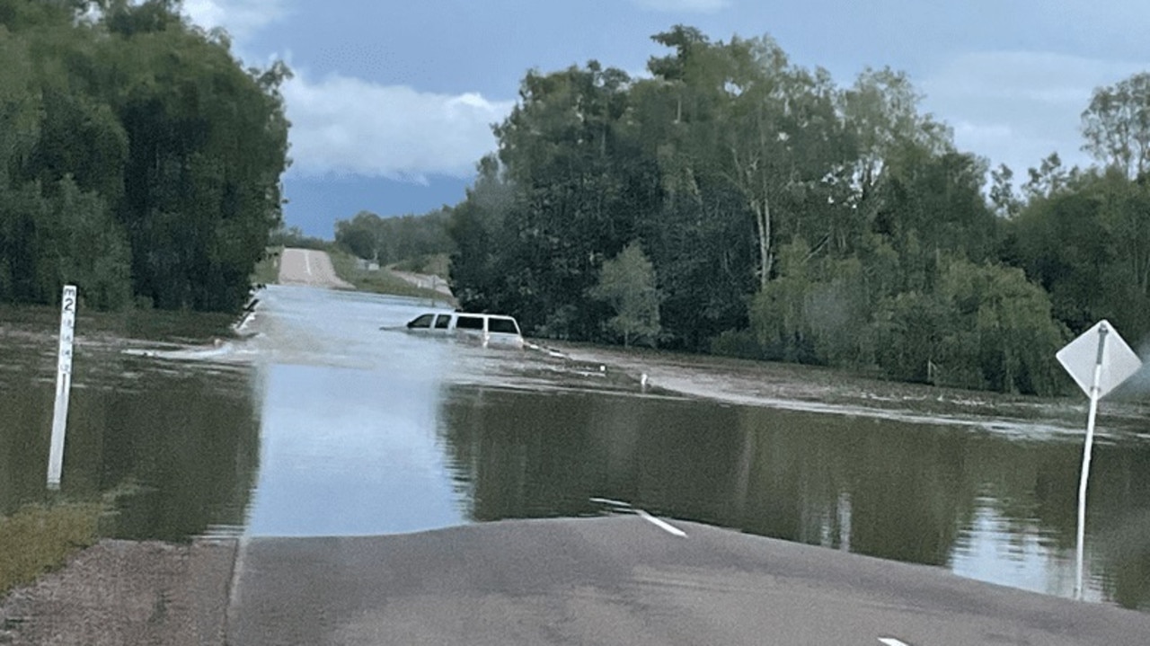
Officers from Ayr Station attended and located the man out of the vehicle and uninjured.
He was charged for driving under the influence of alcohol and driving without due care or attention.
He is due to appear in the Ayr Magistrates Court on February 24.
More Coverage

“There is no excuse for trying to cross flooded roads, and putting yourself and others in danger,” Townsville Acting Chief Superintendent Chris Lawson said.
“You can’t tell what may be lurking under the surface, or how quickly water is moving.
“Remember if it’s flooded, forget it.”
Originally published as Townsville weather: Life-threatening flood warning issued amid 250mm+ forecast
Join the conversation

Where and when to vote to avoid Magic Round chaos
NRL Magic Round is set to attract plenty of fans – and Aussie voters. Here is what you need to know.
Read more
Where to vote: Full list of polling booths in Qld
Australians are heading to the polls to cast their vote. See the full list of Queensland polling booth locations here — including the ones that will have a democracy sausage sizzle.
Read more

What to do while in Brisbane for NRL Magic Round
If you are heading to Brisbane for Magic Round here is your ultimate guide on how you can spend your time in the River City.
Read more