
Cyclone Alfred makes landfall in SEQ: Live updates and information
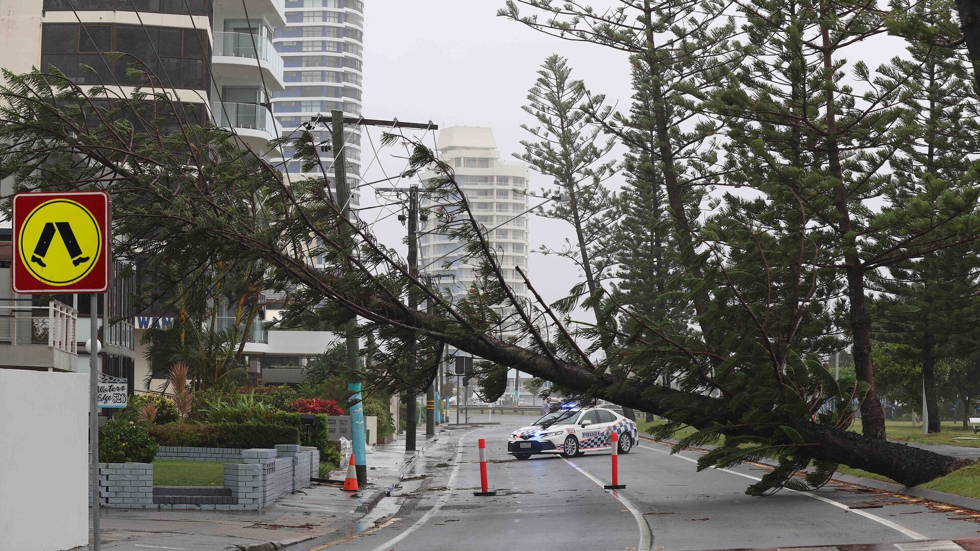
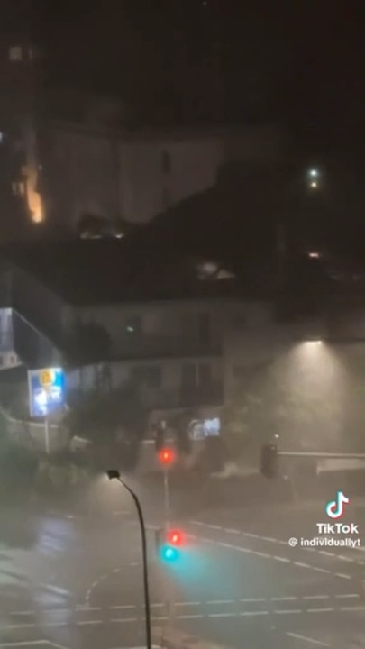
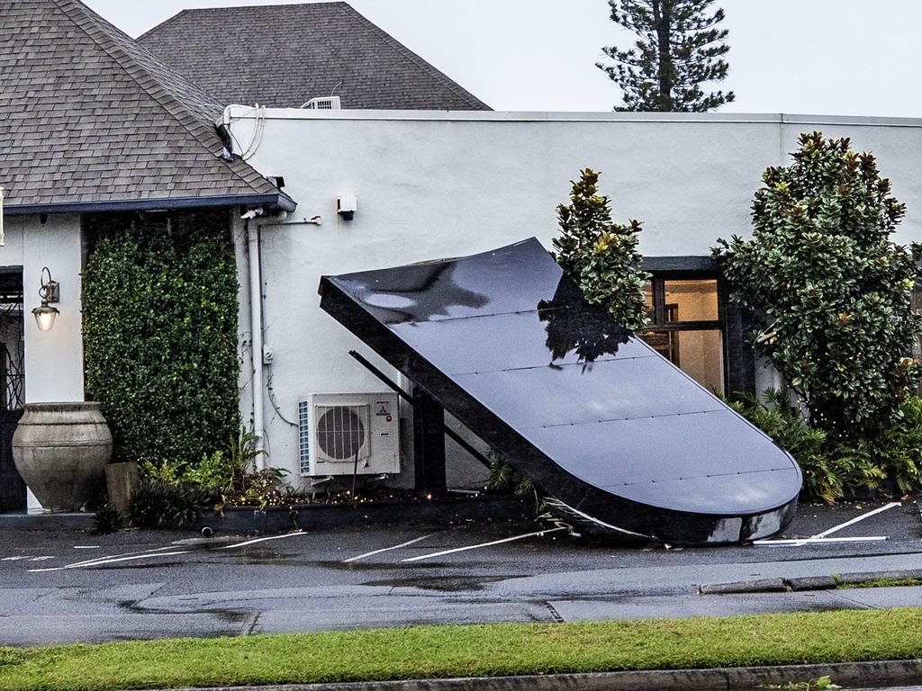
Ex-Tropical Cyclone Alfred has unleashed on Brisbane with Category 1 winds, causing damage and downing trees, with planes unable to land and mass power outages across the region, despite it being downgraded to a tropical low.
Brisbane homes were starting to lose power and planes struggling to land at the airport as the unpredictable Ex-Tropical Cyclone Alfred delivered category 1 cyclonic wind.
Despite Lord Mayor Adrian Schrinner on Saturday morning claiming Brisbane “dodged a bullet” overnight as the weather system weakened, Alfred reintensified by 8pm.
According to the Bureau of Meteorology, wind gusts of 95km/h have been recorded at Redcliffe, 74km/h at Brisbane Airport, 67km/h in the Redlands, 65km/h at Archerfield, and 61km in Brisbane.
According to the Bureau of Meteorology, a category 1 cyclone has a maximum mean wind speed between 63–88km/h.
“We’re kind getting some pretty strong, gusty winds out there,” BOM senior meteorologist Dean Narramore said.
“So we’re seeing Redcliffe gusts to 100km/h, our obvs out in Moreton Bay are gusting around 90km/h, Brisbane Airport 74km/h, Archerfield 70km/h, Brisbane City 60km/h, Amberley 60km/h as well.
“We’re definitely seeing that 60-80km/h winds, particularly around the bayside and northern suburbs.
“The tropical low is starting to get a little bit of a wobble towards Bribie Island, it might be starting to slowly move west after being stalled for about 12 to 15 hours.
“The tropical low, ex-Tropical Cyclone Alfred has still got some pretty strong winds around its southern western flank.”
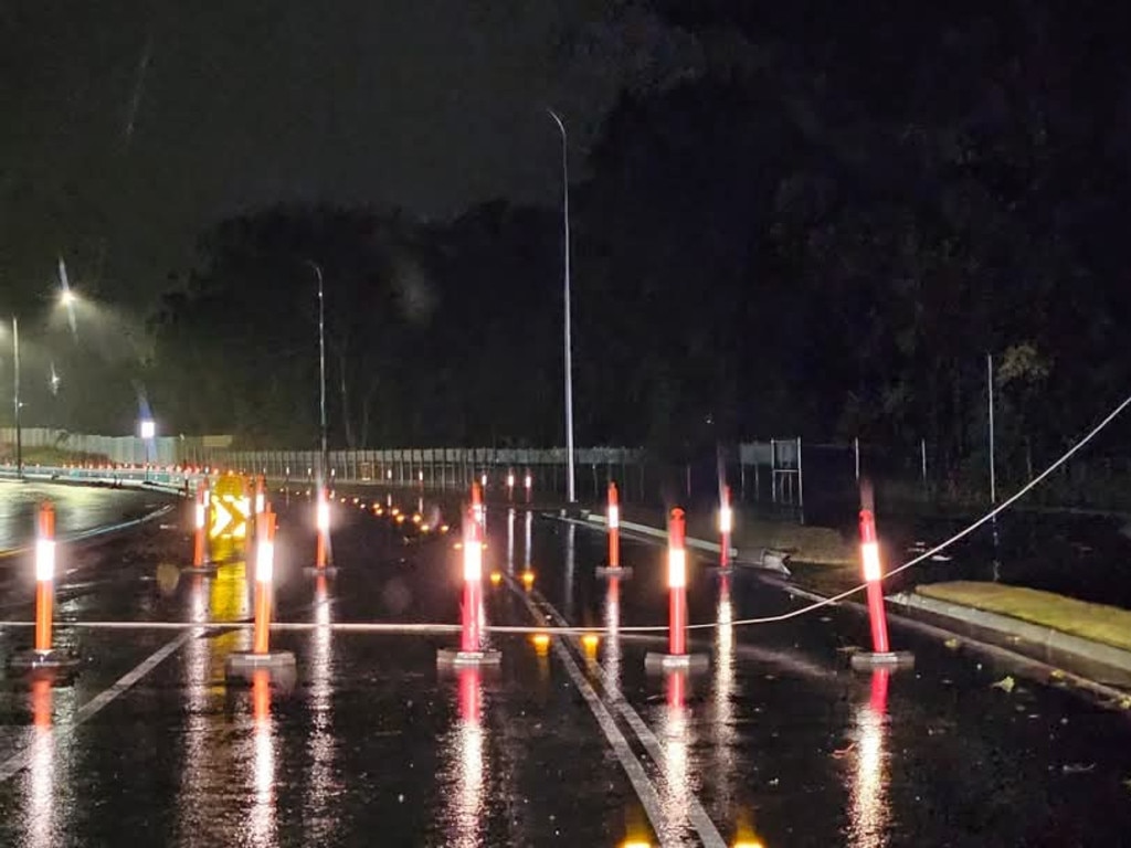
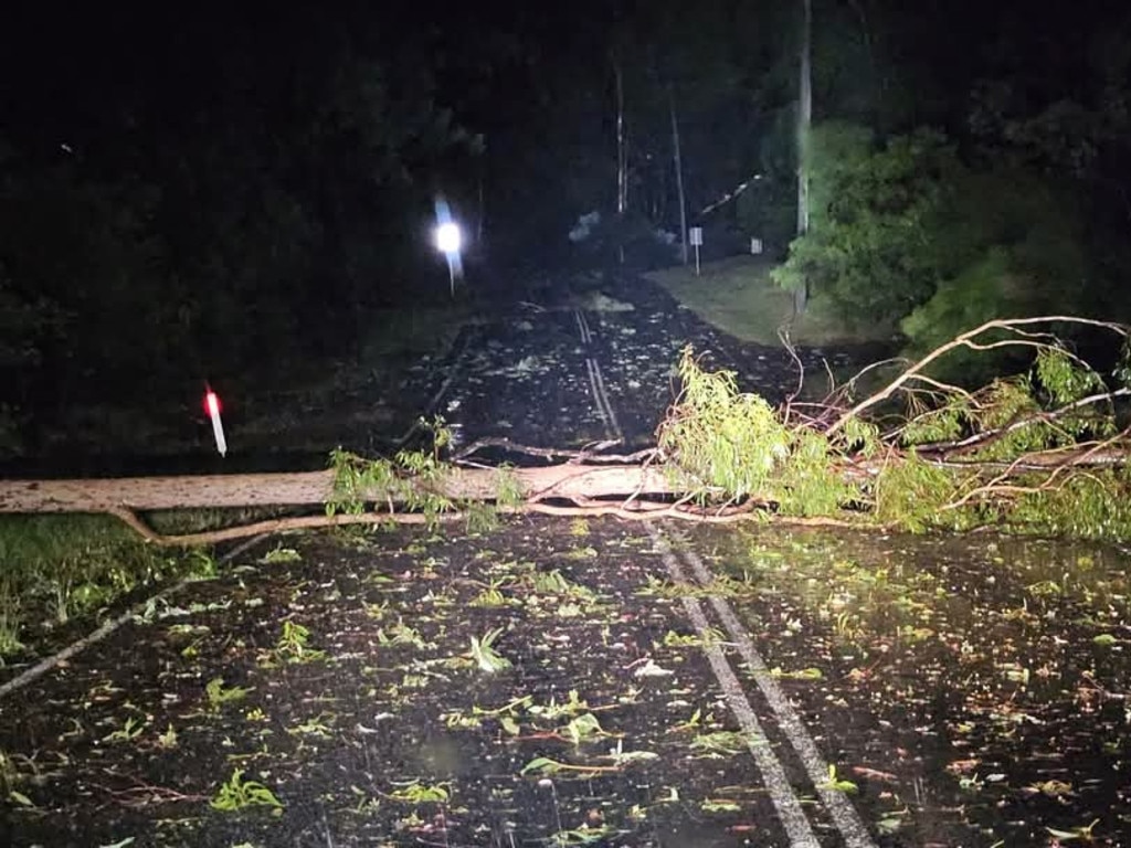
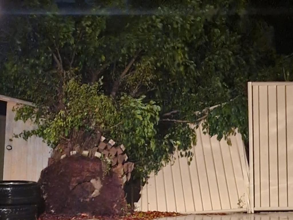
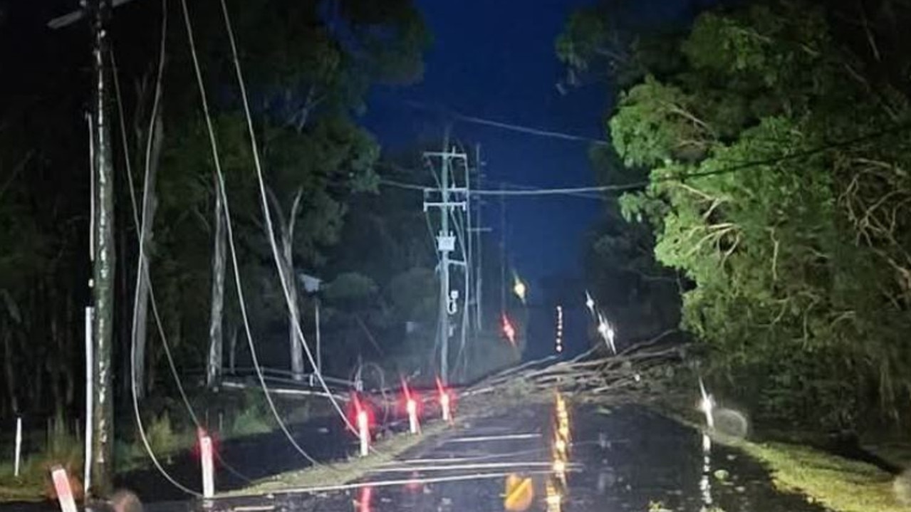
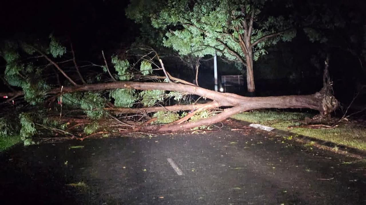
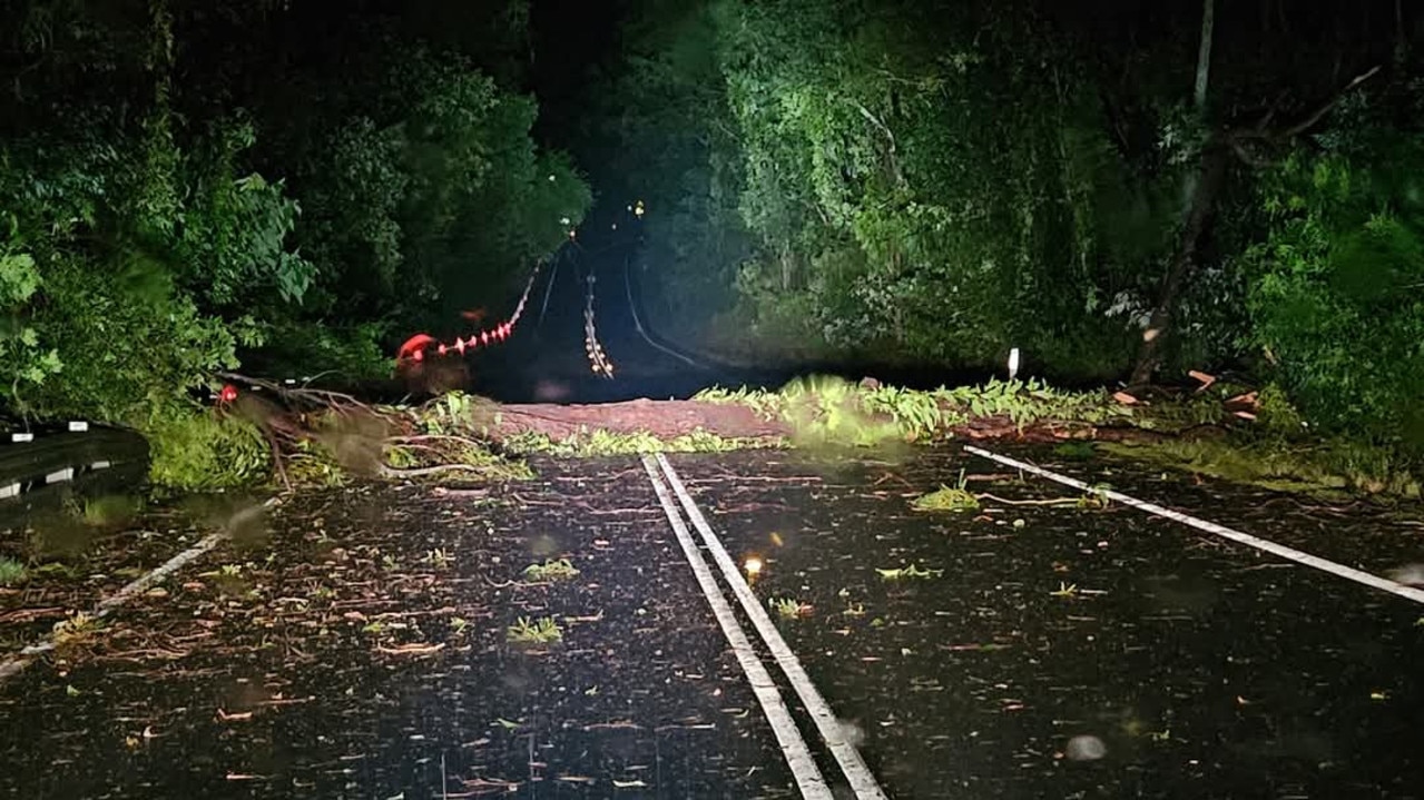
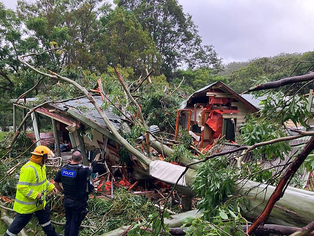
A fallen tree closed the southbound lanes of the Bruce Highway at Bald Hills near the Gympie Arterial Road, about midnight on Saturday.
Queensland Police Service said traffic was being diverted onto the Gateway Motorway.
Residents in the city of Moreton Bay, home to half a million people, were issued a severe weather alert around 8.45pm asking them to stay indoors.
“Dangerous winds are impacting parts of City of Moreton Bay now, especially around Redcliffe Peninsula. People should move or stay indoors now to be safe,” the alert read.
“Conditions could be very dangerous. Damaging winds have created multiple hazards in areas around homes and roads.”
Mr Narramore added that the tropical low hasn’t crossed the mainland coast yet and will do so in the coming hours.
“Alfred made landfall over the islands, but hasn’t actually crossed the mainland coast,” he said.
“We’re starting to see it slowly track back towards the west, so that tropical low is probably going to start moving over land in the coming hours.”
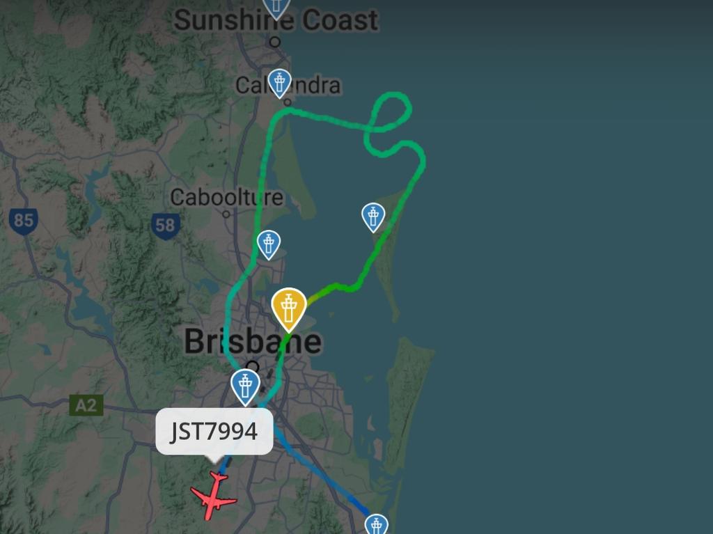
Planes attempting to land at Brisbane Airport on Saturday night appeared to be struggling to navigate the strong gusts. A Jetstar flight travelling from Sydney to Brisbane was forced to loop around off the coast of Caloundra before coming to the airport from the east coast.

The plane appeared to be heading out west after being unable to land at Brisbane Airport.
A Qantas flight from Perth to Brisbane was forced to make a drastic turn as it approached the coast and now appears to be heading towards Sydney Airport.
Several flights were showing as cancelled on the Brisbane Airport website.
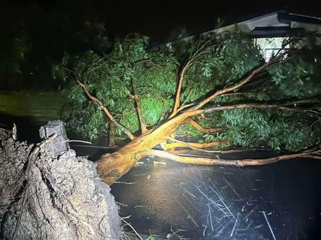
Emergency services were called to the scene at the Anzac Avenue off ramp after severe weather brought a tree down on a car with someone inside.
Paramedics arrived on scene and assessed one person’s injuries.
A Queensland Ambulance Service spokesman said the patient was in a stable condition, but he did not know if they would be taken to hospital.
He also could not say for sure if there were any other people in the car when the tree struck it.
“Dangerous winds are impacting parts of City of Moreton Bay now, especially around Redcliffe Peninsula. People should move or stay indoors now to be safe,” the alert read.
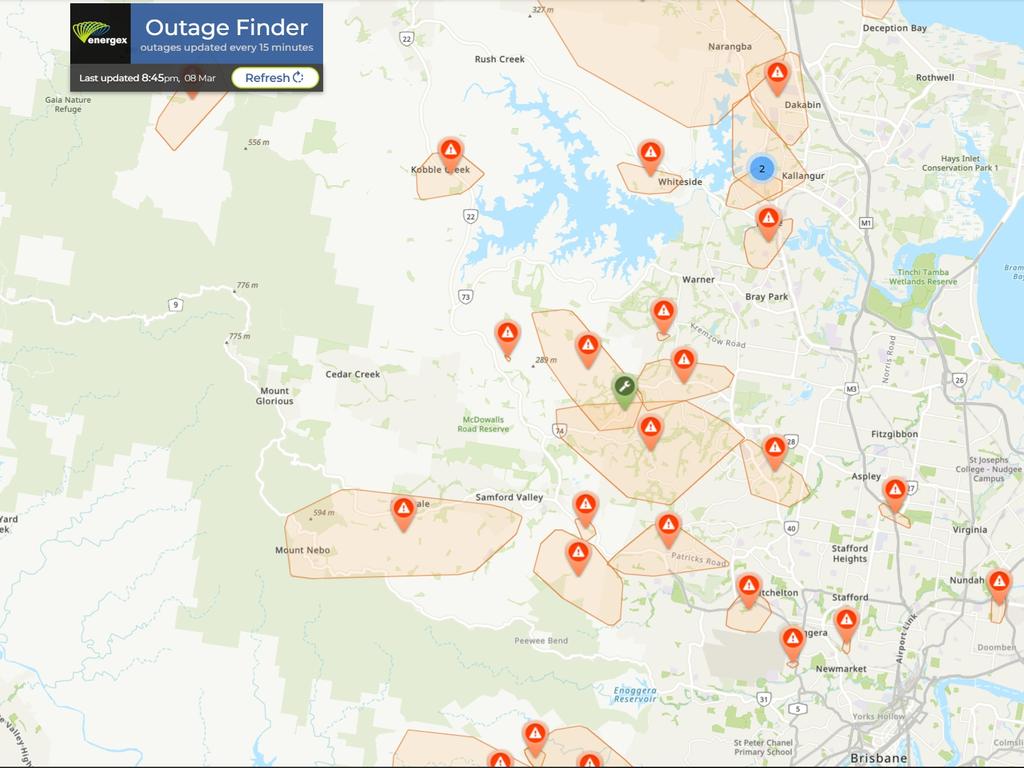
Speaking earlier on Saturday, Premier David Crisafulli said the 330,000 homes without power at the time was “the largest loss of power from a natural disaster in Queensland’s history”.
“It’s bigger than (Cyclone) Yasi, bigger than Debbie, bigger than Oswald,” he said.
“So it shows you the scale of the destruction, because of that populated area.”
He said about 70,000 connections had been restored since Thursday night.
“It’s a big challenge, we are throwing everything at it because we understand how important that is for Queenslanders,” Mr Crisafulli said.
WATCH PREMIER DAVID CRISAFULLI’S LATEST UPDATE BELOW
#LIVE: I’m delivering an update on Ex-Tropical Cyclone Alfred https://t.co/KPRXB0WEMQ
— David Crisafulli (@DavidCrisafulli) March 8, 2025
Power to the Gold Coast University Hospital has been restored, he said.
He said there were 850 fire and rescue crews on the ground, in almost 300 trucks, removing fallen trees and debris.
He said there was about 100 Australian Defence Force personnel helping in 30 trucks, including at Mount Tamborine.
The SES had 1000 callouts on Saturday, a third of the calls for structural damage and a third for trees.
Mr Crisafulli said there were areas in the state still without telecommunications connections.
He added there were 2000 health staff who stayed overnight in hospitals to make sure they stayed open.

“Two thousand Queenslanders who spent the night away from their loved ones, at a time when staying at home would have been far and away the option they would have chosen.
“And instead they chose you - they chose Queenslanders.
“Thank you to every single one of you, it means a great deal.”
Mr Crisafulli said the government had been working with supermarkets and some had already opened on Saturday.
“Many more will re-open tomorrow,” he said.
From Sunday in Brisbane, Moreton Bay (other than Bribie Island), Ipswich, Toowoomba and Sunshine Coast the normal timetable will operate for buses.
In Logan and Caboolture there will be partial services. There will be no services on the Gold Coast.
Rail services will not resume on Sunday.
The Moreton Bay ferry service will have limited services.
Mr Crisafulli said 50 traffic lights had been restored on on Saturday.
He said about half of the traffic lights on the Gold Coast remain offline.
He said about 16 per cent in Brisbane remained offline and three per cent on the Sunshine Coast.
Mr Crisafulli said airports would open on Sunday.
He said the government had started assessments of schools in the southeast and the public would be updated about schools on Sunday.
He said the government intended to open as many schools as possible on Monday.
“It’s been a big effort. There’s a lot more work to be done,” Mr Crisafulli said.
“And I know there is a whole heap of Queenslanders tonight who are yearning for power to come back on; yearning for their phone to be able to work again; yearning to be able to be able to drive those roads without impediments.
“They need to know we share the same goals as them.”
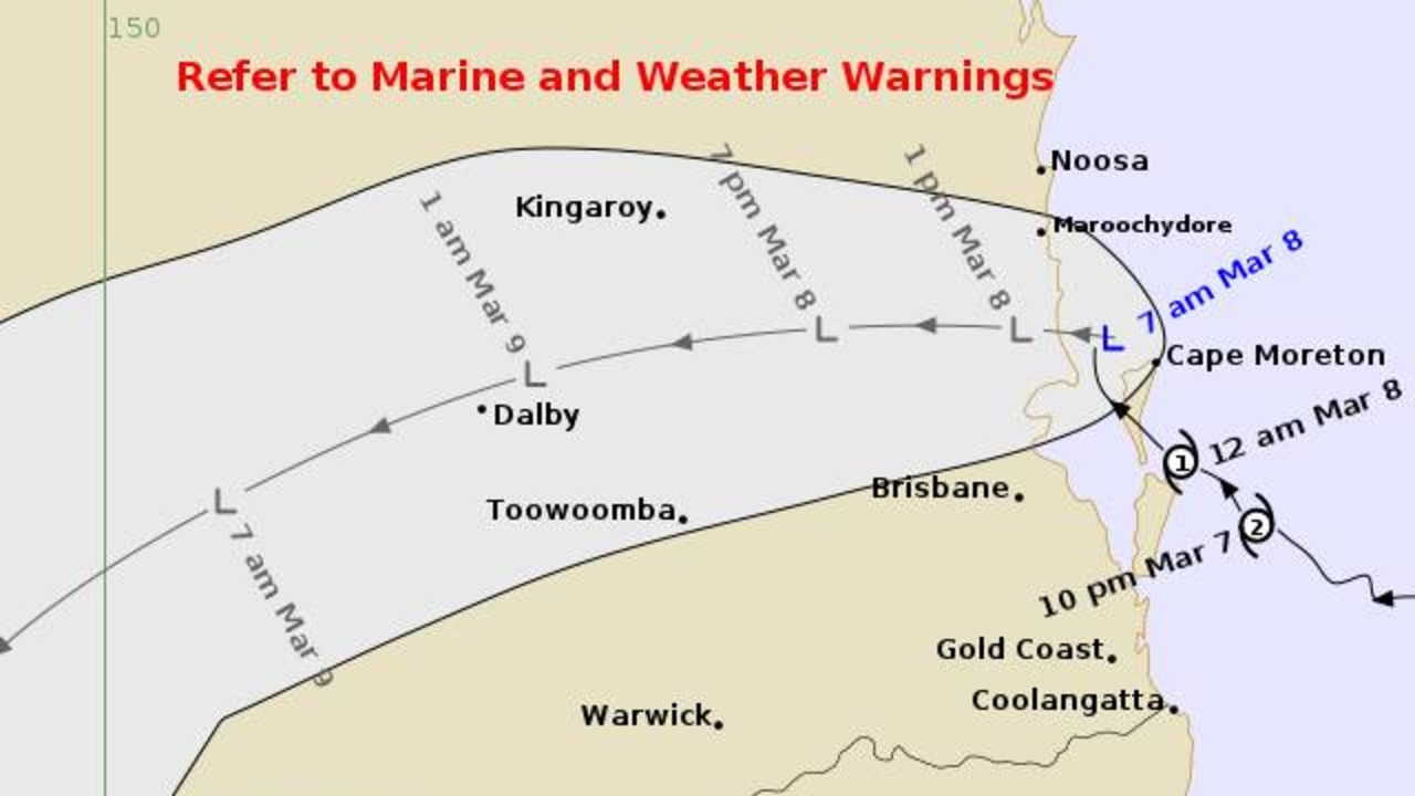
Matt Collopy from the Bureau of Meteorology said at 5pm Ex Tropical Cyclone Alfred remained near Bribie Island and would cross the coastline in the coming hours.
“It is currently slow moving, but is expected to move inland during the evening, to be near Dalby by midnight, and then continue south west to be near Goondiwindi by later Sunday,” Mr Collopy said.
“Storm surge and wind risks have eased, although we are still seeing gusty wind conditions, about exposed locations.
“The real threat now is from that locally heavy to intense rainfall, which may lead to flash and riverine flooding.”
While the wind risk has largely subsided, Mr Collopy said wind gusts have been observed in recent hours.
“Locations from Moreton Island right through the Gold Coast continue to see those wind gusts, we’ve seen observations of around 80 to 95 km/h over the past few hours.”
Mr Collopy said high rainfall totals have already been recorded across southeast Queensland, with possible falls between 300 to 500mm possible in coming days.
“We have already seen rainfall totals as high as 280mm to 9am this morning, and since 9am we’ve seen falls of between 40 and 70mm across southeast Queensland, including Brisbane,” he said.
“We’re expecting widespread totals of 300 to 500 mm and event totals of up to 700mm are possible through to Monday.
“As the system tracks west, localized falls of 100 to 200mm are possible during six hour periods, and these may lead to life-threatening flash flooding.”
Mr Collopy said while some severe weather risks have eased, the concern now is for “heavy to intense rainfall”.
Queensland Police Service Acting Commissioner Shane Chelepy said there has not been any loss of life or missing persons as a result of Ex-Tropical Cyclone Alfred, as emergency service personnel respond to call outs across southeast Queensland.
“We’ve seen police respond to 167 calls for service (on Saturday) alone, Queensland Fire Department 270 calls for service, and we’ve seen Marine Rescue Queensland respond to six jobs,” he said.
Act. Comm Chelepy said focus will now turn to ensuring communication lines and power are back up and running, while emergency services will continue to door knock in significantly impacted areas.
Act. Comm Chelepy urged Queensland residents to heed the advice of authorities and not to drive through floodwaters.
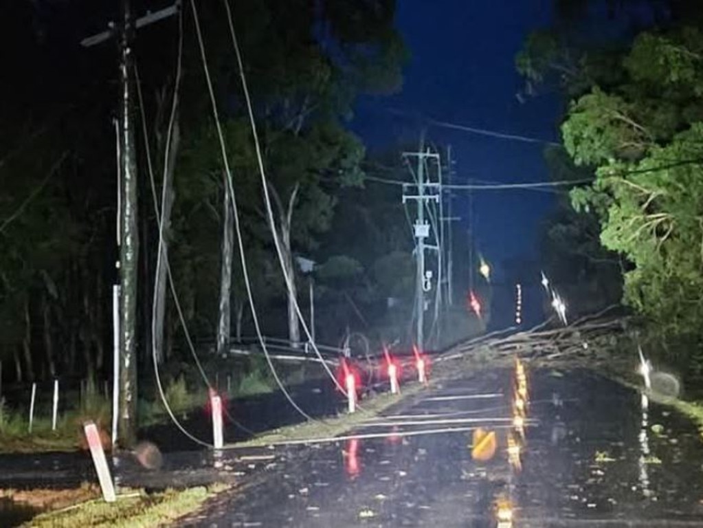
Energex chief executive Peter Scott said 60,000 people have been reconnected to power following significant power outages across southeast Queensland, while more than 1000 power lines have been downed across the region.
“There’s been in excess of 1000 live lines on the ground that we’ve had to deal with,” he said.
“So please be careful, but don’t assume that they’re turned off.”
Flood warnings
A flood warning was issued for the Brisbane River downstream of Wivenhoe Dam, with minor flooding expected with the high tide on Monday and Tuesday mornings.
Flood warnings have also been issued for the Logan and Albert Rivers, Bremer River and Warrill Creek, as well as the Nerang and Coomera rivers.
Moderate flood warnings are currently active for the Lockyer and Laidley creeks, as well as an initial flood warning for the Maroochy and Noosa rivers.
’Brisbane dodged a bullet’
Lord Mayor Adrian Schrinner says Brisbane has “dodged a bullet” – and it could be down to the presence of three islands just off the coast.
Tropical Cyclone Alfred has been downgraded to a tropical low but millions remain in the firing line for life-threatening flash flooding over coming days with authorities warning the danger is far from over.
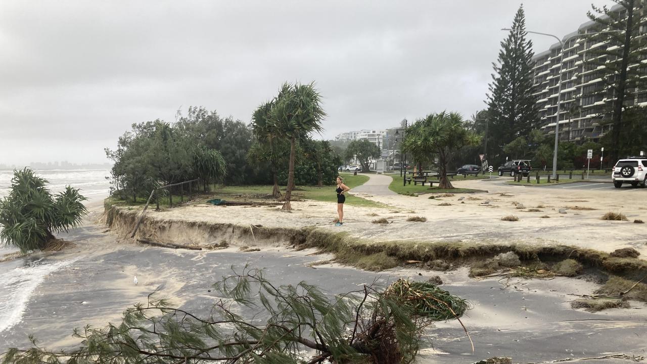
However, Brisbane was spared the worst of Alfred’s impact compared with the Gold Coast and northern NSW.
Alfred is yet to hit the coast, still stalling up near Bribie Island. It is expected to move west and cross the mainland coast between Maroochydore and Caboolture later today.
The Bureau of Meteorlogy has explained that as Alfred approached the city overnight, it interreacted with North Stradbroke, Moreton and Bribie Islands and began weakening.
“Wind gusts eased, and as a result, the system dropped below cyclone intensity,” a Bureau spokesman said.
Warnings are still in place for heavy rainfall across South East Queensland and northeast New South Wales across the weekend, possibly into next week.
Totals in excess of 800mm are possible, the Bureau’s Matt Collopy said.
“As the remnants of Tropical Cyclone Alfred move inland, we’ll see more tropical moisture streaming across South East Queensland, and we are expecting widespread totals of 300-500mm, with localised amounts of 800mm-plus possible in some areas,” Mr Collopy said.
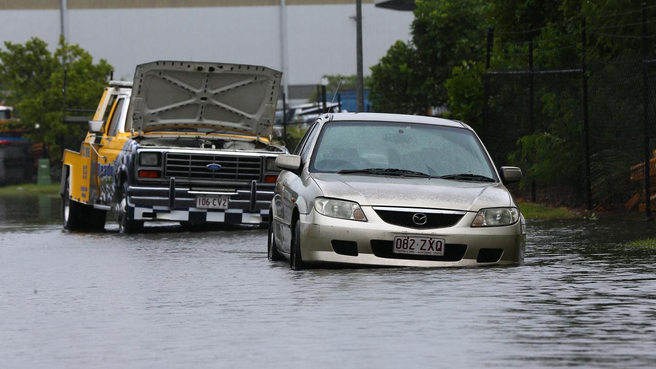
“In terms of the flooding, that heavy to intense rainfall is expected to produce the risk of dangerous and life threatening flash flooding and widespread minor to major riverine flooding across much of the south east.”
There were 295,000 homes without power as of midday on Saturday.
Gold Coast had more than 134,000 outages, Redland City had 48,000, Brisbane 48,000, Logan 46,000, Moreton Bay Regional Council area 10,500, Scenic Rim 5700 and Ipswich had 1100 homes without power.
Premier David Crisafulli said the risk over the next few days was rainfall leading to widespread flooding.
“The challenge is now,” he said.
“Flash flooding, creek rising – they remain a real prospect. We have to be ready for that prospect.
“I ask Queenslanders to remain vigilant.”
Mr Crisafulli said the work to reconnect power was significant, but there were 1200 Energex staff ready to respond.
He said there was a race against the clock to get everything back up and running.
Regarding schools and public transport, Mr Crisafulli said people would be updated every day for the following day.
“We plan to give people the opportunity to plan ahead … we will update Queenslanders tomorrow regarding the plans for schools,” he said.
“A decision for Monday will be made on Sunday.”
When asked if Queenslanders dodged a bullet, Mr Crisafulli said “you just can’t underestimate how much an experience like this tests people”.
“There’s always the unknown, and the fact that people decided to do the right things and put those preparations in place means that they are well prepared for the next phase, and the next challenge will be, will be heavy rain and flooding that comes with that.”
Mr Crisafulli said he did not seek to “dictate orders to people” when questioned whether residents could leave their homes.
“We’ve given the advice, and people have responded accordingly.
.
Bureau of Meteorology forecaster Daniel Hayes said the tropical low hadn’t crossed the coast despite crossing the islands overnight.
“It’s been sitting in that area just off Bribie for pretty much the whole morning and now into the afternoon,” he said.
“We are looking for it to start moving to the west, and as it does that’s when we’re likely to see heavier rainfall moving.
“Because at the moment, if you look at the radar, we do have quite a significant amount of rainfall out there. It is just sitting just off the coast at the moment.”
He said Mount Glorious and Samford had seen falls of 30-40mm but that would pick up through the afternoon and into the evening.
He said in the next 12 hours or so the rain would pick up in Brisbane up to Sunshine Coast towards but not into the Gold Coast area.
“And then, as we see it continue to shift further west, we’ll see it extend a little bit further towards Gympie, towards Ipswich, those areas, and ultimately seeing rainfall extend to places like Toowoomba or Warwick tomorrow as well,” he said.
“So we will see it become a little more widespread as it starts to shift westwards, heavy to intense rainfall is more likely this afternoon through the eastern extent of that severe weather warning.”
Overnight there was an apartment complex in Labrador on the Gold Coast that was damaged and 21 people were safely evacuated.
Queensland Police Service Acting Commissioner Shane Chelepy said there were no loss of lives,” he said
He said there were no significant reports of damage to houses or infrastructure on Stradbroke or Moreton islands.
“The SES received 77 jobs overnight, 45 on the Gold Coast, and the majority of these requests were for storm damage and structural damage, leaky roofs, tarping and assisting the community with their residents,” he said.
“We do see a large number of traffic lights out this morning as a result of power so if you are travelling on the roadways today, please be careful while you are moving about.
“What I’m really concerned about today, and the emergency services are concerned about today, is that this could cause rapid flash flooding, which could catch our motorists unaware if they are moving about.
“This flash flooding could pose a significant risk to life today, particularly if you drive into flood waters, or play in those flood waters, if you’re moving about the roads, please have a plan.”
Following a briefing from the national emergency management agency in Canberra, Prime Minister Anthony Albanese said those in the firing line of ex-tropical Cyclone Alfred were “well prepared.”
“Right now, very clearly, we need to stick together and continue to look after each other.
“The impacts are already being felt, and there is worse to come in the hours ahead, we must remain vigilant.
The Prime Minister warned while the system had been downgraded, “very serious risks remain”.
“It is important that people do not take this downgrading as a reason for complacency.”
Torrential rain has smashed parts of Brisbane, while the Gold Coast has been hit by dangerous flash flooding overnight.
City of Gold Coast has issued a “too dangerous to leave” alert for Tallebudgera residents with “unpredictable flooding occurring near Tallebudgera Creek. Southern Coast residents are also advised to monitor conditions for flooding in the Currumbin catchment.
Earlier, it produced sustained winds of 55km/h near its centre, and 85km/h wind gusts.
“Gales are no longer occurring over coastal or island locations. It is expected to move towards and cross the mainland coast this morning, with winds weakening further as it moves inland,” the Bureau of Meteorology advises.
“Despite its weakening, heavy rainfall is likely to continue over South East Queensland and northeast New South Wales during the weekend.”
Alfred passed over Moreton Island at 1am.
Energex’s Danny Donaldson said at least 1000 power lines were down.
Seqwater has revoked its notice for Mount Cotton, Alexandra Circuit and Alexandra Hills residents to conserve water.
“Seqwater would like to thank the Redlands community for their support while we returned the asset to service,” a spokeswoman said.
The Bureau’s Dean Narramore said despite Alfred weakening into a low, the south east could still expect heavy, widespread rain.
He said overnight, there were widespread falls across the Gold Coast, with Upper and Lower Springbrook recording the highest totals of 245mm and 224mm.
The Gold Coast recorded the highest wind gusts with 109km/h at the Gold Coast Seaway, while there were 93km/h gusts at Brisbane Airport.
“We have major flooding on the Bremer River, Warrill Creek and the Logan River,” Mr Narramore said.
“We’re expecting widespread rainfall to continue near or south of tropical cyclone, or ex-tropical cyclone Alfred, as it crosses in the coming hours and continues tracking into the Darling Downs.

Conditions are not expected to ease until late Sunday or potentially into early next week.
As of 5am on Saturday wind gusts of 69km/h were recorded at Coolangatta with sustained winds of 48km/h.
The Gold Coast Seaway also recorded gusts of 69km/h and sustained winds of 52km/h.
Winds in Redcliffe were also picking up with gusts of 63km/h and sustained winds of 54km/h, with the North West 10 Beacon in Moreton Bay recording gusts of 70km/h.
Brisbane Airport remained calmer with gusts of only 39km/h, whereas Cape Byron in NSW continued to see strong gusts of 85km/h and sustained winds of 59km/h.
Brisbane City Council issued a warning to all residents to stay indoors at midnight Friday.
“Go to the strongest, safest part of the building you are in,” the statement said.
“This will be away from big windows. It could be a bathroom, walk-in wardrobe, or hallway. Stay there.”
The update comes after the Gold Coast was hammered by cyclonic winds and torrential rain as Alfred unleashed fury on Southeast Queensland Friday night.
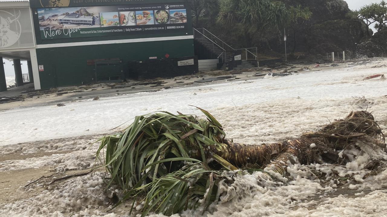
Residents were ordered to take shelter immediately via a Gold Coast City Council emergency alert just before 4pm Friday which warned of impending heavy rain, wild winds and flash flooding.
Gusts of up to 107km/h were recorded at the Gold Coast Seaway just north of Main Beach on top of sustained speeds of up to 70km/h.
At Coolangatta, the winds were sustained at 54km/h with a peak of 100km/h.
Point Lookout on North Stradbroke Island had wind speeds between 50-60km/h.
At Cape Byron in northern NSW, the sustained winds were 76km/h with gusts of 98km/h.
Brisbane’s airport had a gust of 67km/h, but the winds there remained lighter at 44km/h.
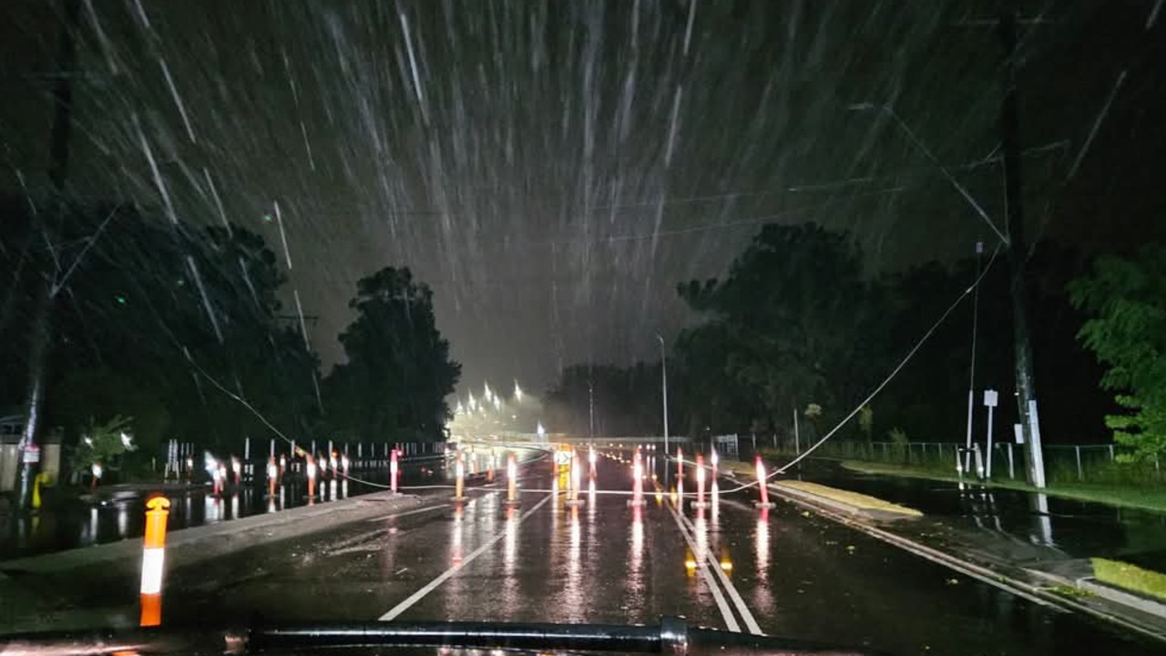
The intermittent showers from earlier in the day had also made way for unrelenting sideways rain.
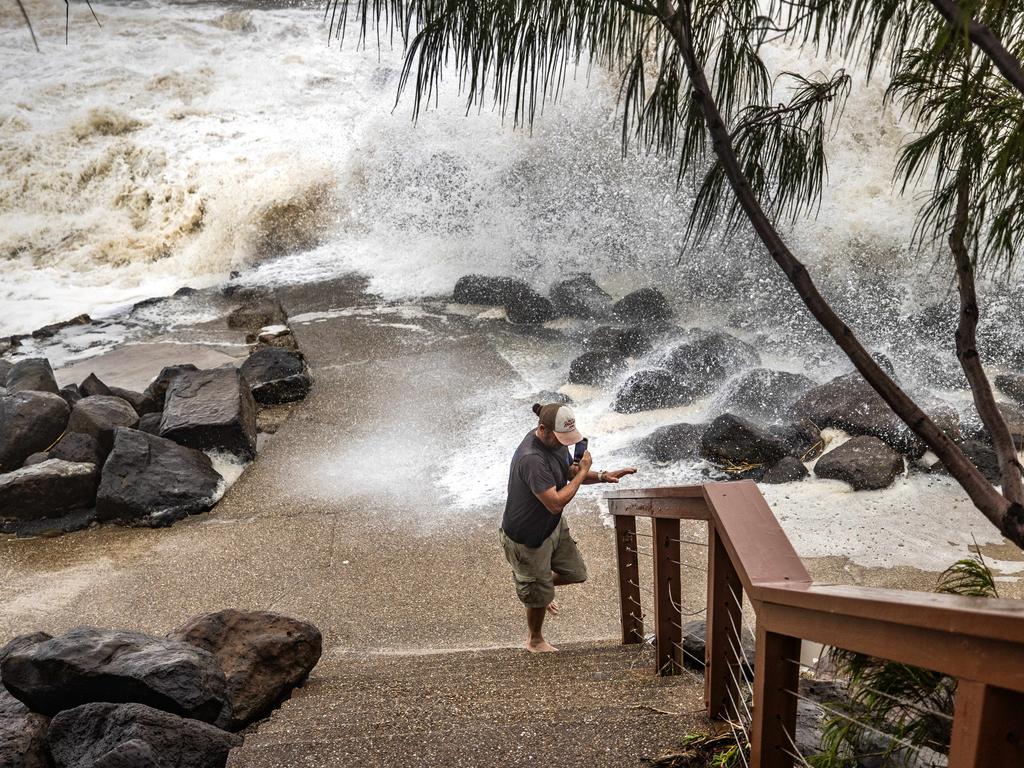
An emergency alert for dangerous flash flooding was issued for Currumbin Valley and Tallebudgera Creek – with residents told it was too late to leave and they must get to higher ground where they are.
The dangerous flash flooding is impacting Currumbin Creek with Currumbin Creek Rd cut by floodwaters in several sections.
An emergency warning for Moreton Bay residents was issued at 9.45pm Friday, advising residents to take shelter from Cyclone Alfred and to remain indoors until conditions had eased.
Mayor Peter Flannery said while the system had been downgraded, the danger had not yet passed.
“Public and staff safety is the focus, and people should still stay inside and not go out until it is safe,” he said.
“There does remain a real risk of flooding, so this situation is not over, and I know we will be able to support people with the excellent planning already in place.”
Gold Coast residents were warned to bunker down for up to 36 hours from Friday afternoon.
Southeast Queenslanders had been warned they could be without power for up to a week with 800mm of rain, widespread flooding, and destructive winds possible.
In northern New South Wales a frantic search was underway late yesterday for a man missing in floodwaters.
Premier David Crisafulli said the state should prepare for “significant rainfall”.
“We are expecting some significant rainfall in the next 24 to 48 hours right across that system,” Mr Crisafulli said.
“This system remains a very broad one … it is really large and slow-moving and that does present the prospect of significant rainfall over a period of time.”
Bureau of Meteorology senior meteorologist Matt Collopy said the heavy rain meant an increased concern of flooding, with major flood warnings in place for the Logan and Albert Rivers.
“We are particularly concerned about the flood risk and that risk extends beyond the cyclone crossing,” Mr Collopy said.
He said the movement of TC Alfred continued to be “erratic”.
Mr Collopy said SEQ could see widespread daily rainfall totals between 300mm and 500mm.
Wind gusts of 115km/h were recorded from Moreton Island to Cape Byron, with winds speeds expected to increase.
When asked if ex-tropical cyclone Alfred constitutes a cyclone hitting the south east despite not making it to the mainland, Mr Collopy said the Bureau’s focus was on “the impacts of the system”.
“It certainly crossed the bay islands as a category one system, and then you know the impacts we saw across the Gold Coast and indeed in Brisbane, and the flooding we’re expecting over the coming days, all those impacts obviously affected us and occurred.
“The exact coastal crossing times and those features will be analysed in good time,” he said.
Acting Commissioner Shane Chelepy said there had been 11 search and rescues for swimmers, kayakers and jet skiers in dangerous conditions.
“Now is not the time to be in the surf, all you’re doing is putting emergency services at risk, and yourself at risk,” Mr Chelepy said.
Queensland Fire Department Commissioner Steve Smith said the department had already responded to 60 incidents with “no water rescues or evacuations currently required”.
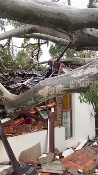
“However we have had a rescue this morning in the Currumbin Valley where QFD firefighters responded to two people trapped in a bedroom after a large tree collapsed on a house,” he said.
“Firefighters used saws to rescue those two people.”
Mr Smith said the occupants of the home sustained minor injuries.
He said 180 swift water rescue firefighters remained on standby as he urged the community to not be “complacent”.
Mr Smith said about 300 additional firefighters had been engaged including on the state’s “island communities”, namely Bribie Island and Stradbroke Island.
“Please never drive, walk or play in flood water,” he said.
Queensland Ambulance Service paramedics also helped deliver a set of twins at Dunwich on North Stradbroke Island overnight into Friday.
Mr Chelepy said emergency services were now preparing for flash flooding and heavy riverine flooding which was expected to impact roads later on Friday.
Meanwhile, Queensland parliament has already been cancelled for Tuesday with politicians to return at 9:30am on Wednesday and will make up for the lost day by sitting an extra day.
“The safety of members and staff remains foremost in our minds and we appreciate that some members will be concentrating on recovery in their roles and their communities,” he said.
State Emergency Service chief officer Mark Armstrong said in the 24 hours to 11am on Friday there had been more than 1300 requests for SES assistance.
The SES received a further 307 jobs while the QPS had received 76 jobs by the afternoon.
The SES had distributed more than one million sandbags to local governments, with more in reserve if needed.
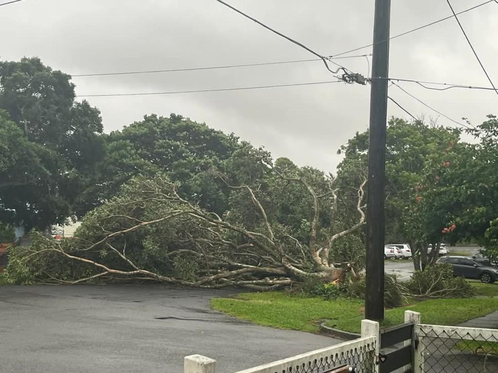
He said the SES worked with Queensland Ambulance Service on Friday morning where a large 20m tree had fallen on a house which injured an elderly resident.
Originally published as Cyclone Alfred makes landfall in SEQ: Live updates and information

The Qld seats and candidates to watch this federal election
After David Crisafulli ended Labor’s nine-year grip on power at the state level, the LNP hopes to increase its already huge presence in Queensland at federal level on May 3.
Read more

Anzac Day trading: What’s open, closed in Brisbane
Whether you are heading to a Dawn Service, needing a bus to get to the local parade, or need some extra supplies on Friday, we have tracked down what is open on Anzac Day.
Read more

Where to attend Anzac Day Dawn Services in SEQ
Anzac Day is a sacred day when we come together to commemorate and honour those who have served our country, this Friday Dawn Services will be held across the southeast. SEE THE LIST
Read more