Cyclone Jasper’s ‘moderate chance’ of storming Darwin, Top End
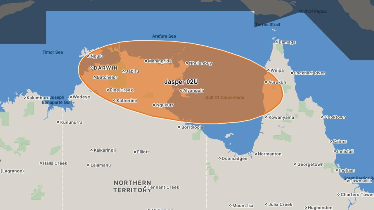
The Bureau of Meteorology’s seven-day forecast reveals Cyclone Jasper’s potentially stormy pathway across the Top End to Darwin.

Storms and wet weather are set to track across the Top End from Friday, with moderate chances of a cyclone over the weekend.
The Bureau of Meteorology’s seven-day cyclone forecast map predicts Cyclone Jasper will make landfall in Queensland as a category two storm on Wednesday.
But Territorians’ concerns are on the rise as there is a 25-35 per cent chance Jasper could track across the NT-QLD border on Friday.
Morgan Pumpa from the Bureau of Meteorology said a lot of uncertainty clouded Cyclone Jasper’s potential path through the NT, but storms and showers were in store across the Top End regardless.
“We do have one to 20mm (forecast) for Darwin on Saturday, and on Sunday we’ve got two to 35mm,” she said.
“Throughout the rest of the work week, we do have the chance of some showers.”
Ms Pumpa also said the Bureau expected a below average cyclone season.
“Usually we get around 11, that’s probably the average,” she said.
More Coverage
A Bureau spokesman previously confirmed there was a moderate chance Cyclone Jasper would move into the Gulf of Carpentaria.
“Certainly, there’ll be an increase in rainfall over Northern Australia as Cyclone Jasper approaches,” he said.
The Bureau advised East Arnhem residents to use the Bureau’s new ‘seven-day forecast’ which shows the range of possible locations cyclones may impact.


