Intense heatwave sweeps Australia, temperatures ‘well above average’
Parts of Australia are bracing for another oppressive heatwave, with temperatures expected to reach 16C above the December average.
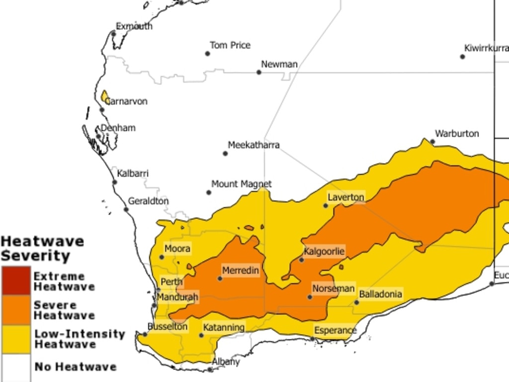
Western Australia is bracing itself for another stiflingly hot day as the heatwave continues to weigh down the state, while Perth recorded its hottest day since February.
Meanwhile, scorching hot conditions are expected to reach the southern, central and eastern states over the next few days and into the weekend, with temperatures soaring 14C to 16C above the December average.
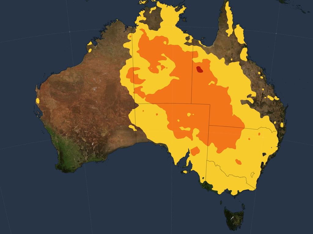
The Bureau of Meteorology has issued a heatwave warning for much of Australia, coming off the back of a suffocatingly hot Wednesday in Western Australia, with the south-easterly region bearing the brunt of the heat.
Perth’s metro area exceeded 40C on Wednesday, marking the city’s warmest day since February – and the heat is going to stick around.
“Today will be another hot day for large parts of Western Australia,” said Bureau of Meteorology senior meteorologist Angus Hines.
While temperatures won’t be as hot as on Wednesday along the coast, Mr Hines warned WA residents of temperatures reaching “well above average”.
The peak of the heat will likely move slightly inlands, reaching the Wheatbelt and Great Southern regions, with temperatures expected to reach the high 30s and low 40s.
While stifling heat impacted the southern regions of the state, thunderstorms ripped through the northern parts, particularly in the Pilbara and Gascoyne regions, mainly inland.
It isn’t just WA that is facing an oppressive heatwave, with the mercury expected to rise across the southerly regions of the country over the coming days.
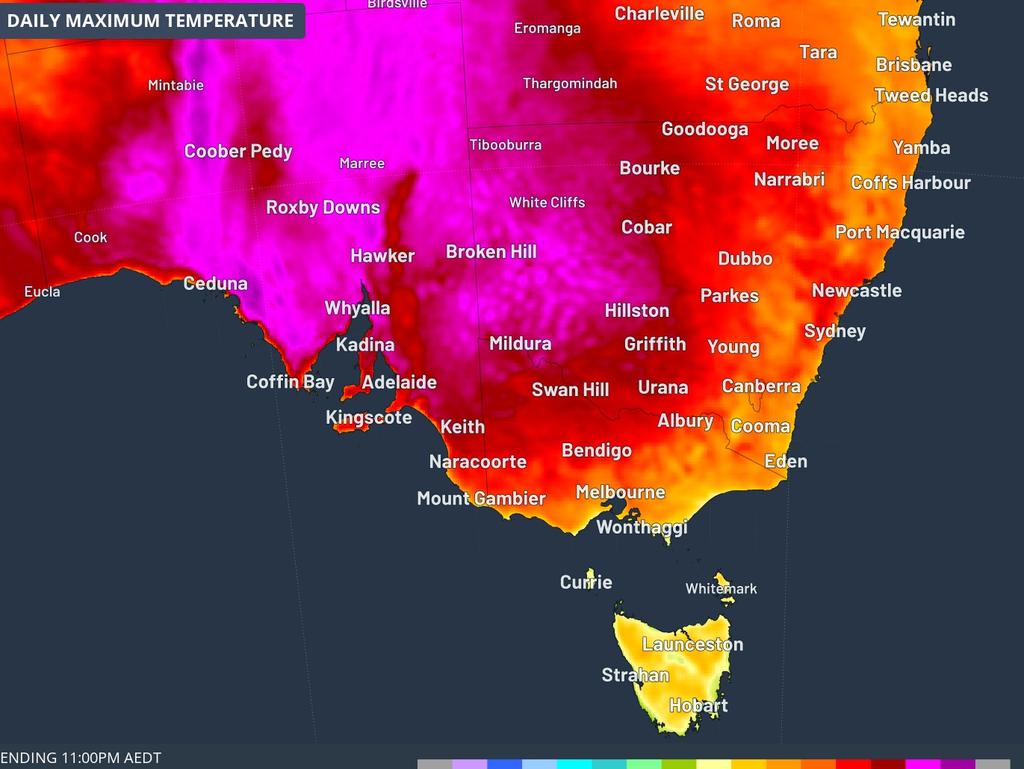
“Intense heat is expected to spike in the southeast of the country from the weekend into next week” said Mr Hines, which includes South Australia, Victoria, Tasmania, NSW and the ACT.
Conditions are expected to warm up over the weekend, before reaching a peak on Sunday and Monday.
“South Australia is forecast to have its hottest day on Sunday, Adelaide trending towards 40C,” said Mr Hines.
Similar temperatures are expected in Victoria, with mercury spiking to 40C in Melbourne on Monday, and hotter conditions anticipated in the other parts of Victoria, reaching the low-to-mid-40s.
It will be just as scorching for residents in some spots in western NSW, with temperatures likely to reach the mid-to-upper-40s on Monday.
Thankfully, a cool change is expected to take hold in the second-half of Monday afternoon, potentially dropping 15C in just half an hour and providing much-needed relief to residents in the southeastern states.
Due to the suffocating heat, widespread high fire danger warnings have been issued for parts of the southeast of the country, including parts of WA, South Australia, Victoria and NSW.
“Residents should keep an eye on any advice from fire services as well as their local forecast,” said Mr Hines.
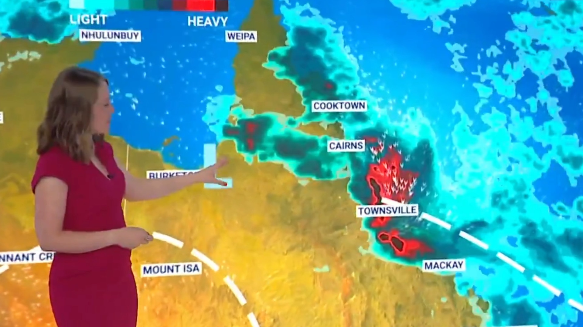
While the oppressive heat takes its hold across the southern and western states, it’s a different story in the north, with thunderstorms and heavy rainfall battering parts of Queensland and the Northern Territory.
While Queensland copped a “drenching” overnight, high humidity will likely continue in large parts of the northern and eastern regions for the rest of the week, causing widespread showers and thunderstorms in the coming days.
Looking ahead, a coastal trough is expected to develop near Mackay on Friday, driving further rainfall around the Central Coast and Townsville Coast.
Overnight, storms impacted the coast of Queensland, with 162mm of rain recorded on the Central Coast near Mackay, which included over 100mm of rainfall in a little over two hours.
The “significant” storms also hit Innisfail, Townsville and Cairns, Mr Hines said.
“Cairns Airport was hit by a severe thunderstorm, which brought an incredible 109mm of rain within an hour,” he continued.
The northern states aren’t in the clear yet, either, with thunderstorms still impacting the state as of early Thursday morning.
Brisbane will be mostly sunny on Thursday,though there is a slight chance of a shower and a top of 30C.
It will also be a sunny day for Sydney resident on Thursday, with light winds in the early afternoon and a maximum temperature of 28C.
Melbourne will face cloudy skies in the morning, clearing to a sunny afternoon and reaching a top of 26C.
There is a slight chance of a shower in the Dandenongs and outer southeast suburbs in the morning, with westerly winds reaching speeds of 20km/h.
Residents in Adelaide will have a sunny day with a top temperature of 27C and winds reaching speeds of 25km/h throughout the day, becoming lighter in the late evening.
The heat is going strong in Perth, which will have a sunny day and a forecast of 35C.
It will be a cloudy day for Hobart, with a medium chance of showers, becoming less likely in the evening and reaching a top of 19C.
Residents in Darwin can anticipate a partly cloudy day with a medium chance of showers in the afternoon and early evening. There is also a chance of thunderstorms as temperatures reach a maximum of 33C.
It will be a bright and sunny day in Canberra, with light winds in the middle of the day and a top of 31C.

