
Cold storm to hit eastern states already suffering from floods
The floods hitting parts of NSW are going nowhere fast, with a cold front to bring even more pain in the coming days.
Major flooding has continued across NSW and Victoria despite a temporary easing of rainfall, with warnings a cold front will bring more pain to residents in the coming days.
Central west NSW is facing particularly bad circumstances, with floodwaters still rising for parts of the state.
The town of Forbes is still in the grips of major flooding, with the river level expected to remain high into the weekend “due to large inflows and releases from Wyangala Dam” according to the Bureau of Meteorology.
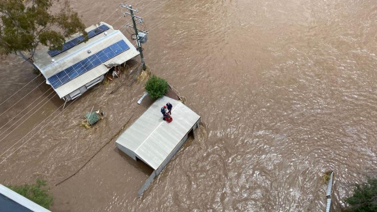
“As of 8am AEDT Thursday, the Lachlan River was at 10.68m with the possibility of reaching 10.80m later today,” the Bureau said.
The river level will stay above the major flooding level of 10.55m on the weekend, with the level at Forbes Iron Bridge to remain at 10.70m on Friday.
Major flooding is also occurring at Condobolin, Nanami, Euabalong, Warren, Hay, Barham, Boundary Bend, Bourke, Brewarrina, Hillston, Jemalong, Mungindi, Walgett and Wee Waa.
Police are also desperately searching for a body which was seen in floodwaters at Eugowra on Monday morning.
An elderly woman spotted the man’s body while being assisted by a police officer, who was unable to leave her to investigate.
The man was described as being in his 20s, of caucasian appearance with a slim build and fair hair.


It comes as police are also searching for 85-year-old Ljubisa “Les” Vugec, who was last seen in his Eugowra home on Monday morning.
The area around the town of Hay, one of the flattest areas in the southern hemisphere, was turned into an “inland sea”.
No high ground here. floods, Hay pic.twitter.com/j6XJQFhwfd
— Suzie Clark (@suzie_clark01) November 15, 2022
“It‘s going to be hanging around for a very long time because it is such a flat area,” Sky News Meteorologist Rob Sharpe said.
“The water crawls through and there‘s more water coming through, courtesy of the floods that we’ve been seeing in and around the Wagga region.”
Though parts of NSW experienced a break from cold and wet weather on Thursday, that isn‘t expected to last long.
Weatherzone meteorologists say a “doozy” of cold weather is on the way for the south of the country.
“Yet another extremely strong cold front is ploughing its way across the Southern Ocean, heading for the southeast of the country on Sunday and Monday,” Weatherzone said.
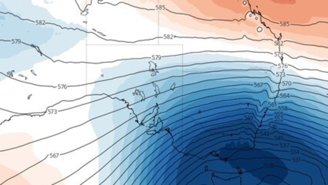
“It would be classed as a strong cold storm in June, July or August, but as November systems go, it is seriously cold.
The BOM has also confirmed a cold front will swing across the country to hit western NSW and Victoria on Saturday.
“Showers and thunderstorms will move through much of southeast Australia on Saturday and Sunday, with most of the rain expected to fall over Victoria and Tasmania,” it said.
“On Monday, colder winds with widespread showers, possible hail and thunder are forecast for southern South Australia, Victoria, Tasmania and southeast NSW.”

Big step to kick off $25 medicines pledge
Labor will begin its first steps to bring down the cost of PBS-listed medicines from $31.60 to just $25. Here’s how it’ll work.

Cops shoot ‘wanted’ Aussie man
An allegedly “wanted” Aussie man has been rushed to hospital after he was shot by police officers.

Man identified after fatal motorsport crash
The motorsports community is in mourning following the death of an experienced racer during a competition.