
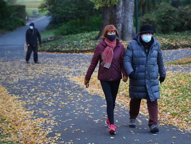
Victoria shivers through freezing morning, frost covers part of state
Frost covered parts of Victoria on Monday as the state shivered through its third freezing morning in a row, but a warm winter is in sight.
Environment
Don't miss out on the headlines from Environment. Followed categories will be added to My News.
Victorians have shivered through their third freezing start in a row, with temperatures dropping to -4.4C in some parts of the state on Monday morning.
It comes as the state is being warned to prepare for a warmer than average winter, with lower rainfall expected throughout the coming months.
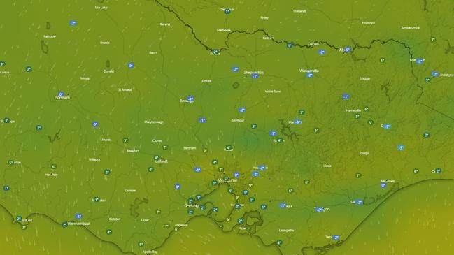
Large parts of the state dropped below 0C on Monday morning, with most of the Wimmera-Mallee, Northern Country and North East forecast districts north of the ranges measuring minimum temperatures of between -1 and -3.
But the Bureau of Meteorology said the rest of the week should be slightly warmer as a trough system moved through later in the week, bringing showers and dropping the snow level in the ranges.
Forecaster Miriam Bradbury said some of the notable temperatures on Monday were -4.4C at Rutherglen, -4.2C at Wangaratta and -2.9C at Horsham.
“It wasn’t just north of the ranges. Throughout the outer-eastern Yarra Valley pushing down into West Gippsland we had very low minimum temperatures,” she said.
“Coldstream got down to -3C and Yarram got down to -4.1C.
“In Melbourne, the outer eastern Yarra region saw the coldest temperatures, but also Avalon got down to -1.3C.”
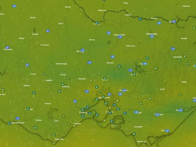
Melbourne city managed to stay “slightly positive” on Monday morning, with the mercury still hovering at 3C at 8am, but it will warm up to 16C throughout the day.
“Once the sun rises, we should hopefully see a similar day to yesterday with beautiful blue skies,” Ms Bradbury said.
“And today was the last of the very cold mornings. The North East will still see negative temperatures overnight, but the remainder of the state will have slightly warmer conditions.
“It will still be cool, just not as freezing cold overnight.”
It comes as the Bureau’s senior climatologist, Lynette Bettio, said the winter climate outlook showed night-time temperatures would be warmer than average for the majority of the country.
Coastal areas, in particular, could experience days warmer than average, and parts of southern Australia could be drier than average.
Dr Bettio said this was consistent with observations from the past 20 years.
“Our climate drivers are currently neutral, meaning we’re not getting El Nino or La Nina bringing particularly dry nor particularly wet conditions to the continent,” she said.
While autumn has been wetter than average for parts of the country, some parts of Victoria missed out on their usual autumn rainfall and could be heading into a dry winter.
A trough will move through the state later this week, with cloud building from the west on Tuesday into Wednesday. Shower activity will pick up on Thursday before it contracts east on Friday.
“It’s not going to be a significant frontal system, there aren’t any high rainfall totals expected, just around 5-10mm,” Ms Bradbury said.
“We will see the snow level dropping later in this week to 1200m … That’s standard this time of year.”
Originally published as Victoria shivers through freezing morning, frost covers part of state
Women injured by lightning amid Anzac deluge
Two women have been injured in separate lightning strikes after one Aussie state was pounded by more than 200mm of rain over Anzac Day.
Read more

Millions facing long weekend washout
Long weekend plans could be under threat across swathes of the country as millions brace for heavy rain and thunderstorms.
Read more