Stunning photos as rare ‘UFO storm’ hits regional Queensland
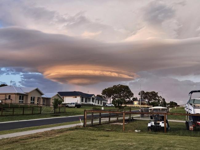
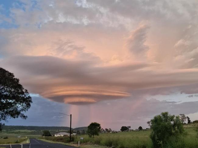
Queenslanders have been left awed by photos of a rare weather phenomenon in the state’s southeast.
Environment
Don't miss out on the headlines from Environment. Followed categories will be added to My News.
Queenslanders have been left awed by photos of a rare weather phenomenon in the state’s southeast.
The images, sent to and subsequently shared by the Higgins Storm Chasing Facebook page, were taken early Thursday morning in the state’s Darling Downs.
“We received several pics of this really cool UFO looking storm this morning,” the group wrote.
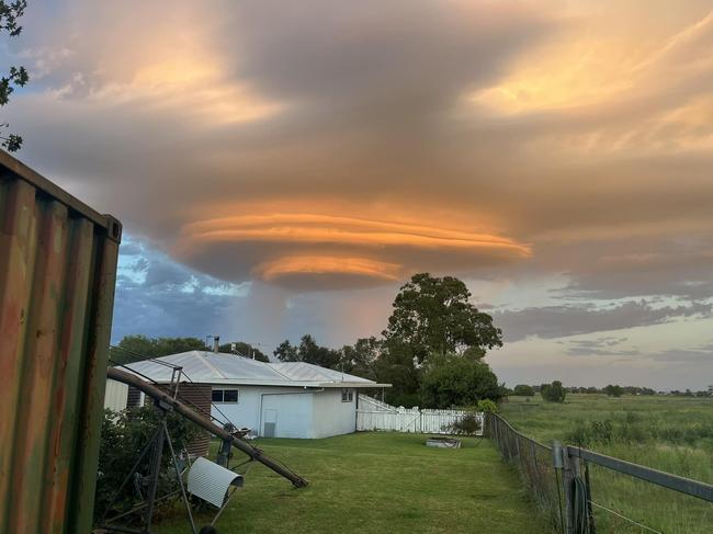
“This is a lenticular storm cloud and it’s not that common to see. It occurred with a hailstorm that was moving across the Darling Downs towards Oakey and north of Toowoomba around sunrise.
“The sunrise helped ignite the eastern side of the storm, turning it pink and orange.”
Followers of the page on Facebook took to the post’s comments section, thanking “nature for providing us with such amazing phenomena”.
“Our sky never fails to be amazing,” another person wrote.
While a third said: “Wow!! Cool and freaky at the same time!!”
According to Higgins Storm Chasing, lenticular clouds are “formed as orographic waves where the air is stable and the winds blow from a similar or same direction at many levels in the atmosphere”.
“As the winds blow across mountainous or sometimes hilly terrain, the air then undulates in a downstream train of waves,” the group explained.
“If there is enough moisture present (which is where the orographic lifting process comes into play) then the unique cloud develops … These clouds are one of the most common explanations for UFO sightings across the entire globe.”
Parts of Queensland, including Brisbane and the Gold Coast, were lashed by rain and severe thunderstorms overnight, with certain areas recording almost 60mm of rain within 30 minutes, The Courier-Mail reported.
The Bureau of Meteorology has issued another severe thunderstorm warning for Thursday for residents in the Southern Downs, South Burnett, Toowoomba and Western Downs areas, with damaging winds, heavy rain and the possibility of large hail stones.
It was a similar situation in NSW, with a deluge battering the state overnight and into Thursday morning.
BOM senior meteorologist Miriam Bradbury said there would be plenty more rainfall on the way heading into the weekend, anticipating up to 20mm in the eastern districts to the east of the ranges.
“Showers will extend from the Queensland border as far south as the Illawarra, with thunderstorms a risk in the state’s northeast, extending as far south as the Hunter,” she told NewsWire.
“Where storms develop locally, higher rainfall totals are possible today.”
Originally published as Stunning photos as rare ‘UFO storm’ hits regional Queensland


