Qld, WA, NT brace for severe thunderstorms as heatwave hits
Millions of Australians are being urged to keep an eye out for changing weather conditions, as severe thunderstorms are likely to develop.

Environment
Don't miss out on the headlines from Environment. Followed categories will be added to My News.
Severe thunderstorm warnings are threatening to hit, as ‘unsettling’ conditions continue to loom over large parts of the country.
As showers continue to develop, Queensland and West Australian residents continue to battle through extreme heatwaves.
A severe heatwave warning remains in place for the Peninsula, Northern Goldfields and Upper Flinders, North Tropical Coast and Tablelands, Herbert and Lower Burdekin, Central Coast and Whitsundays, Central West and North West Districts in Queensland.
In WA, a severe heatwave warning remains in place for Gascoyne, Central West, Lower West, Great Southern and Central Wheat Belt Districts.

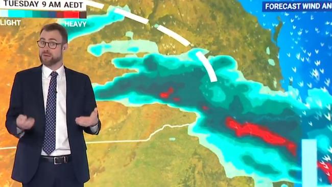
Bureau of Meteorology meteorologist Jonathan How said storm conditions were “quite unsettled right across northern Australia, particularly through eastern and central Queensland” on Tuesday evening.
Mr How said the coming days would see a mix of storms and heatwaves, for different parts of the country.
“It’s a contrasting story of humid and stormy conditions for northern Australia but for southern Australia it’s looking mostly dry,” Mr How said.
“There’s a possibility of severe thunderstorms for northeast NSW.
“This high pressure system in the southern ocean will continue to move towards the east and is it does temperatures will start to rise in the southern and eastern parts of the country.
“But also it is causing this surface trough over Western Australia to strengthen and that’s funnelling heat and humidity down across the west and the south west of the state.”
In WA, the Bureau warns that “hot and unsettled conditions” continue to build over much of the state, including Perth.
“Low to severe intensity heatwave conditions will impact much of the south and southwest of the state,” the Bureau said.
A high fire danger is also forecast.
Showers and thunderstorms continue to impact north-east #NSW and large parts of #Queensland.
— Bureau of Meteorology, Australia (@BOM_au) December 10, 2024
On Tuesday, #thunderstorms are again possible for parts of north-east NSW, and southern and central Qld.
Latest: https://t.co/4W35o8i7wJpic.twitter.com/maGEwcNYqS
Queensland continues to cop continued showers and thunderstorms after 140mm was recorded at Dalby on Monday.
Sky News meteorologist Rob Sharpe said the Sunshine State would continue to experience patchy rain and showery weather conditions as the system moved from the inland and drifted out towards the coast.
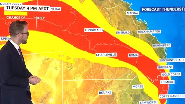
“Showers, possibly periods of rain but then also thunderstorms developing again this afternoon (Tuesday) with some of them possibly severe,” Mr Sharpe said.
“I don’t think it will be severe in Brisbane again, just like yesterday it will miss out but it will be a bit more showery.”
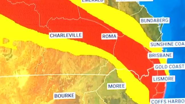
However, Mr Sharpe forecasts a chance of severe storms developing in the northeastern parts of NSW and inland parts of Queensland “all the way to Mt Isa” and through the southern parts of the Northern Territory and into WA.
“Over the coming days, those storms will continue their journey further north across Queensland and there could be some heavy falls particularly around The Central Coast on Thursday,” he said.
“All of this wet weather we’ve got (is because of) the heat and humidity across Queensland at the moment.
“Stormy weather continuing through the centre and the north of WA and the NT at the moment and we’re going to see plenty of that over the few days, with the showers and thunderstorms set to continue there.”

It comes as Brisbane recorded a low temperature of 25.5C overnight.
The Bureau of Meteorology forecast that humid conditions would continue throughout the week.
“During the week, humid conditions associated with a series of low-pressure troughs triggered storms, some severe, and widespread rainfall over the interior, parts of eastern Australia and southwestern parts of the country,” the bureau stated.
Weekly rainfall totals of 50 to 100mm were recorded across parts of northern Australia, southern Queensland, western Tasmania, northeastern Victoria and inland areas of NSW.
Sydney will hit a top of 26C on Tuesday, while Melbourne will be slightly cooler at a high of 21C.
In Brisbane, temperatures will reach 28C, while Adelaide will hit 27C.
Out west, Perth will top all the capitals with a maximum temperature of 36C forecast, while Darwin will experience thunderstorms and a high of 32C.
Originally published as Qld, WA, NT brace for severe thunderstorms as heatwave hits


