Mapped: Areas at highest fire risk this spring
Thanks to some recent crazy weather, the bushfire outlook map for spring looks different to other recent years. See the areas most at risk this season.
Environment
Don't miss out on the headlines from Environment. Followed categories will be added to My News.
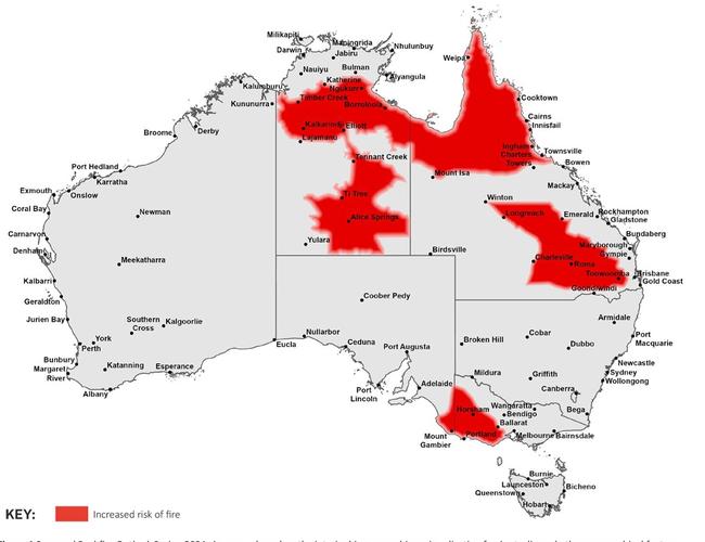
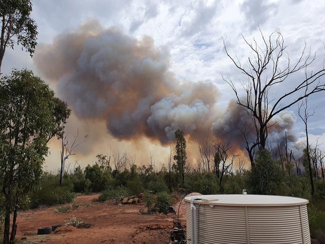
Large parts of Queensland and the Northern Territory, western Victoria and eastern South Australia are at elevated fire risk this spring, with emergency services warning record August heat and low rainfall has brought forward the start of the danger season in many areas.
The final month of winter was exceptionally warm in most Australian states, according to the Bureau of Meteorology, with the national area-averaged mean temperature up 3.03°C. This anomaly was the largest the Bureau had ever seen in its August records, going back to 1910, and the equal second-largest for any month. (Only the December 2019 anomaly, when average temperatures spiked 3.21°C above “normal”, has been greater.)
Coupled with below-average rainfall, the warm temperatures have led to increased spring fire risk in many areas, according to the latest bushfire outlook report, released on Wednesday.

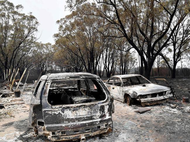
Queensland experienced its worst spring fire season in 70 years in 2023 and there are concerns the state could burn again, with vast parts of the interior and Cape York rated at high risk.
Darren Klemm, President of AFAC, the national council for fire and emergency services, said another early start to the fire season was expected for the Sunshine State.
“What we’ve seen over the last five or six years for Queensland has been a change in their bushfire season; spring is their time,” he said.
The red map markings in the outlook report denoting increased fire risk are missing from New South Wales, Tasmania, Western Australia and most of South Australia, but Commissioner Klemm said this should not lead to complacency.
“The red is highlighting areas where there is potential for elevated risk; that doesn’t mean that risk doesn’t exist in the parts that aren’t red,” he said. “The community in NSW shouldn’t expect that there will be no problem because there’s no red on the map.”

Last summer, the return of El Nino conditions prompted warnings about a possible summer of blazes, which never really eventuated. But this also shouldn’t lead to lax preparations this year, Commissioner Klemm said.
“If we have seasons where we don’t have significant bushfires that’s a real positive but it shouldn’t stop the preparation work that people need to do. It’s mitigation, it’s cleaning up around your home, making sure you’re cutting trees back, doing all those things, but equally, it’s the physical and mental preparedness people need to undertake as a family, to make sure that they’ve got a really solid bushfire plan,” he said.
He also warned this outlook report covered the next three months only, and the areas deemed at risk could look very different by December.
In regards to the regions marked as being at highest risk this spring, Bureau of Meteorology climatologist Zhi-Weng Chua said western Victoria was likely to experience above-average temperatures, but in northern Queensland and the Northern Territory there was greater chance the heat would be “unusually high”.
The latest climate outlook from the Bureau stated it was still not clear whether a La Nina – associated with generally cooler and wetter weather – would form this summer.
Mr Chua said it was possible we’d get neither a La Nina or an El Nino – a neutral scenario Australia has not experienced since the summer of 2019/2020.
It may take until the end of Spring before the Bureau would know for sure, Mr Chua said.
QUEENSLAND

Increased risk of fire this spring for Cape York and adjacent Tropical Coast centres including Cooktown, Cairns and Townsville, extending inland all the way to the Top End.
Elevated fire risk also apparent for areas east of Brisbane, including Toowoomba, and extending northwest into the centre of the state, including Roma and Longreach.
Grassland fire activity predicted in the early months of spring after “significant curing event” in winter.
Above average day time temperatures expected for the majority of the state, but combined with above average rainfall in some regions.
The southern and central coast experienced late winter rain, likely delaying fire danger until later in spring.
VICTORIA
Increased risk of fire for the far west and southwest parts of the state during spring, extending through the Wimmera, Grampians National Park and into the mallee country. Early bushfire season likely.
In other parts of the state, normal fire risk expected.
State had a notably dry autumn and winter, particularly in the far west and southwest.
A warmer than average spring is forecast, as well as average rainfall outlook for most of the state.
SOUTH AUSTRALIA
The southeast, including areas around Mount Gambier, Kingston EA, Bordertown and Pinaroo rated at increased fire risk for spring.
Forest and scrub areas in parts of the mid north are dry, which could lead to elevated fire risk in the southern Flinders Ranges and northern Mount Lofty Ranges.
Below average rainfall and well above average temperatures predicted across the state for the season.
NORTHERN TERRITORY

Increased fire risk across the interior of the Territory, including population centres such as Alice Springs, Tennant Creek and Katherine.
Above normal minimum and maximum temperatures are forecast across the NT along with short periods of strong, gusty winds.
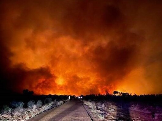
Fire services warn that vegetation is drying quickly and fires are carrying overnight.
NEW SOUTH WALES

Average to above average rainfall in winter largely prevented prescribed burning operations.
Normal fire potential predicted across the state for spring.
TASMANIA
Relatively warmer days and nights predicted with normal spring rainfall.
Normal fire potential predicted across the state for spring.
WESTERN AUSTRALIA
Warmer than average spring temperatures expected, along with decent spring rainfall.
Normal fire potential predicted across the state for spring.
AUSTRALIAN CAPITAL TERRITORY
Warmer conditions with average rainfall predicted for the coming season.
Normal fire potential predicted across territory for spring.
Originally published as Mapped: Areas at highest fire risk this spring


