
Climate models warn of ‘super El Nino’ later this year
More catastrophic weather events could be on the horizon with high temperatures forecast later this year.

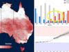
Australia could be facing a “super El Nino” event later this year, according dire forecasts of some climate models around the globe.
El Nino is characterised by extremely hot temperatures that can increase the risk of catastrophic weather events.
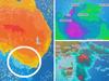
It occurs when sea surface temperatures in the central and eastern tropical Pacific Ocean become substantially warmer than average, and this causes a shift in atmospheric circulation.
Some global climate models are raising the possibility of an extreme, or “super El Nino”, marked by very high temperatures in a central region of the Pacific, The Guardian reports.
Australia’s Bureau of Meteorology said in a Tuesday update that all seven models it had surveyed – including those from weather agencies in the UK, Japan and the US – showed sea surface temperatures passing the El Nino threshold by August.
However the BOM stressed that it “does not use the term super El Nino” and “the term has no technical or scientific basis”.
“It is very early in the seasonal cycle to comment on the strength of a potential El Niño,” a spokeswoman said.
“Accuracy is naturally lower at this time of the year, so some caution is needed when looking at forecasts for El Nino.
“The strength of an El Nino event doesn’t necessarily translate to the strength of its effects, we have seen strong events with a weak rainfall effect in Australia, and weak events with strong rainfall effects. For example, 1997 was a strong event with a weak effect on rainfall, and 2002 was a weaker event with a strong effect.”

The last extreme El Nino in 2016 helped push global temperatures to the highest on record, sparking floods, droughts and disease outbreaks.
Several of the models suggest temperatures could get this high by October.
The bureau said there was a 50 per cent chance of an El Nino developing before the end of the year.
The agency warned that the forecasts were much less reliable during the southern hemisphere autumn and outlooks should be “viewed with some caution”.
La Nina ‘near its end’
In March, the BOM declared La Nina, the Pacific Ocean climate driver that has caused havoc for three years, including delivering multiple deadly floods, was officially “near its end”.
La Nina is one extreme of the climate driver known as the El Nino – Southern Oscillation (ENSO).
During a La Nina phase, cool waters from the depths of the Pacific Ocean are hauled up to the surface around the equator. Winds then push warmer seas towards Australia which aid in the creation of more clouds, moisture and windier conditions for the continent.
Conversely, an El Nino can see Australia become far drier.

La Nina did tail off in January 2022, but then came back again later in the year. That’s unlikely to occur this time.
A climate driver update released by the BOM in March found La Nina was fading once more.
“La Nina has weakened in the tropical Pacific Ocean and is likely near its end,” the agency stated.
“Ocean indicators of La Nina have returned to neutral levels, while atmospheric indicators that remain at La Nina levels have started to weaken.”
Drought on the horizon
A return to El Nino could trigger a drought for some regions of Australia, after three years of heavy rain associated with consecutive La Ninas.
Writing on academic website The Conversation Abraham Gibson from Southern Cross University and Danielle Verdon-Kidd from the University of Newcastle said it was “too early to tell”.

Putting aside the uncertainties in long-range forecasts of El Nino, they wrote, there are other factors that will determine whether Australia returns to drought.
“Our catchments are displaying wet to slightly drier than average conditions and our dams are generally full,” said Gibson and Verdon Kidd.
“We would need significant drying for a severe drought such as 2017-2019 or 1982-1983 to take hold.”
-- with Benedict Brook
Originally published as Climate models warn of ‘super El Nino’ later this year

