Burst of record-breaking heat ends with week of wet weather ahead
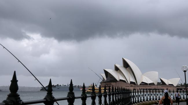
A record-breaking heatwave is soon to be a distant memory, as much of Australia’s southeast gears up for heavy rain and storms.
Environment
Don't miss out on the headlines from Environment. Followed categories will be added to My News.
A record-breaking autumnal heatwave is drawing to a close as temperatures fall and the southeast coast braces for a wet week.
The heat felt by much of the southeast over the weekend will persist across parts of NSW on Monday but will begin to ease over the coming days.
Thunderstorms and showers will begin to develop on Tuesday, with severe storms, damaging winds, large hail and heavy rainfall covering southeast NSW and eastern Victoria by the middle of the week.

Bureau of Meteorology senior meteorologist Miriam Bradbury said the areas affected by storms on Tuesday would include South Australia’s southeast, including Adelaide, most of Victoria, and southern and central parts of NSW.
“The storms are really going to be inland,” she said.
“Those severe storms will include the Sydney area by around the Thursday mark, but in general it will be milder and showery right across the southeast.
“That is going to bring a bit of relief from the heat but it is going to be quite humid, so it could feel a bit sticky.”
Multiple NSW heat records were broken during March’s “unseasonable” heatwave following consecutive summers of wet weather.
One such record was broken in Sydney last week, with the city recording four consecutive days more than 30C for the first time in 165 years.

West Australia can expect a “pretty dry week” ahead, with some thunderstorm activity likely to continue after significant lightning over the past 24 hours in northern parts of the state.
“Similar areas are likely to have thunderstorms on Monday through to Central Australia and into large parts of South Australia,” Ms Bradbury said.
“There is a risk we could see some gusty and damaging winds in the Kimberly and parts of the Pilbara, but very little rainfall is expected.”
The west coast trough will likely continue to trigger thunderstorm activity along the West Australia coast, bringing risks of damaging winds in some parts.

Flood-affected residents in western Queensland should see “very little rainfall” over the next week as the region continues to grapple with cut-off roads and isolated communities.
“We will likely see the impacts of that flooding ongoing for quite some time,” Ms Bradbury said.
“It will be weeks to months given how extensive the flooding has been and how much water is still moving.”
While there will be some showers and isolated thunderstorms over Northern Australia, they will mostly be moving over coastal areas and are not expected to move inland.
“If we do see any storms, it will be dry storm activity with not much rain in it at all,” Ms Bradbury said.
“Not too wet a week at all for Northern Australia.”
Hottest March day on record for parts of NSW today as temperatures soar into the high 30s/low 40s.
— Bureau of Meteorology, Australia (@BOM_au) March 19, 2023
Cool change will move through tonight/Monday, with showers and storms returning to SE Aus from Tuesday.
Heat will continue in WA this week.
Latest https://t.co/nSYxhl945ipic.twitter.com/FjYwlLu5Fq
The recent blast of scorching weather across NSW came only days after the bureau confirmed the third consecutive La Nina had officially ended.
An El Nino watch was immediately issued following Tuesday’s announcement.
Originally published as Burst of record-breaking heat ends with week of wet weather ahead


