
Bureau of Meteorology puzzled by stalled climate conditions
The forecast El Niño has still not begun and the stalled climate conditions are unusual.

Climate Change
Don't miss out on the headlines from Climate Change. Followed categories will be added to My News.
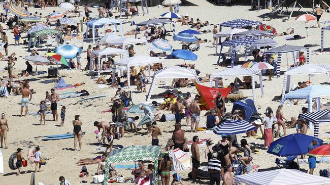
Spring has kicked off with a bang in many Australian cities with temperatures already pushing the high 20s, but according to the Bureau of Meteorology, the much-predicted El Niño has still not begun.
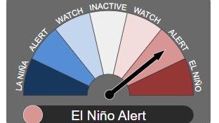
In its latest climate driver update, the Bureau of Meteorology (BOM) kept the El Niño status on “alert”, which means it has a 70 per cent chance of developing.
But senior BOM climatologist Simon Grainger told the ABC the bureau has
“never seen anything quite like” this year’s developing El Niño.
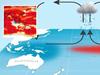
An El Niño is characterised by a complex interaction between the atmosphere and the ocean over the Pacific Ocean.
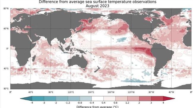
Dr Grainger said what makes this year’s event unique is the incredibly warm ocean temperatures it comes on top of.
Sea surface temperatures are currently 1.6 degrees celsius above normal, double the El Niño threshold of 0.8 degrees celsius above normal.
This has given the BOM “a lot of food for thought” about why the development of the El Niño has stalled, Dr Grainger said.
Two possible explanations are the warm ocean temperatures on the western side of the Pacific, near Australia, or a hangover from the three La Niña years Australia has experienced.
“We would expect to see the oceans to cool down in the western Pacific [during an El Niño], and that’s been happening only really, very slowly this year,” Dr Grainger said.
He added “the El Niño could be delayed because it just takes that much longer for the full conditions to be set up to full reverse from a La Niña”.
The BOM expects that this year’s El Niño will be significant for the insights it gives into how El Niños will behave in a warmer climate globally.
“This can have real impacts on agriculture, on bushfire risk, on the potential for more intense heatwaves, and all these things have had significant impacts on human health and the economy,” Dr Grainger said.
The BOM is also rating the chances of reduced rainfall and above-average temperatures in winter and spring as “very likely”.
This is driven by an effect known as the Indian Ocean Dipole (IOD), which the BOM said has been above the positive threshold for the past month.
“If the IOD index continues to remain above this threshold, a positive IOD event will be considered underway. All models indicate this is highly likely and that a positive IOD will be sustained to at least the end of spring. A positive IOD typically decreases spring rainfall for central and southeast Australia and can increase the drying influence of El Niño,” it said.
A positive IOD was one of the key drivers behind the dry conditions that fuelled the Black Summer bushfires of 2019-2020.
Despite Australia not yet being in an El Niño, there are already warnings about how hot the upcoming summer will be from Australian National University climatologist Professor Janette Lindesay.
“Whether it does or not, it remains highly likely that spring and summer temperatures will be above average across eastern and southeastern Australia, and the scales are weighted towards a drier spring/summer than has been our recent experience,” she said.
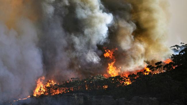
She added that such conditions could bring out the extra heat needed for a horror bushfire season.
“These conditions are cause for concern regarding the coming bushfire season in the east, south and southeast (which could start earlier than usual), where recent wetter years have contributed to considerable vegetation growth and a potentially dangerous fuel load in hot dry weather,” Professor Lindesay said.
Former Fire and Rescue NSW Commissioner and Councillor with the Climate Council, Greg Mullins, agrees that “we’re set for a bad year”.
“I’m not a betting man, but if I was a betting man, I’d say we’re going to get big fires this year,” he told the Climate Council’s El Nino media briefing in July.

Originally published as Bureau of Meteorology puzzled by stalled climate conditions
Worst spot for EVs revealed
Home of fake tan, jet skis and beachfront high rises, one Australian region has been named the best for EVs in the country.
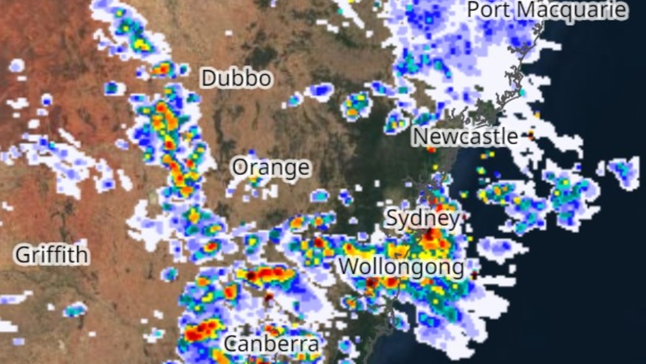
Wild storms smash Sydney
Sydney was lashed by torrential rain as a severe storm hit the Harbour City, causing blackouts and flash flooding, and leaving pedestrians drenched.