
Victoria’s ‘rollercoaster’ weather is here to stay as cold snap hits state
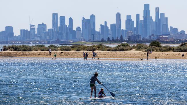
After some sunny days, Victorians are set to shiver through the rest of the week when temperatures drop more than 10C – and it looks like the fluctuating weather pattern isn’t changing anytime soon.


Weather
Don't miss out on the headlines from Weather. Followed categories will be added to My News.
As northern parts of the country swelter through summer temperatures, icy weather is here to stay as Victoria’s “rollercoaster weather” continues to dominate.
Victorians will need to swap their sunglasses for their umbrellas in the coming days, with chilly temperatures, rainfall and possibly hail forecasted across the state.
When Tuesday’s sunny skies and wild winds subside late in the afternoon, temperatures in Melbourne’s CBD will plummet by 9C, with the Bureau of Meteorology (BOM) predicting highs of 15C on Wednesday and Thursday.
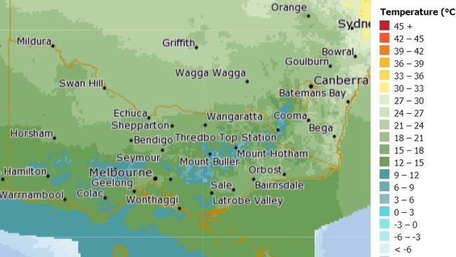
According to the bureau’s forecast, showers will develop into the afternoon and evening on Wednesday, while on Thursday, the rain will ease. The temperature will then increase to a high of 19C on Friday and will continue to rise into the weekend.
BOM Meteorologist Joanna Hewes told the Herald Sun a cold front is to thank for the chilly end to the week.
“Basically, we’ve got this big pocket of cold air that’s moving up from the Southern Ocean and it’s moving over Victoria. That’s bringing those low temperatures,” she said.
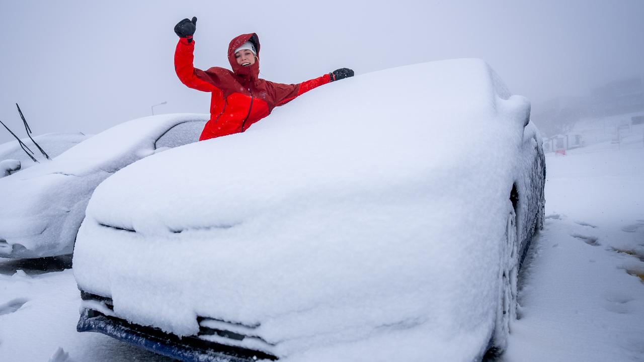
“It’s also lowering snow levels over the Alpine peaks to about 900 metres late Wednesday and early Thursday. That will bring you the possibility of small hail as well, including for Melbourne.”
The fluctuation of temperatures in recent weeks has caused many Victorians to question whether such dramatic changes in weather are normal.
However, Ms Hewes reassured the variation in climate was typical for this time of year, especially given spring and autumn are known as “shoulder seasons”.
“I think it always takes us by surprise when it comes around in spring time … but basically during those seasons the atmosphere is shifting between its winter and summer patterns so there is a lot of changeable weather as the atmosphere tries to adjust,” she said.
In the coming days, residents living in Melbourne’s eastern suburbs and the state’s west will experience cooler temperatures compared to its counterpart suburbs, before the cold front will sweep eastwards on Thursday.
“(On Wednesday) it’s looking to be 6C to 8C below average in western Victoria, particularly inland, but usually around coastal areas the ocean helps to keep the temperatures a bit more stable,” Ms Hewes said.
“Then from Friday it starts to warm up again as that cold air moves away and the winds start to turn a bit more easterly and a little bit more northerly as we head into the weekend.”
Wednesday’s temperature will be a far cry from the hottest October 25 day in Melbourne recorded – which was 31.3C in 2015 – and will also remain below the month’s average of about 20C.
However, forecasters aren’t expecting this week’s weather to break any records.
As for weather conditions, Victorians are urged to brace for gusty showers and the chance of small hail in the state’s south, while cold thunderstorms could pass over the state’s southwest.
Meanwhile, strong winds are forecasted along the coast, with the BOM expected to issue gale warnings for the following days later on Tuesday.
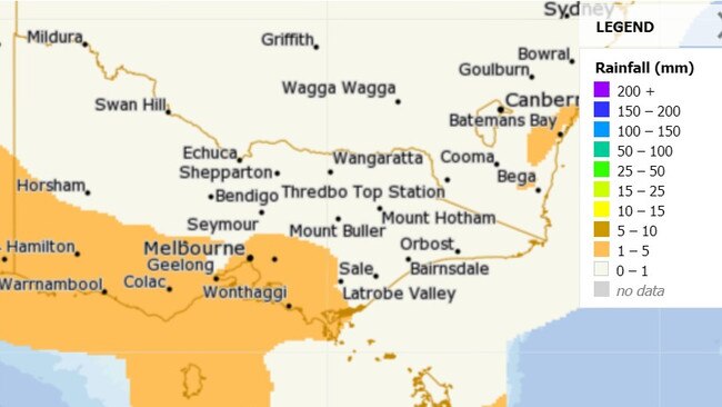
“It’s pretty windy out over the border for sure and then overland it’ll be that sort of gusty, showery type weather through Wednesday,” Ms Hewes said.
“Then on Thursday the system sort of starts moving off to the east and things will start to generally ease off.”
For those wondering when they’ll be able to put away the winter wardrobe for good, Ms Hewes said Victorians will have to wait until December to see consistently warm temperatures.
“In terms of the historical data, it looks as though December is the time when we start to see more consistently warm weather where most days are 20 degrees and above,” she said.


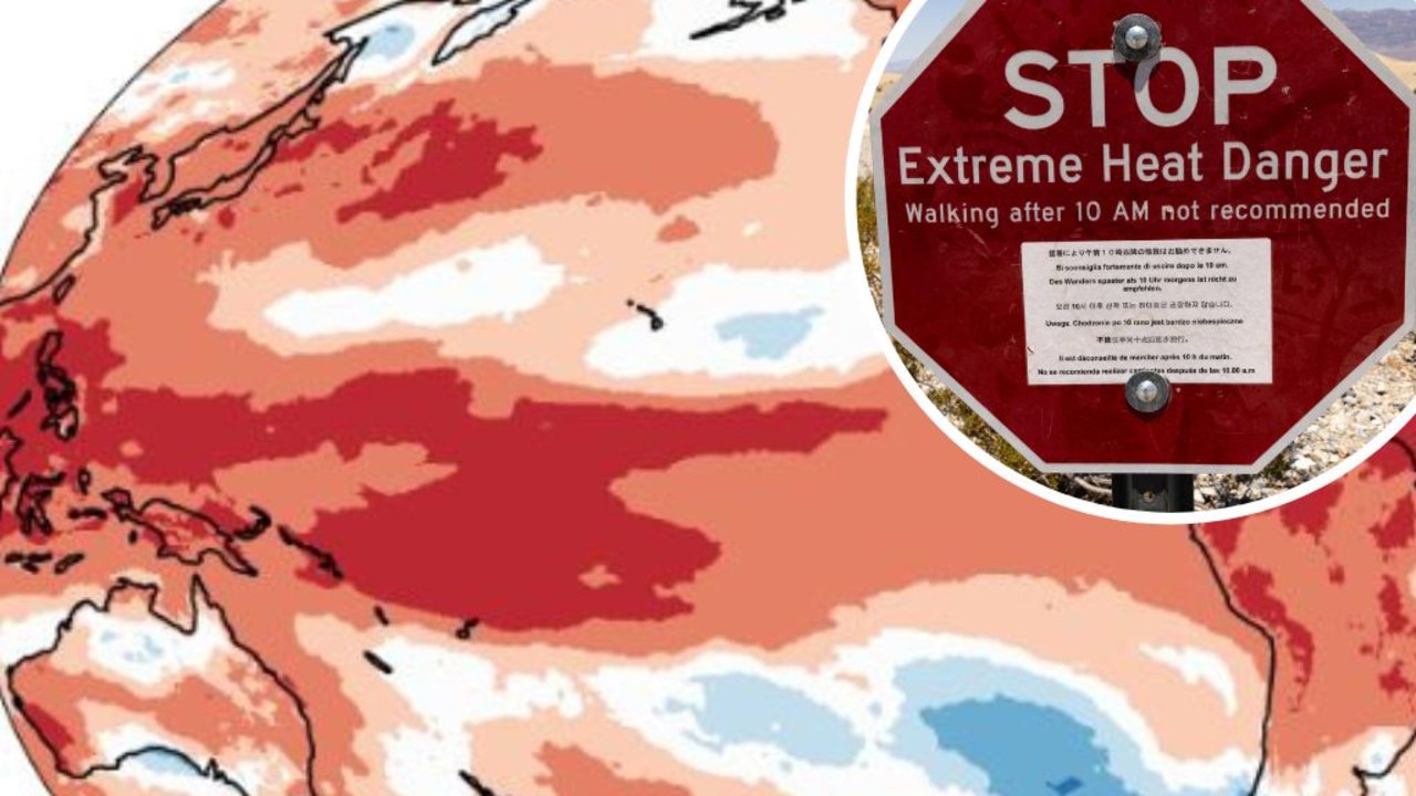
Mapped: Why 2024 could be our hottest year
Australia is suffering through a wet and chilly winter, but heat records are being broken all around the world - prompting new ideas about how we should be dealing with it.
Aussies freeze through coldest morning of the year
An extra blanket or two could be in order as Australians woke up to icy weather across the country. See how long the cold blast will last.