
Damaging winds to hit Dandenongs
Dandenongs suburbs devastated by last month’s wild storms are again set to be thrashed, with damaging winds to hit Victoria this afternoon.

Weather
Don't miss out on the headlines from Weather. Followed categories will be added to My News.
The Dandenongs is on high alert again with wild weather and winds of up to 100km/h forecast throughout Victoria.
A cold front is set to sweep across the state over the weekend, bringing icy winds and a ‘feels like’ temperature below zero in most regions, the Bureau of Meteorology reports.
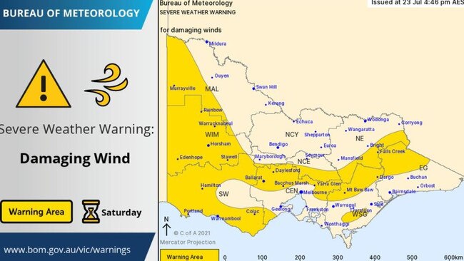
They issued an emergency alert on Friday afternoon, putting out a severe weather warning for damaging winds.
The warning area includes Falls Creek, Mt Baw Baw, the Dandenongs, Yarra Glen, Bacchus Marsh, Daylesford, Ballarat, most of the Wimmera region, the western side of the Mallee and parts of the South West district including Colac, Warrnambool, Portland and Hamilton.
But by Sunday morning, Melbourne could see wind gusts of up to 100km/h an SES spokesperson said.
“Winds are expected to increase from Saturday morning, with showers and storms expected for much of the state until Sunday night,” they said.
“Winds are expected to average 50-60km/h in the warning area, with peak gusts around 90km/h, although gusts may reach 100km/h across the Alpine and Grampians peaks.”
Authorities are particularly concerned about the impact of such winds in the Dandenongs, where trees could already be weakened by previous storms.

SES State Agency Commander David Baker said people should secure any loose items — such as trampolines — and be careful around trees.
“Please remain vigilant to the further risk of falling trees,” he said.
“Avoid unnecessary road travel during the periods of high winds.”
The agency has been preparing for extra call outs this weekend and Mr Baker urged Victorians to take flood risks seriously.
He said motorists should never risk driving through flooded water.
“It can take only 15cm of water for a small car to float,” he said.
Minor flood warnings have been issued for the Yarra River — from Warrandyte to Millgrove — and Watts River.
By Friday afternoon, low-lying areas alongside the river such as bike paths had already seen small flooding.
In Coldstream, the Yarra had already surpassed the minor floor level (4m) by Thursday night and was holding “steady” at 4.22m.
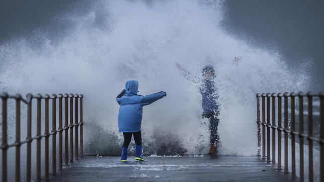
The wild weather will also hit Victoria’s coastline where a storm surge and “significantly higher than usual” sea levels are expected.
Surf Life Saving Victoria General Manager Liam Krige said people should “seriously consider if (they) need to be on, in or near the ocean”.
“Make sure you take the appropriate safety precautions if you do,” he said.
“With such windy conditions and powerful waves forecast, this message goes to people planning on being near the ocean’s edge, too.
“Unintentional entry to water attributed to half of all drownings over the past decade, while cold water shock further increases a person’s risk of drowning during the cooler months.”
He urged people to check conditions before they leave, never turn their backs on the sea and — if boating or rock fishing — wear a lifejacket and ‘grippy’ shoes.
An SES spokesperson warned of “unexpectedly large and deceptively powerful waves which may surprise fishers, boaters or beachgoers”.
“Strong west to south-westerly winds and a west-south-westerly swell of six to eight metres are expected along the southwest coast very early on Sunday morning, however this may be amplified at irregular intervals.”


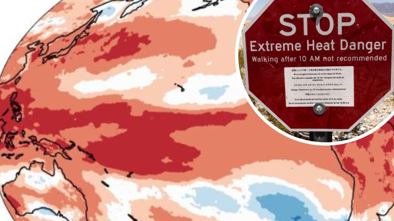
Mapped: Why 2024 could be our hottest year
Australia is suffering through a wet and chilly winter, but heat records are being broken all around the world - prompting new ideas about how we should be dealing with it.
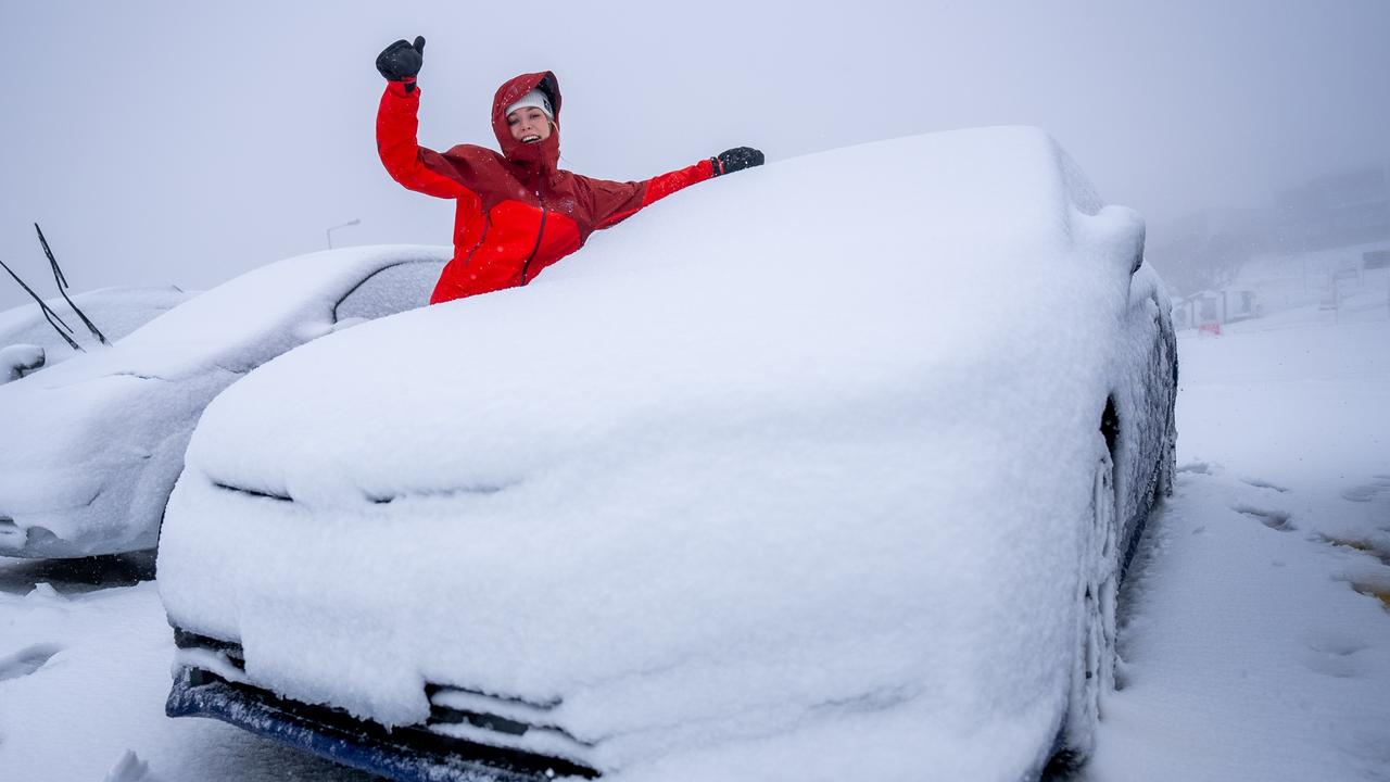
Aussies freeze through coldest morning of the year
An extra blanket or two could be in order as Australians woke up to icy weather across the country. See how long the cold blast will last.