
Hobart suburbs more at risk from bushfire revealed in interactive map
A new interactive map has been launched allowing residents to find out just how vulnerable their home is to bushfires. Is your home at risk?

Tasmania
Don't miss out on the headlines from Tasmania. Followed categories will be added to My News.
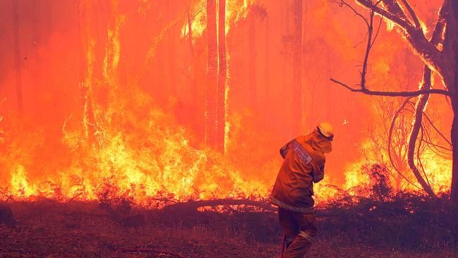
There are more homes in Kingborough and Hobart City at risk of bushfire than anywhere else in the Greater Hobart region, new data suggests.
The 2024 Greater Hobart Bushfire Exposure Index, an analysis by climate mapping company, Geoneon, looked at vegetation, topography, buildings and climate to determine which areas had greater exposure to fires.
It assessed the exposure of 94,000 buildings across 132 suburbs, and found 4.5 per cent of those had a moderately high to extremely high exposure risk.
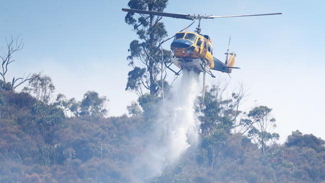
The municipality most at risk was Kingborough, which had 1727 (10.5 per cent) buildings classed as high exposure.
Next was Hobart City, which had 1205 (6.3 per cent).
Click to find out how high the bushfire risk is at your property.
Map provided by Geoneon, developed as part of the 2024 Greater Hobart Bushfire Exposure Index
A breakdown of that data showed which suburbs had buildings with the highest exposure.
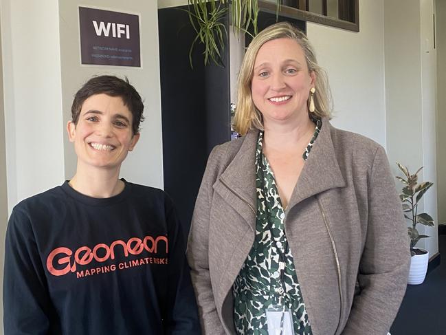
“In terms of percentage of buildings the most exposed, that’s going to be Apollo Bay (86 per cent) in Kingborough, Fern Tree (85 per cent), Mount Rumney (73 per cent) and Bonnet Hill (66 per cent),” Geoneon CEO Roxane Bandini-Maeder said.
“This is not really a surprise.
“We look at where the wildfires will be the most severe, we’re not looking at the spread, we really look at the severity.”
Mr Bandini-Maeder said the information could help members of the public understand the risk and be better prepared.
“This is to look at where we can prioritise mitigation … if people don’t know, people cannot do anything,” she said.
“We hope people will use this for awareness, so they know better and what are the exposures and take proactive measures – looking at what are the tools they can use to reduce exposure.
“We are hoping as well that will be useful for developers and if they build in those areas, they are aware of what are the exposures and take mitigation, in the materials for example.”
City of Hobart acting city life director Karen Abey said the data showed which areas people needed to be more prepared for the possibility of bushfires.
“Part of the beauty of living in Greater Hobart is you are able to be very close to everything yet still live in the bush, the slight downside is that does come with greater risk and people do need to protect themselves,” she said.
“We’re not by any means saying 'don’t build in those areas’, we don’t want to alarm people, it’s just about making sensible decisions.
“I think we need to be realistic that we can’t do everything everywhere. People are going to have to be increasingly mindful of those risks as the impacts from climate change do start to increase.”
But she said those in lower risk areas still needed to be vigilant.
“A bushfire is something that can impact all sorts of communities, particularly with ember attacks,” Ms Abey said.
“Just because you’re not living in the bush doesn’t mean you can just not worry abut bushfire risk.”
In previous years, the company only analysed Hobart City, Glenorchy and Kingborough, this year it added Sorell, Clarence and Brighton.
More Coverage


Originally published as Hobart suburbs more at risk from bushfire revealed in interactive map
Join the conversation
Launceston and Tamar Valley the 4th must-visit destination in world
Respected travel guide company Lonely Planet has named Launceston and the Tamar Valley as fourth-best place to visit in the world in 2025. Here’s why >>
Read more

Named: Alleged Queens Domain abductor faces court
A 60-year-old man alleged to have tried to force a youth into his car at the Queens Domain faces court. What the court heard.
Read more