
SEQ Weather: Severe thunderstorms lash southeast
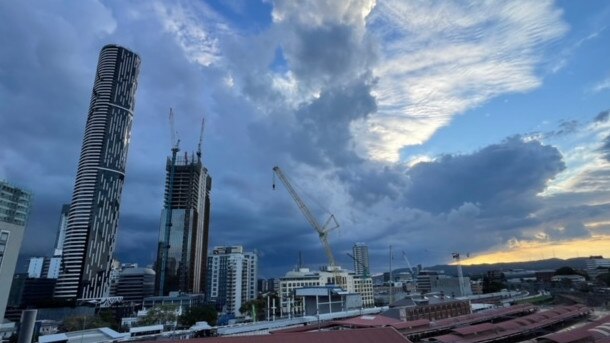
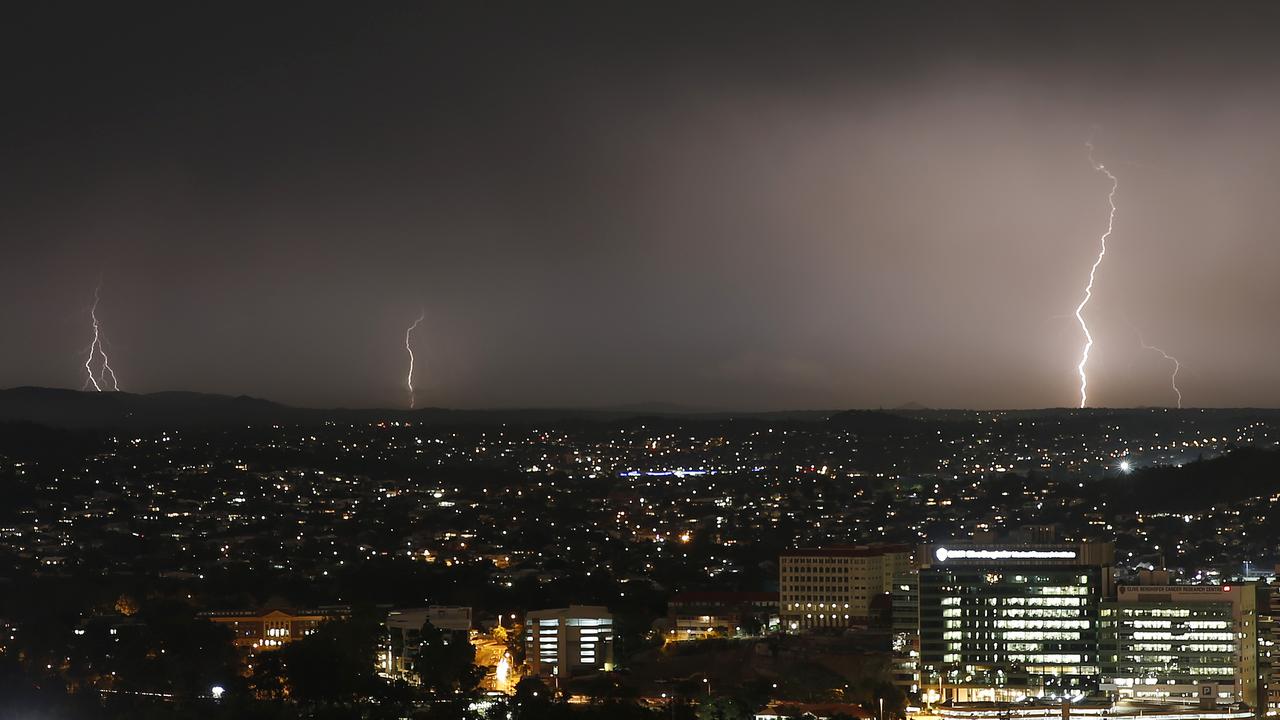
Severe thunderstorms have lashed much of the state’s south, with one area seeing 40mm of rainfall in just 30 minutes. Storm cells continue to sweep across Brisbane.
QLD weather news
Don't miss out on the headlines from QLD weather news. Followed categories will be added to My News.
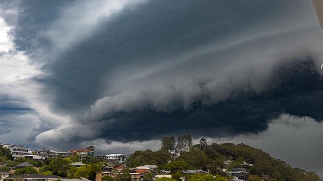
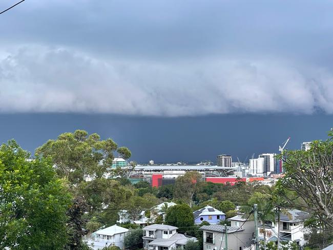
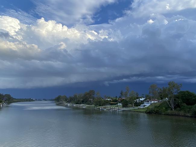
Severe thunderstorms are sweeping southeast Queensland, with heavy rain, strong winds and hail reported.
It comes after an afternoon of storms across the state’s south, with one area seeing 40mm of rainfall in just 30 minutes.
Two separate warnings remain active.
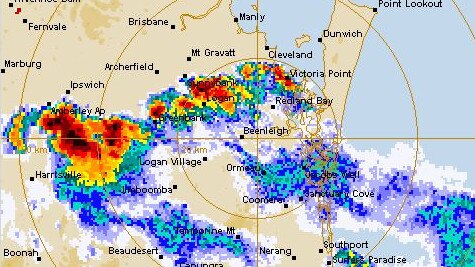
The Bureau of Meteorology issued an updated severe thunderstorm warning for southeast Queensland at 6.11pm.
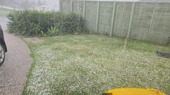
It warned a severe thunderstorm likely to large hailstones and heavy rainfall – that may lead to flash flooding – had been detected near Enoggera, Brisbane Airport, Nudgee and Aspley.
The alert advised the thunderstorm was moving towards the northeast and was forecast to affect Strathpine, Redcliffe, Brighton and Kallangur by 6:35 pm and Tangalooma, northern Moreton Bay, Deception Bay waters and Beachmere by 7:05pm.
A separate severe thunderstorm warning for damaging winds, large hailstones and heavy rainfall remains active for people in parts of Darling Downs and Granite Belt and Southeast Coast forecast districts.
The updated warning, issued at 6.07pm, said “severe thunderstorms are likely to produce damaging winds, large hailstones and heavy rainfall that may lead to flash flooding in the warning area over the next several hours. Locations which may be affected include Brisbane, Caboolture, Millmerran and Redcliffe”.
The biggest rainfall total recorded so far was in Pine Hills, near Chinchilla, which saw 40mm of rainfall in the 30 minutes to 3.18pm.
Senior Meteorologist Steve Hadley confirmed just after 4pm there would be storm clusters around the Scenic Rim, Southern Downs and Gold Coast over the next couple of hours.
“There is a state-based warning covering two big areas, one in the southern interior the other broader and we have a more metropolitan based warning that has been issued at 3.49pm,” Mr Hadley said.
“That was updated for the Gold Coast Hinterland, Scenic Rim and Southern Downs. There have been a few clusters of storms around and a storm has just gone through Beaudesert and one approaching Boonah.
“There is scope for some thunderstorm activity into Brisbane and Gold Coast, Logan and other parts of south east Queensland over the next few hours and will diminish from Brisbane southward during the evening,” Mr Hadley said.
It comes as weather experts forecast that Southeast Queensland residents can expect an “unsettled” week of weather, with storms threatening to hit the region throughout the week.
After several storms across the region in recent weeks, Livio Regano from the Bureau of Meteorology said temperatures would be up and down throughout the week.
“It’s generally unsettled this week, every day there’s the threat of storms,” the meteorologist said.
“The weather is always on edge but may never deliver.
“There’s a lot of cloud cover around at the moment and some storms across South East Queensland but they will clear by this evening.
“There’s a few showers around right now as well which is just left over from last night’s storms.
“The greatest threat of storms is from Thursday to Saturday – Friday and Saturday especially – I would say less than a 50 per cent chance tomorrow (Tuesday) and Wednesday but around 60 to 70 per cent later in the week.”
Mr Regano said there was an increased chance of rain from Thursday to Saturday across all of South East Queensland, with no areas expected to be hit harder than others because of the weather coming from the west.
He said the amount of rain wouldn’t be very high, with an average of only 1mm expected in the coming days before 15mm is expected on Friday.
Mr Regano also said there would be constant changes in temperature across the region this week caused by changes in wind direction.
“Tomorrow is expected to be quite a bit warmer, going from 24 to 29C but the temperature will change again to 26 on Thursday and then 31 on Friday,” he said.
“It will cool down again on Saturday, going back to 28 but then 30 on Sunday.”
Originally published as SEQ Weather: Severe thunderstorms lash southeast

Heavy rain, hail as massive storm front menaces parts of Qld
Heavy rain and hail have been recorded as a severe storm system moved across parts of the state on Thursday afternoon.
Large hail, damaging wind as storms forecast to lash state
Storms producing large hail and damaging winds are tipped to rock southern Queensland, with wild weather expected from Thursday.