
Queensland weather: Towns cut off, 100 roads closed as monster 1600km system wreaks havoc
Several towns are cut off by floodwaters as a monsoon trough stretching 1600km makes its mark. The system is set to dump 300mm on the state’s southeast.
QLD weather news
Don't miss out on the headlines from QLD weather news. Followed categories will be added to My News.
Several towns are cut off by floodwaters as a monsoon trough stretching 1600km from the top of the NT to southwest Queensland makes its mark. The system is set to dump 300mm on the state’s southeast.
It comes as a regional mayor slammed the lack of forecasting in the area as their town was caught off-guard, with a “devastating impact” on farmers’ stock anticipated.
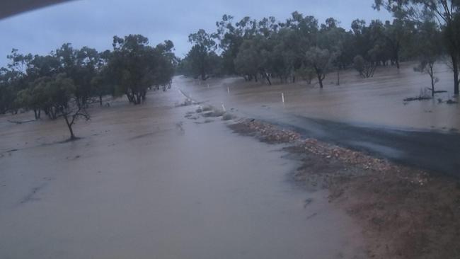
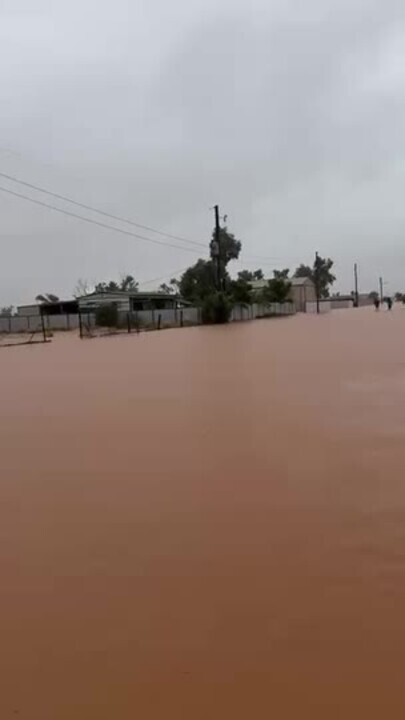
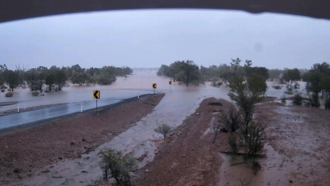
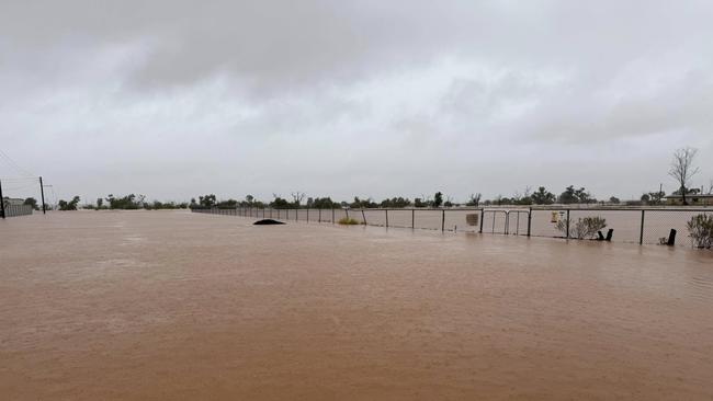
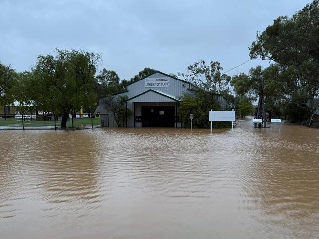
Road closures were on Tuesday afternoon in place for all major roads leading out of Quilpie, Windorah, Jundah, Boulia, Bedourie, Eromanga, Adavale and Birdsville due to flooding.
Close to 100 roads were closed in the Barcaldine and Central West region, while in the Cloncurry, Mount Isa and North West region more than 30 roads had been impacted by floodwater.
While Quilpie Airport remained open, at least one REX flight was cancelled on Tuesday.
Several travellers were given accommodation in Quilpie and were unable to leave the township. Local stores still have food on shelves and alternative accommodation options are available if required for evacuation.
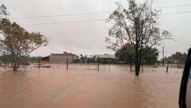
In Eromanga, at least one resident was partially impacted by the floodwaters, however they were able to remain in their residence. A refuge centre was activated at Eromanga State School.
Quilpie Mayor Ben Hall called for more support to be given to the region from the government.
“There is currently no weather radar between Alice Springs and Charleville. This means that the BOM is flying blind and unable to give us any data on what’s happening, when peak flooding will hit or what’s coming for our region. It makes it very hard to coordinate emergency responses in times like this,” he said.
“Our rudimentary forecasting had 5-6mm of rain forecast to hit Sunday – the reality was nearly double this amount hit Sunday night but was then followed up the next day with 100mm of rain in our direct region, and a catastrophic 340mm in Belombre – which is more than the 2010 floods.
“No forward planning for stock movement or anything else can happen without more accurate forecasting and we’re still flying in the dark trying to work out what next for Quilpie Shire.
“With another 100mm of rain expected to fall today on top of the flooding we’re currently experiencing, there will undoubtedly be a devastating impact on stock in our region. It’s heartbreaking for farmers who were battling drought only a week ago.”
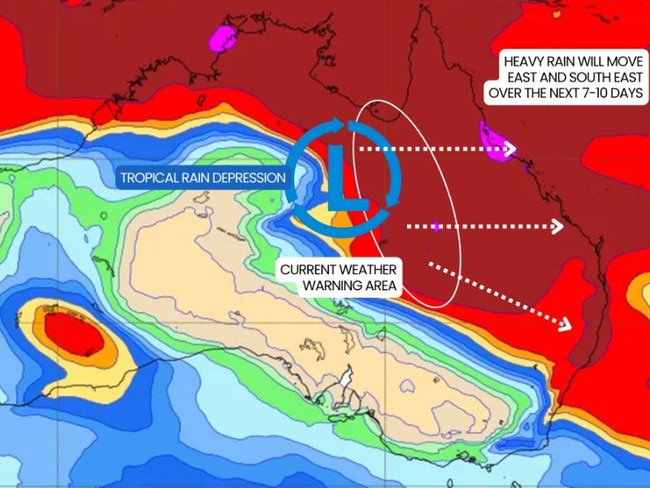
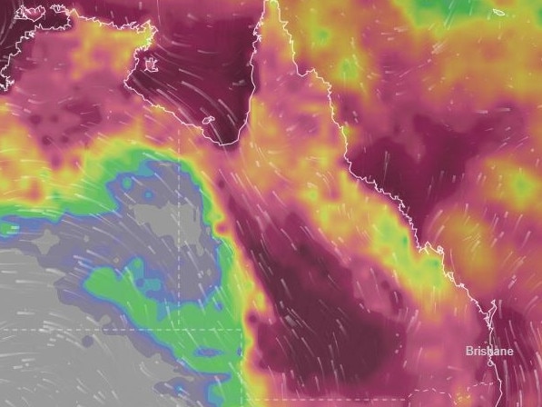
The southeast could see isolated totals up to 300mm next weekend as the 1600km monsoon trough stretching from the top of the Northern Territory to southwest Queensland triggers rain, humidity and thunderstorms.
It comes as North Queensland records its wettest March since measurements started in 1940, with more than 760mm of rain falling so far this month.
The torrential rain is being caused by a slow-monsoon trough that has moved over northern parts of the country and western parts of Queensland.
Widespread totals over 400mm were forecast for much of inland Queensland, including Windorah, Longreach and Charleville.
Heavy rain is forecast for South East Queensland on the weekend, with daily falls of 60mm on Friday and Saturday, while isolated daily totals up to 150mm are possible.
Bureau of Meteorology senior meteorologist Sarah Scully said the monsoon trough would bring heavy rainfall and humidity into South East Queensland from about Thursday.
“This trough has resulted in widespread heavy rainfall totals across particularly northern, western and central Queensland over the last few days,” she said.

“We’re forecasting the heavy rainfall to be dragged into eastern or southeastern parts of Queensland from Thursday and into the weekend.
“The humidity starts to shift into eastern parts of Queensland from Thursday and continues into the weekend.”
In the 24 hours from about 9am on Monday, 124mm was recorded at Paluma, 106mm at Paradise Lagoon, and 103mm fell at Halifax near Townsville.
Near Winton, 121mm fell at Malboona, while 110mm was recorded at Quilpie.
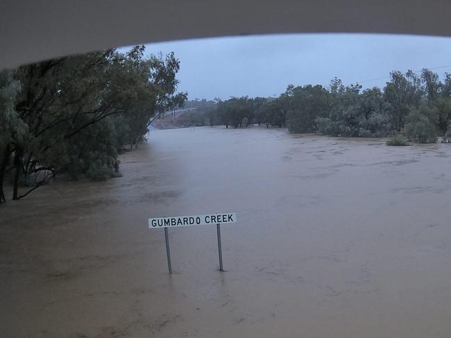
Flood warnings were in place for many river systems across inland Queensland as well as the North Tropical Coast and Herbert and Lower Burdekin.
A major flood warning was issued for the Bulloo River, while moderate flood warnings were active for the Barcoo River, Houghton River south of Townsville, Georgina River and Eyre Creek.
Originally published as Queensland weather: Towns cut off, 100 roads closed as monster 1600km system wreaks havoc
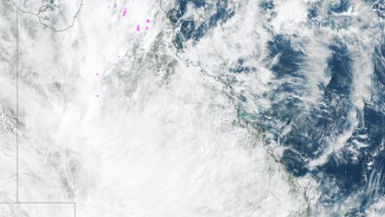
Satellite image captures Qld like you’ve rarely seen it before
Stunning satellite imagery has captured a rare sight of Queensland as a 1600km monsoon trough collides with a stream of tropical moisture, triggering a year’s worth of rain.
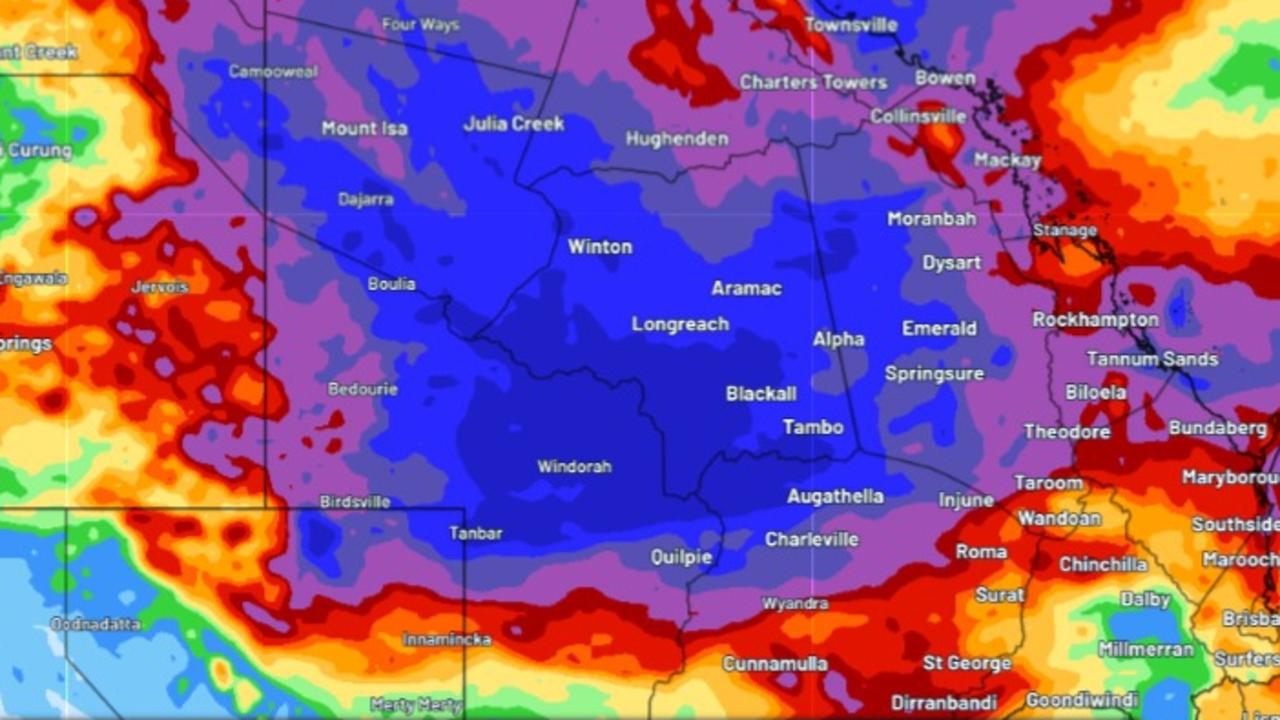
Entire year’s worth of rain could hit already saturated outback Qld
Parts of Queensland are enduring their wettest March since 2011, as record-breaking rainfall triggers several flood watches and warnings, with forecasters warning it is far from over.