
Qld weather: More heavy rain forecast for flood-hit areas of state’s north
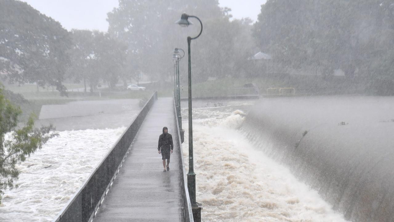
Flood-soaked NQ communities have been warned of more heavy rain that could lead to life-threatening flash flooding in coming days – and even the slight chance of a tropical cyclone developing off the coast.

QLD weather news
Don't miss out on the headlines from QLD weather news. Followed categories will be added to My News.
Flood-soaked North Queensland communities have been warned of more heavy rain that could lead to life-threatening flash flooding in coming days – and even the chance of a tropical cyclone developing off the coast.
Senior Meteorologist Sarah Scully said the widespread rainfall would hit flood-affected parts of the northeast tropical coast over the weekend.
“There is a lot of tropical moisture sitting across northern Queensland at the moment and that is combining with (a) monsoon trough to bring rain areas, and an increase in both shower and storm activity.
“By Saturday we are expecting there to be a burst of widespread heavy rainfall about the northeast tropical Queensland coast extending further inland.”
Another 200mm to 300mm could fall in some places.
“We are not expecting these peak rainfall totals to be anywhere near what we saw last weekend or earlier this week,” she said.
“However there is still the chance for big community impacts due to grounds being so wet and catchments so swollen.”
The meteorologist said a severe weather warning was likely to be issued on Friday due to heavy rainfall, which could lead to life-threatening flash flooding.
“Grounds are very wet across the region and river systems are already very swollen,” she said.
“So any further rainfall that falls across this area is going to respond very quickly and lead to an increase in both flash and riverine flooding.
“As we move into Saturday we can see (a) tropical low that develops in the Coral Sea just off the coast. There is a low chance of this developing into a tropical cyclone and it is expected to move eastwards away from the mainland which we will see on Sunday.
“We see this low-pressure system moving away with heavy rainfall potentially continuing but moving slightly northwards as that monsoon trough moves northwards.”
A severe thunderstorm warning has been issued for parts of northwestern Queensland on Thursday afternoon.
Issued just after 4:30 pm severe thunderstorms were likely to produce heavy rainfall which may lead to flash flooding in the warning area over the next several hours.
Dajarra, Duchess, Selwyn and Middleton were likely to be impacted by the warning.
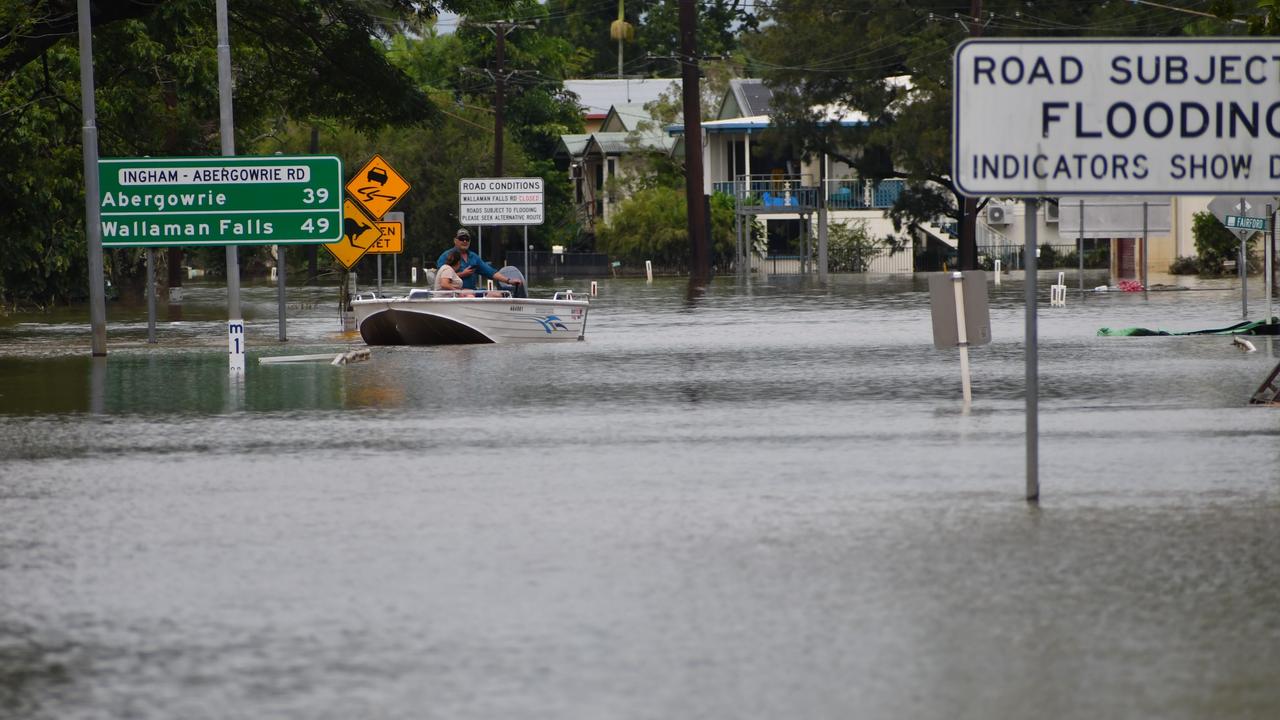
Ms Scully said there were a number of flooding warnings in place extending all the way from Cairns down towards Saint Lawrence.
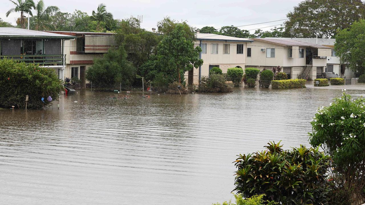
“Including major flood warnings for the Murray and for the Herbert Rivers,” she said.
“With minor to moderate flood warnings elsewhere across the region including moderate flood warnings for the Tully, the Burdekin, the Ross, the Bohle and down south we have got the Connors and the Isaac Rivers.”
Ms Scully also said an initial minor flood warning was in place for the Barcoo River after heavy rainfall hit inland parts of central Queensland.
“We also do have extensive flood watches for the northern and central interior and that is because we are moving towards several days where moderate to heavy rainfalls are expected,” she said.
By Monday northern Queensland would finally see reprieve from the rain, with drier conditions tipped for next week.
“As the low moves away, it draws in much drier air, seeing the showers clear from the coast down towards the south,” she said.
“As we move into Monday that dry air extends further northwards to include Townsville as well.”

Originally published as Qld weather: More heavy rain forecast for flood-hit areas of state’s north
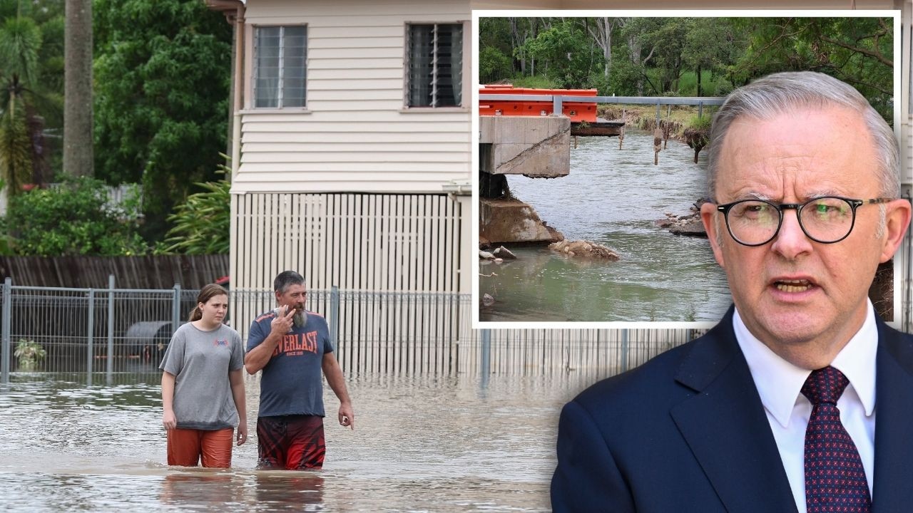
PM slams Bruce Hwy, as military might unleashed on flood clean-up
The Prime Minister hasn’t pulled any punches in his assessment of a critical part of the Bruce Highway as he visits flood-ragaved North Queensland, vowing to provide “whatever support is necessary”.

‘So tiny, so cold’: Lost, shivering joey melts hearts
Washed up under a Townsville patio and with no sign of its mother, a tiny shivering wallaby joey has captured the hearts of Queenslanders as it’s whisked away to a local wildlife carer.