
Qld weather: Severe thunderstorm forecast for SEQ as temperatures soar
Amateur storm chasers are warning destructive storms are possible for large parts of southern Queensland this afternoon. It comes as temperatures soar over 36C in parts.

QLD News
Don't miss out on the headlines from QLD News. Followed categories will be added to My News.
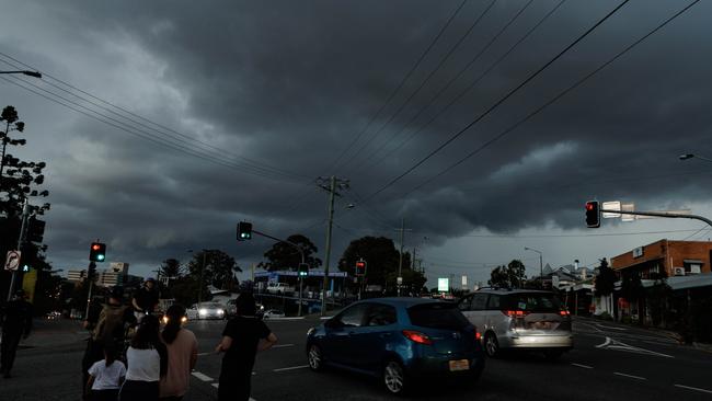
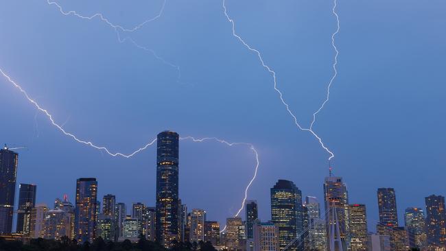
Storm chasers are predicting an explosive afternoon for the southeast with the potential for giant hail and damaging winds, while the Bureau of Meteorology is saying there is an “outside chance” for severe storms.
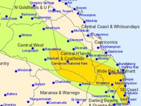
Higgins Storm Chasing is predicting severe storms are likely on the Sunshine Coast across the Gympie, Kingaroy and Taroom regions.
Meanwhile, Higgins says storms are possible from as far south as Byron Bay to the Gold Coast, Brisbane, Ipswich and inland areas depending on conditions.
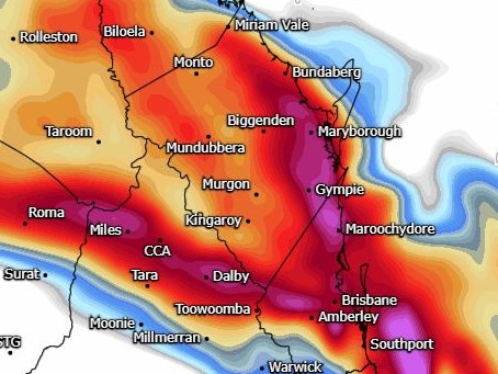
Cooper Haines from Coopers Severe Weather is predicting areas from Lismore to Rockhampton and inland to just passed Roma, Emerald and Dalby are at highest risk.
“Damaging winds of up to 90km/h, heavy rain and large hail are all possible.”
Bureau of Meteorology senior meteorologist Angus Hines said there was an “outside chance” of severe thunderstorms this afternoon.
“The storms, if they do develop, don’t look like they’ll bring too much rainfall, but they do bring a risk of some damaging wind and some large hailstones,” Mr Hines said.
Temperatures were sitting at over 30C for some parts of South East Queensland at 1.15pm, with Gatton, (36.9C), Amberley (34.4C) and Nambour (33C) the hottest locations.
The Bureau forecast maximum temperatures of up to 35C, with Brisbane expected to get to 33C. The city is currently 29.4C
The warm weather isn’t just be confined to the southeast.
Much of Queensland will experience hot conditions, with inland regions also facing the possibility of thunderstorms, particularly across the Wide Bay and Central Highlands areas. Meanwhile, northern coastal regions, including Bundaberg and the Tropical North, will enjoy mostly settled, dry weather.
Looking ahead to Sunday, temperatures are set to drop slightly, with Brisbane expected to cool down to a more comfortable 28C.
“It’s likely to cool off a little bit tomorrow [Sunday]. Doesn’t become cold, necessarily, but we might see Brisbane go from 33C today down to about 28C tomorrow, and we’ll see a similar drop in temperature of between three and five degrees for much of the rest of the southeast as well,” Mr Hines said.
No severe thunderstorm warnings have been issued at this stage, but the bureau will continue to monitor storm development closely throughout the day.
“Warnings for thunderstorms tend to be issued only once the storms begin to develop, so there’s a chance we’ll see some later today,” Mr Hines said.
Strong wind warnings are already in place for marine areas along the Sunshine and Gold Coast and Moreton Bay.
Originally published as Qld weather: Severe thunderstorm forecast for SEQ as temperatures soar

The Palaszczuk supporters who have abandoned Steven Miles
An exclusive Courier-Mail poll reveals many of the voters who helped an Annastacia Palaszczuk-led Labor secure victory at the last state election have returned to the LNP.

Deepest divide of all: Where Miles, Crisafulli stand on sporting loyalty
Steven Miles and David Crisafulli have opened up about the one area where they are divided even more deeply than on political ideology, in response to a reader question.