
‘Widespread frost outbreak’ brings subzero temperatures for Canberra
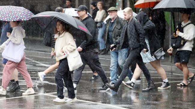
Sydneysiders have woken to a chilly morning with an icy blast sending temperatures plunging across much of the state.

NSW
Don't miss out on the headlines from NSW. Followed categories will be added to My News.
The whole country is shivering through an icy blast this week, with one city waking to subzero temperatures.
Canberra dropped to a chilling -3.5C on Monday morning, with the rest of the week expected to bring in similar frosty starts each day.
The territory is set for a low of -4C on Tuesday, -3C on Wednesday, and -1C on Thursday and Friday during the cold blast.
Frost was forecast for large swathes of Victoria, Sydney, the ACT and even southeast Queensland on Monday morning, with the icy temperatures likely to continue into the week.
Sky News Weather Meteorologist Rob Sharpe said this the “widespread” outbreak, which began on Sunday, increased in size and stature into Tuesday and Wednesday.
“For the southeast of the country, the frost that we saw in Canberra on Saturday morning was just a taste of what is to come through the start of the week,” he said.
“A widespread frost outbreak will take shape across the country.”
In NSW, the Bureau of Meteorology to issue a large-scale warning to sheep graziers in the Mid North Coast, Hunter, Northern Tablelands, Illawarra, South Coast, Central Tablelands, Southern Tablelands, North West Slopes & Plains, Central West Slopes & Plains, South West Slopes, Snowy Mountains forecast districts.
Despite this, Sydney will be considerably warmer than Canberra, with maximum temperatures ranging between 16C and 19C throughout the week.
However, possible showers are expected on Monday right through to Friday.
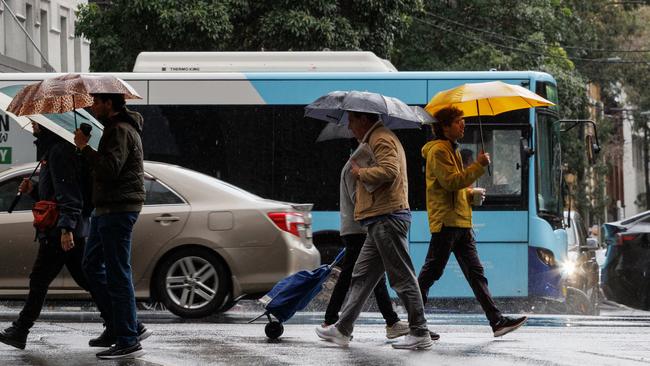
South-westerly winds between 25 to 35km/h could however increase the wind chill factor and make temperatures feel colder than what they are.
Melbourne is expected to shiver through a cloudy and cold day punctuated with a high chance of showers, with a minimum of 7C and a high of 14C forecast for Monday.
Wednesday will be the coldest out of a chilly week, with the temperate to drop to 3C and a max of just 13C.
In South Australia a frost warning is in place for the Mount Lofty Ranges, Mid North, Riverland, Murraylands, Upper South East and Lower South East forecast districts, where temperatures could creep down between -2C to -4C.
In Adelaide, the BOM has predicted a mostly sunny day ranging between 4C to 15C for Monday, and a temperature range between 6C to 16C for Tuesday.
A cold front passing through southwest Western Australia will also result in storms and showers, with the heaviest rain forecast for the coastline south of Perth.
While the majority occurred from Sunday afternoon, light showers will continue into the week, with a chance of thunderstorms in Perth’s northern suburbs.
However the cold snap has bought a raft of snow to the ACT, elevated areas in Victoria’s east and NSW’s Central Tablelands above 800m.
In Thredbo, about 17cm of snow greeted skiers and snowboarders on Sunday morning, with a slight chance of a snow shower to continue on Monday morning.
Victoria’s Mt Buller ski resort also reported 16cm of fresh powder between Saturday to Sunday.

Originally published as ‘Widespread frost outbreak’ brings subzero temperatures for Canberra

Mum perished trying to save Aurora, 6, from horrific inferno
A neighbour has remembered her close friend Veronica Carmady as a loving mother who died attempting to save her daughter Aurora from an inferno that ripped through their south west Sydney home on Wednesday.

Driver miraculously escapes after car smashes into Sydney home
A driver has miraculously escaped with only minor injuries after an SUV crashed into a home in Kellyville, causing significant structural damage and prompting a specialist rescue response.